|
Maloja Pass
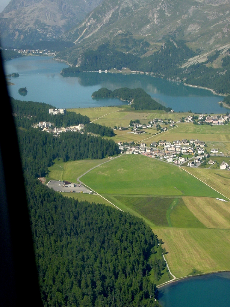
Maloja Pass (Italian: ''Passo del Maloja'', German: ''Malojapass'') (1815m a.s.l.) is a high mountain pass in the Swiss Alps in the canton of Graubünden, linking the Engadine with the Val Bregaglia, still in Switzerland and Chiavenna in Italy. It marks the divide between the Danube and Po watersheds. Lägh da Bitabergh is near the pass. The road from Chiavenna to Silvaplana with distances and elevation: * 0 km Chiavenna 333 m * 10 km Castasegna (Italian-Swiss border) 696 m * 13 km Promontogno 802 m * 16 km Stampa 994 m * 18 km Borgonovo 1029 m * 19 km Vicosoprano 1065 m * 27 km Casaccia 1458 m * 32 km Maloja Pass 1815 m * 33 km Maloja 1809 m * 40 km Sils im Engadin/Segl 1798 m * 44 km Silvaplana 1802 m The Maloja Pass is open in winter. However, after heavy snowfalls the road may be closed for a couple of hours or for an entire day. Even if open, the road might be covered with snow making snow/winter tires, or c ... [...More Info...] [...Related Items...] OR: [Wikipedia] [Google] [Baidu] |
Castasegna
Castasegna () is a former municipality in the district of Maloja in the Swiss canton of Grisons, on the Italian border. It is currently part of the municipality of Bregaglia. The town is situated in the Bergell valley, above the river Mera. History Castasegna is first mentioned in 1374 as ''Castexegnia''. Geography Castasegna has an area, , of . Of this area, 19.2% is used for agricultural purposes, while 40.1% is forested. Of the rest of the land, 2.1% is settled (buildings or roads) and the remainder (38.6%) is non-productive (rivers, glaciers or mountains). The municipality is located in the Bergell sub-district of the Maloja district in the lower section of the Bergell valley. It consists of the linear village of Castasegna with the Italian border on the edge of town and the neighboring Italian village of Villa di Chiavenna nearby. The main highway in the valley used to run through the main, narrow street. In order to relieve the town of the congestion, the highway ... [...More Info...] [...Related Items...] OR: [Wikipedia] [Google] [Baidu] |
Maloja Wind
The Maloja Wind (german: ) is a Foehn-type mountain wind that occurs in the upper Engadin, an alpine valley located in Switzerland. The wind blows up-valley during the nighttime and down-valley during the day, a deviation of the typical direction of mountain and valley winds. The phenomenon is caused by wind from the Val Bregaglia crossing the Maloja Pass and intruding into the Engadin. The Maloja Wind occasionally produces a weather phenomenon known as the Maloja Snake (german: ), a low-lying cloud so named for its long, serpentine shape. Description Maloja Wind The Maloja Wind is a Foehn-type wind that occurs in the upper Engadin in Switzerland. The wind blows up-valley during the nighttime and down-valley during the day, contradicting the typical direction of mountain and valley winds. The phenomenon is caused by wind from the Val Bregaglia crossing the valley's terminus at Maloja Pass and intruding into the adjoining Engadin. The roughly 1 km-wide Maloja Pass creates a ... [...More Info...] [...Related Items...] OR: [Wikipedia] [Google] [Baidu] |
List Of Mountain Passes In Switzerland ...
This is a list of mountain passes in Switzerland. They are generally situated in the Jura Mountains or in the Swiss Alps. Pass roads Trails Railway See also * List of highest road passes in Switzerland * List of highest paved roads in Switzerland * List of mountains of Switzerland External links Map with all drivable passes in Switzerland {{DEFAULTSORT:List Of Mountain Passes In Switzerland Passes, mountain Switzerland Mountain passes A mountain pass is a navigable route through a mountain range or over a ridge. Since many of the world's mountain ranges have presented formidable barriers to travel, passes have played a key role in trade, war, and both human and animal migrati ... [...More Info...] [...Related Items...] OR: [Wikipedia] [Google] [Baidu] |
List Of Highest Road Passes In Switzerland
This is a list of the highest road passes in Switzerland. It includes passes in the Alps and the Jura Mountains that are over above sea level. All the listed passes are crossed by paved roads. These are popular with drivers, bikers and cyclists for their spectacular scenery and are often the highlights of bicycle races such as Tour de Suisse and Tour de Romandie. Many of them are also served by public transport, the main transport company being PostBus Switzerland. Only fully paved roads of which both ends are connected to the main Swiss or European road network are included. Dead-end roads such as the Sanetsch and Glas Pass are not listed. For a list including dead-end roads as well, see list of highest paved roads in Switzerland. For a list of all passes, whether crossed by a paved road or not, see List of mountain passes in Switzerland. List References *Swisstopo Swisstopo is the official name for the Swiss Federal Office of Topography (in German language, German: ... [...More Info...] [...Related Items...] OR: [Wikipedia] [Google] [Baidu] |
List Of Highest Paved Roads In Switzerland
This is a list of the highest paved roads in Switzerland. It includes paved roads in the Alps that are over long and whose culminating point is over above sea level. This height approximately corresponds to that of the highest major settlements in the country.The highest towns with over 1000 inhabitants are St. Moritz (1,822 m), Silvaplana (1,815 m), Pontresina (1,805 m) and Saas-Fee (1,803 m). Some of the listed roads are closed to motorised vehicles, although they are normally all accessible to pedestrians and cyclists. These mountain roads are popular with drivers, bikers and cyclists for their spectacular scenery and are often the highlights of bicycle races such as Tour de Suisse and Tour de Romandie. Many of them are also served by public transport, the main transport company being PostBus Switzerland. As the tree line lies at approximately 2,000 metres in the Alps, almost all the upper sections of the listed roads are in the alpine zone, where the main form of precipita ... [...More Info...] [...Related Items...] OR: [Wikipedia] [Google] [Baidu] |
Engadine Line
The Engadine Line is an over long strike-slip fault in the Swiss canton of Graubünden, which extends into Italy and Austria. It runs along the Engadine Valley (which formed on the fault) and the Bregaglia Valley and offsets Austroalpine and Penninic units in a sinistral direction. The western end of the fault appears to peter out into ductile deformation in the Bregaglia Valley or continues as the Gruf Line to the southwest; the eastern end is buried by the Ötztal tectonic block and may continue as the " Inntal fault", "Isar fault" or "Loisach fault". Total offset along the Engadine Line is about , decreasing southwest. It began in the Oligocene, but there is evidence of recent neotectonic activity, which resulted in the collapse of the Maloja Pass area at the beginning of the Holocene. Seismic activity occurs along the Engadine Line, and springs and carbon dioxide exhalations in the Engadine are linked to the fault. Geology The Engadine Line is an over long northeast ... [...More Info...] [...Related Items...] OR: [Wikipedia] [Google] [Baidu] |
Silvaplana
Silvaplana ( Romansh: ) is a municipality in the Maloja Region in the Swiss canton of Graubünden and the name of a lake in the municipality. History The first sign of a settlement in the borders of the municipality are some Roman-era broken pillars on the Julier Pass. The village church was first mentioned in 1356. A new, late gothic church was built in 1491. In 1556 the village converted to the Protestant Reformation. Geography Silvaplana has an area, , of . Of this area, 19.6% is used for agricultural purposes, while 14.1% is forested. Of the rest of the land, 2.2% is settled (buildings or roads) and the remainder (64.1%) is non-productive (rivers, glaciers or mountains). Silvaplana is located on Lake Silvaplana in the Upper Engadine german: Oberengadin. Before 2017, it was located in the Oberengadin sub-district of the Maloja, after 2017 it was part of the Maloja Region. Above the village at , the Julier Pass connects the Engadine valley to the rest of Graubünden and t ... [...More Info...] [...Related Items...] OR: [Wikipedia] [Google] [Baidu] |
Sils Im Engadin/Segl
Sils im Engadin/Segl (german: Sils im Engadin; Romansh ), often also as ''Sils i.E./Segl'', is a municipality and village in the Maloja Region, Upper Engadine in the Swiss canton of the Grisons. It consists of two villages, Segl Maria (Romansh, german: Sils Maria; ''Seglias'' is part of Segl Maria) and Segl Baselgia (German: ''Sils Baselgia''; ''Baselgia'' is Romansh for church); the Val Fex (German: ''Fextal''); and three ''Maiensäss''e (Alpine pastures traditionally used for spring grazing): Grevasalvas, Blaunca and Buaira, above ''Plaun da Lej'' on the left side of the valley. Name and coat of arms The municipality's official label uses both the German and the Romansh versions of its name: ''Segl'' is the Romansh version while ''Sils im Engadin'' is the German. Engadin is Romansh for "Valley of the Inn ( rm, En)", the river, which flows northeast from Maloja through Sils Baselgia and eventually into the Danube at Passau, Germany at the German-Austrian border. Sils i. ... [...More Info...] [...Related Items...] OR: [Wikipedia] [Google] [Baidu] |
Maloja, Switzerland
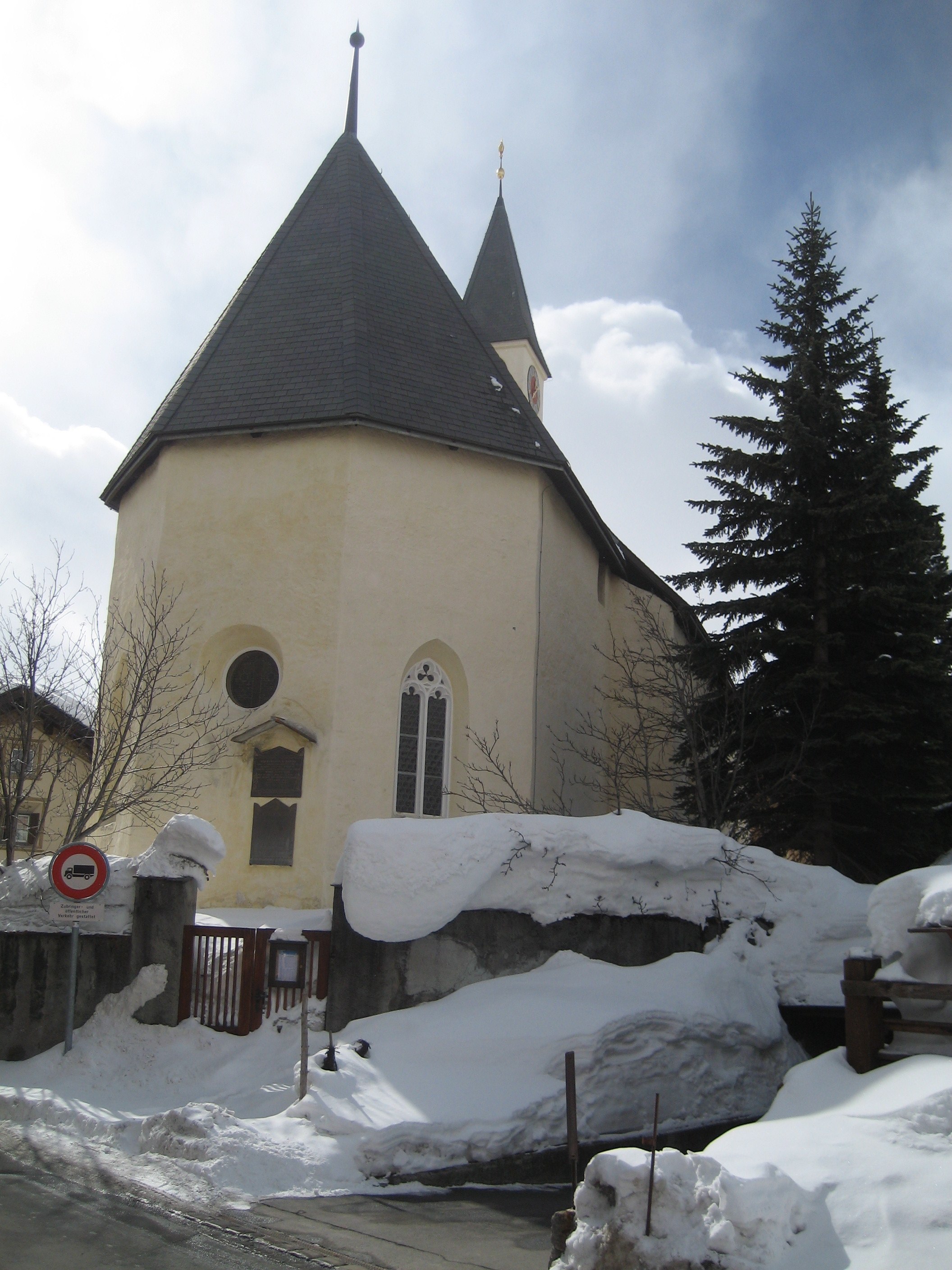
Maloja ( rm, Malögia) is a village in the Swiss canton of Grisons. It is part of the municipality of Bregaglia. It is located at the western end of Lake Sils, near the summit of the Maloja Pass. Since 1884 it boasts the luxury hotel Maloja Palace The Maloja Palace is a hotel from St Moritz, in the Graubünden canton of Switzerland, at the top of the Maloja Pass (Italian: Passo del Maloja, German: Malojapass) (el. 1815 m.) linking the Engadin and the Bregell valley, very close to the vil .... Bibliography * References Engadin Bregaglia Villages in Graubünden {{Graubünden-geo-stub ... [...More Info...] [...Related Items...] OR: [Wikipedia] [Google] [Baidu] |
Casaccia, Graubünden
Casaccia is a village located in the Val Bregaglia, in the Switzerland, Swiss Graubünden, canton of Graubünden. It lies at an altitude of 1,458 metres above sea level, at the southern foot of Piz Lunghin. The village belongs to the municipality of Bregaglia. External linksCasaccia official website Villages in Graubünden Bregaglia {{Graubünden-geo-stub ... [...More Info...] [...Related Items...] OR: [Wikipedia] [Google] [Baidu] |
Vicosoprano
Vicosoprano is a former municipality in the district of Maloja in the Swiss canton of Graubünden and is the largest village in the Val Bregaglia. It's now part of the municipality of Bregaglia. History Vicosoprano is first mentioned in 1096 as ''Vicus Supranus''. Geography Vicosoprano has an area, , of . Of this area, 8.6% is used for agricultural purposes, while 25.6% is forested. Of the rest of the land, 1% is settled (buildings or roads) and the remainder (64.7%) is non-productive (rivers, glaciers, or mountains). The municipality is located in the Bergell sub-district of the Maloja district. It is the largest municipality of the Bergell sub-district. It consists of the village of Vicosoprano (elev. ) and the hamlets of Roticcio and Pongello. In 1971 the settlement of Casaccia joined Vicosoprano. On 1 January 2010 the municipalities of Bondo, Castasegna, Soglio, Stampa, and Vicosoprano merged into a new municipality, Bregaglia. [...More Info...] [...Related Items...] OR: [Wikipedia] [Google] [Baidu] |


