|
Mall 211
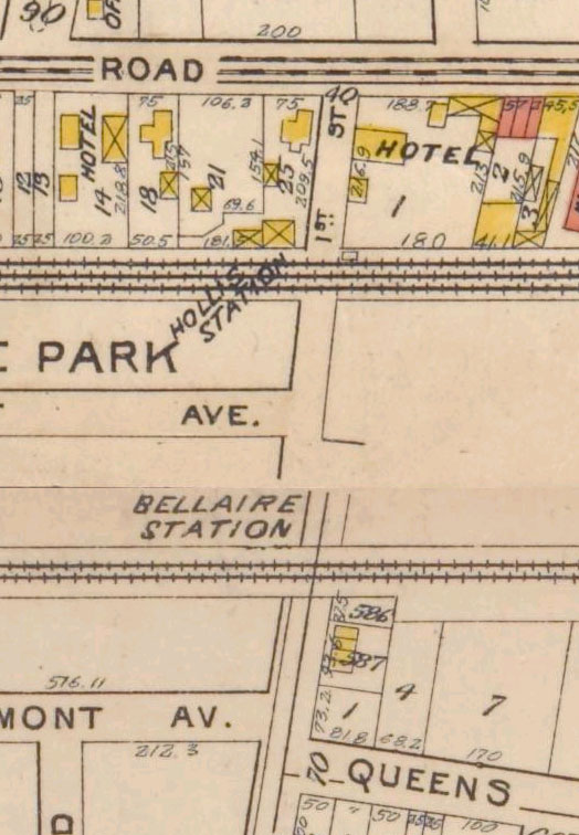
Mall 211 is a series of nine traffic medians on 211th Street, between 99th Avenue and Hollis Avenue in the Bellaire section of the Queens Village neighborhood of Queens. When the Bellaire section was developed in 1907, a wide road connecting to the Bellaire station on the Long Island Rail Road was given a green median with nine traffic islands serving as a centerpiece of the planned suburban community. Bellaire Boulevard connected two historic roads that predate the neighborhood’s development, Jamaica Avenue and Hollis Avenue. Prior to its development as a residential community, the nearly 40 acres around Mall 211 were part of Interstate Park, a shooting range A shooting range, firing range, gun range or shooting ground is a specialized facility, sports venue, venue or playing field, field designed specifically for firearm usage qualifications, training, practice or shooting sport, competitions. So ... and casino operated by the National Trapshooting Association. At its an ... [...More Info...] [...Related Items...] OR: [Wikipedia] [Google] [Baidu] |
Queens Village, Queens
Queens Village is a mostly residential middle class neighborhood in the eastern part of the New York City borough of Queens. It is bound by Hollis to the west, Cambria Heights to the south, Bellerose to the east, and Oakland Gardens to the north. Shopping in the community is located along Braddock Avenue, Hillside Avenue, Hempstead Avenue, and Jamaica Avenue (NY 25), as well as on Springfield Boulevard. Located just east of Queens Village, in Nassau County, is the Belmont Park race track. Close to the neighborhood are Cunningham Park and Alley Pond Park, as well as the historic Long Island Motor Parkway (LIMP), home of the turn of the century racing competition, the Vanderbilt Cup. The LIMP was built by William Kissam Vanderbilt, a descendant of the family that presided over the New York Central Railroad and Western Union; it is now part of the Brooklyn-Queens Greenway. Queens Village is located in Queens Community District 13 and its ZIP Codes are 11427, 11428, and 11429. It ... [...More Info...] [...Related Items...] OR: [Wikipedia] [Google] [Baidu] |
Queens
Queens is a borough of New York City, coextensive with Queens County, in the U.S. state of New York. Located on Long Island, it is the largest New York City borough by area. It is bordered by the borough of Brooklyn at the western tip of Long Island to its west, and Nassau County to its east. Queens also shares water borders with the boroughs of Manhattan, the Bronx, and Staten Island (via the Rockaways). With a population of 2,405,464 as of the 2020 census, Queens is the second most populous county in the State of New York, behind Kings County (Brooklyn), and is therefore also the second most populous of the five New York City boroughs. If Queens became a city, it would rank as the fifth most-populous in the U.S. after New York City, Los Angeles, Chicago, and Houston. Approximately 47% of the residents of Queens are foreign-born. Queens is the most linguistically diverse place on Earth and is one of the most ethnically diverse counties in the United States. Queens was est ... [...More Info...] [...Related Items...] OR: [Wikipedia] [Google] [Baidu] |
Bellaire Station
Bellaire was a station stop along the Hempstead Branch of the Long Island Rail Road. The station was located between 211th Street and 212th Street between 99th Avenue and Jamaica Avenue in Bellaire, Queens. The station was first opened in 1837 as Brushville, which opened as a replacement of a station further to the east. The station closed in 1871, and was reopened in 1897 as Brushville Road. This station was replaced by Interstate Park in 1900, and was renamed Bellaire in 1907. The station was rebuilt on an elevated structure in 1924 as part of a grade crossing elimination project, and was closed in 1972 due to low ridership. History Brushville station With the opening of the Long Island Rail Road Main Line from Jamaica to Hicksville on March 1, 1837, De Lancey Avenue station was opened, located in the vicinity of where Queens Village station is today at Springfield Boulevard. The station was constructed east of Jamaica. On November 27, 1837, this station was replaced by ... [...More Info...] [...Related Items...] OR: [Wikipedia] [Google] [Baidu] |
Long Island Rail Road
The Long Island Rail Road , often abbreviated as the LIRR, is a commuter rail system in the southeastern part of the U.S. state of New York (state), New York, stretching from Manhattan to the eastern tip of Suffolk County, New York, Suffolk County on Long Island. With an average weekday ridership of 354,800 passengers in 2016, it is the List of United States commuter rail systems by ridership, busiest commuter railroad in North America. It is also one of the world's few commuter systems that runs 24/7 year-round. It is Government-owned corporation, publicly owned by the Metropolitan Transportation Authority, which refers to it as MTA Long Island Rail Road. In , the system had a ridership of , or about per weekday as of . The LIRR logo combines the circular MTA logo with the text ''Long Island Rail Road'', and appears on the sides of trains. The LIRR is one of two commuter rail systems owned by the MTA, the other being the Metro-North Railroad in the northern suburbs of the New ... [...More Info...] [...Related Items...] OR: [Wikipedia] [Google] [Baidu] |
Jamaica Avenue
Jamaica Avenue is a major avenue in the New York City boroughs of Brooklyn and Queens, New York, in the United States. Jamaica Avenue's western end is at Broadway and Fulton Street, as a continuation of East New York Avenue, in Brooklyn's East New York neighborhood. Physically, East New York Avenue connects westbound to New York Avenue, where East New York Avenue changes names another time to Lincoln Road; Lincoln Road continues to Ocean Avenue in the west, where it ends. Its eastern end is at the city line in Bellerose, Queens, where it becomes Jericho Turnpike to serve the rest of Long Island. The section of Jamaica Avenue designated as New York State Route 25 runs from Braddock Avenue to the city line, where Jamaica Avenue becomes Jericho Turnpike. History Jamaica Avenue was part of a pre-Columbian trail for tribes from as far away as the Ohio River and the Great Lakes, coming to trade skins and furs for wampum. It was in 1655 that the first settlers paid the Native A ... [...More Info...] [...Related Items...] OR: [Wikipedia] [Google] [Baidu] |
Shooting Range
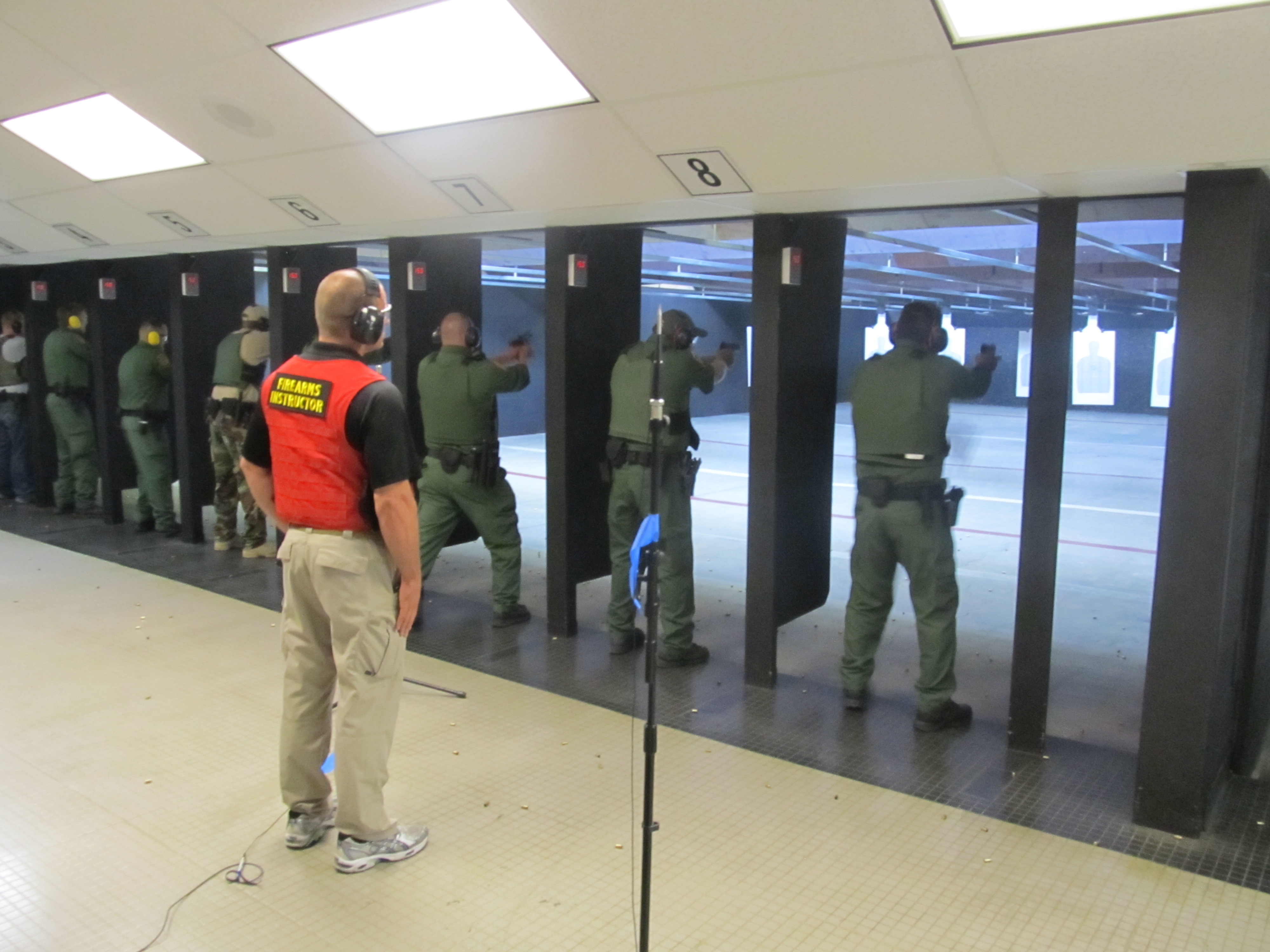
A shooting range, firing range, gun range or shooting ground is a specialized facility, sports venue, venue or playing field, field designed specifically for firearm usage qualifications, training, practice or shooting sport, competitions. Some shooting ranges are operated by military or law enforcement agencies, though the majority of ranges are privately owned by civilians and sporting clubs and cater mostly to recreational shooters. Each facility is typically overseen by one or more supervisory personnel, variously called a ''range master'' or "Range Safety Officer" (RSO) in the United States, or a ''range conducting officer'' (RCO) in the United Kingdom. Supervisory personnel are responsible for ensuring that all weapon safety rules and relevant gun law, government regulations are followed at all times. Shooting ranges can be indoor or outdoor, and may be restricted to certain types of firearm that can be used such as handguns or long guns, or they can specialize in cert ... [...More Info...] [...Related Items...] OR: [Wikipedia] [Google] [Baidu] |
Parks In Queens, New York
A park is an area of natural, semi-natural or planted space set aside for human enjoyment and recreation or for the protection of wildlife or natural habitats. Urban parks are green spaces set aside for recreation inside towns and cities. National parks and country parks are green spaces used for recreation in the countryside. State parks and provincial parks are administered by sub-national government states and agencies. Parks may consist of grassy areas, rocks, soil and trees, but may also contain buildings and other artifacts such as monuments, fountains or playground structures. Many parks have fields for playing sports such as baseball and football, and paved areas for games such as basketball. Many parks have trails for walking, biking and other activities. Some parks are built adjacent to bodies of water or watercourses and may comprise a beach or boat dock area. Urban parks often have benches for sitting and may contain picnic tables and barbecue grills. The largest ... [...More Info...] [...Related Items...] OR: [Wikipedia] [Google] [Baidu] |


