|
Maine State Route 145
State Route 145 (SR 145) is part of Maine's system of numbered state highways. It runs from an intersection with SR 4 in Strong to an intersection with SR 142 near Kingfield. The route is also known as Main Street in Strong. Major junctions References External links Floodgap Roadgap's RoadsAroundME: Maine State Route 145 145 145 may refer to: *145 (number), a natural number *AD 145, a year in the 2nd century AD *145 BC, a year in the 2nd century BC *145 (dinghy), a two-person intermediate sailing dinghy *145 (South) Brigade *145 (New Jersey bus) 145 may refer to: *14 ... Transportation in Franklin County, Maine {{Maine-road-stub ... [...More Info...] [...Related Items...] OR: [Wikipedia] [Google] [Baidu] |
Strong, Maine
Strong is a town in Franklin County, Maine, United States. The population was 1,122 at the 2020 census. Strong is home to the annual Sandy River Festival. History The plantation was called Township No. 3, First Range North of Plymouth Claim, West of Kennebec River (or T3 R1 NPC WKR), then successively known as Middletown and Readstown. It was first settled in 1784 by William Read from Nobleboro. Readstown was incorporated on January 31, 1801, and named for Caleb Strong, a Founding Father of the United States and governor of Massachusetts. The Maine Republican Party was founded here on August 7, 1854. Set on a hilly intervale above a big bend in the Sandy River, the area provided fertile soil for agriculture. Farmers grew hay, wheat, corn, oats and potatoes. The northeast branch of the Sandy River provided water power for mills, helping make Strong prosperous. By 1859, when the population was 1,008, it had sawmills, a gristmill, a fulling mill, a carding machine, a starch ... [...More Info...] [...Related Items...] OR: [Wikipedia] [Google] [Baidu] |
Kingfield, Maine
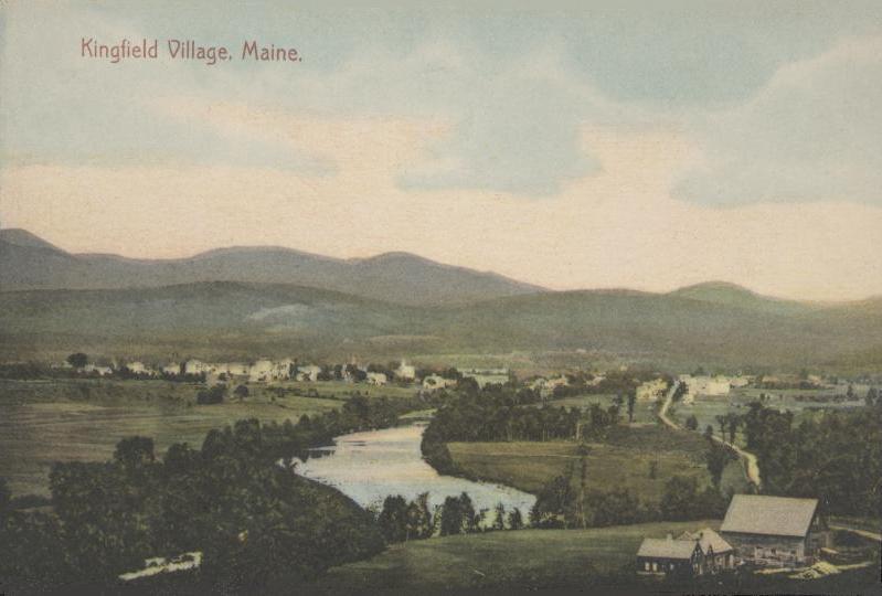
Kingfield is a town in Franklin County, Maine, United States. The population was 960 at the 2020 census. Kingfield, the primary village in the town, is a census-designated place. Kingfield is the principal gateway to Sugarloaf, a major ski resort, and is headquarters to Maine Huts and Trails. History The first recorded European visitors were John W. Dutton and Nathaniel Kimball in 1805. They returned the following year with their families and began a settlement. In 1807, William King (later to be Maine's first Governor) purchased the township as part of the Bigham Plantation. In 1816 Kingfield was incorporated as the 210th town in the Maine District of the Commonwealth of Massachusetts. Salomon Stanley was one of the earliest town settlers. His twin sons, Francis Edgar (F.E.) and Freelan Oscar (F.O.) became famous as manufacturers of Stanley Dry Plate, bought in 1903 by Eastman Kodak, and the Stanley Steamer automobile, manufactured from 1902 to 1924. Their sister, Cha ... [...More Info...] [...Related Items...] OR: [Wikipedia] [Google] [Baidu] |
Franklin County, Maine
Franklin County is a county located in the state of Maine, in the United States. As of the 2020 census, the population was 29,456, making it the second-least populous county in Maine. Its county seat is Farmington. The county was established on May 9, 1838 and named for Benjamin Franklin. Geography According to the U.S. Census Bureau, the county has a total area of , of which is land and (2.7%) is water. The county high point is Sugarloaf Mountain, the ski mountain in Carrabassett Valley, Maine, Carrabassett Valley whose elevation is 4237 feet. Adjacent counties and municipalities *Somerset County, Maine, Somerset County – northeast *Kennebec County, Maine, Kennebec County – southeast *Androscoggin County, Maine, Androscoggin County – south *Oxford County, Maine, Oxford County – southwest *Le Granit Regional County Municipality, Quebec – northwest Demographics 2015 As of 2015 the largest self-reported ancestry groups in Franklin County, Maine are: 2000 censu ... [...More Info...] [...Related Items...] OR: [Wikipedia] [Google] [Baidu] |
Maine
Maine () is a state in the New England and Northeastern regions of the United States. It borders New Hampshire to the west, the Gulf of Maine to the southeast, and the Canadian provinces of New Brunswick and Quebec to the northeast and northwest, respectively. The largest state by total area in New England, Maine is the 12th-smallest by area, the 9th-least populous, the 13th-least densely populated, and the most rural of the 50 U.S. states. It is also the northeasternmost among the contiguous United States, the northernmost state east of the Great Lakes, the only state whose name consists of a single syllable, and the only state to border exactly one other U.S. state. Approximately half the area of Maine lies on each side of the 45th parallel north in latitude. The most populous city in Maine is Portland, while its capital is Augusta. Maine has traditionally been known for its jagged, rocky Atlantic Ocean and bayshore coastlines; smoothly contoured mountains; heavily f ... [...More Info...] [...Related Items...] OR: [Wikipedia] [Google] [Baidu] |
Maine State Route 4
State Route 4 (SR 4) is a long state highway located in southern and western Maine. It is a major interregional route and the first such route to be designated in the state. The southern terminus is at the New Hampshire border in South Berwick, where it connects to New Hampshire Route 4, and the northern terminus is at Haines Landing on Mooselookmeguntic Lake in Rangeley. Major cities and towns along the length of SR 4 include Sanford, Gorham, Windham, Auburn and Farmington. Route description South Berwick to Alfred SR 4 begins at the New Hampshire state line where NH 4 crosses into South Berwick. It has a brief concurrency with SR 236 in the downtown area before splitting off to the northeast. SR 4 runs in a northeasterly direction, running along the southeastern edge of Berwick and into the town of North Berwick, where it junctions with SR 9 and has a concurrency through downtown, then turns nearly due north. SR 4 passes through the city of Sanford, bypassing the dow ... [...More Info...] [...Related Items...] OR: [Wikipedia] [Google] [Baidu] |
Maine State Route 142
State Route 142 (SR 142) is a numbered state highway in the U.S. state of Maine that runs from U.S. Route 2 (US 2) and SR 17 in Dixfield to SR 16 and SR 27 in Kingfield. Route description The route begins at its southern terminus in Dixfield. It heads north through Carthage before turning left at SR 156 in Weld. It goes north again before turning right onto a concurrency with SR 4 in Phillips. It turns left twice there before going northwest to Kingfield, then another left turn leads to the route's northern terminus. Major junctions References External links * 142 142 may refer to: * 142 (number), an integer * AD 142 Year 142 ( CXLII) was a common year starting on Sunday (link will display the full calendar) of the Julian calendar. At the time, it was known in the Roman Empire as the Year of the Consul ... Transportation in Oxford County, Maine Transportation in Franklin County, Maine {{Maine-road-stub ... [...More Info...] [...Related Items...] OR: [Wikipedia] [Google] [Baidu] |
Maine State Route 145 In Freeman Township
Maine () is a U.S. state, state in the New England and Northeastern United States, Northeastern regions of the United States. It borders New Hampshire to the west, the Gulf of Maine to the southeast, and the Provinces and territories of Canada, Canadian provinces of New Brunswick and Quebec to the northeast and northwest, respectively. The largest state by total area in New England, Maine is the List of U.S. states and territories by area, 12th-smallest by area, the List of U.S. states and territories by population, 9th-least populous, the List of U.S. states by population density, 13th-least densely populated, and the most rural of the List of states and territories of the United States, 50 U.S. states. It is also the northeastern United States, northeasternmost among the contiguous United States, the northernmost state east of the Great Lakes, the only state whose name consists of a single syllable, and the only state to border exactly one other U.S. state. Approximately half ... [...More Info...] [...Related Items...] OR: [Wikipedia] [Google] [Baidu] |
State Highways In Maine
State may refer to: Arts, entertainment, and media Literature * ''State Magazine'', a monthly magazine published by the U.S. Department of State * ''The State'' (newspaper), a daily newspaper in Columbia, South Carolina, United States * ''Our State'', a monthly magazine published in North Carolina and formerly called ''The State'' * The State (Larry Niven), a fictional future government in three novels by Larry Niven Music Groups and labels * States Records, an American record label * The State (band), Australian band previously known as the Cutters Albums * ''State'' (album), a 2013 album by Todd Rundgren * ''States'' (album), a 2013 album by the Paper Kites * ''States'', a 1991 album by Klinik * ''The State'' (album), a 1999 album by Nickelback Television * ''The State'' (American TV series), 1993 * ''The State'' (British TV series), 2017 Other * The State (comedy troupe), an American comedy troupe Law and politics * State (polity), a centralized political organizatio ... [...More Info...] [...Related Items...] OR: [Wikipedia] [Google] [Baidu] |


