|
Maine State Route 103
State Route 103 (SR 103) is a long state highway in extreme southern Maine. The route is signed east–west, but forms a half-loop, with most of its western segment running strongly southeast slightly inland of the Piscataqua River and the state border with New Hampshire, its central skirting the Piscataqua generally easterly, and its eastern strongly northeast slightly inland from the Atlantic Ocean. The route piggybacks on different roads with many turns throughout its length. Route description SR 103 begins in the west at an intersection with SR 236 (which is itself a former alignment of SR 103 there) west of Eliot, near its intersection with SR 101 just southwest of the border between South Berwick and Dover, New Hampshire. For its first mile SR 103 heads south-southwest, until crosses Sturgeon Creek, a tidal inlet of the Piscataqua River, the state border with New Hampshire. There it turns southeast to parallel the river, meandering slightly inland southeast t ... [...More Info...] [...Related Items...] OR: [Wikipedia] [Google] [Baidu] |
Eliot, Maine
Eliot is a town in York County, Maine, United States. Originally settled in 1623, it was formerly a part of Kittery, Maine, to its east. After Kittery, it is the next most southern town in the state of Maine, lying on the Piscataqua River across from Portsmouth and Newington, New Hampshire. The population was 6,717 at the 2020 census. It is part of the Portland– South Portland–Biddeford, Maine metropolitan statistical area. Eliot is home to Ambush Rock, Green Acre, and the Raitt Homestead Farm Museum. History Founding Today's town of Eliot was formerly the Middle Parish of the town Kittery, Maine,Old Kittery and Her Families", Everett Stackpole, 1903 originally part of the royal grant to Sir Ferdinando Gorges known as the Piscataqua Plantation. Kittery was incorporated in 1647, today distinguishing itself as "the oldest incorporated town in Maine." While this may be so, settlements upriver on the north side of the Piscataqua River in today's Eliot were established ... [...More Info...] [...Related Items...] OR: [Wikipedia] [Google] [Baidu] |
Memorial Bridge (Portsmouth, New Hampshire)
The World War I Memorial Bridge is a vertical-lift bridge that carries U.S. Route 1 across the Piscataqua River between Portsmouth, New Hampshire, and Badger's Island in Kittery, Maine, United States. The current bridge was opened in 2013, replacing a bridge of similar design that existed from 1923 to 2012. A large overhead plaque carried over from the original reads "Memorial to the Sailors and Soldiers of New Hampshire who gave their lives in the World War 1917–1919." The lift span can be fully opened to allow large commercial vessels to pass. During summer, the lift section remains partially elevated every half-hour between 7 a.m. and 7 p.m. for about 15 minutes. This allows smaller commercial and recreational boat traffic. The bridge is currently the only one of the three Piscataqua River bridges with provisions for pedestrians. New Hampshire and Maine designated the bridge as part of their State Bicycle Routes, and the bridge is part of the proposed East Coast Greenway. Or ... [...More Info...] [...Related Items...] OR: [Wikipedia] [Google] [Baidu] |
State Highways In Maine
State may refer to: Arts, entertainment, and media Literature * ''State Magazine'', a monthly magazine published by the U.S. Department of State * ''The State'' (newspaper), a daily newspaper in Columbia, South Carolina, United States * ''Our State'', a monthly magazine published in North Carolina and formerly called ''The State'' * The State (Larry Niven), a fictional future government in three novels by Larry Niven Music Groups and labels * States Records, an American record label * The State (band), Australian band previously known as the Cutters Albums * ''State'' (album), a 2013 album by Todd Rundgren * ''States'' (album), a 2013 album by the Paper Kites * ''States'', a 1991 album by Klinik * ''The State'' (album), a 1999 album by Nickelback Television * ''The State'' (American TV series), 1993 * ''The State'' (British TV series), 2017 Other * The State (comedy troupe), an American comedy troupe Law and politics * State (polity), a centralized political organizatio ... [...More Info...] [...Related Items...] OR: [Wikipedia] [Google] [Baidu] |
Portsmouth, NH
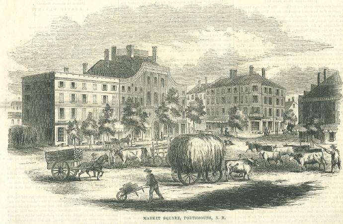
Portsmouth is a city in Rockingham County, New Hampshire, United States. At the 2020 census it had a population of 21,956. A historic seaport and popular summer tourist destination on the Piscataqua River bordering the state of Maine, Portsmouth was formerly the home of the Strategic Air Command's Pease Air Force Base, since converted to Portsmouth International Airport at Pease. History American Indians of the Abenaki and other Algonquian languages-speaking nations, and their predecessors, inhabited the territory of coastal New Hampshire for thousands of years before European contact. The first known European to explore and write about the area was Martin Pring in 1603. The Piscataqua River is a tidal estuary with a swift current, but forms a good natural harbor. The west bank of the harbor was settled by European colonists in 1630 and named Strawbery Banke, after the many wild strawberries growing there. The village was protected by Fort William and Mary on what is now Ne ... [...More Info...] [...Related Items...] OR: [Wikipedia] [Google] [Baidu] |
Maine State Route 9
State Route 9 (SR 9) is a numbered state highway in Maine, running from the New Hampshire border at Berwick in the west to the Canada–US border with New Brunswick at Calais in the east. SR 9 runs a total of . Route description State Route 9 is a meandering highway that works its way from New Hampshire to Canada. It frequently runs concurrent with other highways listed below and also frequently changes direction. For instance, in Kennebunk, State Route 9 travels in a westerly direction even though it is signed as eastbound. State Route 9 runs through most of Maine's major cities including Biddeford, Saco, South Portland, Portland, Augusta, and Bangor. Over the years, a number of improvements have been made by the Route 9 Committee, a partnership of local government officials and business interests in the Baileyville-Calais area. The Airline The leg from Bangor to Calais is often referred to as "The Airline" commonly thought to be due to its shorter route than ... [...More Info...] [...Related Items...] OR: [Wikipedia] [Google] [Baidu] |
New England Road Marking System
, , , , , The New England road marking system was a regional system of marked numbered routes in the six-state region of New England in the United States. The routes were marked by a yellow rectangular sign with black numbers and border. Many signs were painted on telephone poles. The routes were approved by the highway departments of the six New England states in April 1922. Prior to the New England road marking system, through routes were mainly marked with colored bands on telephone poles. These were assigned by direction (red for east–west, blue for north–south and yellow for intermediate or diagonal routes). The Massachusetts Highway Commission convinced the rest of southern New England and New York to use this system in 1915 (New Hampshire and Vermont already had their own schemes, and Maine also opted out), and it was the main system until 1922. The New England road marking system, while limited to New England, was designed for expansion to the whole country. ... [...More Info...] [...Related Items...] OR: [Wikipedia] [Google] [Baidu] |
York Harbor
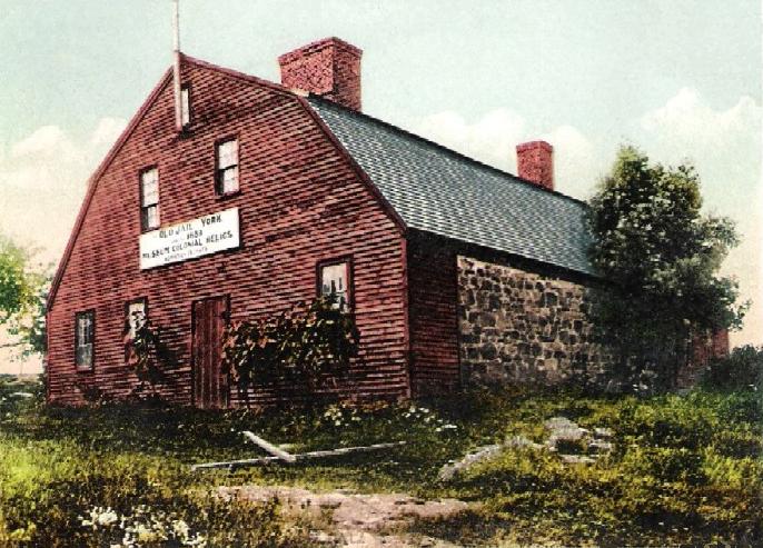
York Harbor is a census-designated place (CDP) in the town of York in York County, Maine, United States. The population was 3,033 at the 2010 census. York Harbor is a distinguished former Gilded Age summer colony noted for its resort architecture. It is part of the Portland– South Portland–Biddeford, Maine Metropolitan Statistical Area. History York was a prosperous seaport in the 18th century. Its harbor, then known as Lower Town, was lined with wharves and warehouses to which upriver settlers brought their goods for trade and shipping. The tongue of land at the mouth of the York River was called Gallows Point, where criminals at Old York Gaol in York Village were hanged. At high tide the tongue became an island, from which a ferry licensed in 1652 crossed to Seabury. During the American Revolution, fishermen and their families abandoned the Isles of Shoals off the coast and floated their homes to the Lower Town waterfront, where they were rebuilt. They hauled th ... [...More Info...] [...Related Items...] OR: [Wikipedia] [Google] [Baidu] |
York River (Maine)
The York River is a U.S. Geological Survey. National Hydrography Dataset high-resolution flowline dataThe National Map, accessed June 30, 2011 stream in southeast Maine, United States. It is tidal for over half of its length. It rises at York Pond in Eliot, and conjoined by brooks and creeks, feeds the tidal section. The York River flows southeast to the Atlantic Ocean at York Harbor in the town of York. The Abenaki name for the York River is ''Agamenticus'', which means "Beyond-the-hill-little-cove". According to Eben Norton Horsford, Agamenticus "described the site of the mouth of Little York River to one approaching it from the ''north'', as it lay behind the hill called by the Indians "Sassanows" (the modern Agamenticus). Little York River, a short tidal river, was the "Beyond-the-hill-little-cove." Legislation On May 23, 2013, Rep Chellie Pingree introduced the York River Wild and Scenic River Study Act of 2013 (H.R. 2197; 113th Congress) would have required the National ... [...More Info...] [...Related Items...] OR: [Wikipedia] [Google] [Baidu] |
York, Maine
York is a town in York County, Maine, United States, near the southern tip of the state. The population in the 2020 census was 13,723. Situated beside the Atlantic Ocean on the Gulf of Maine, York is a well-known summer resort town. It is home to three 18-hole golf clubs, four sandy beaches, and Mount Agamenticus. It includes the villages of York Village, York Harbor, York Beach and Cape Neddick. York is part of the Portland– South Portland–Biddeford, Maine metropolitan statistical area. History First settled by Europeans in 1624, the plantation was originally called Agamenticus, the Abenaki term for the York River. In 1638, settlers changed the name to Bristol after Bristol, England, from which they had immigrated. Envisioning a great city arising from the wilderness, Sir Ferdinando Gorges, lord proprietor of Maine under the Plymouth patent, named the capital of his province Gorgeana. On March 1, 1642, by charter of King Charles I, Gorgeana became the first incorpora ... [...More Info...] [...Related Items...] OR: [Wikipedia] [Google] [Baidu] |
Gerrish Island
Gerrish may refer to: People * Benjamin Gerrish (1717–1772), merchant and political figure in Nova Scotia * Billy Gerrish (1884–1916), English professional footballer * Howard Gerrish (1910–1988), author and teacher * Jeffrey Gerrish, American lawyer * John Gerrish (1910–2010), American composer * Joseph Gerrish (1709–1774), soldier, merchant, judge and political figure in Nova Scotia * Louise Gerrish (born 1948), track and field athlete * Samuel Gerrish 1680s-1741), bookseller and publisher in Boston, Massachusetts * Sylvia Gerrish (1860–1906), American musical theatre performer * William Gerrish (1898–1978), British philatelist * Winfield Scott Gerrish (1849-1882), figure in the lumber industry Geography * Gerrish Township, Michigan, a civil township in Michigan * Gerrish Warehouse, an historic warehouse in Maine Other * E.H. Gerrish Canoe Company * Gerrish's Regiment Gerrish's Regiment was one of the 27 infantry regiments of the Massachusetts line created b ... [...More Info...] [...Related Items...] OR: [Wikipedia] [Google] [Baidu] |
Kittery Point, Maine
Kittery Point is a census-designated place (CDP) in the town of Kittery, York County, Maine, United States. First settled in 1623, Kittery Point traces its history to the first seafarers who colonized the shore of what became Massachusetts Bay Colony and later the State of Maine. Located beside the Atlantic Ocean, it is home to Fort McClary State Historic Site, and Fort Foster Park on Gerrish Island. Cutts Island is home to Seapoint Beach and the Brave Boat Harbor Division of the Rachel Carson National Wildlife Refuge. Kittery Point is part of the Portland– South Portland–Biddeford, Maine Metropolitan Statistical Area. The population was 1,012 at the 2010 census. History Settled as early as 1623, the southern part of Kittery was once called Champernowne's after Sir Francis Champernowne, a prominent merchant adventurer and cousin of Sir Ferdinando Gorges, the prime mover behind settlement north of the Massachusetts Bay Colony. Nicholas Shapleigh built the first hou ... [...More Info...] [...Related Items...] OR: [Wikipedia] [Google] [Baidu] |
Portsmouth, New Hampshire
Portsmouth is a city in Rockingham County, New Hampshire, United States. At the 2020 census it had a population of 21,956. A historic seaport and popular summer tourist destination on the Piscataqua River bordering the state of Maine, Portsmouth was formerly the home of the Strategic Air Command's Pease Air Force Base, since converted to Portsmouth International Airport at Pease. History American Indians of the Abenaki and other Algonquian languages-speaking nations, and their predecessors, inhabited the territory of coastal New Hampshire for thousands of years before European contact. The first known European to explore and write about the area was Martin Pring in 1603. The Piscataqua River is a tidal estuary with a swift current, but forms a good natural harbor. The west bank of the harbor was settled by European colonists in 1630 and named Strawbery Banke, after the many wild strawberries growing there. The village was protected by Fort William and Mary on what is now ... [...More Info...] [...Related Items...] OR: [Wikipedia] [Google] [Baidu] |


