|
Main North Line, New Zealand
The Main North Line, sometimes referred to as part of the South Island Main Trunk railway, is a railway line that runs north from Christchurch in New Zealand up the east coast of the South Island through Kaikōura and Blenheim to Picton. It is a major link in New Zealand's national rail network and offers a connection with roll-on roll-off ferries A ferry is a ship, watercraft or amphibious vehicle used to carry passengers, and sometimes vehicles and cargo, across a body of water. A passenger ferry with many stops, such as in Venice, Italy, is sometimes called a water bus or water taxi ... from Picton to Wellington. It was also the longest railway construction project in New Zealand's history, with the first stages built in the 1870s and not completed until 1945. Construction The first proposal for a line resembling the present day Main North Line was made in 1861. A proposal for a line linking Christchurch and Blenheim was put before the Marlborough Provin ... [...More Info...] [...Related Items...] OR: [Wikipedia] [Google] [Baidu] |
Regional Rail
Regional rail, also known as local trains and stopping trains, are passenger rail services that operate between towns and cities. These trains operate with more stops over shorter distances than inter-city rail, but fewer stops and faster service than commuter rail. Regional rail services operate beyond the limits of urban areas, and either connect similarly-sized smaller cities and towns, or cities and surrounding towns, outside or at the outer rim of a suburban belt. Regional rail normally operates with an even service load throughout the day, although slightly increased services may be provided during rush-hour. The service is less oriented around bringing commuters to the urban centers, although this may generate part of the traffic on some systems. Other regional rail services operate between two large urban areas but make many intermediate stops. In North America, "regional rail" is not recognized as a service classification between "commuter rail" and "inter-city r ... [...More Info...] [...Related Items...] OR: [Wikipedia] [Google] [Baidu] |
Broad Gauge
A broad-gauge railway is a railway with a track gauge (the distance between the rails) broader than the used by standard-gauge railways. Broad gauge of , commonly known as Russian gauge, is the dominant track gauge in former Soviet Union (CIS states, Baltic states, Rail transport in Georgia (country), Georgia and Ukraine), Rail transport in Mongolia, Mongolia and Rail transport in Finland, Finland. Broad gauge of , commonly known as Irish Gauge, is the dominant track gauge in Ireland, and the Australian states of Rail transport in Victoria, Victoria and Railways in Adelaide, Adelaide. Broad gauge of , commonly known as Iberian gauge, is the dominant track gauge in Spain and Portugal. Broad gauge of , commonly known as Indian gauge, is the dominant track gauge in Indian Railways, India, Pakistan Railways, Pakistan, Bangladesh, Sri Lanka Railways, Sri Lanka, Rail transport in Argentina, Argentina, Empresa de los Ferrocarriles del Estado, Chile, and on Bay Area Rapid Transit, BAR ... [...More Info...] [...Related Items...] OR: [Wikipedia] [Google] [Baidu] |
Waiau Branch
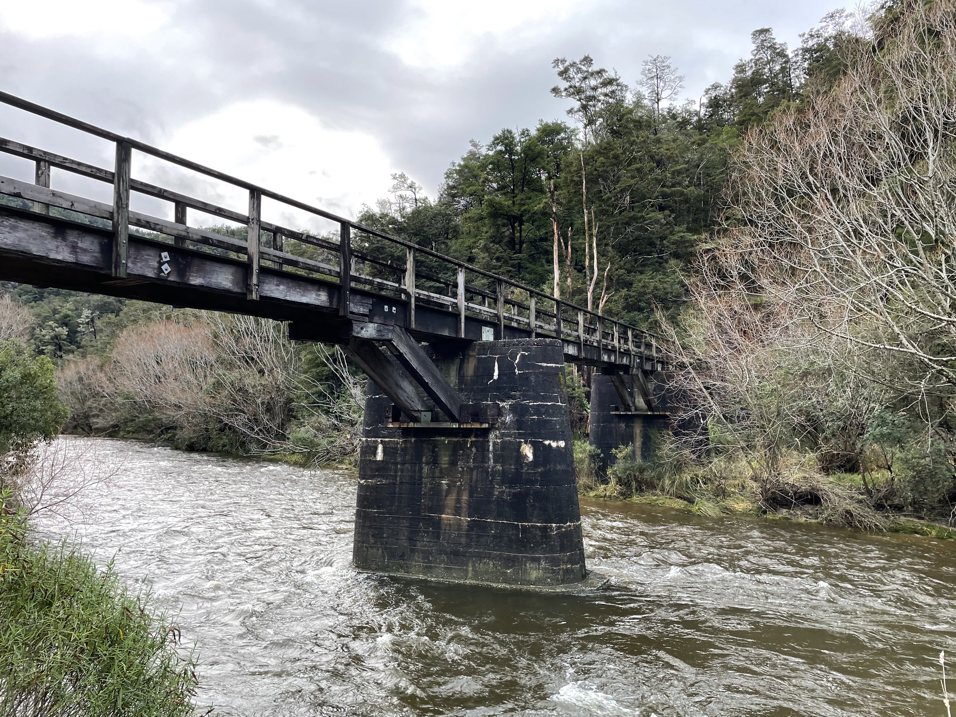
The Waiau Branch was a branch line railway in the northern Canterbury region of New Zealand's South Island. Known as the Great Northern Railway for its first few decades of life, the Waiau Branch was seen as part of a main line north but was ultimately superseded by a coastal route. Opened in stages from 1882 to 1919, the line closed in 1978 but a portion has been retained as the Weka Pass Railway. Construction During the 1870s, significant debates motivated by regional interests took place regarding the most desirable route for a railway from Canterbury to the West Coast, Nelson, and Marlborough. A number of these plans involved lines that would have in some way incorporated the route of what became the Waiau Branch, and when it was built, it was seen as an integral part of the Main North Line. Despite an 1879 report favouring a coastal route via Kaikoura as the line north, the inland route was initially chosen and construction work soon began. Its junction with th ... [...More Info...] [...Related Items...] OR: [Wikipedia] [Google] [Baidu] |
West Coast, New Zealand
The West Coast ( mi, Te Tai Poutini, lit=The Coast of Poutini, the Taniwha) is a region of New Zealand on the west coast of the South Island that is administered by the West Coast Regional Council, and is known co-officially as Te Tai Poutini. It comprises the territorial authorities of Buller District, Grey District and Westland District. The principal towns are Westport, Greymouth and Hokitika. The region, one of the more remote areas of the country, is also the most sparsely populated. With a population of just 32,000 people, Te Tai Poutini is the least populous region in New Zealand, and it is the only region where the population is declining. The region has a rich and important history. The land itself is ancient, stretching back to the Carboniferous period; this is evident by the amount of carboniferous materials naturally found there, especially coal. First settled by Kāi Tahu in approximately 1200 CE, the area was famous across New Zealand for its richness in pounamu ... [...More Info...] [...Related Items...] OR: [Wikipedia] [Google] [Baidu] |
Canterbury, New Zealand
Canterbury ( mi, Waitaha) is a region of New Zealand, located in the central-eastern South Island. The region covers an area of , making it the largest region in the country by area. It is home to a population of The region in its current form was established in 1989 during nationwide local government reforms. The Kaikoura District joined the region in 1992 following the abolition of the Nelson-Marlborough Regional Council. Christchurch, the South Island's largest city and the country's second-largest urban area, is the seat of the region and home to percent of the region's population. Other major towns and cities include Timaru, Ashburton, Rangiora and Rolleston. History Natural history The land, water, flora, and fauna of Waitaha/Canterbury has a long history stretching from creation of the greywacke basement rocks that make up the Kā Tiritiri o te Moana/Southern Alps to the arrival of the first humans. This history is linked to the creation of the earth, t ... [...More Info...] [...Related Items...] OR: [Wikipedia] [Google] [Baidu] |
Nelson Section
The Nelson Section was an isolated government-owned railway line between Nelson and Glenhope in the Tasman district of New Zealand's South Island. While part of the New Zealand Government Railways, the section was never connected to the national railway network, although there were plans to do so. The line operated for years between 1876 and 1955. Unusually for an isolated line, there were passenger and freight services for most of its existence, with freight outlasting passenger services by just a year. This line is noteworthy for several reasons, including being the last completely isolated section of the government-owned railway network; gaining a reprieve after being closed for the first time until being closed for a second – and final – time; and, its route was chosen to serve existing communities in Nelson's hinterland rather than being constructed to open up new areas for development or serve specific industries. History Nelson was founded as a New Zealand C ... [...More Info...] [...Related Items...] OR: [Wikipedia] [Google] [Baidu] |
Nelson, New Zealand
(Let him, who has earned it, bear the palm) , image_map = Nelson CC.PNG , mapsize = 200px , map_caption = , coordinates = , coor_pinpoint = , coordinates_footnotes = , subdivision_type = Country , subdivision_name = New Zealand , subdivision_type1 = Unitary authority , subdivision_name1 = Nelson City , subdivision_type2 = , subdivision_name2 = , established_title1 = Settled by Europeans , established_date1 = 1841 , founder = Arthur Wakefield , named_for = Horatio Nelson , parts_type = Suburbs , p1 = Nelson Central , p2 = Annesbrook , p3 = Atawhai , p4 = Beachville , p5 = Bishopdale , p6 = Britannia Heights , p7 = Enner Gly ... [...More Info...] [...Related Items...] OR: [Wikipedia] [Google] [Baidu] |
New Zealand Legal Information Institute
The New Zealand Legal Information Institute (NZLII) is operated by the University of Otago Faculty of Law with assistance from the University of Canterbury and Victoria University, Wellington. It contains more than 100 databases of New Zealand law including many decision from Courts and Tribunals that are not available anywhere else, including from commercial operators. It operates using voluntary labour and grants from thNew Zealand Law Foundation NZLII is a member of the Free Access to Law Movement. References * Buckingham ‘What’s in a Name?: New Zealand and the growth of free on-line legal information’005 ''005'' is a 1981 arcade game by Sega. They advertised it as the first of their RasterScan Convert-a-Game series, designed so that it could be changed into another game in minutes "at a substantial savings". It is one of the first examples of a ...CompLRes 2; 7th Law via Internet Conference, Vila, Vanuatu * Section on NZLII in Greenleaf, Legal Information Institu ... [...More Info...] [...Related Items...] OR: [Wikipedia] [Google] [Baidu] |
The Vogel Era
The Vogel Era describes the history of New Zealand between 1873 and 1876, when the country adopted an immigration and public works scheme inaugurated by the colonial treasurer, then premier, Julius Vogel to develop the country and to relieve the slump of the late 1860s; to be financed by borrowing overseas. His "Great Public Works Policy" resulted in a large increase in migrants and provision of many new railways, roads and telegraph lines. The railway system developed from a few lines in three gauges to the start of a national network including the main line from Christchurch to Dunedin, though the narrow "Cape gauge" required later upgrading to increase the restricted height and weight limits. A Grand Go-ahead Policy Julius Vogel, the premier and colonial treasurer, appreciated that settlement was confined to coastal lands because of inadequate transport, and ("before Lord Keynes was born") propounded a "grand go-ahead policy" to dispel the slump with increased government expe ... [...More Info...] [...Related Items...] OR: [Wikipedia] [Google] [Baidu] |
Narrow Gauge Railway
A narrow-gauge railway (narrow-gauge railroad in the US) is a railway with a track gauge narrower than standard . Most narrow-gauge railways are between and . Since narrow-gauge railways are usually built with tighter curves, smaller structure gauges, and lighter rails, they can be less costly to build, equip, and operate than standard- or broad-gauge railways (particularly in mountainous or difficult terrain). Lower-cost narrow-gauge railways are often used in mountainous terrain, where engineering savings can be substantial. Lower-cost narrow-gauge railways are often built to serve industries as well as sparsely populated communities where the traffic potential would not justify the cost of a standard- or broad-gauge line. Narrow-gauge railways have specialised use in mines and other environments where a small structure gauge necessitates a small loading gauge. In some countries, narrow gauge is the standard; Japan, Indonesia, Taiwan, New Zealand, South Africa, and the ... [...More Info...] [...Related Items...] OR: [Wikipedia] [Google] [Baidu] |
Rail Gauge
In rail transport, track gauge (in American English, alternatively track gage) is the distance between the two rails of a railway track. All vehicles on a rail network must have wheelsets that are compatible with the track gauge. Since many different track gauges exist worldwide, gauge differences often present a barrier to wider operation on railway networks. The term derives from the metal bar, or gauge, that is used to ensure the distance between the rails is correct. Railways also deploy two other gauges to ensure compliance with a required standard. A ''loading gauge'' is a two-dimensional profile that encompasses a cross-section of the track, a rail vehicle and a maximum-sized load: all rail vehicles and their loads must be contained in the corresponding envelope. A ''structure gauge'' specifies the outline into which structures (bridges, platforms, lineside equipment etc.) must not encroach. Uses of the term The most common use of the term "track gauge" refers to the ... [...More Info...] [...Related Items...] OR: [Wikipedia] [Google] [Baidu] |
Waipara
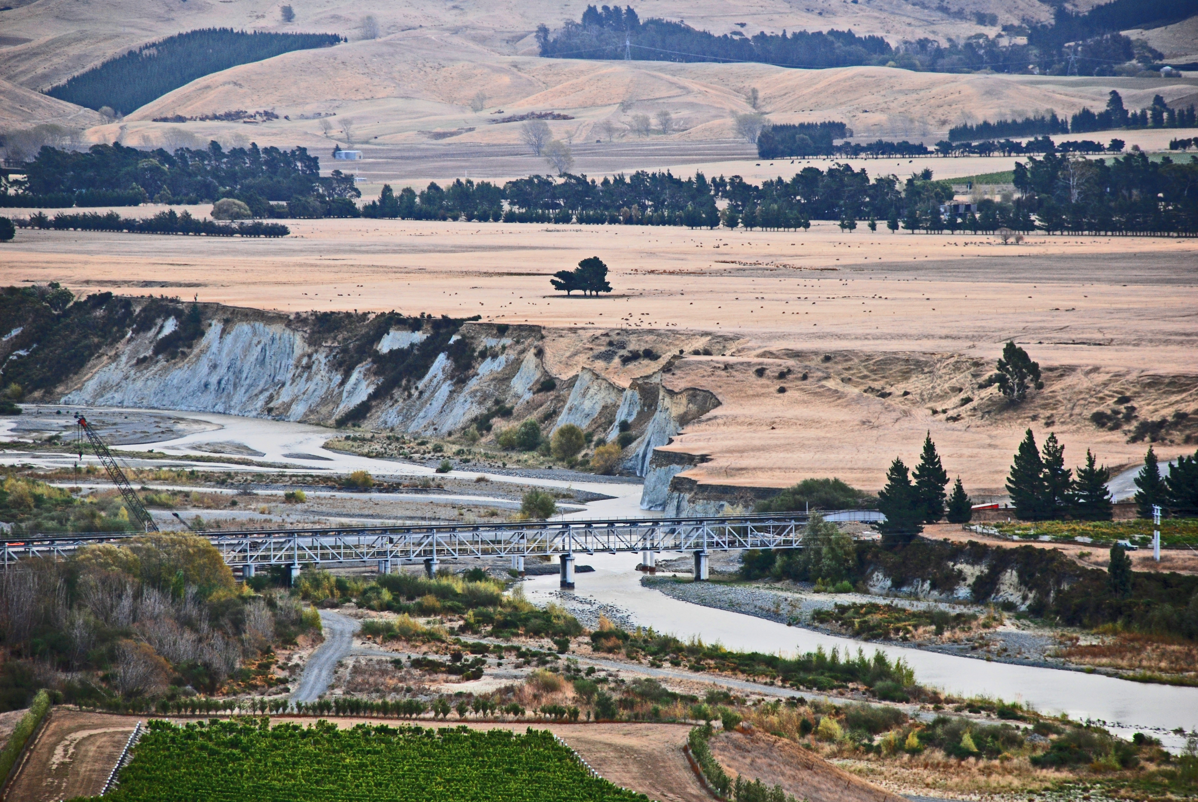
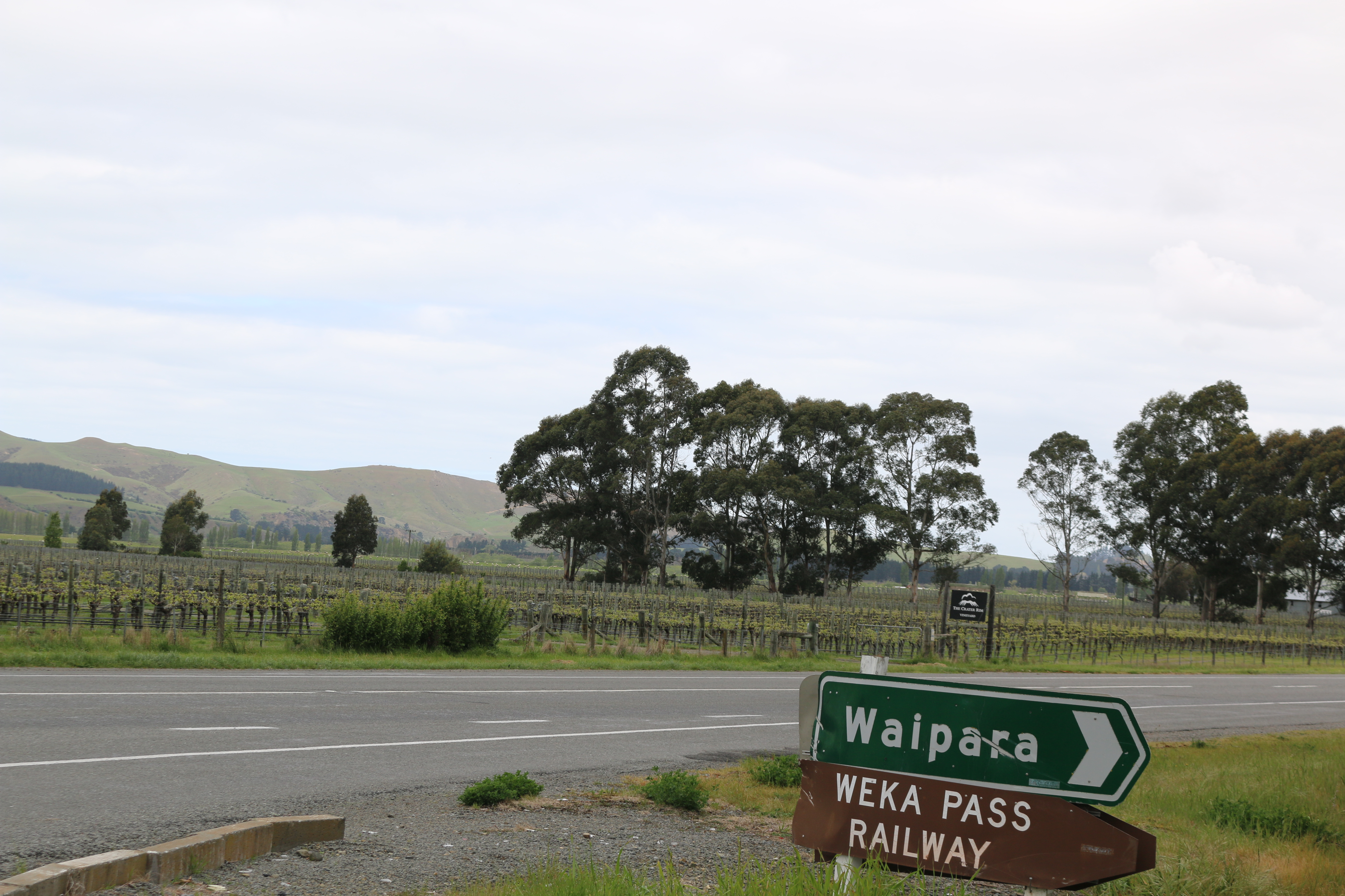
Waipara is a small town in north Canterbury, New Zealand, on the banks of the Waipara River. Its name translates to "Muddy Water", ''wai'' meaning water and ''para'' meaning mud. It is at the junction of state highways 1 and 7, 60 kilometres north of Christchurch. Hanmer Springs is 76 kilometres (55 minutes drive) north of Waipara. It is also situated on the Main North Line railway. Waipara lies at one of the points of the Alpine Pacific Triangle, which also includes the major tourist centers of Hanmer Springs and Kaikoura. The Weka Pass Railway has its base in Waipara, and runs on 12 kilometres of track between there and Waikari over the former route of the Waiau Branch, a branch line railway that diverged from the Main North Line and ran to Waiau. The Glenmark station is based in Waipara. The Glenmark church has closed down. It was damaged during the 2010 Christchurch earthquakes. The Waipara Hotel burnt down in 2014. It was not insured at the time and has not been r ... [...More Info...] [...Related Items...] OR: [Wikipedia] [Google] [Baidu] |


