|
Mackinac County
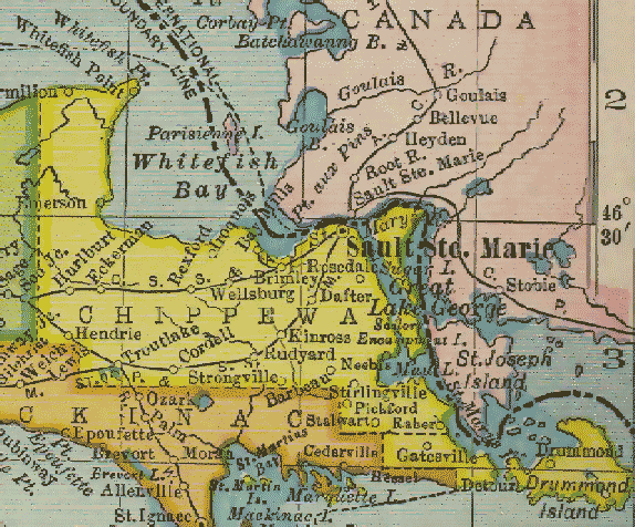
Mackinac County ( ) is a County (United States), county in the Upper Peninsula of the U.S. state of Michigan. As of the 2020 United States Census, 2020 Census, the population was 10,834. The county seat is St. Ignace, Michigan, St. Ignace. Formerly known as Michilimackinac County, in 1818 it was one of the first counties of the Michigan Territory, as it had long been a center of French and British colonial fur trading, a Catholic church and Protestant mission, and associated settlement. The county's name is believed to be shortened from "''Michilimackinac''", which referred to the Straits of Mackinac area as well as the French settlement at the tip of the lower peninsula. History Michilimackinac County was created on October 26, 1818, by proclamation of territorial governor Lewis Cass. The county originally encompassed the Lower Peninsula of Michigan north of Macomb County, Michigan, Macomb County and almost the entire present Upper Peninsula. As later counties were settled and ... [...More Info...] [...Related Items...] OR: [Wikipedia] [Google] [Baidu] |
Business Routes Of Interstate 75 In Michigan
There have been nine business routes for Interstate 75 in the US state of Michigan. Numbered either Business Loop Interstate 75 (BL I-75) or Business Spur Interstate 75 (BS I-75) depending if they are a full business loop or a business spur, these highways are former routings of Interstate 75 in Michigan, I-75's predecessor highways in the state. They were designated as I-75 was completed through the various areas of Michigan. The business loop in Pontiac, Michigan, Pontiac runs through that city's downtown along a section of Woodward Avenue and a segment of roadway formerly used by M-24 (Michigan highway), M-24. The former Saginaw, Michigan, Saginaw business loop was once a part of U.S. Route 23 in Michigan, US Highway 23 (US 23), as was most of the original Bay City, Michigan, Bay City business loop (that one has been converted into a business spur). The roadways that make up the business loops in West Branch, Michigan, West Branch and Roscommon, Michigan, ... [...More Info...] [...Related Items...] OR: [Wikipedia] [Google] [Baidu] |
Northern Michigan
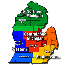
Northern Michigan, also known as Northern Lower Michigan (known colloquially to residents of more southerly parts of the state and summer residents from cities such as Detroit as " Up North"), is a region of the U.S. state of Michigan. A popular tourist destination, it is home to several small- to medium-sized cities, extensive state and national forests, lakes and rivers, and a large portion of Great Lakes shoreline. The region has a significant seasonal population much like other regions that depend on tourism as their main industry. Northern Lower Michigan is distinct from the more northerly Upper Peninsula and Isle Royale, which are also located in "northern" Michigan. In the northernmost 21 counties in the Lower Peninsula of Michigan, the total population of the region is 506,658 people.The largest city is Traverse City. The 4 counties surrounding it make up Traverse City Micropolitan Area and have a population of 143,372, 7th in nation. Geography Boundary descript ... [...More Info...] [...Related Items...] OR: [Wikipedia] [Google] [Baidu] |
Emmet County, Michigan
Emmet County is a county located in the U.S. state of Michigan. It is the northernmost county in the Lower Peninsula. As of the 2020 Census, the population was 34,112. The county seat is Petoskey. Emmet County is located at the top of the Lower Peninsula of Michigan, bounded on the west by Lake Michigan and on the north by the Straits of Mackinac. Its rural areas are habitat for several endangered species. Long a center of occupation by the Odawa people, today the county is the base for the federally recognized Little Traverse Bay Bands of Odawa Indians. The county was created by the Michigan Legislature in April 1840, from Mackinac County. It was first named Tonedagana County, a name derived from a Cross Village Odawa war chief, and renamed Emmet County effective March 8, 1843. Emmet County remained attached to Mackinac County for administrative purposes until county government was organized in 1853. "Emmet" refers to the Irish nationalist Robert Emmet, who in 1803 was tried ... [...More Info...] [...Related Items...] OR: [Wikipedia] [Google] [Baidu] |
Cheboygan County, Michigan
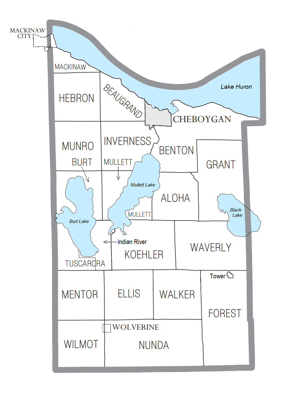
Cheboygan County ( ) is a county in the U.S. state of Michigan. As of the 2020 Census, the population was 25,579. The county seat is Cheboygan. The county boundaries were set off in 1840, with land partitioned from Mackinac County. The Cheboygan County government was organized in 1853. Etymology of the name Cheboygan The name of the county shares the same origin as that of the Cheboygan River, although the precise meaning is no longer known. It may have come from an Ojibwe word ''zhaabonigan,'' meaning "sewing needle". Alternatively, the origin may have been ''Chabwegan,'' meaning "a place of ore". It has also been described as "a Native American word first applied to the river. ''See'' List of Michigan county name etymologies. "Cheboygan" is pronounced the same as " Sheboygan" (a city in Wisconsin). Geography According to the U.S. Census Bureau, the county has a total area of , of which is land and (19%) is water. The county is considered to be part of Northern Michigan. ... [...More Info...] [...Related Items...] OR: [Wikipedia] [Google] [Baidu] |
Presque Isle County, Michigan
Presque Isle County ( ') is a county in the Lower Peninsula of the U.S. state of Michigan. As of the 2020 Census, the population was 12,982. The county seat is Rogers City. The county was authorized by state legislative action on April 1, 1840, but the county government was not established until 1871. The government was reorganized in 1875. Both the county and Presque Isle Township are named for Presque Isle (French, "almost an island"; the term for a narrow peninsula). A large part of the township consists of that peninsula, with Lake Huron on the east, Grand Lake on the west, and narrow strips of land connecting it to the mainland at the north and south ends. The community of Presque Isle is near the center of this peninsula. History Early Native Americans living in the area were nomadic, using the land as hunting grounds. To them the land between the Ocqueoc and Swan Rivers was sacred ground. The name "Presque Isle" was given to the area by fur traders who portage ... [...More Info...] [...Related Items...] OR: [Wikipedia] [Google] [Baidu] |
Chippewa County, Michigan
Chippewa County is a county in the Upper Peninsula of the U.S. state of Michigan. As of the 2020 Census, the population was 36,785. The county seat is Sault Ste. Marie. The county is named for the Ojibwe (Chippewa) people, and was set off and organized in 1826. Chippewa County comprises the Sault Ste. Marie, MI micropolitan statistical area. Geography According to the U.S. Census Bureau, the county has a total area of , of which is land and (42%) is water. It is the second-largest county in Michigan by land area and fifth-largest by total area. The Michigan Meridian runs through the eastern portion of the county. South of Nine Mile Road, M-129 (Meridian Road) overlays the meridian. In Sault Ste. Marie, Meridian Street north of 12th Avenue overlays the meridian. Adjacent counties & districts * Algoma District, Ontario, Canada (northeast) * Manitoulin District, Ontario, Canada (east) * Presque Isle County (southeast) * Mackinac County (south) * Luce County (west) Nat ... [...More Info...] [...Related Items...] OR: [Wikipedia] [Google] [Baidu] |
Straits Of Mackinac, Cropped From ISS067-E-7708
A strait is an oceanic landform connecting two seas or two other large areas of water. The surface water generally flows at the same elevation on both sides and through the strait in either direction. Most commonly, it is a narrow ocean channel that lies between two land masses. Some straits are not navigable, for example because they are either too narrow or too shallow, or because of an unnavigable reef or archipelago. Straits are also known to be loci for sediment accumulation. Usually, sand-size deposits occur on both the two opposite strait exits, forming subaqueous fans or deltas. Terminology The terms ''channel'', ''pass'', or ''passage'' can be synonymous and used interchangeably with ''strait'', although each is sometimes differentiated with varying senses. In Scotland, ''firth'' or ''Kyle'' are also sometimes used as synonyms for strait. Many straits are economically important. Straits can be important shipping routes and wars have been fought for control of them. ... [...More Info...] [...Related Items...] OR: [Wikipedia] [Google] [Baidu] |
Mackinac Island
Mackinac Island ( ; french: Île Mackinac; oj, Mishimikinaak ᒥᔑᒥᑭᓈᒃ; otw, Michilimackinac) is an island and resort area, covering in land area, in the U.S. state of Michigan. The name of the island in Odawa is Michilimackinac and "Mitchimakinak" in Ojibwemowin meaning "Big Turtle". It is located in Lake Huron, at the eastern end of the Straits of Mackinac, between the state's Upper and Lower Peninsulas. The island was long home to an Odawa settlement and previous indigenous cultures before European colonization began in the 17th century. It was a strategic center of the fur trade around the Great Lakes. Based on a former trading post, Fort Mackinac was constructed on the island by the British during the American Revolutionary War. It was the site of two battles during the War of 1812 before the northern border was settled and the US gained this island in its territory. In the late 19th century, Mackinac Island became a popular tourist attraction and summer ... [...More Info...] [...Related Items...] OR: [Wikipedia] [Google] [Baidu] |
Mackinac Bridge
The Mackinac Bridge ( ) is a suspension bridge spanning the Straits of Mackinac, connecting the Upper and Lower peninsulas of the U.S. state of Michigan. Opened in 1957, the bridge (familiarly known as "Big Mac" and "Mighty Mac") is the world's 27th-longest main span and the longest suspension bridge between anchorages in the Western Hemisphere. The Mackinac Bridge is part of Interstate 75 (I-75) and the Lake Michigan and Huron components of the Great Lakes Circle Tour across the straits; it is also a segment of the U.S. North Country National Scenic Trail. The bridge connects the city of St. Ignace on the north end with the village of Mackinaw City on the south. Envisioned since the 1880s, the bridge was designed by the engineer David B. Steinman and completed in 1957 only after many decades of struggles to begin construction. Length The bridge opened on November 1, 1957, connecting two peninsulas linked for decades by ferries. At the time, the bridge was formally d ... [...More Info...] [...Related Items...] OR: [Wikipedia] [Google] [Baidu] |
Lake Michigan
Lake Michigan is one of the five Great Lakes of North America. It is the second-largest of the Great Lakes by volume () and the third-largest by surface area (), after Lake Superior and Lake Huron. To the east, its basin is conjoined with that of Lake Huron through the wide, deep, Straits of Mackinac, giving it the same surface elevation as its easterly counterpart; the two are technically a single lake. Lake Michigan is the world's largest lake by area in one country. Located in the United States, it is shared, from west to east, by the states of Wisconsin, Illinois, Indiana, and Michigan. Ports along its shores include Milwaukee and the City of Green Bay in Wisconsin; Chicago in Illinois; Gary in Indiana; and Muskegon in Michigan. Green Bay is a large bay in its northwest, and Grand Traverse Bay is in the northeast. The word "Michigan" is believed to come from the Ojibwe word (''michi-gami'' or ''mishigami'') meaning "great water". History Some of most studied ea ... [...More Info...] [...Related Items...] OR: [Wikipedia] [Google] [Baidu] |
Lake Huron
Lake Huron ( ) is one of the five Great Lakes of North America. Hydrology, Hydrologically, it comprises the easterly portion of Lake Michigan–Huron, having the same surface elevation as Lake Michigan, to which it is connected by the , Straits of Mackinac. It is shared on the north and east by the Canadian province of Ontario and on the south and west by the U.S. state of Michigan. The name of the lake is derived from early French explorers who named it for the Wyandot people, Huron people inhabiting the region. The Huronian glaciation was named from evidence collected from Lake Huron region. The northern parts of the lake include the North Channel (Ontario), North Channel and Georgian Bay. Saginaw Bay is located in the southwest corner of the lake. The main inlet is the St. Marys River (Michigan–Ontario), St. Marys River, and the main outlet is the St. Clair River. Geography By surface area, Lake Huron is the second-largest of the Great Lakes, with a surface area of — ... [...More Info...] [...Related Items...] OR: [Wikipedia] [Google] [Baidu] |
United States Census Bureau
The United States Census Bureau (USCB), officially the Bureau of the Census, is a principal agency of the U.S. Federal Statistical System, responsible for producing data about the American people and economy. The Census Bureau is part of the U.S. Department of Commerce and its director is appointed by the President of the United States. The Census Bureau's primary mission is conducting the U.S. census every ten years, which allocates the seats of the U.S. House of Representatives to the states based on their population. The bureau's various censuses and surveys help allocate over $675 billion in federal funds every year and it assists states, local communities, and businesses make informed decisions. The information provided by the census informs decisions on where to build and maintain schools, hospitals, transportation infrastructure, and police and fire departments. In addition to the decennial census, the Census Bureau continually conducts over 130 surveys and programs ... [...More Info...] [...Related Items...] OR: [Wikipedia] [Google] [Baidu] |


