|
Macintyre Shire
Macintyre Shire was a local government area in the North West Slopes region of New South Wales, Australia. Macintyre Shire was proclaimed on 7 March 1906, one of 134 shires created after the passing of the ''Local Government (Shires) Act 1905''. On 15 November 1940, the shire absorbed the neighbouring Bannockburn Shire. The shire offices were based in Inverell. Other towns and villages in the shire included Delungra, Gilgai, Stannifer and Wandera. The Shire was amalgamated with the Municipality of Inverell and Ashford Shire to form Inverell Shire '' Inverell Shire is a local government area in the North West Slopes region of New South Wales, Australia adjacent to the Macintyre River and the Gwydir Highway. The Mayor of Inverell Shire Council is Cr. Paul Harmon, who is unaligned with ... on 1 July 1979. References Former local government areas of New South Wales 1906 establishments in Australia 1979 disestablishments in Australia {{NSW-geo-stub ... [...More Info...] [...Related Items...] OR: [Wikipedia] [Google] [Baidu] |
North West Slopes
The North West Slopes region of New South Wales, Australia, refers generally to the area west of the Northern Tablelands, to the north of the Central West region and to the east of the Far West region. Despite its name, the region is in north-central New South Wales, corresponding generally to the Australian Bureau of Meteorology's forecast area of ''North West Slopes and Plains''. The administrative areas of the region include the city of Tamworth, Gunnedah, Moree, Narrabri and Inverell. The region is higher, hillier and wetter on its eastern edge than on its western edge. The North West Slopes are situated on various tributaries to the Darling River, such as the Barwon, Gwydir, and Namoi Rivers, which rise in the Great Dividing Range country to its east. The region has one city, Tamworth. The North West Slopes also includes the towns of Gunnedah, Warialda, Manilla, Boggabri, Mungindi, Narrabri, Moree, Quirindi and Wee Waa; and many villages. It has traditionally been ... [...More Info...] [...Related Items...] OR: [Wikipedia] [Google] [Baidu] |
Inverell
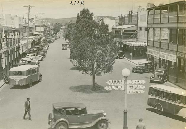
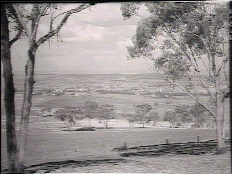
Inverell is a large town in northern New South Wales, Australia, situated on the Macintyre River, close to the Queensland border. It is also the centre of Inverell Shire. Inverell is located on the Gwydir Highway on the western slopes of the Northern Tablelands. It has a temperate climate. In the , the population of Inverell was 12,057 and the Inverell Shire population was 17,853. History Prior to white settlement, the Gamilaraay Nation (commonly known as Kamilaroi) of Aboriginal peoples lived in and occupied this region. In 1848, Alexander Campbell held the Inverell Station on the Macintyre River. The name derives from the name of Mr. MacIntyre's estate. The word is of Gaelic origin, and signifies "meeting place of the swans"; from "Inver", a meeting place, and "Ell", a swan. The MacIntyre River and Swanbrook Creek join here. The area was also known as "Green Swamp" in the 1850s. Wheat growers, Colin and Rosanna Ross established a store there in 1853, when he asked that a ... [...More Info...] [...Related Items...] OR: [Wikipedia] [Google] [Baidu] |
Local Government In Australia
Local government is the third level of government in Australia, administered with limited autonomy under the states and territories, and in turn beneath the federal government. Local government is not mentioned in the Constitution of Australia, and two referendums in 1974 and 1988 to alter the Constitution relating to local government were unsuccessful. Every state/territory government recognises local government in its own respective constitution. Unlike the two-tier local government system in Canada or the United States, there is only one tier of local government in each Australian state/territory, with no distinction between counties and cities. The Australian local government is generally run by a council, and its territory of public administration is referred to generically by the Australian Bureau of Statistics as the local government area or LGA, each of which encompasses multiple suburbs or localities often of different postcodes; however, stylised terms such a ... [...More Info...] [...Related Items...] OR: [Wikipedia] [Google] [Baidu] |
New South Wales
) , nickname = , image_map = New South Wales in Australia.svg , map_caption = Location of New South Wales in AustraliaCoordinates: , subdivision_type = Country , subdivision_name = Australia , established_title = Before federation , established_date = Colony of New South Wales , established_title2 = Establishment , established_date2 = 26 January 1788 , established_title3 = Responsible government , established_date3 = 6 June 1856 , established_title4 = Federation , established_date4 = 1 January 1901 , named_for = Wales , demonym = , capital = Sydney , largest_city = capital , coordinates = , admin_center = 128 local government areas , admin_center_type = Administration , leader_title1 = Monarch , leader_name1 = Charles III , leader_title2 = Governor , leader_name2 = Margaret Beazley , leader_title3 = Premier , leader_name3 = Dominic Perrottet (Liberal) , national_representation = Parliament of Australia , national_representation_type1 = Senat ... [...More Info...] [...Related Items...] OR: [Wikipedia] [Google] [Baidu] |
Local Government (Shires) Act 1905
Local Government (Shires) Act 1905 was a landmark New South Wales statute notable for the compulsory incorporation of local government areas for around 40% of the area of New South Wales. The Act created 134 rural shires, many surrounding a small urban area separately and voluntarily incorporated under the ''Municipalities Act 1858'' and the following '' Municipalities Act 1867'' and '' Municipalities Act 1897'' As well as the compulsory incorporation of rural areas, the ''Local Government (Shires) Act'' repealed the ''Municipalities Act'' - bringing local government under one legislative framework. The Act provided the newly constituted Shires with a limited set of powers; to act as a roads board and to provide other necessary local functions such as nightsoil Night soil is a historically used euphemism for human excreta collected from cesspools, privies, pail closets, pit latrines, privy middens, septic tanks, etc. This material was removed from the immediate area, usually ... [...More Info...] [...Related Items...] OR: [Wikipedia] [Google] [Baidu] |
Bannockburn Shire
Bannockburn Shire was a local government area in the North West Slopes region of New South Wales, Australia. Bannockburn Shire was proclaimed on 7 March 1906, one of 134 shires created after the passing of the ''Local Government (Shires) Act 1905''. The shire offices were based in Inverell Inverell is a large town in northern New South Wales, Australia, situated on the Macintyre River, close to the Queensland border. It is also the centre of Inverell Shire. Inverell is located on the Gwydir Highway on the western slopes of the No .... Towns and villages in the shire included Delungra. Bannockburn Shire was abolished and its area absorbed into Macintyre Shire on 15 November 1940. References Former local government areas of New South Wales 1906 establishments in Australia 1940 disestablishments in Australia {{NSW-geo-stub ... [...More Info...] [...Related Items...] OR: [Wikipedia] [Google] [Baidu] |
Delungra
Delungra is a small town on the Gwydir Highway, from Inverell and from Bingara in Inverell Shire, New South Wales, Australia. At the , Delungra and the surrounding area had a population of 647. The urban centre had a population of 285. Delungra was incorporated as a town in 1907 and celebrated the centenary of the town combined with Australia Day celebrations in 2007. An earlier ''Reedy Creek'' Post Office was renamed ''Delungra'' on 11 June 1906. in 2015, Delungra was named Australia's lowest-earning postcode by the Australian Taxation Office, with a mean taxable income of just $21,691. Delungra has two horse events each year, with campdrafting in March, and a horse sports weekend in October. A number of annual events also occur throughout the year such as an Australia Day parade on 26 January, a Christmas parade followed by carols by candlelight at Christmas time. On 25 April and the 11 November there are remembrance services for those that have died during times of wa ... [...More Info...] [...Related Items...] OR: [Wikipedia] [Google] [Baidu] |
Gilgai, New South Wales
Gilgai is a town in the Northern Tablelands region of New South Wales, Australia The village is situated 10 km south of Inverell, New South Wales on Thunderbolts Way and is in Inverell Shire. At the 2006 census, Gilgai had a population of 289 people. The name Gilgai is an Aboriginal word meaning 'waterhole'. The area around Gilgai is dotted with mine shafts that are unique in Australia. They are known as 'concertina shafts' because the seams of tin bearing ore were in a zigzag pattern and were mined accordingly. The precious stones found here include sapphires, rubies and some diamonds. Wine grapes were grown here in 1849 by Charles Wyndham''Reader's Digest Guide to Australian Places'', Reader's Digest, Sydney and re-introduced in 1968. Agriculture is the main industry in the area with beef cattle production and wine the main products. Gilgai has a public school which was built in 1878 from bricks baked on the site. There is also a general store, rural supplies store, Angl ... [...More Info...] [...Related Items...] OR: [Wikipedia] [Google] [Baidu] |
Stannifer, New South Wales
Stannifer is a small rural village, on the Northern Tablelands, New South Wales, Australia. The village is situated nine kilometres north of Tingha, New South Wales on the Elsmore Road and is within Inverell Shire '' Inverell Shire is a local government area in the North West Slopes region of New South Wales, Australia adjacent to the Macintyre River and the Gwydir Highway. The Mayor of Inverell Shire Council is Cr. Paul Harmon, who is unaligned wit .... Middle Creek, a tributary of the Macintyre River is nearby. The village is several kilometres from the locality of Old Mill and both are old tin mining villages with remnants of the mining past still visible in places and fossicking still carried on in local creek beds. The main industries are mining, timber, fossicking and agriculture. Several varieties of gems can be found in the Stannifer fossicking area, including jellybeans, quartz and grass stone. History Stannifer Post Office opened on 1 October 1880 ... [...More Info...] [...Related Items...] OR: [Wikipedia] [Google] [Baidu] |
Inverell Times
The ''Inverell Times'' is an English language newspaper published in Inverell, New South Wales, Australia. It absorbed the ''Inverell Argus'' in 1925. It is published bi-weekly on Tuesday and Friday, and as an online publication. History The ''Inverell Times'' was established on 12 June 1875 by Thomas Harland, a former school teacher, and Colin Ross. Kate Bond was proprietor of the paper for eight years after the death of her husband, William Henry Bond, in 1895. See also * List of newspapers in Australia * List of newspapers in New South Wales This is a list of newspapers in New South Wales in Australia. List of newspapers in New South Wales (A) List of newspapers in New South Wales (B) List of newspapers in New South Wales (C) List of newspapers in New South Wales (D) Li ... References External links * {{Official website, http://www.inverelltimes.com.au/ Newspapers published in New South Wales ... [...More Info...] [...Related Items...] OR: [Wikipedia] [Google] [Baidu] |
Municipality Of Inverell
A municipality is usually a single administrative division having corporate status and powers of self-government or jurisdiction as granted by national and regional laws to which it is subordinate. The term ''municipality'' may also mean the governing body of a given municipality. A municipality is a general-purpose administrative subdivision, as opposed to a special-purpose district. The term is derived from French and Latin . The English word ''municipality'' derives from the Latin social contract (derived from a word meaning "duty holders"), referring to the Latin communities that supplied Rome with troops in exchange for their own incorporation into the Roman state (granting Roman citizenship to the inhabitants) while permitting the communities to retain their own local governments (a limited autonomy). A municipality can be any political jurisdiction, from a sovereign state such as the Principality of Monaco, to a small village such as West Hampton Dunes, New York. ... [...More Info...] [...Related Items...] OR: [Wikipedia] [Google] [Baidu] |


