|
M5 (Durban)
The M5 is a long metropolitan route in the eThekwini Metropolitan Municipality, South Africa. It starts in KwaMashu in the north-western townships of Durban. It passes through the townships of KwaMashu, Newlands East, Newlands West, Ntuzuma and KwaDabeka. It then passes through the industrial town of New Germany and the leafy towns of Pinetown and Queensburgh before entering Durban and ending with the R102 in the Umbilo industrial area. Route The northern terminus of the M5 is at the M25 (to Inanda)/R102 (to Durban) off-ramp with the R102 (to Phoenix) in the Duffs Road suburb of KwaMashu. It heads south-west as a dual-carriageway roadway named Dumisani Makhaye Drive and forms an intersection with the M45 Queen Nandi Drive. Turning east it passes the townships of KwaMashu and Newlands East. Here it intersects with the M21 Inanda Road and proceeds to head west-southwest between the townships of KwaMashu, Ntuzuma and Newlands West where it gains freeway status with t ... [...More Info...] [...Related Items...] OR: [Wikipedia] [Google] [Baidu] |
EThekwini Metropolitan Municipality
eThekwini Metropolitan Municipality is a metropolitan municipality created in 2000, that includes the city of Durban, South Africa and surrounding towns. eThekwini is one of the 11 districts of KwaZulu-Natal province of South Africa. The majority of its 3,442,361 people speak Zulu. It was formed from seven formerly independent local councils and tribal land. Etymology In an 1859 Zulu grammar book, Bishop Colenso asserted that the root word ' means "bay of the sea" taken from the Thabethe tribes clan name Mtheku which were the leaders of the Nguni people. Furthermore the original local inhabitants and noted that the locative form, ', was used as a proper name for Durban. An 1895 English-Zulu dictionary translates the base word ' as "bay", "creek", "gulf" or "sinus", while a 1905 Zulu-English dictionary notes that ' is used for Durban. Geography eThekwini is surrounded by: * iLembe (DC29) to the north * the Indian Ocean to the east * Ugu (DC21) to the south * Umgungundlo ... [...More Info...] [...Related Items...] OR: [Wikipedia] [Google] [Baidu] |
Phoenix, KwaZulu-Natal
Phoenix is a South African town about 25 kilometres northwest of Durban Central, in KwaZulu-Natal, South Africa. It was established as a town by the apartheid government in 1976, but it has a long history of Indian occupation. It is associated with the Phoenix Settlement, built by Mahatma Gandhi. In 2021, riots broke out in KwaZulu-Natal after the imprisonment of former president Jacob Zuma. The riots also occurred in Phoenix and armed citizen militias were formed. There were violent clashes between the community and rioter from nearby settlements like Inanda, which caused the deaths of 36 people and increased racial tensions between Indian and black communities in the area. History The township was founded initially as a sugarcane estate. After the passing of the Group Areas Act, a law which designated specific regions for occupation by specific races, Phoenix became an Indian township. Sections were initially labelled as precincts or units, and then later renamed with prope ... [...More Info...] [...Related Items...] OR: [Wikipedia] [Google] [Baidu] |
N3 (South Africa)
The N3 is a national routes (South Africa), national route in South Africa that connects Johannesburg and Durban, respectively South Africa's largest and third-largest cities. Johannesburg is the financial and commercial heartland of South Africa, while Durban is South Africa's key port and one of the busiest ports in the Southern Hemisphere and is also a holiday destination. Durban is the port through which Johannesburg imports and exports most of its goods. As a result, the N3 is a very busy highway and has a high volume of traffic. Route The N3 is divided into 12 sections, starting with section 1 in Durban and ending with section 12 in Johannesburg. Between the two cities, the route passes the following towns and cities: Pietermaritzburg, Estcourt, KwaZulu-Natal, Estcourt, Ladysmith, KwaZulu-Natal, Ladysmith, Harrismith, Heidelberg, Gauteng, Heidelberg and Germiston, Gauteng, Germiston. It no longer passes through most of these towns, as bypasses have been built around all of ... [...More Info...] [...Related Items...] OR: [Wikipedia] [Google] [Baidu] |
EB Cloete Interchange
The EB Cloete Interchange near Durban in South Africa is the interchange between the two national roads that pass through Durban: the N2 and N3. It has been given various nicknames, the most famous one is "Spaghetti Junction". The N3 is the busiest highway in South Africa and is a very busy truck route. Since Johannesburg is not located near a body of water such as a river or an ocean, most of the city's exports rely on the Port of Durban to export its goods. The N2 connects Cape Town with Durban, and it serves other South African cities as well, such as Port Elizabeth, East London, George and the towns of Mthatha, Port Shepstone and Richards Bay and Greater St. Lucia Wetland Park. Two very busy roads intersect at this junction, thus leading to a very busy junction. A four level stack interchange was chosen for this junction to serve the high volumes of traffic. This is the only 4 level interchange in South Africa. Origin of nickname The interchange's nickname comes from ... [...More Info...] [...Related Items...] OR: [Wikipedia] [Google] [Baidu] |
Pietermaritzburg
Pietermaritzburg (; Zulu: umGungundlovu) is the capital and second-largest city in the province of KwaZulu-Natal, South Africa. It was founded in 1838 and is currently governed by the Msunduzi Local Municipality. Its Zulu name umGungundlovu is the name used for the district municipality. Pietermaritzburg is popularly called Maritzburg in Afrikaans, English and Zulu alike, and often informally abbreviated to PMB. It is a regionally important industrial hub, producing aluminium, timber and dairy products, as well as the main economic hub of Umgungundlovu District Municipality. The public sector is a major employer in the city due to local, district and provincial governments located here. The city has many schools and tertiary education institutions, including a campus of the University of KwaZulu-Natal. It had a population of 228,549 in 1991; the current population is estimated at over 600,000 residents (including neighbouring townships) and has one of the largest populatio ... [...More Info...] [...Related Items...] OR: [Wikipedia] [Google] [Baidu] |
King Shaka International Airport
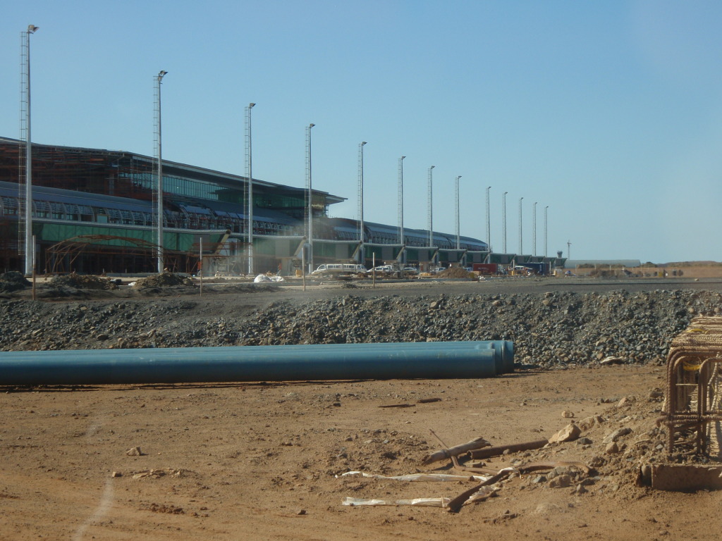
King Shaka International Airport , abbreviated KSIA, is the primary international airport serving Durban, South Africa. Located in La Mercy, KwaZulu-Natal, approximately north of the city centre of Durban. The airport opened its doors to passengers on 1 May 2010, 41 days before the start of the 2010 FIFA World Cup. It replaced Durban International Airport and uses the same International Air Transport Association airport code, IATA airport code. The airport was designed by Osmond Lange Architects and Planners and cost (about ). Although the larger airport was built to grow the area's international services, it is also a key airport for domestic services throughout South Africa, serving the "Golden Triangle" between Cape Town International Airport, O. R. Tambo International Airport in Johannesburg, and KSIA itself with 7 passenger and 2 cargo airlines offering domestic air services. The airport forms part of the Dube TradePort, which will additionally consist of a Free trade zo ... [...More Info...] [...Related Items...] OR: [Wikipedia] [Google] [Baidu] |
Jacob Zuma
Jacob Gedleyihlekisa Zuma (; born 12 April 1942) is a South African politician who served as the fourth president of South Africa from 2009 to 2018. He is also referred to by his initials JZ and clan name Msholozi, and was a former anti-apartheid activist, member of Umkhonto we Sizwe, and president of the African National Congress (ANC) between 2007 and 2017. Zuma was born in the rural region of Nkandla, which is now part of the KwaZulu-Natal province and the centre of Zuma's support base. He joined the ANC at the age of 17 in 1959, and spent ten years in Robben Island Prison as a political prisoner. He went into exile in 1975, and was ultimately appointed head of the ANC's intelligence department. After the ANC was unbanned in 1990, he quickly rose through the party's national leadership and became deputy secretary general in 1991, national chairperson in 1994, and deputy president in 1997. He was the deputy president of South Africa from 1999 to 2005 under President Thabo ... [...More Info...] [...Related Items...] OR: [Wikipedia] [Google] [Baidu] |
Isipingo
Isipingo is a town situated south of Durban in KwaZulu-Natal, South Africa and currently forms part of eThekwini Metropolitan Municipality. The town is named after the Siphingo River, which in turn is thought to be named (in the Zulu language) for the intertwining cat-thorn shrubs ''( Scutia myrtina)'' present in the area, or the river's winding course. History Dick King went to Natal in 1828 and was awarded a large stretch of land between the Umlaas/uMlaza and Mbokodweni rivers at present-day Isipingo Rail, an area where he had already acquired some farmland and built himself a house. King managed a sugar mill in Isipingo until his death in 1871 and was buried in the town. In May 1853, the Natal Mercury reported that Mr Jeffels of Isipingo ventured into sugarcane cultivation and is erecting buildings for sugar manufacturing. The indenture system was used from 1860 to supply cheap Indian labour to the sugar cane farms in Isipingo and the surrounding areas. In 1880, the railw ... [...More Info...] [...Related Items...] OR: [Wikipedia] [Google] [Baidu] |
Central Business District
A central business district (CBD) is the commercial and business centre of a city. It contains commercial space and offices, and in larger cities will often be described as a financial district. Geographically, it often coincides with the "city centre" or "downtown". However, these concepts are not necessarily synonymous: many cities have a central ''business'' district located away from its commercial and or cultural centre and or downtown/city centre, and there may be multiple CBDs within a single urban area. The CBD will often be characterised by a high degree of accessibility as well as a large variety and concentration of specialised goods and services compared to other parts of the city. For instance, Midtown Manhattan, New York City, is the largest central business district in the city and in the United States. London's city centre is usually regarded as encompassing the historic City of London and the medieval City of Westminster, while the City of London and the transform ... [...More Info...] [...Related Items...] OR: [Wikipedia] [Google] [Baidu] |
Bellaire, Durban
Bellair is a suburb of Durban, KwaZulu-Natal, South Africa. It is administered by the eThekwini Metropolitan Municipality and its postal code A postal code (also known locally in various English-speaking countries throughout the world as a postcode, post code, PIN or ZIP Code) is a series of letters or digits or both, sometimes including spaces or punctuation, included in a postal a ... is 4006. References * Suburbs of Durban {{KwaZuluNatal-geo-stub ... [...More Info...] [...Related Items...] OR: [Wikipedia] [Google] [Baidu] |
M7 (Durban)
The M7 is a metropolitan route in the Ethekwini Metropolitan Municipality, South Africa, connecting Pinetown to Brighton Beach in the Bluff. Route The M7 begins at the M13 off-ramp intersection with the M19 in Pinetown and follows a route south as a dual-carriage highway named 'Solomon Mahlangu Drive' (previously Edwin Swales VC Drive). Shortly after, it then meets the N3 highway (which connects to Pietermaritzburg Pietermaritzburg (; Zulu: umGungundlovu) is the capital and second-largest city in the province of KwaZulu-Natal, South Africa. It was founded in 1838 and is currently governed by the Msunduzi Local Municipality. Its Zulu name umGungundlovu ...) at an interchange and proceeds south-east as a dual-carriage highway. After the M34 (Durban), M34 Moseley Park off-ramp, the M7 leaves Pinetown and enters Queensburgh, winding through the town. It then turns eastwards at the Bellville Road off-ramp before ending as a dual-carriage highway east of Queensburgh at ... [...More Info...] [...Related Items...] OR: [Wikipedia] [Google] [Baidu] |
.jpg)


.jpg)