|
Lütschine River
The Lütschine is a river in the Bernese Oberland region of Switzerland. The Lütschine proper runs from Zweilütschinen, where its two tribututaries join, to Lake Brienz at Bönigen. The Schwarze Lütschine, or Black Lütschine, flows from Grindelwald to Zweilütschinen. The Weisse Lütschine, or White Lütschine, flows from the Lauterbrunnen Valley to Zweilütschinen. The common stretch of the river has a length of , whilst the Schwarze Lütschine is long and the Weisse Lütschine is long. Both branches of the Lütschine include a large number of mountain streams as tributaries. A notable tributary of the Schwarze Lütschine, emerging from the gorge of the Lower Grindelwald Glacier, is confusingly referred to as "Weisse Lütschine". The highest point of the drainage basin is the Jungfrau.1:25'000 Swisstopo topographic map A story passed on by word of mouth showing friendly banter between villagers that lived on the two rivers is that the people on the Weisse Lütschine said th ... [...More Info...] [...Related Items...] OR: [Wikipedia] [Google] [Baidu] |
Wilderswil
Wilderswil is a village and a Municipalities of Switzerland, municipality in the Interlaken-Oberhasli (administrative district), Interlaken-Oberhasli administrative district in the Cantons of Switzerland, canton of Bern (canton), Bern in Switzerland. Wilderswil belongs to the Small Agglomeration ''Interlaken'' with 23,300 inhabitants (2014). Geography The village of Wilderswil is situated at the southern border of the Bödeli, the tongue of land between Lake Thun and Lake Brienz in the Bernese Oberland region. It lies at the entrance to the mountain valleys containing the Lütschine river and its tributary the Saxetenbach, and is some south of Interlaken, the main town of the Bödeli. The municipality extends for some from the village, along the west bank of the Lütschine river, and includes the flanks of the mountains that border that valley to the west. Its altitude ranges from some , on the Bödeli plain, to , at the summit of Sulegg. It consists of the villages of Wil ... [...More Info...] [...Related Items...] OR: [Wikipedia] [Google] [Baidu] |
Lower Grindelwald Glacier
, photo = UntererGrindelwaldgletscher 01.jpg , photo_caption = Above the glacier lake the scrawny leftovers of the former much larger Lower Grindelwald Glacier (dark, polluted part) directly below of the blue-white ''Ischmeer'' (lit.: Ice Sea) and the Fiescherhörner ( a.s.l., The Horns of Fiesch). On the very right a nameless peak () and the Ostegg (, lit.: Eastern Corner), two peaks of the Hörnli, the eastern extension of the Eiger. On the left and above the glacier lake the green ''Bänisegg'' behind which the glacier's connection to its source used to be. View from ''Bäregg'' (, lit.: Bear's Corner). This valley used to be filled with ice as thick as up to (picture from July 2009). , type = Alpine , location = Canton of Berne, Switzerland , coords = , area = , length = , elevation_max = , elevation_min = , terminus = glacier lake (Weisse Lütschine (a tributary of the Schwarze Lütschine)) , thickness = , status = fast retreating , map = Switzerland#Alps , ... [...More Info...] [...Related Items...] OR: [Wikipedia] [Google] [Baidu] |
Berner Oberland Railway
The Bernese Oberland Railway (german: Berner Oberland-Bahn, BOB) is a narrow-gauge mountain railway in the Bernese Oberland region of Switzerland. It runs, via a "Y" junction at Zweilütschinen to serve Lauterbrunnen and Grindelwald from Interlaken. The railway is rack assisted (that is although an adhesion railway, rack and pinion operation is used on steep sections of the line to assist traction). The BOB is owned by the ''Berner Oberland-Bahnen AG'', a company that also owns the Schynige Platte Railway. Through that company it is part of the ''Allianz - Jungfrau Top of Europe'' marketing alliance, which also includes the separately owned Wengernalpbahn, Jungfraubahn, Bergbahn Lauterbrunnen–Mürren, Harderbahn, and Firstbahn. History Planning The first proposals for the Berner Oberland-Bahn, made in 1873, showed a line from Interlaken (at that time Aarmühle) to Zweilütschinen with later options to Lauterbrunnen and Grindlewald with starting point at Bönigen. Four year ... [...More Info...] [...Related Items...] OR: [Wikipedia] [Google] [Baidu] |
Swisstopo
Swisstopo is the official name for the Swiss Federal Office of Topography (in German language, German: ''Bundesamt für Landestopografie''; French language, French: ''Office fédéral de topographie''; Italian language, Italian: ''Ufficio federale di topografia''; Romansh language, Romansh: ''Uffizi federal da topografia''), Switzerland's national mapping agency. The current name was made official in 2002. It had been in use as the domain name for the institute's homepage, swisstopo.ch, since 1997. Maps The main class of products produced by Swisstopo are topographical maps on seven different Scale (map), scales. Swiss maps have been praised for their accuracy and quality. Regular maps * 1:25.000. This is the most detailed map, useful for many purposes. Those are popular with tourists, especially for famous areas like Zermatt and St. Moritz. These maps cost CHF 13.50 each (2004). 208 maps on this scale are published at regular intervals. The first map published on this scale ... [...More Info...] [...Related Items...] OR: [Wikipedia] [Google] [Baidu] |
Jungfrau
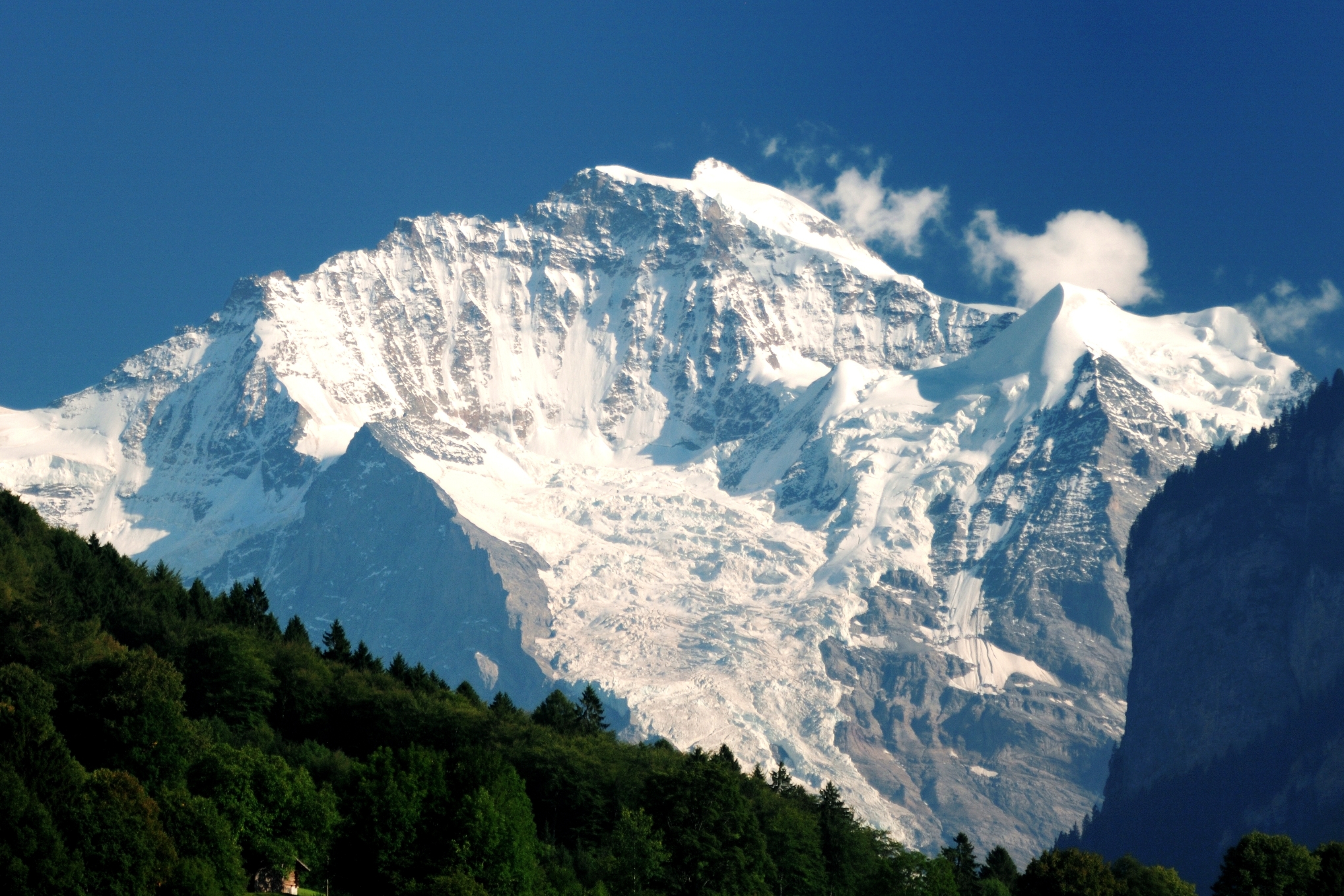
The Jungfrau ( "maiden, virgin"), at is one of the main summits of the Bernese Alps, located between the northern canton of Bern and the southern canton of Valais, halfway between Interlaken and Fiesch. Together with the Eiger and Mönch, the Jungfrau forms a massive wall of mountains overlooking the Bernese Oberland and the Swiss Plateau, one of the most distinctive sights of the Swiss Alps. The summit was first reached on August 3, 1811, by the Meyer brothers of Aarau and two chamois hunters from Valais. The ascent followed a long expedition over the glaciers and high passes of the Bernese Alps. It was not until 1865 that a more direct route on the northern side was opened. The construction of the Jungfrau Railway in the early 20th century, which connects Kleine Scheidegg to the Jungfraujoch, the saddle between the Mönch and the Jungfrau, made the area one of the most-visited places in the Alps. Along with the Aletsch Glacier to the south, the Jungfrau is part of the Jungf ... [...More Info...] [...Related Items...] OR: [Wikipedia] [Google] [Baidu] |
Lauterbrunnen
, neighboring_municipalities= Aeschi bei Spiez, Blatten (Lötschen) (VS), Fieschertal (VS), Grindelwald, Gündlischwand, Kandersteg, Lütschental, Reichenbach im Kandertal, Saxeten, Wilderswil , twintowns = } Lauterbrunnen is a village and Municipalities of Switzerland, municipality in the Interlaken-Oberhasli (administrative district), Interlaken-Oberhasli administrative district in the Cantons of Switzerland, canton of Canton of Bern, Bern in Switzerland. The municipality comprises the other villages of Wengen, Mürren, Gimmelwald, Stechelberg and Isenfluh, as well as several other hamlets. The population of the village of Lauterbrunnen is less than that of Wengen, but larger than that of the others. The municipality comprises the Lauterbrunnen Valley (german: Lauterbrunnental), located at the foot of the Bernese Alps. It is notably overlooked by the Eiger, Mönch and Jungfrau and many other high peaks. The valley, drained by the White Lütschine, comprehends the Soustal, t ... [...More Info...] [...Related Items...] OR: [Wikipedia] [Google] [Baidu] |
Switzerland
). Swiss law does not designate a ''capital'' as such, but the federal parliament and government are installed in Bern, while other federal institutions, such as the federal courts, are in other cities (Bellinzona, Lausanne, Luzern, Neuchâtel, St. Gallen a.o.). , coordinates = , largest_city = Zürich , official_languages = , englishmotto = "One for all, all for one" , religion_year = 2020 , religion_ref = , religion = , demonym = , german: Schweizer/Schweizerin, french: Suisse/Suissesse, it, svizzero/svizzera or , rm, Svizzer/Svizra , government_type = Federalism, Federal assembly-independent Directorial system, directorial republic with elements of a direct democracy , leader_title1 = Federal Council (Switzerland), Federal Council , leader_name1 = , leader_title2 = , leader_name2 = Walter Thurnherr , legislature = Fe ... [...More Info...] [...Related Items...] OR: [Wikipedia] [Google] [Baidu] |
Grindelwald
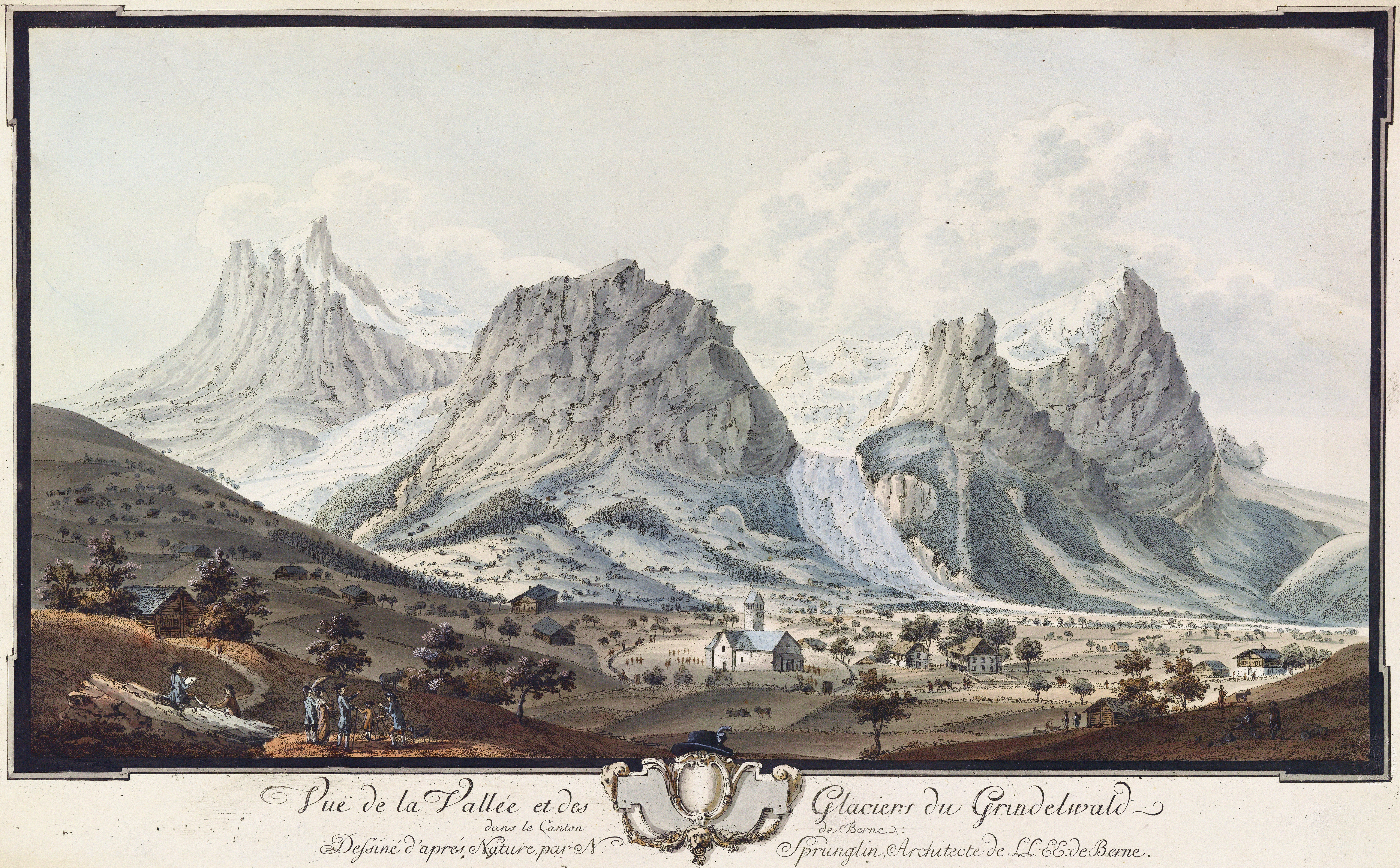
Grindelwald is a village and Municipalities of Switzerland, municipality in the Interlaken-Oberhasli (administrative district), Interlaken-Oberhasli administrative district in the Cantons of Switzerland, canton of Bern (canton), Berne. In addition to the village of Grindelwald, the municipality also includes the settlements of Alpiglen, Burglauenen, Grund, Itramen, Mühlebach, Schwendi, Tschingelberg and Wargistal. Grindelwald village is located at AMSL, above sea level. Mentioned for the first time in 1146, it has become a major tourist destination of both Switzerland and the Alps since the golden age of alpinism in the 19th century. It is notably overlooked by the section of the Bernese Alps from the Wetterhorn to the Eiger, making up a huge natural barrier. Together with the adjacent valley of Lauterbrunnen, the valley of Grindelwald forms part of the Jungfrau Region of the Bernese Oberland, between Interlaken and the main crest of the Bernese Alps. Similarly to Lauterbrunnen, ... [...More Info...] [...Related Items...] OR: [Wikipedia] [Google] [Baidu] |
Bönigen
Bönigen is a village and municipality in the Interlaken-Oberhasli administrative district in the Swiss canton of Bern. It lies on the shore of Lake Brienz, near to the mouth of the river Lütschine, and adjacent to the resort town of Interlaken. Bönigen belongs to the Small Agglomeration ''Interlaken'' with 23,300 inhabitants (2014). Bönigen belongs to the church parish of Gsteig bei Interlaken, which includes eight other nearby municipalities. History Bönigen is first mentioned in 1261 as ''villa Boningen''. The name Bönigen ("of the people of the Bono clan") is composed of the Old High German personal name ''Bono'' and the toponymic suffix ''-ingun''. The village was first mentioned in 1261 then the Freiherr of Eschenbach gave part of the village to Interlaken Abbey. He gave the Abbey additional lands in the village in 1275., the 1261 and 1275 it gave with Iselten and Künzlenalp the Interlaken monastery. Throughout its history, Bönigen was often at the center of unsuc ... [...More Info...] [...Related Items...] OR: [Wikipedia] [Google] [Baidu] |


