|
Louisiana Highway 3046
Louisiana Highway 3046 (LA 3046) is a state highway in Louisiana that serves Jefferson Parish. It spans in a south to north direction. It is known locally as Causeway Boulevard. Route description From the south, LA 3046 begins in Jefferson at an interchange with U.S. 90 ( Jefferson Highway). It heads north and immediately becomes elevated to cross several railroad tracks and LA 3139 (Earhart Expressway). LA 3046 ends at a multi-level traffic circle interchange with U.S. 61 (Airline Drive) in Metairie. Causeway Boulevard continues northward through Metairie to I-10 (Exit 228) and ultimately the Lake Pontchartrain Causeway. LA 3046 is a divided, four-lane highway for its entire length. History LA 3046 began as part of the Greater New Orleans Expressway, a 1950s project to transform the century-old Harlem Avenue right-of-way into a multilane highway connecting U.S. 90 (Jefferson Highway), U.S. 61 (Airline Highway, now Drive), and Veterans Memorial Highway (now Boulevard) to ... [...More Info...] [...Related Items...] OR: [Wikipedia] [Google] [Baidu] |
Jefferson, Louisiana
Jefferson is a census-designated place (CDP) in Jefferson Parish, Louisiana, United States, on the north side (referred to as the "East Bank") of the Mississippi River. Jefferson is part of the New Orleans– Metairie–Kenner metropolitan statistical area. The population was 11,193 at the 2010 census, and 10,533 in 2020. It is often known by locals as "Old Jefferson" (to distinguish itself from the rest of Jefferson Parish), but should not be confused with Old Jefferson in East Baton Rouge Parish, Louisiana. History Early French colonial documents show what would become Jefferson as part of the "Tchoupitoulas Coast" of Native American settlement. In the French and Spanish colonial era it was divided into a series of plantations with boundary lines perpendicular to the Mississippi River. In the American Civil War, Camp Parapet was built originally by Confederate forces to defend New Orleans from an attack from the upriver side. After the Union liberated the city sailin ... [...More Info...] [...Related Items...] OR: [Wikipedia] [Google] [Baidu] |
Metairie, Louisiana
Metairie ( ) is a census-designated place (CDP) in Jefferson Parish, Louisiana, United States, and is part of the New Orleans metropolitan area. With a population of 143,507 in 2020, Metairie is the largest community in Jefferson Parish and was (as of 2010) the fifth-largest CDP in the United States. It is an unincorporated area that (as of 2020) would have been Louisiana's fourth-largest city behind Shreveport if incorporated."Metairie, Louisiana (LA) Detailed Profile" (notes), ''City Data'', 2019, webpageC-Metr "Census 2020 Data for the State of Louisiana" (town list), US Census Bureau, May 2003, webpageC2020-LA Etymology ''Métairie'' () is the French term for a small tenant farm which paid the landlord with a share of the produce, a practice also known as sharecropping (in French, ''métayage''). In the 1760s many of the original French farmers were tenants; after the Civil War, the majority of the community's inhabitants were sharecroppers until urbanization started in the ... [...More Info...] [...Related Items...] OR: [Wikipedia] [Google] [Baidu] |
Jefferson Parish, Louisiana
Jefferson Parish (french: Paroisse de Jefferson; es, Parroquia de Jefferson) is a parish in the U.S. state of Louisiana. As of the 2020 census, the population was 440,781. Its parish seat is Gretna, its largest community is Metairie, and its largest incorporated city is Kenner. Jefferson Parish is included in the Greater New Orleans area. History 1825 to 1940 Jefferson Parish was named in honor of U.S. President Thomas Jefferson of Virginia when the parish was established by the Louisiana Legislature on February 11, 1825, a year before Jefferson died. A bronze statue of Jefferson stands at the entrance of the General Government Complex on Derbigny Street in Gretna. The parish seat was in the city of Lafayette, until that area was annexed by New Orleans in 1852. In that year the parish government moved to Carrollton, where it remained for twenty-two years. Originally, this parish was larger than it is today, running from Felicity Street in New Orleans to the St. Charles P ... [...More Info...] [...Related Items...] OR: [Wikipedia] [Google] [Baidu] |
State Highway
A state highway, state road, or state route (and the equivalent provincial highway, provincial road, or provincial route) is usually a road that is either ''numbered'' or ''maintained'' by a sub-national state or province. A road numbered by a state or province falls below numbered national highways (Canada being a notable exception to this rule) in the hierarchy (route numbers are used to aid navigation, and may or may not indicate ownership or maintenance). Roads maintained by a state or province include both nationally numbered highways and un-numbered state highways. Depending on the state, "state highway" may be used for one meaning and "state road" or "state route" for the other. In some countries such as New Zealand, the word "state" is used in its sense of a sovereign state or country. By this meaning a state highway is a road maintained and numbered by the national government rather than local authorities. Countries Australia Australia's State Route system covers u ... [...More Info...] [...Related Items...] OR: [Wikipedia] [Google] [Baidu] |
Louisiana
Louisiana , group=pronunciation (French: ''La Louisiane'') is a state in the Deep South and South Central regions of the United States. It is the 20th-smallest by area and the 25th most populous of the 50 U.S. states. Louisiana is bordered by the state of Texas to the west, Arkansas to the north, Mississippi to the east, and the Gulf of Mexico to the south. A large part of its eastern boundary is demarcated by the Mississippi River. Louisiana is the only U.S. state with political subdivisions termed parishes, which are equivalent to counties, making it one of only two U.S. states not subdivided into counties (the other being Alaska and its boroughs). The state's capital is Baton Rouge, and its largest city is New Orleans, with a population of roughly 383,000 people. Some Louisiana urban environments have a multicultural, multilingual heritage, being so strongly influenced by a mixture of 18th century Louisiana French, Dominican Creole, Spanish, French Canadian, Acadi ... [...More Info...] [...Related Items...] OR: [Wikipedia] [Google] [Baidu] |
Jefferson Highway
The Jefferson Highway was an automobile highway stretching through the central United States from New Orleans, Louisiana, to Winnipeg, Manitoba, Canada. The Jefferson Highway was replaced with the new numbered US Highway system in the late 1920s. Portions of the highway are still named Jefferson Highway, for example: the portions that run through Jefferson Parish, Louisiana; East Baton Rouge Parish, Louisiana; Lee's Summit, Missouri; Osseo, Minnesota; and Wadena, Minnesota. It was built in the 1910s as part of the National Auto Trail system. Named for President Thomas Jefferson, inspired by the east–west Lincoln Highway, it was nicknamed the "Palm to Pine Highway", for the varying types of trees found at either end. History The southern terminus of the Jefferson Highway was in New Orleans, Louisiana at the intersection of St. Charles Avenue and Common Street. It is marked by a six-foot tall Georgia granite obelisk donated by the New Orleans chapter of the Daughters ... [...More Info...] [...Related Items...] OR: [Wikipedia] [Google] [Baidu] |
Louisiana Highway 3139
Louisiana , group=pronunciation (French: ''La Louisiane'') is a state in the Deep South and South Central regions of the United States. It is the 20th-smallest by area and the 25th most populous of the 50 U.S. states. Louisiana is bordered by the state of Texas to the west, Arkansas to the north, Mississippi to the east, and the Gulf of Mexico to the south. A large part of its eastern boundary is demarcated by the Mississippi River. Louisiana is the only U.S. state with political subdivisions termed parishes, which are equivalent to counties, making it one of only two U.S. states not subdivided into counties (the other being Alaska and its boroughs). The state's capital is Baton Rouge, and its largest city is New Orleans, with a population of roughly 383,000 people. Some Louisiana urban environments have a multicultural, multilingual heritage, being so strongly influenced by a mixture of 18th century Louisiana French, Dominican Creole, Spanish, French Canadian, Acadi ... [...More Info...] [...Related Items...] OR: [Wikipedia] [Google] [Baidu] |
Earhart Expressway
The Earhart Expressway, named for former New Orleans Commissioner of Public Utilities, Fred A. Earhart, is a state highway located in both Jefferson Parish and Orleans Parish, Louisiana. It is also designated as Louisiana Highway 3139 (LA 3139), spanning a total of . Although it is an odd-numbered highway and is bannered north/south, it travels in a more east-to-west direction. Route description From the south (east), LA 3139 begins at the intersection of Earhart Boulevard and Monroe Street in New Orleans. The expressway designation begins several blocks later as Earhart Boulevard transitions into a limited-access freeway after crossing Hamilton Street. Earhart Expressway proceeds westward and passes over Hoey's Canal and the Canadian National Railway (CN) as it crosses from Orleans Parish into Jefferson Parish. A partial interchange at Deckbar Avenue provides access to U.S. 90 (Jefferson Highway). Continuing westward along the southern boundary of Metairie, the expressway p ... [...More Info...] [...Related Items...] OR: [Wikipedia] [Google] [Baidu] |
Airline Drive
Airline Highway is a divided highway in the U.S. state of Louisiana, built in stages between 1925 and 1953 to bypass the older Jefferson Highway. It runs , carrying U.S. Highway 61 from New Orleans northwest to Baton Rouge and U.S. Highway 190 from Baton Rouge west over the Mississippi River on the Huey P. Long Bridge. US 190 continues west towards Opelousas on an extension built at roughly the same time. The highway was named "Airline" because it runs relatively straight on a new alignment, rather than alongside the winding Mississippi River. (Compare with the similar term ''air-line railroad''.) The name later became even more fitting, as both Louis Armstrong New Orleans International Airport and Baton Rouge Metropolitan Airport were built along the highway. Airline Highway also runs close to the site of the old Baton Rouge airfield (near the intersection of Airline and Florida Boulevard, now a park and government office complex), which brings it within blocks of the simila ... [...More Info...] [...Related Items...] OR: [Wikipedia] [Google] [Baidu] |
Interstate 10 In Louisiana
Interstate 10 (I-10), a major transcontinental Interstate Highway in the Southern United States, runs across the southern part of Louisiana for from Texas to Mississippi. It passes through Lake Charles, Lafayette, and Baton Rouge, dips south of Lake Pontchartrain to serve the New Orleans metropolitan area, then crosses Lake Pontchartrain and leaves the state. On August 29, 2005, the I-10 Twin Span Bridge was severely damaged by Hurricane Katrina, rendering it unusable. The bridge was repaired, and later replaced with two higher elevation spans in 2009 and 2010. Route description I-10 enters Louisiana at the state's southwestern corner from Orange, Texas, in a concurrency with US Route 90 (US 90), which leaves the freeway at the first exit. The two routes closely parallel each other through much of the state. The first community I-10 approaches in the state is Vinton, Louisiana. Between Sulphur and Lake Charles there is an interchange with I-210. I-10 cr ... [...More Info...] [...Related Items...] OR: [Wikipedia] [Google] [Baidu] |
Lake Pontchartrain Causeway
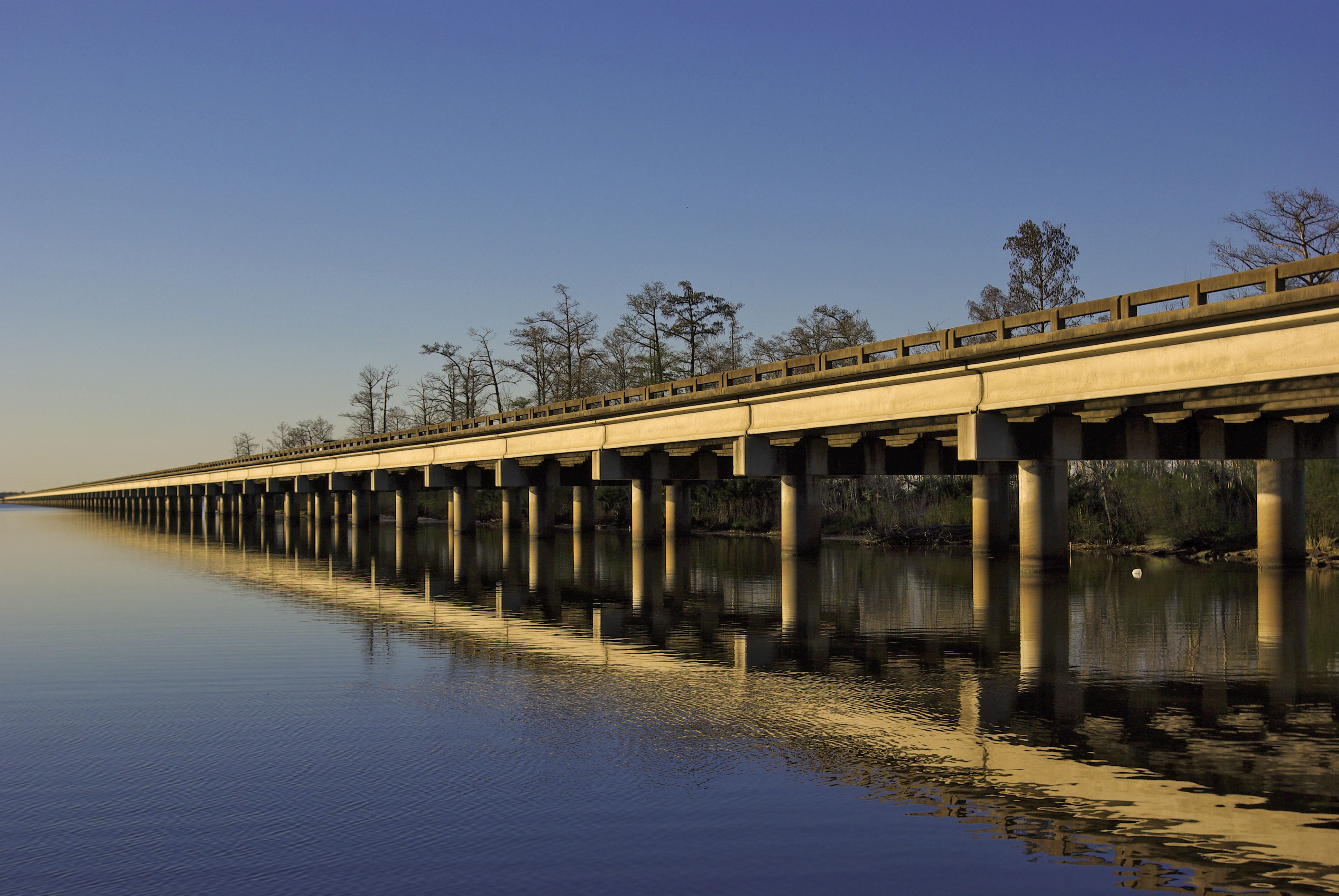
The Lake Pontchartrain Causeway (french: Chaussée du lac Pontchartrain), also known simply as The Causeway, is a fixed link composed of two parallel bridges crossing Lake Pontchartrain in southeastern Louisiana, United States. The longer of the two bridges is long. The southern terminus of the causeway is in Metairie, Louisiana, a south shore suburb of New Orleans. The northern terminus is in Mandeville, Louisiana, a north shore suburb of New Orleans. From 1969 until 2011, it was listed by ''Guinness World Records'' as the List of longest bridges in the world, longest bridge over water in the world; in 2011, in response to the opening of the longer Jiaozhou Bay Bridge in China, ''Guinness World Records'' created two categories for bridges over water: continuous and aggregate lengths over water. Lake Pontchartrain Causeway then became the longest bridge over water (continuous), while Jiaozhou Bay Bridge the longest bridge over water (aggregate). The bridges are supported by 9,5 ... [...More Info...] [...Related Items...] OR: [Wikipedia] [Google] [Baidu] |
Greater New Orleans Expressway
Greater may refer to: *Greatness Greatness is a concept of a state of superiority affecting a person or object in a particular place or area. Greatness can also be attributed to individuals who possess a natural ability to be better than all others. An example of an expressio ..., the state of being great *Greater than, in inequality * ''Greater'' (film), a 2016 American film * Greater (flamingo), the oldest flamingo on record * "Greater" (song), by MercyMe, 2014 * Greater Bank, an Australian bank * Greater Media, an American media company See also * * {{Disambiguation ... [...More Info...] [...Related Items...] OR: [Wikipedia] [Google] [Baidu] |


