|
Loobu River
The Loobu is a river in Northern Estonia. Its source is about 12 km southwest from Rakvere in Lääne-Viru County and it drains into Eru Bay (part of Finnish Gulf) near the village of Vihasoo in Lahemaa National Park. Its drainage basin is rather small and narrow, Loobu lacks any major tributaries. At Joaveski, 10 km upstream from its mouth, the Loobu flows over the Baltic Klint, forming the Joaveski Waterfall. Kadrina (population: 2,600) is the only significant settlement on the river. Gallery File:Undla veskijärv (Loobu jõgi).JPG, Undla impounded lake on the Loobu File:Loobu jõe "kalatrepp".JPG, A fish ladder on the Loobu File:Joaveski juga.jpg, The Joaveski Waterfall References * Rivers of Estonia Landforms of Lääne-Viru County {{Estonia-river-stub ... [...More Info...] [...Related Items...] OR: [Wikipedia] [Google] [Baidu] |
Jõepere
Jõepere is a village in Kadrina Parish, Lääne-Viru County, in northeastern Estonia. It's the origin of the Loobu River. Writer Friedrich Reinhold Kreutzwald (1803–1882) was born in Jõepere Manor. References Villages in Lääne-Viru County Kreis Wierland {{LääneViru-geo-stub ... [...More Info...] [...Related Items...] OR: [Wikipedia] [Google] [Baidu] |
Eru Bay
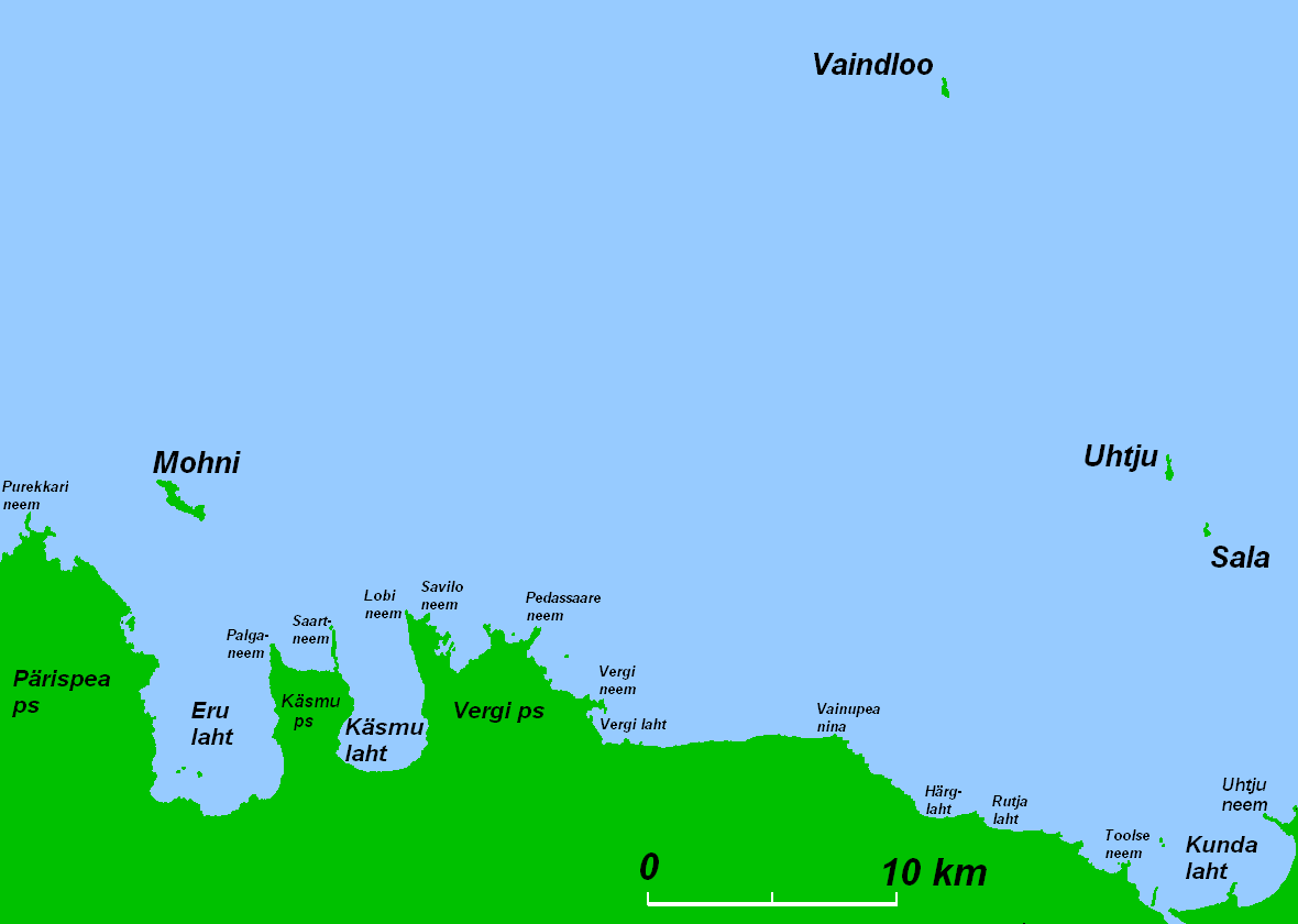
Eru Bay ( et, Eru laht, also et, Mungalaht) is bay in Kuusalu Parish (Harju County) and Haljala Parish, Lääne-Viru County in Estonia; the bay is part of Gulf of Finland. Area of the bay is 7656 ha. The bay is bordered by Pärispea Peninsula and Käsmu Peninsula. Loobu River The Loobu is a river in Northern Estonia. Its source is about 12 km southwest from Rakvere in Lääne-Viru County and it drains into Eru Bay (part of Finnish Gulf) near the village of Vihasoo in Lahemaa National Park. Its drainage basin is ... drains into Eru Bay. References {{WikidataCoord, Q12362344, display=title Bays of Estonia Kuusalu Parish Haljala Parish ... [...More Info...] [...Related Items...] OR: [Wikipedia] [Google] [Baidu] |
Gulf Of Finland
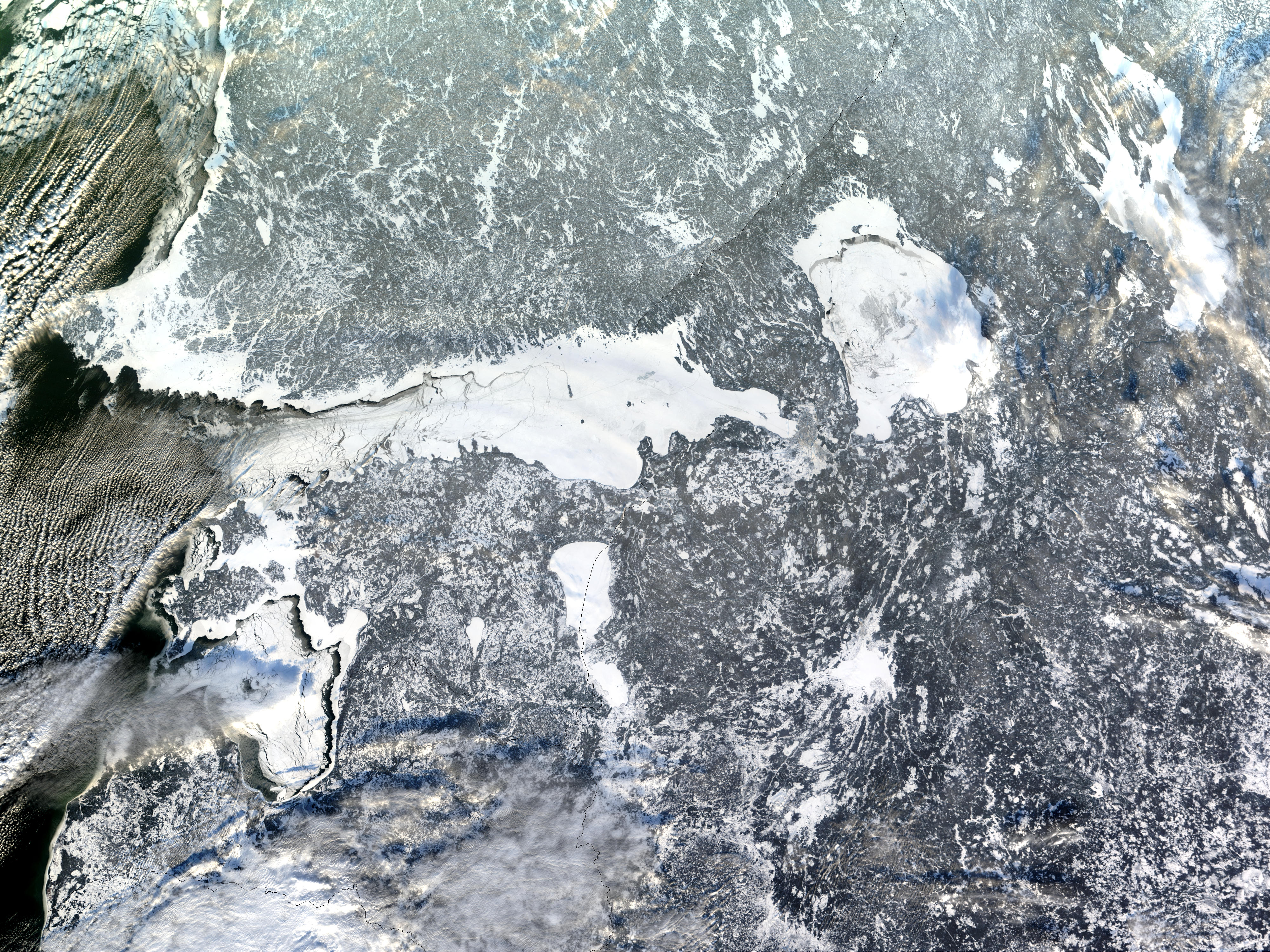
The Gulf of Finland ( fi, Suomenlahti; et, Soome laht; rus, Фи́нский зали́в, r=Finskiy zaliv, p=ˈfʲinskʲɪj zɐˈlʲif; sv, Finska viken) is the easternmost arm of the Baltic Sea. It extends between Finland to the north and Estonia to the south, to Saint Petersburg in Russia to the east, where the river Neva drains into it. Other major cities around the gulf include Helsinki and Tallinn. The eastern parts of the Gulf of Finland belong to Russia, and some of Russia's most important oil harbors are located farthest in, near Saint Petersburg (including Primorsk). As the seaway to Saint Petersburg, the Gulf of Finland has been and continues to be of considerable strategic importance to Russia. Some of the environmental problems affecting the Baltic Sea are at their most pronounced in the shallow gulf. Proposals for a tunnel through the gulf have been made. Geography The gulf has an area of . The length (from the Hanko Peninsula to Saint Petersburg) is and t ... [...More Info...] [...Related Items...] OR: [Wikipedia] [Google] [Baidu] |
Estonia
Estonia, formally the Republic of Estonia, is a country by the Baltic Sea in Northern Europe. It is bordered to the north by the Gulf of Finland across from Finland, to the west by the sea across from Sweden, to the south by Latvia, and to the east by Lake Peipus and Russia. The territory of Estonia consists of the mainland, the larger islands of Saaremaa and Hiiumaa, and over 2,200 other islands and islets on the eastern coast of the Baltic Sea, covering a total area of . The capital city Tallinn and Tartu are the two largest urban areas of the country. The Estonian language is the autochthonous and the official language of Estonia; it is the first language of the majority of its population, as well as the world's second most spoken Finnic language. The land of what is now modern Estonia has been inhabited by '' Homo sapiens'' since at least 9,000 BC. The medieval indigenous population of Estonia was one of the last " pagan" civilisations in Europe to adopt Ch ... [...More Info...] [...Related Items...] OR: [Wikipedia] [Google] [Baidu] |
Rakvere
Rakvere is a town in northern Estonia and the administrative centre of the Lääne-Viru ''maakond'' (county), 20 km south of the Gulf of Finland of the Baltic Sea. Rakvere is the 8th most populous urban area in Estonia. Rakvere has a total area of 10.75 square kilometres, and although about 15% of it is covered by forest, the city is still populated so densely as to make it the third most densely populated city in Estonia. From the 13th century until the early 20th century, Rakvere was more widely known by its historical German name, ''Wesenberg(h)''. History The earliest signs of human settlement dating back to the 3rd–5th centuries AD have been found on the present theatre hill. Probably to protect that settlement, a wooden stronghold was built on the present-day Vallimägi. Soon after the kingdom of Denmark had conquered northern Estonia, in 1220, the new rulers started to erect stone buildings. A settlement called ''Tarvanpea'' was first mentioned in the Chronicle ... [...More Info...] [...Related Items...] OR: [Wikipedia] [Google] [Baidu] |
Lääne-Viru County
Lääne-Viru County ( et, Lääne-Viru maakond or ''Lääne-Virumaa'') is one of 15 counties of Estonia. It is in northern Estonia, on the south coast of the Gulf of Finland. In Estonian, ''lääne'' means western and ''ida'' means east or eastern. Lääne-Viru borders Ida-Viru County to the east, Jõgeva County to the south, and Järva and Harju counties to the west. In January 2013, Lääne-Viru County had a population of 58,806: 4.5% of the population in Estonia. History In prehistoric times, Lääne-Virumaa was settled by Estonians of the Vironian tribe. County Government The County Government ( et, maavalitsus) is led by a governor ( et, maavanem), who is appointed by the Government of Estonia. Since 2014, the governor position has been held by Marko Torm. The county seat is Rakvere. Municipalities The county is subdivided into municipalities. There is one urban municipality ( et, linnad – towns) and seven rural municipalities ( et, vallad – parishes) in Lä� ... [...More Info...] [...Related Items...] OR: [Wikipedia] [Google] [Baidu] |
Finnish Gulf
The Gulf of Finland ( fi, Suomenlahti; et, Soome laht; rus, Фи́нский зали́в, r=Finskiy zaliv, p=ˈfʲinskʲɪj zɐˈlʲif; sv, Finska viken) is the easternmost arm of the Baltic Sea. It extends between Finland to the north and Estonia to the south, to Saint Petersburg in Russia to the east, where the river Neva drains into it. Other major cities around the gulf include Helsinki and Tallinn. The eastern parts of the Gulf of Finland belong to Russia, and some of Russia's most important oil harbors are located farthest in, near Saint Petersburg (including Primorsk, Leningrad Oblast, Primorsk). As the seaway to Saint Petersburg, the Gulf of Finland has been and continues to be of considerable strategic importance to Russia. Some of the Baltic Sea#Environmental status, environmental problems affecting the Baltic Sea are at their most pronounced in the shallow gulf. Proposals for a Helsinki–Tallinn Tunnel, tunnel through the gulf have been made. Geography The gulf ... [...More Info...] [...Related Items...] OR: [Wikipedia] [Google] [Baidu] |
Vihasoo
Vihasoo is a village in Kuusalu Parish, Harju County in northern Estonia, on the territory of Lahemaa National Park. It is situated around the mouth of the Loobu River to the Eru Bay Eru Bay ( et, Eru laht, also et, Mungalaht) is bay in Kuusalu Parish (Harju County) and Haljala Parish, Lääne-Viru County in Estonia; the bay is part of Gulf of Finland. Area of the bay is 7656 ha. The bay is bordered by Pärispea Peninsula a ... (part of the Gulf of Finland). References Villages in Harju County {{Harju-geo-stub ... [...More Info...] [...Related Items...] OR: [Wikipedia] [Google] [Baidu] |
Lahemaa National Park
Lahemaa National Park is a park in northern Estonia, 70 kilometers east from the capital Tallinn. The Gulf of Finland is to the north of the park and the Tallinn-Narva highway (E20) is to the south. Its area covers 747 km2 (including 274.9 km2 of sea).EstonicaLahemaa National Park: from coastal drumlins to Kõrvemaa, Estonica, Encyclopedia About Estonia It was the first area to be designated a national park of the former Soviet Union. It is the largest park in Estonia and one of Europe's biggest national parks. Its charter calls for the preservation, research and promotion of North-Estonian landscapes, ecosystems, biodiversity and national heritage. History The name Lahemaa originates from the most thoroughly studied and visited part of the North Estonian coast, where four large peninsulas (Juminda, Pärispea, Käsmu and Vergi) are separated from each other by four bays (Kolga, Hara, Eru and Käsmu). Lahemaa translates roughly as "Land of Bays". The national park, estab ... [...More Info...] [...Related Items...] OR: [Wikipedia] [Google] [Baidu] |
Drainage Basin
A drainage basin is an area of land where all flowing surface water converges to a single point, such as a river mouth, or flows into another body of water, such as a lake or ocean. A basin is separated from adjacent basins by a perimeter, the '' drainage divide'', made up of a succession of elevated features, such as ridges and hills. A basin may consist of smaller basins that merge at river confluences, forming a hierarchical pattern. Other terms for a drainage basin are catchment area, catchment basin, drainage area, river basin, water basin, and impluvium. In North America, they are commonly called a watershed, though in other English-speaking places, "watershed" is used only in its original sense, that of a drainage divide. In a closed drainage basin, or endorheic basin, the water converges to a single point inside the basin, known as a sink, which may be a permanent lake, a dry lake, or a point where surface water is lost underground. Drainage basins are similar ... [...More Info...] [...Related Items...] OR: [Wikipedia] [Google] [Baidu] |
Joaveski
Joaveski is a village in Kuusalu Parish, Harju County in northern Estonia, on the territory of Lahemaa National Park. It lies at the Loobu River The Loobu is a river in Northern Estonia. Its source is about 12 km southwest from Rakvere in Lääne-Viru County and it drains into Eru Bay (part of Finnish Gulf) near the village of Vihasoo in Lahemaa National Park. Its drainage basin .... References Villages in Harju County {{Harju-geo-stub ... [...More Info...] [...Related Items...] OR: [Wikipedia] [Google] [Baidu] |
Baltic Klint
The Baltic Klint (Clint, Glint; et, Balti klint, sv, Baltiska klinten, russian: Балтийско-Ладожский уступ, Глинт) is an erosional limestone escarpment and cuesta on several islands of the Baltic Sea, in Estonia, in Leningrad Oblast of Russia and in the islands of Gotland and Öland of Sweden. It was featured on the reverse of the 50 krooni note of 1928 and on the 100 krooni note of 1992. The Baltic Klint is active landform showing some retreat in the present. However it is not known to which degree the Baltic Klint originated in postglacial time or if it evolved from cliff-like forms sculpted by the Fennoscandian Ice Sheet. In Gotland 20th century cliff retreat rates have been estimated at 0.15 to 0.78 cm/year. Retreat of the Baltic Klint in Gotland has widened shore platforms. Geography The Baltic Klint extends approximately 1200 km from the island of Öland in Sweden through the continental shelf and the Estonian islands of Osmussaa ... [...More Info...] [...Related Items...] OR: [Wikipedia] [Google] [Baidu] |


