|
Longue-Pointe
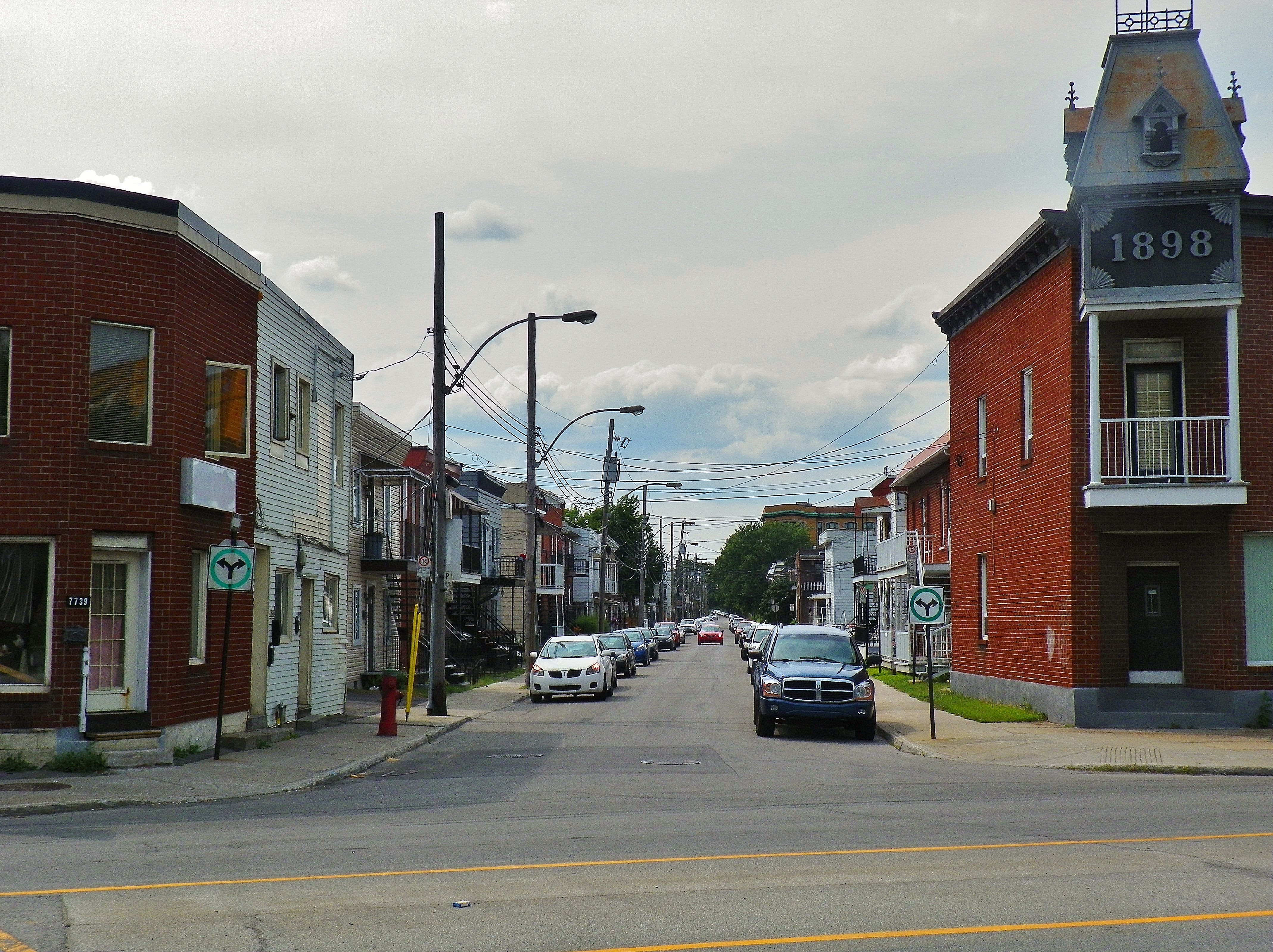
Longue-Pointe () was a Montreal neighbourhood now located in the borough of Mercier-Hochelaga-Maisonneuve. The neighborhood was permanently divided by the construction of the Louis-Hippolyte Lafontaine Tunnel. Most of its territory is now part of the Mercier-Ouest while some of the area that fell east of the highway is now within Mercier-Est. It is best known for its military base, CFB Longue-Pointe, the supply depot for all of Eastern Canada's armed forces. Around 2000 civilians and soldiers work at CFB Longue Pointe. Longue-Pointe was the site of a famous battle in the American Revolutionary War in 1775, in which Ethan Allen made an ill-fated attempt to capture Montreal from the Kingdom of Great Britain The Kingdom of Great Britain (officially Great Britain) was a Sovereign state, sovereign country in Western Europe from 1 May 1707 to the end of 31 December 1800. The state was created by the 1706 Treaty of Union and ratified by the Acts of .... References Exte ... [...More Info...] [...Related Items...] OR: [Wikipedia] [Google] [Baidu] |
Longue-Pointe-de-Mingan, Quebec
Longue-Pointe-de-Mingan is a municipality in the Côte-Nord region of the province of Quebec in Canada. The descriptive name Longue-Pointe (French for "Long Point") refers to a long spit of sand west of the village that has had various names through the centuries: first called Longue Pointe on a map of 1735, followed by the English form of Long Point in the late 17th and early 18th century, then Mingan Point on the map of Captain Carver (1776). James Cook and Placide Vigneau called it Pointe de Mingan (1784) and Longue-Pointe-de-Mingan (1857) respectively. History Around 1880, the first settlers arrived, mostly from Paspébiac, themselves descendants of Acadians. In 1885, the post office opened. The municipality was officially created in 1966 as Longue-Pointe, but renamed to Longue-Pointe-de-Mingan on April 5, 1997. Demographics Population Language Tourism In the region, there is a statue of a Giant Puffin. It is a tribute to the seabirds that live in colonies around the ... [...More Info...] [...Related Items...] OR: [Wikipedia] [Google] [Baidu] |
Battle Of Longue-Pointe
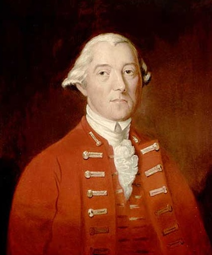
The Battle of Longue-Pointe (french: Bataille de Longue-Pointe) was an attempt by Ethan Allen and a small force of American and Quebec militia to capture Montreal from British forces on September 25, 1775, early in the American Revolutionary War. Allen, who had been instructed only to raise militia forces among the local inhabitants, had long had thoughts of taking the lightly defended city. When he reached the southern shore of the St. Lawrence River with about 110 men, he seized the opportunity to try. Major John Brown, whom Allen claimed was supposed to provide additional forces, did not appear as they had planned, isolating Allen and his men on the north side of the river. British General Guy Carleton sent a force composed mostly of Quebec militia in response to news of Allen's crossing of the St. Lawrence. This force cut off Allen's escape route, and eventually surrounded and captured Allen and a number of his men. Carleton eventually abandoned Montreal, which fell without ... [...More Info...] [...Related Items...] OR: [Wikipedia] [Google] [Baidu] |
Mercier-Ouest
Mercier denotes the eastern portion of the Mercier–Hochelaga-Maisonneuve borough of the city of Montreal, Quebec. It consists of two neighbourhoods Mercier-Ouest (''Longue-Pointe'') and Mercier-Est (''Tétreaultville''). History Mercier was named after Honoré Mercier (1840–1894), Premier of Quebec from 1887 to 1891. Urbanization began in 1890, and the western portion, Longue-Pointe, become an industrial area by the early 20th century. This social transformation was induced by the arrival of large industries in Longue-Pointe and the building of a tramway on Notre-Dame Street. Originally an agglomeration of old villages, Longue-Pointe and Tétreaultville, they were annexed to Montreal in 1910. The neighbourhood's social and economic character was vastly transformed during the urban planning of the 1960s in Montreal in anticipation of Expo 67. In 1960, the construction of the Autoroute 25 saw the demolition of many residential buildings in Mercier and divided it int ... [...More Info...] [...Related Items...] OR: [Wikipedia] [Google] [Baidu] |
Mercier-Est
Mercier denotes the eastern portion of the Mercier–Hochelaga-Maisonneuve borough of the city of Montreal, Quebec. It consists of two neighbourhoods Mercier-Ouest (''Longue-Pointe'') and Mercier-Est (''Tétreaultville''). History Mercier was named after Honoré Mercier (1840–1894), Premier of Quebec from 1887 to 1891. Urbanization began in 1890, and the western portion, Longue-Pointe, become an industrial area by the early 20th century. This social transformation was induced by the arrival of large industries in Longue-Pointe and the building of a tramway on Notre-Dame Street. Originally an agglomeration of old villages, Longue-Pointe and Tétreaultville, they were annexed to Montreal in 1910. The neighbourhood's social and economic character was vastly transformed during the urban planning of the 1960s in Montreal in anticipation of Expo 67. In 1960, the construction of the Autoroute 25 saw the demolition of many residential buildings in Mercier and divided it into ... [...More Info...] [...Related Items...] OR: [Wikipedia] [Google] [Baidu] |
Ethan Allen
Ethan Allen ( – February 12, 1789) was an American farmer, businessman, land speculator, philosopher, writer, lay theologian, American Revolutionary War patriot, and politician. He is best known as one of the founders of Vermont and for the capture of Fort Ticonderoga early in the Revolutionary War. He was the brother of Ira Allen and the father of Frances Allen. Allen was born in rural Connecticut and had a frontier upbringing, but he also received an education that included some philosophical teachings. In the late 1760s, he became interested in the New Hampshire Grants, buying land there and becoming embroiled in the legal disputes surrounding the territory. Legal setbacks led to the formation of the Green Mountain Boys, whom Allen led in a campaign of intimidation and property destruction to drive New York settlers from the Grants. He and the Green Mountain Boys seized the initiative early in the Revolutionary War and captured Fort Ticonderoga in May 1775. In Septemb ... [...More Info...] [...Related Items...] OR: [Wikipedia] [Google] [Baidu] |
CFB Longue-Pointe
Canadian Forces Base Montreal (also CFB Montreal or "Longue-Pointe" to members of 34 Brigade) is a Canadian Forces Base network located in Montreal, Quebec. Its official name is 2nd Canadian Division Support Base Valcartier, Detachment Montreal The address of CFB Montreal is 6769 Notre-Dame Street. History In 1994, the Canadian Forces Bases (CFBs) in Montreal and Saint-Jean were merged to create a new entity, an expanded CFB Montreal that included the Longue-Pointe, Saint-Hubert ( Saint-Hubert), CFB Saint-Jean, Farnham and Saint-Bruno sites. In 1998, the mergers culminated in the amalgamation of CFB Montreal and CFB Valcartier into a new organization, 5 Area Support Group (now 2nd Canadian Division Support Group). Physical description CFB Montreal is delimited by sectors north and south accessible from streets Notre-Dame Street and Hochelaga. The north and south sectors of CFB Montreal occupy an area of square. Montreal CFB covers several sites: for example many armories ... [...More Info...] [...Related Items...] OR: [Wikipedia] [Google] [Baidu] |
List Of Neighbourhoods In Montreal
This is the list of the neighbourhoods in the city of Montreal, Quebec, Canada. They are sorted by the borough they are located in. Ahuntsic-Cartierville * Ahuntsic * Nouveau-Bordeaux * Cartierville *Saint-Sulpice * Sault-au-Récollet ( Île de la Visitation) Anjou *Bas-Anjou: The Southeastern older portion, where the main services are located (town Hall, main library, fire station, high school) *Haut-Anjou: The L-shaped part consisting of every street North of Autoroute 40 and every street West of Autoroute 25 Côte-des-Neiges–Notre-Dame-de-Grâce * Côte-des-Neiges * Notre-Dame-de-Grâce ** Benny Farm * Snowdon * Le Triangle Lachine * Ville Saint-Pierre LaSalle No particular neighbourhoods. Cecil-P.-Newman Sault-Saint-Louis Le Plateau-Mont-Royal The Plateau Montreal's trendy and colourful Plateau Mont Royal neighbourhood is located on the twin North-South axes of Saint Laurent Boulevard and Saint Denis Street, and East-West axes of Mount Royal Avenue ... [...More Info...] [...Related Items...] OR: [Wikipedia] [Google] [Baidu] |
Côte-Nord
Côte-Nord (, ; ; land area ) is the second-largest administrative region by land area in Quebec, Canada, after Nord-du-Québec. It covers much of the northern shore of the Saint Lawrence River estuary and the Gulf of Saint Lawrence past Tadoussac. While most of the region is in the same time zone as the rest of Quebec, the far eastern portion east of the 63rd meridian, excluding the Minganie Regional County Municipality, is officially in the Atlantic Time Zone and does not observe daylight saving time. Population At the 2016 Canadian Census, the population amounted to 92,518, approximately 1.1% of the province's population, spread across 33 municipalities, various Indian reserves and a Naskapi reserved land. The towns of Baie-Comeau and Sept-Îles, Quebec, Sept-Îles combined amount to a little more than half of the population of the region. Geography and economy Côte-Nord was created as an administrative region in 1966. Important landmarks of Côte-Nord include Anticost ... [...More Info...] [...Related Items...] OR: [Wikipedia] [Google] [Baidu] |
Quebecor Media Inc
Quebecor Inc. is a Canadian diversified media and telecommunications company serving Québec based in Montreal. It was spelled Quebecor in both English and French until May 2012, when shareholders voted to add the acute accent, Québecor, in French only. The company was founded in 1965 by Pierre Péladeau and remains run by his family. Quebecor Inc. owns Quebecor Media and formerly owned the printing company Quebecor World. Assets Telecommunications *Vidéotron **illico TV (channel 900) **illico.tv **Club illico ( SVOD service) **Vrai (unscripted SVOD service) **illico app **Canal Indigo (pay-per-view and NVOD channel; bilingual with English- and French-language services) **Fizz (internet and cellular provider) **Vidéotron Business ***Fibrenoire **MAtv (community channels) **Helix (internet and IPTV provider) **Le SuperClub Vidéotron (video rental chain) ***Microplay (video game retail) *SETTE Postproduction * VMedia (Toronto, Ontario) Media *Groupe TVA **TVA *** CFTM-DT Mo ... [...More Info...] [...Related Items...] OR: [Wikipedia] [Google] [Baidu] |
Kingdom Of Great Britain
The Kingdom of Great Britain (officially Great Britain) was a Sovereign state, sovereign country in Western Europe from 1 May 1707 to the end of 31 December 1800. The state was created by the 1706 Treaty of Union and ratified by the Acts of Union 1707, which united the kingdoms of Kingdom of England, England (which included Wales) and Kingdom of Scotland, Scotland to form a single kingdom encompassing the whole island of Great Britain and its outlying islands, with the exception of the Isle of Man and the Channel Islands. The unitary state was governed by a single Parliament of Great Britain, parliament at the Palace of Westminster, but distinct legal systems – English law and Scots law – remained in use. The formerly separate kingdoms had been in personal union since the 1603 "Union of the Crowns" when James VI of Scotland became King of England and King of Ireland. Since James's reign, who had been the first to refer to himself as "king of Great Britain", a political un ... [...More Info...] [...Related Items...] OR: [Wikipedia] [Google] [Baidu] |
American Revolutionary War
The American Revolutionary War (April 19, 1775 – September 3, 1783), also known as the Revolutionary War or American War of Independence, was a major war of the American Revolution. Widely considered as the war that secured the independence of the United States, fighting began on April 19, 1775, followed by the Lee Resolution on July 2, 1776, and the Declaration of Independence on July 4, 1776. The American Patriots were supported by the Kingdom of France and, to a lesser extent, the Dutch Republic and the Spanish Empire, in a conflict taking place in North America, the Caribbean, and the Atlantic Ocean. Established by royal charter in the 17th and 18th centuries, the American colonies were largely autonomous in domestic affairs and commercially prosperous, trading with Britain and its Caribbean colonies, as well as other European powers via their Caribbean entrepôts. After British victory over the French in the Seven Years' War in 1763, tensions between the motherland and he ... [...More Info...] [...Related Items...] OR: [Wikipedia] [Google] [Baidu] |


