|
Longriggend
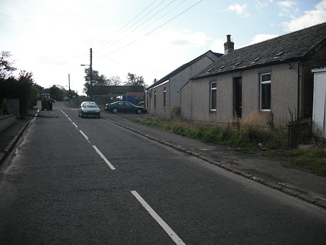
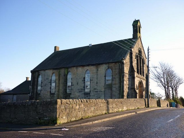
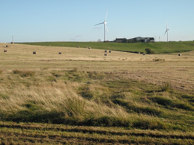
Longriggend is a village in North Lanarkshire, Scotland, with a population of approximately 200. It is situated on moorland 8 km north-east of Airdrie, in the parish of New Monkland. It is roughly half way between Upperton and Caldercruix. The village appeared on a map by Timothy Pont, under the name of ''Langrodge''. It was published in 1596 but the letters are difficult to read. The toponymy is listed along with other -rigg placenames. Longriggend is also shown on another map by Roy c1754. Slamannan Railway joined Longriggend with Airdrie and the Union Canal in 1840, but its gauge prevented its connection with the ''Edinburgh & Glasgow Railway''. Coal pits in the area used the railway extensively, and by 1895 there was a station at Longriggend. By 1901 its population had reached over 1500, and it had a post and telegraph office, and an inn nearby. The Ordnance Survey in 1867 also recorded a Roman Catholic school in the village. Longriggend Fever Hospital and Remand ... [...More Info...] [...Related Items...] OR: [Wikipedia] [Google] [Baidu] |
Longriggend Desolation - Geograph
Longriggend is a village in North Lanarkshire, Scotland, with a population of approximately 200. It is situated on moorland 8 km north-east of Airdrie, in the parish of New Monkland. It is roughly half way between Upperton and Caldercruix. The village appeared on a map by Timothy Pont, under the name of ''Langrodge''. It was published in 1596 but the letters are difficult to read. The toponymy is listed along with other -rigg placenames. Longriggend is also shown on another map by Roy c1754. Slamannan Railway joined Longriggend with Airdrie and the Union Canal in 1840, but its gauge prevented its connection with the ''Edinburgh & Glasgow Railway''. Coal pits in the area used the railway extensively, and by 1895 there was a station at Longriggend. By 1901 its population had reached over 1500, and it had a post and telegraph office, and an inn nearby. The Ordnance Survey in 1867 also recorded a Roman Catholic school in the village. Longriggend Fever Hospital and Remand ... [...More Info...] [...Related Items...] OR: [Wikipedia] [Google] [Baidu] |
Upperton, North Lanarkshire
Upperton is a village in North Lanarkshire, Scotland, near Airdrie and Cumbernauld, about north-east of Glasgow. It lies close to the B803 between Greengairs and Slamannan. Other nearby roads include Hulks Road towards the A73, Fannyside Road to Abronhill and the road to Caldercruix via Longriggend. The Avon Water flows through the village and meets the Shielhill Burn, a tributary of the River Avon, just outside the village. William Forrest's 1816 map of Lanarkshire shows the site as Upper Town. The Ordnance Survey map sites "Uppertown" on Shiel Hill. Longriggend Fever Hospital and Remand Institution Upperton was formerly a part the neighbouring village of Longriggend and a tuberculosis sanitorium was built in the village. The hospital was converted into Longriggend Remand Institution which has now been closed and demolished. Today's Village Maintenance disputes between the Scottish Prison Service and North Lanarkshire Council have left residents angry about the neglect of ... [...More Info...] [...Related Items...] OR: [Wikipedia] [Google] [Baidu] |
Caldercruix
Caldercruix is a semi-rural village in North Lanarkshire, Scotland. The nearest major town is Airdrie, to the west. It has a population of about 2,440. The village is about east of Glasgow and west of Edinburgh. The local Church of Scotland congregation is the Caldercruix and Longriggend Parish Church and the local Roman Catholic Church is Saint Mary's located on Glen Road. The village is home to an active community council. There is a combined primary school (Glengowan/St. Mary's Primary School) which serves the village and surrounding rural area. History Caldercruix developed in the 19th century as the papermaking and mining industries grew. The village was formerly home to a large paper mill, which closed in 1970. The village is situated by the North Calder Water and probably takes its name from the bends or crooks (''cruiks'') in the river. North Calder Water was dammed in the late 18th century to create Hillend Loch, which is used recreationally by angler and sa ... [...More Info...] [...Related Items...] OR: [Wikipedia] [Google] [Baidu] |
Airdrie, North Lanarkshire
Airdrie (; sco, Airdrie; gd, An t-Àrd Ruigh) is a town in North Lanarkshire, Scotland. It lies on a plateau roughly 400 ft (130 m) above sea level, and is approximately 12 miles (19 km) east of Glasgow city centre. , the town had a population of around 37,130. Historically part of Lanarkshire, Airdrie forms part of a conurbation with its neighbour Coatbridge, in what is commonly known as the Monklands, formerly a district. (population approximately 90,000 including outlying settlements). Name Airdrie's name first appeared in the Register of the Great Seal of Scotland (Registrum Magni Sigilii Regum Scotorum) in 1373 as Ardre. By 1546 it had become Ardry and by 1587 it was known as Ardrie. In 1630 it finally appeared in the Register as Airdrie. Given the topography of the area, the most likely interpretation is that the name derives from the Gaelic ''An Àrd Ruigh'' meaning a level height or high pasture land. Another possibility is that it is from the Gaelic ''An Àrd ... [...More Info...] [...Related Items...] OR: [Wikipedia] [Google] [Baidu] |
Slamannan Railway
The Slamannan Railway was an early mineral railway between the north-eastern margin of Airdrie and Causewayend on the Union Canal, near Linlithgow, Scotland. The Slamannan Railway was built to give access for minerals from pits in the Slamannan area to market in Glasgow (over connecting railways) and Edinburgh (over the Union Canal), and it also briefly provided an early passenger connection between Glasgow and Edinburgh in association with other railways and the canal. It had a rope-worked incline at Causewayend. The line opened on 31 August 1840. It crossed very thinly populated moorland, and it was dependent on promised mineral extraction on its own route, but this proved disappointing, and traffic was limited by the extended route over other railways westward, and transshipment to the canal eastward. It was never successful commercially, and in 1848 it combined with other companies, forming the Monkland Railways. None of the route is still in use, and much of it near Aird ... [...More Info...] [...Related Items...] OR: [Wikipedia] [Google] [Baidu] |
Sanitorium
A sanatorium (from Latin '' sānāre'' 'to heal, make healthy'), also sanitarium or sanitorium, are antiquated names for specialised hospitals, for the treatment of specific diseases, related ailments and convalescence. Sanatoriums are often located in a healthy climate, usually in the countryside. The idea of healing was an important reason for the historical wave of establishments of sanatoriums, especially at the end of the 19th- and early 20th centuries. One sought for instance the healing of consumptives, especially tuberculosis (before the discovery of antibiotics) or alcoholism, but also of more obscure addictions and longings, of hysteria, masturbation, fatigue and emotional exhaustion. Facility operators were often charitable associations such as the Order of St. John and the newly founded social welfare insurance companies. Sanatoriums should not be confused with the Russian sanatoriums from the time of the Soviet Union, which were a type of sanatorium resort res ... [...More Info...] [...Related Items...] OR: [Wikipedia] [Google] [Baidu] |
Roman Catholic
Roman or Romans most often refers to: *Rome, the capital city of Italy *Ancient Rome, Roman civilization from 8th century BC to 5th century AD *Roman people, the people of ancient Rome *'' Epistle to the Romans'', shortened to ''Romans'', a letter in the New Testament of the Christian Bible Roman or Romans may also refer to: Arts and entertainment Music * Romans (band), a Japanese pop group * ''Roman'' (album), by Sound Horizon, 2006 * ''Roman'' (EP), by Teen Top, 2011 *" Roman (My Dear Boy)", a 2004 single by Morning Musume Film and television * Film Roman, an American animation studio * ''Roman'' (film), a 2006 American suspense-horror film * ''Romans'' (2013 film), an Indian Malayalam comedy film * ''Romans'' (2017 film), a British drama film * ''The Romans'' (''Doctor Who''), a serial in British TV series People *Roman (given name), a given name, including a list of people and fictional characters *Roman (surname), including a list of people named Roman or Romans *Ῥωμ� ... [...More Info...] [...Related Items...] OR: [Wikipedia] [Google] [Baidu] |
Ordnance Survey
, nativename_a = , nativename_r = , logo = Ordnance Survey 2015 Logo.svg , logo_width = 240px , logo_caption = , seal = , seal_width = , seal_caption = , picture = , picture_width = , picture_caption = , formed = , preceding1 = , dissolved = , superseding = , jurisdiction = Great BritainThe Ordnance Survey deals only with maps of Great Britain, and, to an extent, the Isle of Man, but not Northern Ireland, which has its own, separate government agency, the Ordnance Survey of Northern Ireland. , headquarters = Southampton, England, UK , region_code = GB , coordinates = , employees = 1,244 , budget = , minister1_name = , minister1_pfo = , chief1_name = Steve Blair , chief1_position = CEO , agency_type = , parent_agency = , child1_agency = , keydocument1 = , website = , footnotes = , map = , map_width = , map_caption = Ordnance Survey (OS) is the national mapping agency for Great Britain. The agency's name indicates its original military purpose (se ... [...More Info...] [...Related Items...] OR: [Wikipedia] [Google] [Baidu] |
Telegraph
Telegraphy is the long-distance transmission of messages where the sender uses symbolic codes, known to the recipient, rather than a physical exchange of an object bearing the message. Thus flag semaphore is a method of telegraphy, whereas pigeon post is not. Ancient signalling systems, although sometimes quite extensive and sophisticated as in China, were generally not capable of transmitting arbitrary text messages. Possible messages were fixed and predetermined and such systems are thus not true telegraphs. The earliest true telegraph put into widespread use was the optical telegraph of Claude Chappe, invented in the late 18th century. The system was used extensively in France, and European nations occupied by France, during the Napoleonic era. The electric telegraph started to replace the optical telegraph in the mid-19th century. It was first taken up in Britain in the form of the Cooke and Wheatstone telegraph, initially used mostly as an aid to railway signalling. Th ... [...More Info...] [...Related Items...] OR: [Wikipedia] [Google] [Baidu] |
Track Gauge
In rail transport, track gauge (in American English, alternatively track gage) is the distance between the two rails of a railway track. All vehicles on a rail network must have wheelsets that are compatible with the track gauge. Since many different track gauges exist worldwide, gauge differences often present a barrier to wider operation on railway networks. The term derives from the metal bar, or gauge, that is used to ensure the distance between the rails is correct. Railways also deploy two other gauges to ensure compliance with a required standard. A '' loading gauge'' is a two-dimensional profile that encompasses a cross-section of the track, a rail vehicle and a maximum-sized load: all rail vehicles and their loads must be contained in the corresponding envelope. A ''structure gauge'' specifies the outline into which structures (bridges, platforms, lineside equipment etc.) must not encroach. Uses of the term The most common use of the term "track gauge" refers to the ... [...More Info...] [...Related Items...] OR: [Wikipedia] [Google] [Baidu] |
Union Canal (Scotland)
The Union Canal, full name the Edinburgh and Glasgow Union Canal, is a canal in Scotland, running from Falkirk to Edinburgh, constructed to bring minerals, especially coal, to the capital. It was opened in 1822 and was initially successful, but the construction of railways, particularly the Edinburgh and Glasgow Railway, which opened in 1842, diminished its value as a transport medium. It fell into slow commercial decline and was closed to commercial traffic in 1933. It was officially closed in 1965. The canal is listed as three individual scheduled monuments by Historic Scotland according to the three former counties, Midlothian, West Lothian and Stirlingshire, through which it flows. It has benefited from a general revival of interest in canals and, as a result of the Millennium Link, was reopened in 2001 and reconnected to the Forth and Clyde Canal in 2002 by the Falkirk Wheel. It is now in popular use for leisure purposes. History Proposal The canal was conceived with ... [...More Info...] [...Related Items...] OR: [Wikipedia] [Google] [Baidu] |
Main Street, Longriggend - Geograph
Main may refer to: Geography * Main River (other) **Most commonly the Main (river) in Germany *Main, Iran, a village in Fars Province *"Spanish Main", the Caribbean coasts of mainland Spanish territories in the 16th and 17th centuries *''The Main'', the diverse core running through Montreal, Quebec, Canada, also separating the Two Solitudes *Main (lunar crater), located near the north pole of the Moon *Main (Martian crater) People and organisations *Main (surname), a list of people with this family name *Ma'in, alternate spelling for the Minaeans, an ancient people of modern-day Yemen *Main (band), a British ambient band formed in 1991 *Chas. T. Main, an American engineering and hydroelectric company founded in 1893 *MAIN (Mountain Area Information Network), former operator of WPVM-LP (MAIN-FM) in Asheville, North Carolina, U.S. Ships * ''Main'' (ship), an iron sailing ship launched in 1884 * SS ''Main'', list of steamships with this name * ''Main'' (A515), a modern G ... [...More Info...] [...Related Items...] OR: [Wikipedia] [Google] [Baidu] |


