|
Lolazor, Jabbor Rasulov District
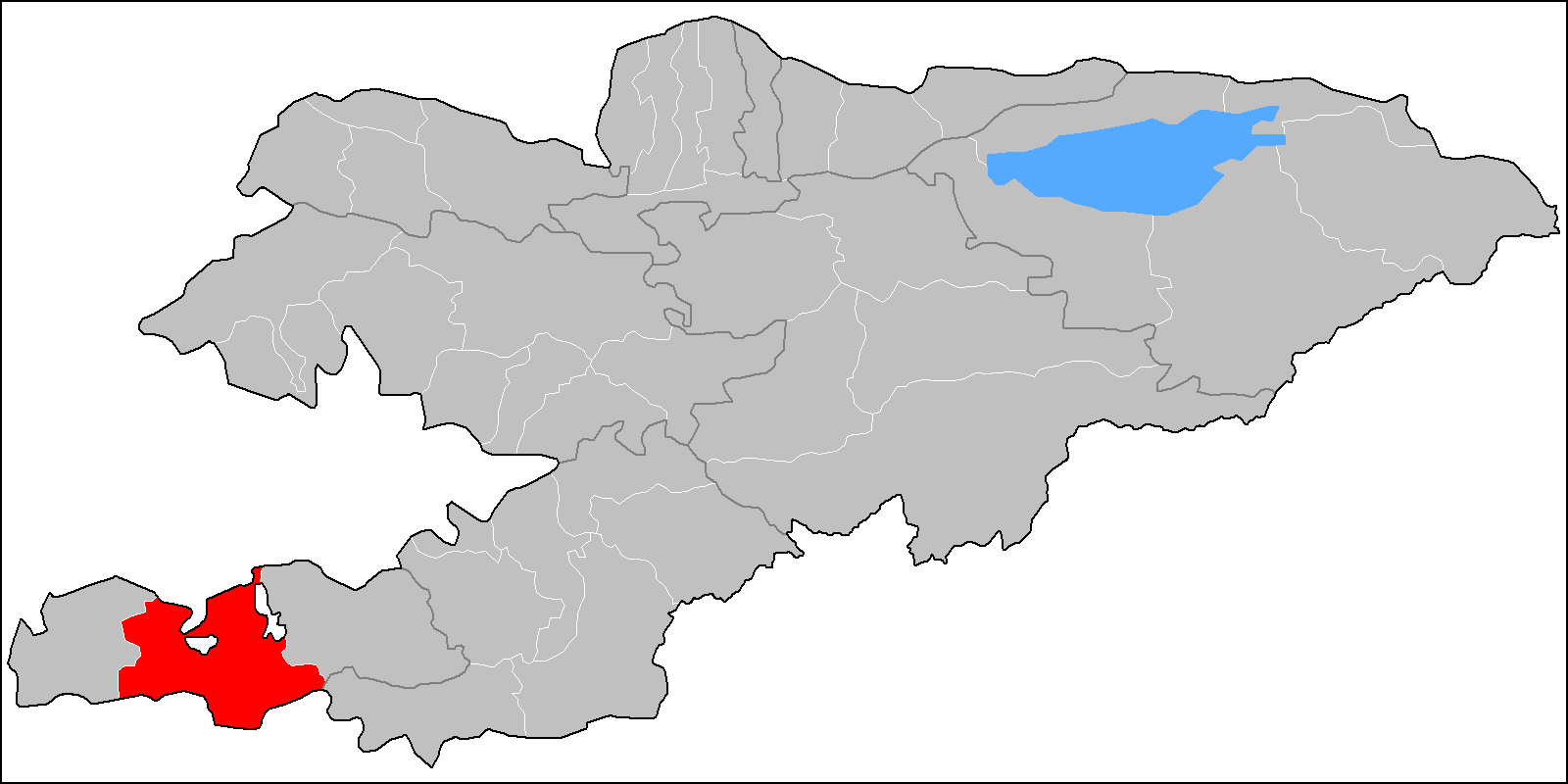
Lolazor ( tg, Лолазор, , formerly Қайрағоч ''Kayraghoch'' or ''Kayragach''; also known as "Western Qal'acha") is a small exclave of Tajikistan, which is just across the international border inside Kyrgyzstan. Situated 7 km south of Mehrobod (formerly Proletarsk, Tajikistan) and 14 km north of Sulukta (Kyrgyzstan), it is completely surrounded by the Leilek District of Batken Region, Kyrgyzstan. It is near the railway station of ''Stantsiya Kayragach'', on the line from Proletarsk to Sulukta. It is part of the jamoat Gulkhona in Jabbor Rasulov District.Village Lolazor tojkiston.ucoz.ru See also * Sarvan, the Tajikistan exclave in Uzbekistan * |
Countries Of The World
The following is a list providing an overview of sovereign states around the world with information on their status and recognition of their sovereignty. The 206 listed states can be divided into three categories based on membership within the United Nations System: 193 member states of the United Nations, UN member states, 2 United Nations General Assembly observers#Present non-member observers, UN General Assembly non-member observer states, and 11 other states. The ''sovereignty dispute'' column indicates states having undisputed sovereignty (188 states, of which there are 187 UN member states and 1 UN General Assembly non-member observer state), states having disputed sovereignty (16 states, of which there are 6 UN member states, 1 UN General Assembly non-member observer state, and 9 de facto states), and states having a political status of the Cook Islands and Niue, special political status (2 states, both in associated state, free association with New Zealand). Compi ... [...More Info...] [...Related Items...] OR: [Wikipedia] [Google] [Baidu] |
Leilek District
Leylek ( ky, Лейлек району, Leylek rayonu) is a district of Batken Region in south-western Kyrgyzstan. It borders with Batken District in the east, and Tajikistan in the south, west, and north. Its area is , and its resident population was 146,020 in 2021. The administrative seat lies at Razzaqov. Geography Leylek District is located between the northern slopes of the Turkestan Range and the Ferghana Valley. It contains the lowest point of Kyrgyzstan: 401 meters above sea level. Population Towns, rural communities and villages In total, Leylek District includes 1 town and 47 villages in 1 town and 9 rural communities ('). The rural communities and settlements in the Leylek District are: # town of district significance [...More Info...] [...Related Items...] OR: [Wikipedia] [Google] [Baidu] |
List Of Enclaves And Exclaves
In political geography, an enclave is a piece of land belonging to one country (or region etc.) that is totally surrounded by another country (or region). An exclave is a piece of land that is politically attached to a larger piece but not physically contiguous with it (connected to it) because they are completely separated by a surrounding foreign territory or territories. Many entities are both enclaves and exclaves. Enclaves that are also exclaves Each enclave listed in this section has an administrative level equivalent to that of the one other entity that entirely surrounds it. Each enclave is also a part of a main region; hence, it is an exclave of that region. National level First-order subnational level Other subnational * In Australia: ** The larger of the two parts of the Aboriginal Shire of Doomadgee in Queensland is surrounded by the Shire of Burke. Except for the ocean, the smaller part is nearly surrounded also by the Shire of Burke. * In China: ** Chaoy ... [...More Info...] [...Related Items...] OR: [Wikipedia] [Google] [Baidu] |
Shohimardon
Shohimardon (also ''Shakhimardan'', uz, Shohimardon / Шоҳимардон, russian: Шахимардан, Shakhimardan) is a village and a subdivision (rural community) of Fergana District, Fergana Region in eastern Uzbekistan. It is an exclave of Uzbekistan, surrounded by Kyrgyzstan, in a valley in the Pamiro-Alai mountains. The river Shohimardonsoy flows through the exclave. There are two villages: Shohimardon and Yordon. Shohimardon is a popular resort with several sanatoriums, and an active place of pilgrimage. According to one folk legend, the Caliph Ali was buried in Shohimardon. Shakhimardan City Resort is situated at 1975m above sea level, 155 km from Ferghana, in the picturesque mountainous district. The Kuliqurbon or Blue Lake is seven kilometers southeast of Shakhimardan. It was formed in 1766 after a series of extreme earthquakes. The lake is located at an altitude of 1,724 metres. It's 170 m long, 60 m tall, 5–10 m deep. The cableway continues to the lak ... [...More Info...] [...Related Items...] OR: [Wikipedia] [Google] [Baidu] |
Vorukh
Vorukh (Russian language, Russian and Tajik language, Tajik: Ворух; sog, Wārōx) is a Jamoats of Tajikistan, jamoat in northern Tajikistan. It is an exclave surrounded by Kyrgyzstan that forms part of the city of Isfara in Sughd Region. , the jamoat had a total population of 30,506.Jamoat-level basic indicators United Nations Development Programme in Tajikistan, accessed 3 October 2020 History and territorial conflicts  Vorukh is the name of a village and one of two exclaves of Tajikistan within the Batken Province of Kyrgyzstan. There are three Tajik enclave ...
[...More Info...] [...Related Items...] OR: [Wikipedia] [Google] [Baidu] |
Sarvan, Tajikistan
Sarvan (or Sarvak, Sarvaksoi and Sarvaki-bolo) is a Tajik enclave of the Sughd Region surrounded by Uzbekistan. It is located in the Fergana region where Kyrgyzstan, Tajikistan and Uzbekistan meet. Sarvan is located 1.4 km from the Tajik-Uzbek border. Sarvan covers a valley with an area of about 8 km² and has a population of around 150 people. The principal economic activity is agriculture. History and territorial conflicts Due to inherent territorial restrictions, violent conflicts over land ownership, access to pasture, and shared water resources have become more common, as logistical complications within this densely populated and impoverished region have also given rise to economic concern. The Uzbek-Tajik border near Sarvan was closed in 2004 following terrorist attacks in Tashkent. References {{Reflist See also *Vorukh, a Tajikistan exclave in Kyrgyzstan * Kayragach, a Tajikistan exclave in Kyrgyzstan *Shohimardon Shohimardon (also ''Shakhimardan'', uz, Sh ... [...More Info...] [...Related Items...] OR: [Wikipedia] [Google] [Baidu] |
Gulkhona
Gulkhona ( tg, Гулхона) is a village and jamoat in western Tajikistan Tajikistan (, ; tg, Тоҷикистон, Tojikiston; russian: Таджикистан, Tadzhikistan), officially the Republic of Tajikistan ( tg, Ҷумҳурии Тоҷикистон, Jumhurii Tojikiston), is a landlocked country in Centr .... It is located in Jabbor Rasulov District in Sughd Region. The jamoat has a total population of 24,077 (2015).Jamoat-level basic indicators United Nations Development Programme in Tajikistan, accessed 6 October 2020 It consists of 11 villages, including Gulkhona (the seat) and Lolazor (formerly: ''Kayragach''). [...More Info...] [...Related Items...] OR: [Wikipedia] [Google] [Baidu] |
Batken Region
Batken Region ( ky, Баткен облусу, Batken oblusu; russian: Баткенская область, Batkenskaya oblast) is a region ('' oblus'') of Kyrgyzstan. Its capital is Batken. It is bounded on the east by Osh Region, on the south, west and north by Tajikistan, and on the northeast by Uzbekistan. The northern part of the region is part of the flat, agricultural Ferghana Valley. The land rises southward to the mountains on the southern border: the Alay Mountains in the east, and the Turkestan Range in the west. Its total area is . The resident population of the region was 548,247 as of January 2021. The region has sizeable Uzbek (14.7% in 2009) and Tajik (6.9% in 2009) minorities. History Batken Region was created on 15 October 1999 from the westernmost section of Osh Region. This was partly in response to the activities of the Islamic Movement for Uzbekistan (IMU), with bases in Tajikistan. In 1999 they kidnapped a group of Japanese geologists and in 2000 some Amer ... [...More Info...] [...Related Items...] OR: [Wikipedia] [Google] [Baidu] |
Regions Of Tajikistan
Administratively, Tajikistan is divided into: * one autonomous region (russian: автономная область; tg, вилояти мухтор, ''viloyati mukhtor'') * two regions ( tg, вилоятҳо, ''viloyatho'' fa, ولایتها), sing. tg, вилоят, ''viloyat''و fa, ولایت, russian: область/вилоят ) * the Districts of Republican Subordination * the capital city, Dushanbe. {, class="wikitable sortable" !No.!!Name!!Russian!! Tajik!!ISO!!Capital!!Area {km2)!!Pop (2000)!!Pop (2010)!!Pop (2019) , - , 1, , Sughd Region, , ''Sogdijskaya oblast' '', , ''Viloyati Sughd'', , TJ-SU, , Khujand , align=25,400, , align=1,871,979, , align=2,233,550, , align=2,658,400 , - , 2, , Districts of Republican Subordination, , ''Rajoni respublikanskovo podchineniya'', , ''Nohiyahoi tobei jumhurī'', , - , , Dushanbe , align=28,600, , align=1,337,479, , align=1,722,908, , align=2,120,000 , - , 3, , Khatlon Region, , ''Khatlonskaya oblast, , ''Viloyati ... [...More Info...] [...Related Items...] OR: [Wikipedia] [Google] [Baidu] |
Mehrobod
tg, Меҳробод , settlement_type=Town and Jamoat , image_skyline = , imagesize = , image_caption = , image_flag = , image_seal = , image_map = , map_caption = , pushpin_map = Tajikistan , pushpin_label_position =bottom , pushpin_mapsize = , pushpin_map_caption =Location in Tajikistan , subdivision_type = Country , subdivision_name = , subdivision_type1 = Region , subdivision_name1 = Sughd Region , subdivision_type2 = District , subdivision_name2 = Jabbor Rasulov District , established_title = , established_date = , government_type = , leader_title = , leader_name = , area_magnitude = , area_total_sq_mi = , area_total_km2 = , area_land_sq_mi = , area_land_km2 = , area_urban_sq_mi = , area_urban_km2 = , area_metro_km2 = , area_metro_sq_mi = , population_as_of=2020 , population_footnotes = , population_total =16600 , population_urban = , population_metro = , population_density_sq_mi = , population_density_km2 = , timezone = TJT , utc_offset ... [...More Info...] [...Related Items...] OR: [Wikipedia] [Google] [Baidu] |


.jpg)

