|
Loch Sgadabhagh
Loch Sgadabhagh or Loch Scadavay is a body of water on the island of North Uist, Scotland. The name may be of Old Norse derivation meaning "lake of tax bay" although if so, the reason is obscure. Loch Sgadabhagh is the largest loch by area on North Uist although Loch Obisary has about twice the volume.Murray and Pullar (1908"Lochs of North Uist"Pages 188-89, Volume II, Part II. National Library of Scotland. Retrieved 20 December 2009. Geography According to Murray and Pullar (1908) "there is probably no other loch in Britain which approaches Loch Scadavay in irregularity and complexity of outline. It is an extraordinary labyrinth of narrow channels, bays, promontories and islands" The loch is crossed by the main A867 road and the northern and southern portions are "connected by such a small channel under the road that in time of flood the south loch may temporarily rise some feet higher than the other, though normally they are at the same level". Located at , it stretches for ov ... [...More Info...] [...Related Items...] OR: [Wikipedia] [Google] [Baidu] |
Loch
''Loch'' () is the Scottish Gaelic, Scots and Irish word for a lake or sea inlet. It is cognate with the Manx lough, Cornish logh, and one of the Welsh words for lake, llwch. In English English and Hiberno-English, the anglicised spelling lough is commonly found in place names; in Lowland Scots and Scottish English, the spelling "loch" is always used. Many loughs are connected to stories of lake-bursts, signifying their mythical origin. Sea-inlet lochs are often called sea lochs or sea loughs. Some such bodies of water could also be called firths, fjords, estuaries, straits or bays. Background This name for a body of water is Insular CelticThe current form has currency in the following languages: Scottish Gaelic, Irish, Manx, and has been borrowed into Lowland Scots, Scottish English, Irish English and Standard English. in origin and is applied to most lakes in Scotland and to many sea inlets in the west and north of Scotland. The word comes from Proto-Indo-Eur ... [...More Info...] [...Related Items...] OR: [Wikipedia] [Google] [Baidu] |
North Uist
North Uist ( gd, Uibhist a Tuath; sco, North Uise) is an island and community in the Outer Hebrides of Scotland. Etymology In Donald Munro's ''A Description of the Western Isles of Scotland Called Hybrides'' of 1549, North Uist, Benbecula and South Uist are described as one island of ''Ywst'' (Uist). Starting in the south of this 'island', he described the division between South Uist and Benbecula where "the end heirof the sea enters, and cuts the countrey be ebbing and flowing through it". Further north of Benbecula he described North Uist as "this countrey is called Kenehnache of Ywst, that is in Englishe, the north head of Ywst".''A Description of the Western Isles of Scotland Called Hybrides''; Monro, Donald, 1549 Some have taken the etymology of Uist from Old Norse, meaning "west", much like Westray in Orkney. Another speculated derivation of Uist from Old Norse is ', derived from ' meaning "an abode, dwelling, domicile". A Gaelic etymology is also possible, with ' mea ... [...More Info...] [...Related Items...] OR: [Wikipedia] [Google] [Baidu] |
Eilean Siar
The Outer Hebrides () or Western Isles ( gd, Na h-Eileanan Siar or or ("islands of the strangers"); sco, Waster Isles), sometimes known as the Long Isle/Long Island ( gd, An t-Eilean Fada, links=no), is an island chain off the west coast of mainland Scotland. The islands are geographically coextensive with , one of the 32 unitary council areas of Scotland. They form part of the archipelago of the Hebrides, separated from the Scottish mainland and from the Inner Hebrides by the waters of the Minch, the Little Minch, and the Sea of the Hebrides. Scottish Gaelic is the predominant spoken language, although in a few areas English speakers form a majority. Most of the islands have a bedrock formed from ancient metamorphic rocks, and the climate is mild and oceanic. The 15 inhabited islands have a total population of and there are more than 50 substantial uninhabited islands. The distance from Barra Head to the Butt of Lewis is roughly . There are various important prehi ... [...More Info...] [...Related Items...] OR: [Wikipedia] [Google] [Baidu] |
Scotland
Scotland (, ) is a Countries of the United Kingdom, country that is part of the United Kingdom. Covering the northern third of the island of Great Britain, mainland Scotland has a Anglo-Scottish border, border with England to the southeast and is otherwise surrounded by the Atlantic Ocean to the north and west, the North Sea to the northeast and east, and the Irish Sea to the south. It also contains more than 790 Islands of Scotland, islands, principally in the archipelagos of the Hebrides and the Northern Isles. Most of the population, including the capital Edinburgh, is concentrated in the Central Belt—the plain between the Scottish Highlands and the Southern Uplands—in the Scottish Lowlands. Scotland is divided into 32 Subdivisions of Scotland, administrative subdivisions or local authorities, known as council areas. Glasgow, Glasgow City is the largest council area in terms of population, with Highland (council area), Highland being the largest in terms of area. Limi ... [...More Info...] [...Related Items...] OR: [Wikipedia] [Google] [Baidu] |
Lochmaddy
Lochmaddy ( gd, Loch nam Madadh, "Loch of the Hounds") is the administrative centre of North Uist in the Outer Hebrides, Scotland. ''Na Madaidhean'' (the wolves/hounds) are rocks in the bay after which the loch, and subsequently the village, are named. Lochmaddy is within the parish of North Uist. Geography Lochmaddy lies on the sea loch of that name and, due to the rocky nature of the coast, is the only settlement of any size on the east coast. Most of the island's settlements are on the west coast. Lochmaddy is at the eastern end of the A865 and close to the eastern end of the A867; these are the only two main roads on the island. History Virtually the first mention anywhere of Lochmaddy is a complaint of "piracie and murder" in a report dated 1616: "Lochmaldie on the coast of Uist is a rendezvous for pirates" it said. The coves and inlets around the village were ideal hiding places for raiding ships stocked with fine goods bound for the clan chiefs of the time, and contraba ... [...More Info...] [...Related Items...] OR: [Wikipedia] [Google] [Baidu] |
Old Norse
Old Norse, Old Nordic, or Old Scandinavian, is a stage of development of North Germanic dialects before their final divergence into separate Nordic languages. Old Norse was spoken by inhabitants of Scandinavia and their overseas settlements and chronologically coincides with the Viking Age, the Christianization of Scandinavia and the consolidation of Scandinavian kingdoms from about the 7th to the 15th centuries. The Proto-Norse language developed into Old Norse by the 8th century, and Old Norse began to develop into the modern North Germanic languages in the mid-to-late 14th century, ending the language phase known as Old Norse. These dates, however, are not absolute, since written Old Norse is found well into the 15th century. Old Norse was divided into three dialects: ''Old West Norse'' or ''Old West Nordic'' (often referred to as ''Old Norse''), ''Old East Norse'' or ''Old East Nordic'', and '' Old Gutnish''. Old West Norse and Old East Norse formed a dialect ... [...More Info...] [...Related Items...] OR: [Wikipedia] [Google] [Baidu] |
Ordnance Survey
Ordnance Survey (OS) is the national mapping agency for Great Britain. The agency's name indicates its original military purpose (see ordnance and surveying), which was to map Scotland in the wake of the Jacobite rising of 1745. There was also a more general and nationwide need in light of the potential threat of invasion during the Napoleonic Wars. Since 1 April 2015 Ordnance Survey has operated as Ordnance Survey Ltd, a government-owned company, 100% in public ownership. The Ordnance Survey Board remains accountable to the Secretary of State for Business, Energy and Industrial Strategy. It was also a member of the Public Data Group. Paper maps for walkers represent only 5% of the company's annual revenue. It produces digital map data, online route planning and sharing services and mobile apps, plus many other location-based products for business, government and consumers. Ordnance Survey mapping is usually classified as either " large-scale" (in other words, more detaile ... [...More Info...] [...Related Items...] OR: [Wikipedia] [Google] [Baidu] |
Crannog
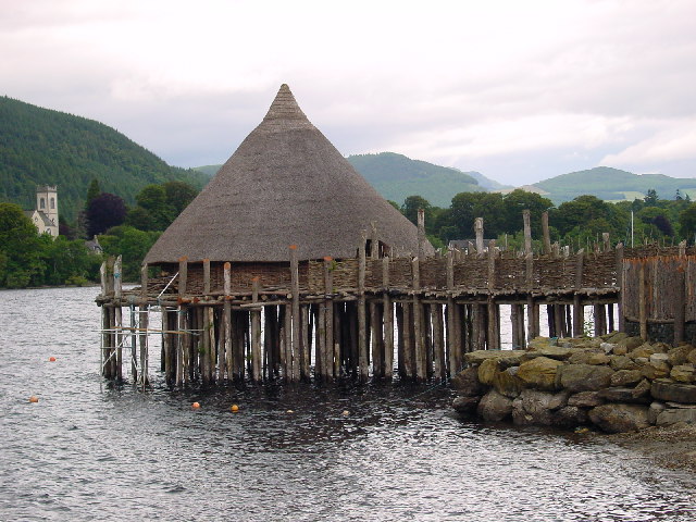
A crannog (; ga, crannóg ; gd, crannag ) is typically a partially or entirely artificial island, usually built in lakes and estuarine waters of Scotland, Wales, and Ireland. Unlike the prehistoric pile dwellings around the Alps, which were built on the shores and not inundated until later, crannogs were built in the water, thus forming artificial islands. Crannogs were used as dwellings over five millennia, from the European Neolithic Period to as late as the 17th/early 18th century. In Scotland there is no convincing evidence in the archaeological record of Early and Middle Bronze Age or Norse Period use. The radiocarbon dating obtained from key sites such as Oakbank and Redcastle indicates at a 95.4 per cent confidence level that they date to the Late Bronze Age to Early Iron Age. The date ranges fall ''after'' around 800 BC and so could be considered Late Bronze Age by only the narrowest of margins. Crannogs have been variously interpreted as free-standing wooden struct ... [...More Info...] [...Related Items...] OR: [Wikipedia] [Google] [Baidu] |
Sheiling
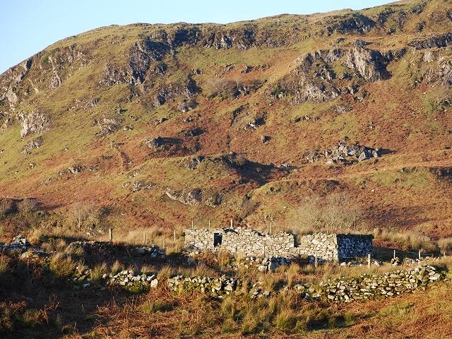
A shieling is a hut or collection of huts on a seasonal pasture high in the hills, once common in wild or sparsely populated places in Scotland. Usually rectangular with a doorway on the south side and few or no windows, they were often constructed of dry stone or turf. More loosely, the term may denote a seasonal mountain pasture for the grazing of cattle in summer. Seasonal pasturage implies transhumance between the shieling and a valley settlement in winter. Many Scottish songs have been written about life in shielings, often concerning courtship and love. The ruins of shielings are abundant landscape features across Scotland, particularly the Highlands. Etymology A "shieling" is a summer dwelling on a seasonal pasture high in the hills. The first recorded use of the term is from 1568. The word "shieling" comes from "shiel", from the forms ''schele'' or ''shale'' in the Northern dialect of Middle English, likely related to Old Frisian ''skul'' meaning "hiding place" and ... [...More Info...] [...Related Items...] OR: [Wikipedia] [Google] [Baidu] |


