|
Llangaffo
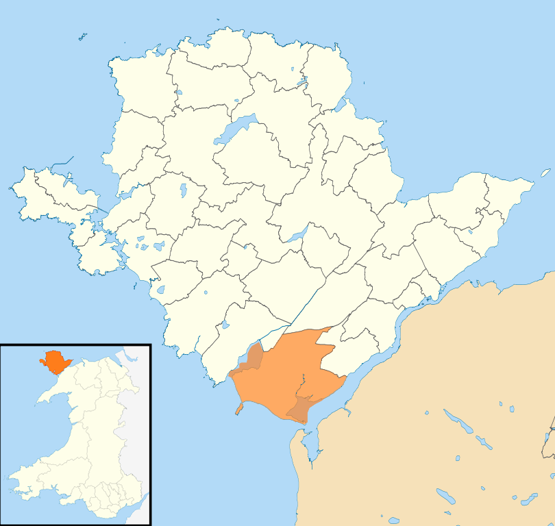
Llangaffo is a village in Anglesey, in north-west Wales. It lies along the B4419 and B4421 roads, north of Dwyran, south of Gaerwen and northwest of Llanidan. It is named after Caffo, a 6th-century saint. A church, St Caffo's Church, is named after him. A war memorial, a village hall and a primary school are also located in the village. The 1851 census recorded 138 people in the village, 75 males, 63 females and a parish area of . It is in the community of Rhosyr. The 2011 census recorded a population of 357. Geography Llangaffo is a parish in the hundred of Menai, county Anglesey. It is located northwest of Caernarfon and south of Llangefni. It is in the vicinity of the North Wales Coast Line, although the nearest station (Gaerwen railway station) closed in 1966. The village is situated on a vantage hill ridge that provides vistas of pastureland and the hills of Snowdonia and the Menai Strait. The Snowdonian mountains terminate in the west with the abrupt precipices of ... [...More Info...] [...Related Items...] OR: [Wikipedia] [Google] [Baidu] |
St Caffo's Church, Llangaffo
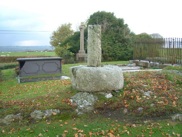
St Caffo's Church, Llangaffo is a 19th-century church, in the south of Anglesey, north Wales, about from the county town, Llangefni. It was constructed in 1846 to replace the previous medieval church in the village of Llangaffo. The new building includes a number of monuments from the old church, and has a spire which is a prominent local landmark. The churchyard has part of a stone cross dating from the 9th or 10th century, and some gravestones from the 9th to 11th centuries. It is dedicated to St Caffo, a 6th-century martyr who was killed in the vicinity. The church is still in use as part of the Church in Wales, one of four churches in a combined parish. It is a Grade II listed building, a designation given to "buildings of special interest, which warrant every effort being made to preserve them", in particular because it is regarded as "a mid 19th-century rural church, consistently articulated and detailed in an Early English style". History and location The date of first co ... [...More Info...] [...Related Items...] OR: [Wikipedia] [Google] [Baidu] |
St Caffo
Caffo was a sixth-century Christian in Anglesey, north Wales, who is venerated as a saint and martyr. The son of a king from northern Britain who took shelter in Anglesey, Caffo was a companion of St Cybi, and is mentioned as carrying a red-hot coal in his clothes to Cybi without his clothes getting burnt. After leaving Cybi, Caffo was killed by shepherds in the south of Anglesey, possibly acting in retaliation for insults Caffo's brother had paid to the local ruler. The area where he died has a village, Llangaffo, named after him, as well as the parish church of St Caffo, Llangaffo. Life and martyrdom Little is known for certain about Caffo; his dates of birth and death are not given in the sources. He is said to have been one of the sons of St Caw, a king in northern Britain who lost his lands and sought safety with his family in Anglesey; the ruler Maelgwn Gwynedd gave him land in the north-east of the island, in the district known as Twrcelyn. Other relatives of Caffo in ... [...More Info...] [...Related Items...] OR: [Wikipedia] [Google] [Baidu] |
Caffo
Caffo was a sixth-century Christian in Anglesey, north Wales, who is venerated as a saint and martyr. The son of a king from northern Britain who took shelter in Anglesey, Caffo was a companion of St Cybi, and is mentioned as carrying a red-hot coal in his clothes to Cybi without his clothes getting burnt. After leaving Cybi, Caffo was killed by shepherds in the south of Anglesey, possibly acting in retaliation for insults Caffo's brother had paid to the local ruler. The area where he died has a village, Llangaffo, named after him, as well as the parish church of St Caffo, Llangaffo. Life and martyrdom Little is known for certain about Caffo; his dates of birth and death are not given in the sources. He is said to have been one of the sons of St Caw, a king in northern Britain who lost his lands and sought safety with his family in Anglesey; the ruler Maelgwn Gwynedd gave him land in the north-east of the island, in the district known as Twrcelyn. Other relatives of Caffo in ... [...More Info...] [...Related Items...] OR: [Wikipedia] [Google] [Baidu] |
Malltraeth Marsh
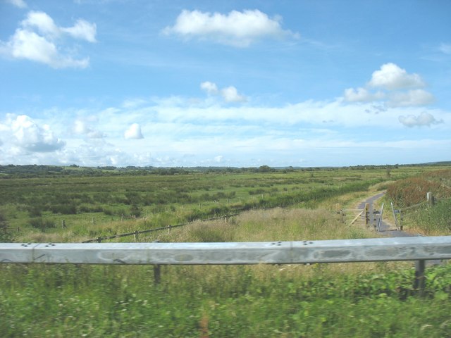
Malltraeth Marsh (also spelled as Malldraeth; cy, Cors Malltraeth or cy, Cors Ddyga, label=none) is a large marsh area in Anglesey, North Wales, north-east of Malltraeth village, along the flatlands of Trefdraeth, Bodorgan, Llangristiolus and south of Cefn Cwmwd, Rhostrehwfa. It was reclaimed from estuarine marshes after the construction of the Malltraeth Cob (dyke), a long embankment, and the subsequent canalisation in 1824 of the Afon Cefni. The name Malltraeth comes from ''mall'' ('bad'), and ''traeth'' ('sandy shore'). The marsh measures in area. The area is recognised as a Site of Special Scientific Interest (SSSI), and has a range of reedbeds, marshes, wet grassland and small pools/lakes. History In the Middle Ages the Malltraeth estuary was tidal, stretching as far inland as Llangefni and Ceint. In 1790, an act of Parliament was obtained for more effectually embanking the marshes called Malltraeth and Corsddeuga, under the provisions of which were allotted to ... [...More Info...] [...Related Items...] OR: [Wikipedia] [Google] [Baidu] |
Rhosyr
Rhosyr is a community in the far southern corner of Anglesey, Wales. It includes the villages of Dwyran and Newborough, Llangeinwen and Llangaffo. The community population taken at the 2011 census was 2,226. and includes Llanddwyn Island and Newborough Forest. Llys Rhosyr Rhosyr was the site of one of the courts of the 13th-century Welsh prince Llewellyn the Great. Llys Rhosyr (''Rhosyr Court'') is now an important archaeological site, located close to Newborough. It was rediscovered and partially excavated in 1992, with local activists currently (2017) seeking funding to uncover the remaining two thirds. Governance Rhosyr elects a community council of fifteen councillors who, amongst other things, are responsible for maintenance of local footpaths and cemeteries. Until the 2012 Isle of Anglesey electoral boundary changes Rhosyr was also an electoral ward for the Isle of Anglesey County Council. However, since the 2013 local elections it has combined with neighbouring c ... [...More Info...] [...Related Items...] OR: [Wikipedia] [Google] [Baidu] |
Gaerwen
Gaerwen () is a village on the island of Anglesey in the community of Llanfihangel Ysgeifiog. It is located in the south of the island west of Llanfairpwllgwyngyll and southeast of Llangefni . The A5 runs through the village, and the A55 runs just a few hundred metres north. According to the 2011 Census Gaerwen is now listed by the Office for National Statistics as Llanfihangel Ysgeifiog. The population of the community is 1,551. Gaerwen and Pentre Berw, Llangaffo are trio villages. The village gets its name from a combination of the Welsh words ''Caer'' (mutated to ''Gaer''), meaning 'fortification', and ''Wen'', meaning 'white'. There are no clear remains of a fort in the area, although the name was originally that of a farm in the area, before becoming the name for the entire settlement. Gaerwen Hoard An important Bronze Age hoard was found near Gaerwen in the nineteenth century. Comprising 2 gold lockrings and 2 penannular bracelets, it is now in the collections o ... [...More Info...] [...Related Items...] OR: [Wikipedia] [Google] [Baidu] |
Anglesey
Anglesey (; cy, (Ynys) Môn ) is an island off the north-west coast of Wales. It forms a principal area known as the Isle of Anglesey, that includes Holy Island across the narrow Cymyran Strait and some islets and skerries. Anglesey island, at , is the largest in Wales, the seventh largest in Britain, largest in the Irish Sea and second most populous there after the Isle of Man. Isle of Anglesey County Council administers , with a 2011 census population of 69,751, including 13,659 on Holy Island. The Menai Strait to the mainland is spanned by the Menai Suspension Bridge, designed by Thomas Telford in 1826, and the Britannia Bridge, built in 1850 and replaced in 1980. The largest town is Holyhead on Holy Island, whose ferry service with Ireland handles over two million passengers a year. The next largest is Llangefni, the county council seat. From 1974 to 1996 Anglesey was part of Gwynedd. Most full-time residents are habitual Welsh speakers. The Welsh name Ynys M ... [...More Info...] [...Related Items...] OR: [Wikipedia] [Google] [Baidu] |
Yr Eifl
Yr Eifl, sometimes called the Rivals in English, is a group of hills on the north coast of the Llŷn Peninsula The Llŷn Peninsula ( cy, Penrhyn Llŷn or , ) extends into the Irish Sea from North West Wales, south west of the Isle of Anglesey. It is part of the historic county of Caernarfonshire, and historic region and local authority area of Gwynedd. Mu ... in Gwynedd, Wales. On a clear day, the views from the highest summit reach as far as the Isle of Man, the Wicklow Mountains in Republic of Ireland, Ireland and the Lake District, as well as the entire sweep of Cardigan Bay. The view of Yr Eifl is especially striking from the SW coast of Anglesey, for instance from Ynys Llanddwyn. Ordnance Survey maps show a height of 564 metres, but a recent survey gives the height at 561 metres (1,841 feet). The three peaks There are three peaks: * ''Tre'r Ceiri'': , * ''Garn Ganol'': and * ''Garn Fôr'': . Garn Ganol, the central summit, is the highest point on Llŷn, with an ... [...More Info...] [...Related Items...] OR: [Wikipedia] [Google] [Baidu] |
Church In Wales
The Church in Wales ( cy, Yr Eglwys yng Nghymru) is an Anglicanism, Anglican church in Wales, composed of six dioceses. The Archbishop of Wales does not have a fixed archiepiscopal see, but serves concurrently as one of the six diocesan bishops. The position is currently held by Andy John, Bishop of Bangor, since 2021. Unlike the Church of England, the Church in Wales is not an established church. Disestablishmentarianism, Disestablishment took place in 1920 under the Welsh Church Act 1914. As a province of the Anglican Communion, the Church in Wales recognises the Archbishop of Canterbury as a focus of unity but without any formal authority. A cleric of the Church in Wales can be appointed to posts in the Church of England, including the See of Canterbury; a former Archbishop of Canterbury, Rowan Williams, was from Wales and served as Archbishop of Wales before his appointment to Canterbury. Official name The Church in Wales ( cy, Yr Eglwys yng Nghymru) adopted its name by a ... [...More Info...] [...Related Items...] OR: [Wikipedia] [Google] [Baidu] |
Menai Strait
The Menai Strait ( cy, Afon Menai, the "river Menai") is a narrow stretch of shallow tidal water about long, which separates the island of Anglesey from the mainland of Wales. It varies in width from from Fort Belan to Abermenai Point to from Traeth Gwyllt to Caernarfon Castle. It then narrows to in the middle reaches (Y Felinheli and Menai Bridge) and then it broadens again. At Bangor, Garth Pier, it is wide. It then widens out, and the distance from Puffin Island (Welsh: ''Ynys Seiriol'') to Penmaenmawr is about . The differential tides at the two ends of the strait cause very strong currents to flow in both directions through the strait at different times, creating dangerous conditions. One of the most dangerous areas of the strait is known as the Swellies (or Swillies – Welsh ''Pwll Ceris'') between the two bridges. Here, rocks near the surface cause over-falls and local whirlpools, which can be of considerable danger in themselves and cause small boats to founde ... [...More Info...] [...Related Items...] OR: [Wikipedia] [Google] [Baidu] |
Listed Building
In the United Kingdom, a listed building or listed structure is one that has been placed on one of the four statutory lists maintained by Historic England in England, Historic Environment Scotland in Scotland, in Wales, and the Northern Ireland Environment Agency in Northern Ireland. The term has also been used in the Republic of Ireland, where buildings are protected under the Planning and Development Act 2000. The statutory term in Ireland is " protected structure". A listed building may not be demolished, extended, or altered without special permission from the local planning authority, which typically consults the relevant central government agency, particularly for significant alterations to the more notable listed buildings. In England and Wales, a national amenity society must be notified of any work to a listed building which involves any element of demolition. Exemption from secular listed building control is provided for some buildings in current use for worship, ... [...More Info...] [...Related Items...] OR: [Wikipedia] [Google] [Baidu] |


