|
List Of Rulers Of Timor
This is a list of rulers of Timor since the 17th century. Timor was traditionally divided into a large number of small kingdoms whose rulers were variously known as liurais, rajas, regulos, na'i, etc. They were drawn into the colonial spheres of the Dutch East India Company and Portugal from the 17th century onwards. The succession of the individual kingdoms is only partly known from the existing literature. After the achieving of Indonesian independence the kingdoms in West Timor were phased out and eventually abolished in about 1962. In Portuguese East Timor the kingdoms (reinos) lost much of their functions after 1912, although they have persisted as ritual domains until the present. Rulers in West Timor Kings of Amabi * Sebastião (before 1652–1658) * Saroro Neno (fl. 1655) * Ama Kefi Meu (1666-1704) * Ama Kefi (1704-1725) on* Loti (1725-1732) on* Nai Balas (1732-1755) rother* Balthazar Loti (1755-1791) on of Loti* Osu I (1791-1795) on* Slolo (1795-c. 1797) on* Afu Bal ... [...More Info...] [...Related Items...] OR: [Wikipedia] [Google] [Baidu] |
Timor
Timor is an island at the southern end of Maritime Southeast Asia, in the north of the Timor Sea. The island is divided between the sovereign states of East Timor on the eastern part and Indonesia on the western part. The Indonesian part, also known as West Timor, constitutes part of the province of East Nusa Tenggara. Within West Timor lies an exclave of East Timor called Oecusse District. The island covers an area of . The name is a variant of ''timur'', Malay for "east"; it is so called because it lies at the eastern end of the Lesser Sunda Islands. Mainland Australia is less than 500 km away, separated by the Timor Sea. Language, ethnic groups and religion Anthropologists identify eleven distinct ethno-linguistic groups in Timor. The largest are the Atoni of western Timor and the Tetum of central and eastern Timor. Most indigenous Timorese languages belong to the Timor–Babar branch of the Austronesian languages spoken throughout the Indonesian archip ... [...More Info...] [...Related Items...] OR: [Wikipedia] [Google] [Baidu] |
Atabae
Atabae is a village in the suco of Rairobo ( subdistrict Atabae, Bobonaro District, East Timor East Timor (), also known as Timor-Leste (), officially the Democratic Republic of Timor-Leste, is an island country in Southeast Asia. It comprises the eastern half of the island of Timor, the exclave of Oecusse on the island's north-w ...). Populated places in East Timor Bobonaro Municipality {{EastTimor-geo-stub ... [...More Info...] [...Related Items...] OR: [Wikipedia] [Google] [Baidu] |
Belu (province)
Belu (also Belos or Behale){{cite book, author=H.G. Schulte Nordholt, editor=M.J.L. Yperen, title=The Political System of the Atoni of Timor, year=2013, publisher=Springer Science & Business Media, isbn=94-015-1013-X was the Portuguese name for eastern part of Timor island, which included the kingdoms of Wehali, Lichisana and Suai-Cabanaza. In 1756 the western part of Belu and West Timor fell to the Dutch. See also * History of East Timor East Timor is a country in Southeast Asia and Oceania known as Democratic Republic of Timor-Leste. The country comprises the eastern half of the island of Timor and the nearby islands of Atauro and Jaco. The first inhabitants are thought ... References Portuguese Timor Former Portuguese colonies ... [...More Info...] [...Related Items...] OR: [Wikipedia] [Google] [Baidu] |
Laleia Subdistrict
Laleia, officially Laleia Administrative Post (, ), is an administrative post (and was formerly a subdistrict) in Manatuto municipality, East Timor. Its seat or administrative centre is . Born * Xanana Gusmão José Alexandre "Xanana" Gusmão (; born 20 June 1946) is an East Timorese politician. A former rebel, he was the third President of the independent East Timor, serving from 2002 to 2007. He then became its fourth prime minister, serving from ... (1946), former president and prime minister of East Timor References External links * – information page on Ministry of State Administration site Administrative posts of East Timor Manatuto Municipality {{EastTimor-geo-stub ... [...More Info...] [...Related Items...] OR: [Wikipedia] [Google] [Baidu] |
Lacluta Subdistrict
Lacluta, officially Lacluta Administrative Post (, ), is an administrative post (and was formerly a subdistrict) in Viqueque municipality, East Timor East Timor (), also known as Timor-Leste (), officially the Democratic Republic of Timor-Leste, is an island country in Southeast Asia. It comprises the eastern half of the island of Timor, the exclave of Oecusse on the island's north-west .... Its seat or administrative centre is . References External links * – information page on Ministry of State Administration site Administrative posts of East Timor Viqueque Municipality {{EastTimor-geo-stub ... [...More Info...] [...Related Items...] OR: [Wikipedia] [Google] [Baidu] |
Laclubar
Laclubar is the main locality in Laclubar Administrative Post, Manatuto Municipality, East Timor East Timor (), also known as Timor-Leste (), officially the Democratic Republic of Timor-Leste, is an island country in Southeast Asia. It comprises the eastern half of the island of Timor, the exclave of Oecusse on the island's north-w .... References Manatuto Municipality Populated places in East Timor {{EastTimor-geo-stub ... [...More Info...] [...Related Items...] OR: [Wikipedia] [Google] [Baidu] |
Laclo Subdistrict
Laclo, officially Laclo Administrative Post (, ), is an administrative post (and was formerly a subdistrict) in Manatuto municipality, East Timor East Timor (), also known as Timor-Leste (), officially the Democratic Republic of Timor-Leste, is an island country in Southeast Asia. It comprises the eastern half of the island of Timor, the exclave of Oecusse on the island's north-west .... Its seat or administrative centre is , and its population at the 2004 census was 7,558. References External links * – information page on Ministry of State Administration site Administrative posts of East Timor Manatuto Municipality {{EastTimor-geo-stub ... [...More Info...] [...Related Items...] OR: [Wikipedia] [Google] [Baidu] |
Ermera
Ermera (''Vila Ermera'') is a city in East Timor and a former capital of the East Timorese community, Ermera. ''Ermera'' in Mambai means "red water." It has a population of 8,907. Its geographical coordinates are , and it lies above sea level. Ermera's center lies in the Suco of Poetete ( Ermera Subdistrict, Ermera District Ermera (, ) is one of the municipalities (formerly districts) of East Timor, located in the west-central part of the country. It has a population of 117,064 (Census 2010) and an area of 756.5 km². Etymology The word ''Ermera'' means ' ...). References Populated places in East Timor Ermera Municipality {{EastTimor-geo-stub ... [...More Info...] [...Related Items...] OR: [Wikipedia] [Google] [Baidu] |
Cailaco
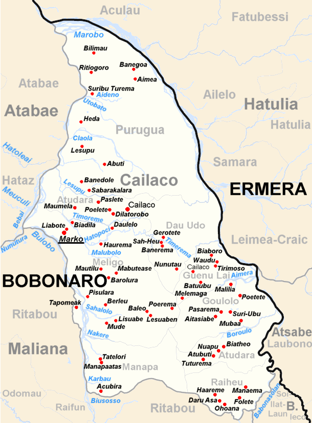
Cailaco is a town in Cailaco Subdistrict in the Bobonaro District of East Timor East Timor (), also known as Timor-Leste (), officially the Democratic Republic of Timor-Leste, is an island country in Southeast Asia. It comprises the eastern half of the island of Timor, the exclave of Oecusse on the island's north-west .... References Populated places in East Timor Bobonaro Municipality {{EastTimor-geo-stub ... [...More Info...] [...Related Items...] OR: [Wikipedia] [Google] [Baidu] |
Bobonaro
Bobonaro is a town in Bobonaro Subdistrict, Bobonaro District, East Timor., United States National Geospatial-Intelligence Agency The district capital is not in Bobonaro, but is in Maliana Maliana is a city in East Timor, 149 kilometers southwest of Dili, the national capital. It has a population of 22,000. It is the capital of the district of Bobonaro and Maliana Subdistrict, and is located just a few kilometers from the bord ... instead. Bobonaro suco has 1,532 inhabitants. Notes and references Populated places in East Timor Bobonaro Municipality {{EastTimor-geo-stub ... [...More Info...] [...Related Items...] OR: [Wikipedia] [Google] [Baidu] |
Baucau
Baucau ( pt, Baucau, tet, Baukau) is the second-largest city in East Timor, after Dili, the capital, which lies to its west. Baucau has about 16,000 inhabitants, and is the capital of Baucau municipality, located in the eastern part of the country. In the times of Portuguese Timor, Baucau was little more than an overgrown village, and for part of those times was called ''Vila Salazar'', after the Portuguese dictator António de Oliveira Salazar. Geography The administrative post of Baucau is divided into 11 villages ( ''sucos'') * Suco Bahú * Suco Bucoli * Suco Buibau * Suco Buruma * Suco Caibada Uaimua * Suco Samalari * Suco Seiçal * Suco Tirilolo * Suco Triloka * Suco Gariuai * Suco Uailili Infrastructure Much of the infrastructure of the city and the surrounding area was damaged or destroyed by pro-Indonesian militia during the violence that followed the referendum for independence in 1999. Nevertheless, in the old part of Baucau there survive a few ... [...More Info...] [...Related Items...] OR: [Wikipedia] [Google] [Baidu] |


