|
List Of Places Along Wales Coast Path
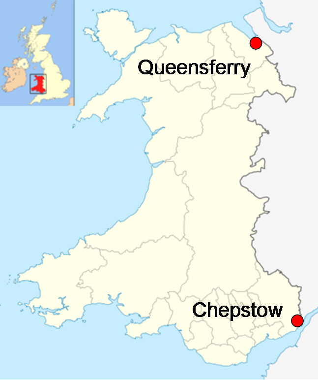
This is a list of cities, towns, villages and hamlets on or near the Wales Coast Path, a long-distance walk which follows the coast of Wales from Chepstow to Chester. It is divided into sections corresponding to those used to market and promote the route. Column 1 lists the settlements, column 2 shows in which administrative community the settlement is located and column 3 the principal area in which it is to be found. South Wales Coast and Severn Estuary Coastal section From Chepstow west to Kenfig. Gower and Swansea Bay Coast section From Kenfig west around Swansea Bay and the Gower Peninsula to Loughor. Carmarthenshire Coast section From the Loughor estuary west around Carmarthen Bay to the Pembrokeshire border near Amroth. Pembrokeshire Coast Path section From Amroth around the entire length of the national park to Cardigan. The inner estuary of the Cleddau is not included. Ceredigion Coast Path section From Cardigan north along the Cardigan Bay coast to t ... [...More Info...] [...Related Items...] OR: [Wikipedia] [Google] [Baidu] |
Wales Coast Path
The Wales Coast Path ( cy, Llwybr Arfordir Cymru) is a designated long-distance trail which follows, or runs close to, the coastline of Wales. Launched in 2012, the footpath is long and was heralded as the first dedicated coast path in the world to cover the entire length of a country's coastline. The Wales Coast Path runs through eleven national nature reserves and other nature reserves such as those managed by the Royal Society for the Protection of Birds and The Wildlife Trusts.www.firstnature.com - wales Coast Path . Retrieved 2 January 2012. 
[...More Info...] [...Related Items...] OR: [Wikipedia] [Google] [Baidu] |
Redwick, Newport
Redwick ( cy, Y Redwig) is a small village and community (parish) to the south east of the city of Newport, in Wales, United Kingdom. It lies within the Newport city boundaries, in the historic county of Monmouthshire and the preserved county of Gwent. in 2011 the population was 206. Location Redwick is located 6 miles (9.5 km) south east of the centre of Newport and some 4 miles (6.5 km) south west of Caldicot, Monmouthshire on the flat coastal lands reclaimed from the Severn Estuary and Bristol Channel and part of the Caldicot and Wentloog Levels. The Church The ancient parish church of Church of St Thomas, Redwick is a Grade I listed building. It is notable for many unusual features. An earlier dedication, when it belonged to Tintern Abbey, appears to have been to St. Michael. It is held with Magor. The church is unusually large for a parish church on the Caldicot and Wentloog Levels, perhaps second only in its grandeur to that at Peterstone. The church has a full ... [...More Info...] [...Related Items...] OR: [Wikipedia] [Google] [Baidu] |
Peterstone Wentlooge
Peterstone or Peterstone Wentlooge ( cy, Llanbedr Gwynllŵg) is a small hamlet to the south west of the city of Newport, South Wales. Location Peterstone Wentlooge lies six miles to the west of Newport city centre and 7½ miles east of Cardiff city centre. It lies in the community parish of Wentloog and electoral ward of Marshfield. History and amenities Like most of the settlements on the Wentlooge Level it lies on land reclaimed from the Bristol Channelbr> Peterstone itself lies right against the sea wallbr> an The former parish church, St Peter's Church, Wentlooge, St Peter's is now a private hous [...More Info...] [...Related Items...] OR: [Wikipedia] [Google] [Baidu] |
Wentlooge
Wentlooge ( cy, Gwynllŵg), sometimes known as Wentloog, is a community in the southwest of the city of Newport, South Wales, in the Marshfield ward. The community includes Peterstone Wentloodge and St. Brides Wentloodge and in 2011 had a population of 737. Description The name Wentlooge is a corruption of the earlier name Gwynllŵg, said to have been named after Gwynllyw, its 5th - 6th century ruler. The community is bounded by Percoed reen to the northwest, the Ebbw River to the northeast, the Bristol Channel to the southeast and the South Wales Main Line to the southwest. It contains the hamlets of St Brides Wentloog and Peterstone Wentloog.Wentlooge Community Council Wentlooge Community Council homepage. Retrieved 18 March 2016. The |
St Brides Wentlooge
St. Bride's or St. Bride's Wentloog ( cy, Llansanffraid Gwynllŵg) is a small hamlet to the south west of the city of Newport in South Wales. Location It lies in the parish of Wentlooge and electoral district (ward) of Marshfield. Like most of the settlements on the Wentloog Level it lies on land behind the sea wall, reclaimed from the Bristol Channel, and criss-crossed by large and small drainage ditches, known locally as reens. History The village and church of St. Bride's, Wentloog is dedicated to St. Bridget. St Brides church is an ancient building of stone in the Decorated and Perpendicular styles, and consists of chancel, nave, south porch and an unusually fine perpendicular embattled western tower containing 6 bells, four of which are dated 1734 and bear inscriptions. A plaque inside the porch marks the high-tide level of the Bristol Channel floods A flood is an overflow of water ( or rarely other fluids) that submerges land that is usually dry. In the sens ... [...More Info...] [...Related Items...] OR: [Wikipedia] [Google] [Baidu] |
Tredegar Park, Newport
Tredegar Park ( cy, Parc Tredegyr) is a community (Wales), community (civil parish) of the city of Newport, Wales, Newport. It is named after the Tredegar Park, nearby park, although the community covers a much smaller area. Description The community is bounded by the Ebbw River to the northeast, the Great Western Main Line to the east, Pencarn Lane to the south, and the grounds of Tredegar House to the northwest. It consists of the 1970s Duffryn estate and immediate surroundings. Many new private housing estates have been built around Duffryn. Governance Until 2022 Tredegar Park was the name of the electoral ward coterminous with the community, surrounded by the Marshfield, Newport, Marshfield ward to the south, west and east. The ward elected one city councillor to Newport City Council. Following an electoral boundary review, the ward was merged with Marshfield, to become Tredegar Park and Marshfield. Three councillors were elected at the 2022 Newport City Council election, May ... [...More Info...] [...Related Items...] OR: [Wikipedia] [Google] [Baidu] |
Duffryn
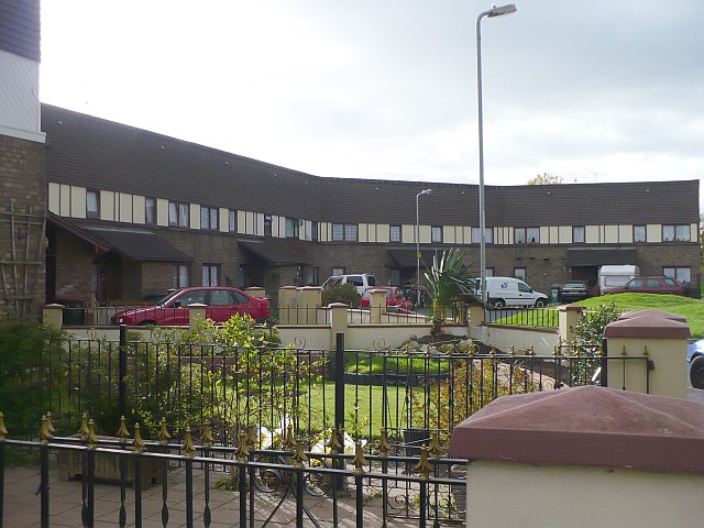
Duffryn ( cy, Dyffryn) is a large housing estatebr>in the southwest of the city of Newport, Wales, Newport, south Wales comprising a large portion of the Tredegar Park electoral district (ward). Built on land belonging to Tredegar Housebr> it was completed in 1978 and at the time won several awards for its design. The layout of the estate, as viewed from above, is that of large terraces undulating around a central wooded area. Originally a Council Estate, Duffryn is now a mix of private ownership and Newport City Homes RSL (Registered Social Landlord) properties. The design of the estate is the result of a council competition. It was won by a consortium committed to the theories of planning devised in the architecture department of Cambridge University in the 1960s. The District Amenities Centre that was planned for the south-west corner of the 96-acre site was never built, so the plan of a largely self-sufficient community was not realised. Despite the relative recent develop ... [...More Info...] [...Related Items...] OR: [Wikipedia] [Google] [Baidu] |
Gaer, Newport
Gaer ( cy, Y Gaer) is a community (Wales), community and electoral district ("ward") of the city of Newport, Wales, Newport, South Wales. The ward includes both the Gaer and Maesglas estates. To the south west of the ward is a listed monument known as the Gaer Hillfort (alternative: the Gollars) a large ancient hill fort and defensive position overlooking the Ebbw River with views south across the River Severn to England and north towards Twmbarlwm and Mynydd Machen. It is believed to date to the Iron Age. The original The Gaer House, Gaer House in the area was built in the reign of Elizabeth I of England, Queen Elizabeth by Alexander Seys, Esq., second son of Roger Seys, Esq., of Boverton. The ward is bounded by Bassaleg Road to the north, the South Wales Main Line, Great Western main line to the east, the Ebbw River to the southeast, Cardiff Road to the southwest, and the M4 motorway to the west. New tree planting on Gaer Fort, Newport - geograph.org.uk - 2297826.jpg, Gaer Hi ... [...More Info...] [...Related Items...] OR: [Wikipedia] [Google] [Baidu] |
Maesglas
Maesglas or Maes-glas is a neighbourhood in the south west of the city of Newport, South Wales. In the 16th century it was recorded as Greenfield but the Welsh language name ''Maesglas'' has remained the more widely used, among English speakers. It lies in the Gaer ward directly north of the A48 Southern Distributor Road, south of Cardiff Road and south-west of the South Wales Main Line railway. The Newport-born author Leslie Thomas wrote of Maesglas: This quote is incorporated into a mural telling the history of the estate, painted on the side of the Maesglas shops. Housing The main housing estate was first built in the 1930s, then many newer houses were added between the 1970s and 1990s in the Bideford Road area, next to the Great Western Main Line. Homes on the Maesglas estate are fairly compact but all have front and back gardens. Most of the houses are terraced but are arranged in all sorts of different rows and shapes of street, due to being built in the suburbs and ... [...More Info...] [...Related Items...] OR: [Wikipedia] [Google] [Baidu] |
Pillgwenlly
Pillgwenlly ( cy, Pilgwenlli), usually known as Pill, is a community (civil parish) and coterminous electoral district (ward) in the city of Newport, South Wales. Etymology The name is an elision of " Pîl Gwynllyw" (or "Gwynllyw's Pîl" in English). ' Pîl' is a localised topographical element (found across the coast of South Wales, from Pembrokeshire and into Somerset) indicating a tidal inlet from the sea, suitable as a harbour. In local tradition, it is said that this name derives from the early part of Gwynllyw's life when he was an active pirate. The tradition states that Gwynllyw maintained his ships at Pillgwenlly. Gwynllyw's reputation amongst sailors saw him adopted as the patron saint of choice for Welsh pirates and smugglers including Sir Henry Morgan. Description The community is bounded by the River Usk to the east and southeast, the Ebbw River to the southwest, the Great Western Main Line to the west and Cardiff Road to the north. It is an inner-city dist ... [...More Info...] [...Related Items...] OR: [Wikipedia] [Google] [Baidu] |
Nash, Newport
Nash ( cy, Trefonnen) is a village and community to the south of the city of Newport, South Wales, in the Lliswerry ward. Origin of the name The name is thought to originate from a contraction of "An Ash" (tree), meaning literally `place of the ash tree(s)'. This is supported by its appearance in deeds as "De Fraxino" (''fraxinus'' was the Latin name for the ash tree). The Welsh name is ''Trefonnen'', given in older sources as ''Tre'r onnen'', also meaning Town (''tref'') of the Ash (''onnen''). Nash and nearby Goldcliff, as Nash and Goldcliffe, are two of the few villages to appear on the Cambriae Typus map of 1573. Location Nash lies about to the south of the built-up area of the city of Newport, on the Caldicot levels, a large area of land reclaimed from the sea and crossed by drainage channels and reens. In addition to the village itself, the parish contains Uskmouth power stations and part of the Newport Wetlands nature reserve, including its Visitors Centre whi ... [...More Info...] [...Related Items...] OR: [Wikipedia] [Google] [Baidu] |


