|
List Of Earthquakes In The United Kingdom
__NOTOC__ The following is a list of notable earthquakes that have affected the British Isles. On average, several hundred earthquakes are detected by the British Geological Survey each year, but almost all are far too faint to be felt by humans. Those that are felt generally cause very little damage. Nonetheless, earthquakes have on occasion resulted in considerable damage, most notably in 1580 and 1884; Musson (2003) reports that there have been ten documented fatalities – six caused by falling masonry and four by building collapse. The causes of earthquakes in the UK are unclear, but may include "regional compression caused by motion of the Earth’s tectonic plates, and uplift resulting from the melting of the ice sheets that covered many parts of Britain thousands of years ago." Medieval reports of "earthquakes" that threw down newly built cathedrals may simply have been catastrophic failure of overloaded masonry, particularly towers, rather than actual tectonic events. ... [...More Info...] [...Related Items...] OR: [Wikipedia] [Google] [Baidu] |
Epicenter
The epicenter, epicentre () or epicentrum in seismology is the point on the Earth's surface directly above a hypocenter or focus, the point where an earthquake or an underground explosion originates. Surface damage Before the instrumental period of earthquake observation, the epicenter was thought to be the location where the greatest damage occurred, but the subsurface fault rupture may be long and spread surface damage across the entire rupture zone. As an example, in the magnitude 7.9 Denali earthquake of 2002 in Alaska, the epicenter was at the western end of the rupture, but the greatest damage was about away at the eastern end. Focal depths of earthquakes occurring in continental crust mostly range from . Continental earthquakes below are rare whereas in subduction zone earthquakes can originate at depths deeper than . Epicentral distance During an earthquake, seismic waves propagate in all directions from the hypocenter. Seismic shadowing occurs on the opposite s ... [...More Info...] [...Related Items...] OR: [Wikipedia] [Google] [Baidu] |
Earthquake Synod
The Earthquake Synod was an English synod that took place on 21 May 1382 in the Blackfriars area of London, England. William Courtenay, the Archbishop of Canterbury, convened the synod to address the emerging Lollard thinkers challenging the church. In particular, the synod condemned John Wycliffe's twenty-four theses, although many had already been condemned as heresy by a synod at St. Paul's Cathedral in February 1377. The synod also issued teachings on the doctrine of transubstantiation and friar A friar is a member of one of the mendicant orders founded in the twelfth or thirteenth century; the term distinguishes the mendicants' itinerant apostolic character, exercised broadly under the jurisdiction of a superior general, from the ol ...s. The synod got its name from the fact that the 1382 Dover Straits earthquake shook the city of London during its meetings.*"Earthquake Synod." In Cross, F. L. and E. A. Livingstone, eds. ''The Oxford Dictionary of the Christian Ch ... [...More Info...] [...Related Items...] OR: [Wikipedia] [Google] [Baidu] |
Earthquake Swarm
In seismology, an earthquake swarm is a sequence of seismic events occurring in a local area within a relatively short period. The time span used to define a swarm varies, but may be days, months, or years. Such an energy release is different from the situation when a major earthquake (main shock) is followed by a series of aftershocks: in earthquake swarms, no single earthquake in the sequence is obviously the main shock. In particular, a cluster of aftershocks occurring after a mainshock ''is not'' a swarm. History and generalities In the Ore Mountains (Erzgebirge), which form the border between the Czech Republic and Germany, western Bohemia and the Vogtland region, have been known since the 16th century as prone to frequent earthquake swarms, which typically last a few weeks to a few months. Austrian geologist Josef Knett, while studying in 1899 a swarm of about a hundred events felt in western Bohemia/Vogtland in January-February 1824, coined the noun ''Schwarmbeben'', ' ... [...More Info...] [...Related Items...] OR: [Wikipedia] [Google] [Baidu] |
Chichester
Chichester () is a cathedral city and civil parish in West Sussex, England.OS Explorer map 120: Chichester, South Harting and Selsey Scale: 1:25 000. Publisher:Ordnance Survey – Southampton B2 edition. Publishing Date:2009. It is the only city in West Sussex and is its county town. It was a Roman and Anglo-Saxon settlement and a major market town from those times through Norman and medieval times to the present day. It is the seat of the Church of England Diocese of Chichester, with a 12th-century cathedral. The city has two main watercourses: the Chichester Canal and the River Lavant. The Lavant, a winterbourne, runs to the south of the city walls; it is hidden mostly in culverts when close to the city centre. History Roman period There is no recorded evidence that the city that became Chichester was a settlement of any size before the coming of the Romans. The area around Chichester is believed to have played a significant part during the Roman invasion of AD 43, ... [...More Info...] [...Related Items...] OR: [Wikipedia] [Google] [Baidu] |
Gumley
Gumley is a village and civil parish in the Harborough district, in the county of Leicestershire, England, United Kingdom. The closest town is Market Harborough. The population of the civil parish (including Laughton, Leics) at the 2011 census was 209. The name Gumley is a contraction of the Anglo-Saxon "Gutmundesleah" – meaning Godmund's clearing. History The village is first mentioned in 749. King Æthelbald of Mercia (r.716-757) held a synod at Gumley in that year, at the instigation of Saint Boniface, to answer accusations that he had been oppressing churches and monasteries. The outcome was that Æthelbald released the Church from all public burdens except the three common burdens of providing military service, and building and repairing bridges and fortresses. These obligations arguably initiated changes in the land tenurial system of England and eventually led to serfdom. King Offa visited Gumley in 772 and 779 for the witanagemot of the kings of Mercia. On the so ... [...More Info...] [...Related Items...] OR: [Wikipedia] [Google] [Baidu] |
Kingston Upon Hull
Kingston upon Hull, usually abbreviated to Hull, is a port city and unitary authority in the East Riding of Yorkshire, England. It lies upon the River Hull at its confluence with the Humber Estuary, inland from the North Sea and south-east of York, the historic county town. With a population of (), it is the fourth-largest city in the Yorkshire and the Humber region after Leeds, Sheffield and Bradford. The town of Wyke on Hull was founded late in the 12th century by the monks of Meaux Abbey as a port from which to export their wool. Renamed ''Kings-town upon Hull'' in 1299, Hull had been a market town, military supply port, trading centre, fishing and whaling centre and industrial metropolis. Hull was an early theatre of battle in the English Civil Wars. Its 18th-century Member of Parliament, William Wilberforce, took a prominent part in the abolition of the slave trade in Britain. More than 95% of the city was damaged or destroyed in the blitz and suffered a perio ... [...More Info...] [...Related Items...] OR: [Wikipedia] [Google] [Baidu] |
Blackburn
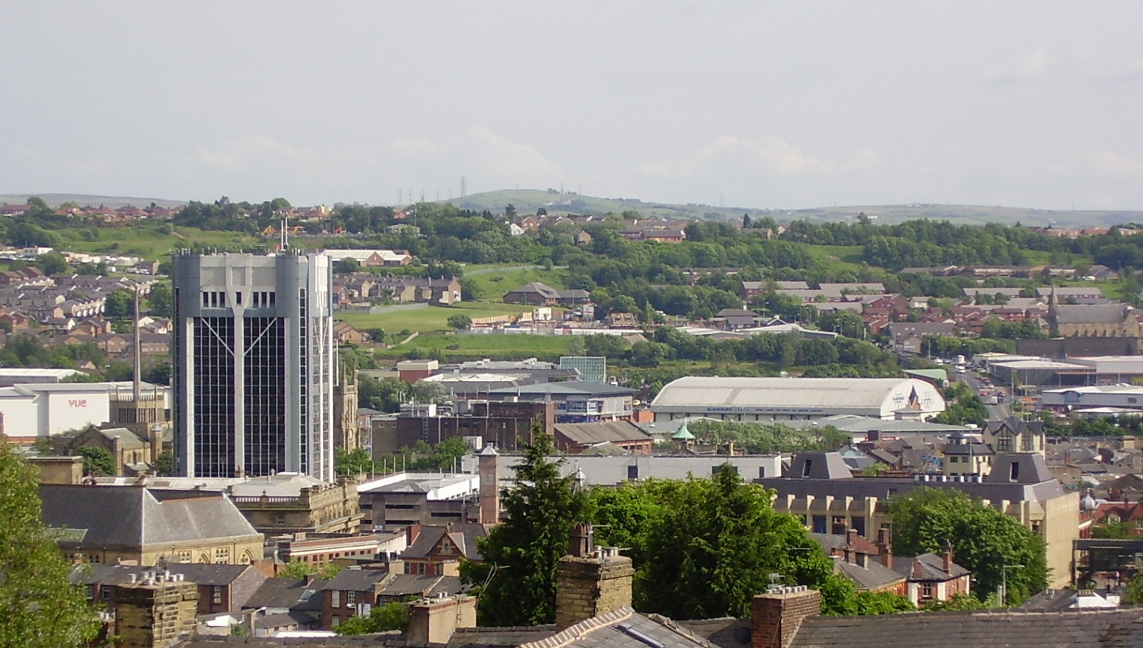
Blackburn () is an industrial town and the administrative centre of the Blackburn with Darwen borough in Lancashire, England. The town is north of the West Pennine Moors on the southern edge of the Ribble Valley, east of Preston and north-northwest of Manchester. Blackburn is the core centre of the wider unitary authority area along with the town of Darwen. It is one of the largest districts in Lancashire, with commuter links to neighbouring cities of Manchester, Salford, Preston, Lancaster, Liverpool, Bradford and Leeds. At the 2011 census, Blackburn had a population of 117,963, whilst the wider borough of Blackburn with Darwen had a population of 150,030. Blackburn had a population of 117,963 in 2011, with 30.8% being people of ethnic backgrounds other than white British. A former mill town, textiles have been produced in Blackburn since the middle of the 13th century, when wool was woven in people's houses in the domestic system. Flemish weavers who settled in t ... [...More Info...] [...Related Items...] OR: [Wikipedia] [Google] [Baidu] |
Mansfield
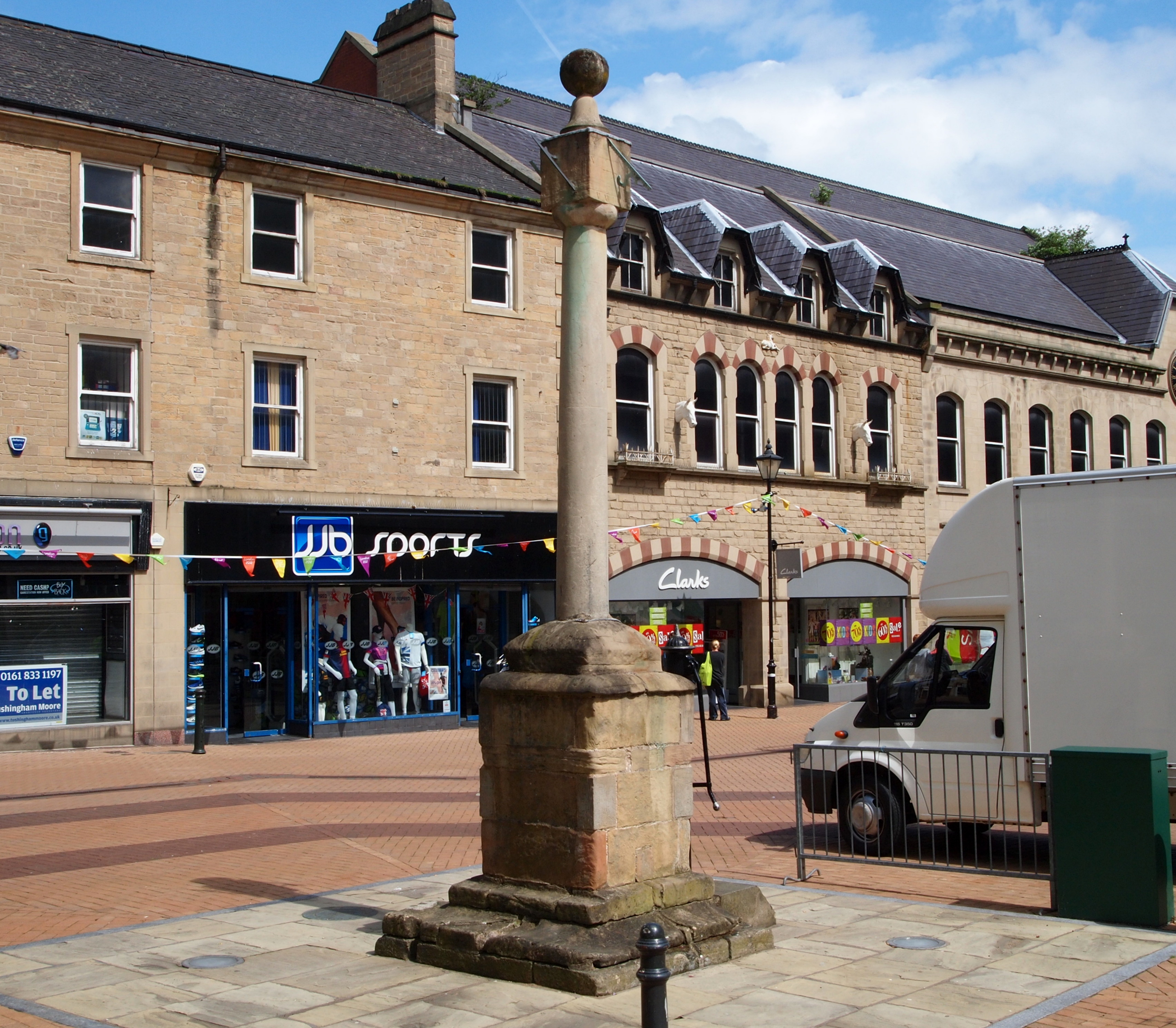
Mansfield is a market town and the administrative centre of Mansfield District in Nottinghamshire, England. It is the largest town in the wider Mansfield Urban Area (followed by Sutton-in-Ashfield). It gained the Royal Charter of a market town in 1227. The town lies in the Maun Valley, north of Nottingham and near Sutton-in-Ashfield. Most of the 109,000 population live in the town itself (including Mansfield Woodhouse), with Warsop as a secondary centre. Mansfield is the one local authority in Nottinghamshire with a publicly elected mayor. History Roman to Mediaeval Period Settlement dates to the Roman period. Major Hayman Rooke in 1787 discovered a villa between Mansfield Woodhouse and Pleasley; a cache of denarii was found near King's Mill in 1849. Early English royalty stayed there; Mercian Kings used it as a base to hunt in Sherwood Forest. The Royal Manor of Mansfield was held by the King. In 1042 Edward the Confessor possessed a manor in Mansfield. William the Conqu ... [...More Info...] [...Related Items...] OR: [Wikipedia] [Google] [Baidu] |
Comrie, Perth And Kinross
Comrie (; Gaelic: ''Cuimridh''; Pictish: ''Aberlednock''; Latin: ''Victoria'') is a village and parish in the southern Highlands of Scotland, towards the western end of the Strathearn district of Perth and Kinross, west of Crieff. Comrie is a historic conservation village in a national scenic area along the river Earn. Its position on the Highland Boundary Fault explains why it has more earth tremors than anywhere else in Britain. The parish is twinned with Carleton Place, Ontario, Canada. Location and etymology Comrie lies within the registration county of Perthshire (Gaelic: '' Siorrachd Pheairt'') and the Perth and Kinross local council area. The name Comrie derives from the original Gaelic name ''con-ruith'' or ''comh-ruith'' (from ''con/comh'' 'together', and ''ruith'' "to run", "running") translating literally as "running together", but more accurately as "flowing together" or "the place where rivers meet". In modern Gaelic the name is more often transcribed as Comraidh, ... [...More Info...] [...Related Items...] OR: [Wikipedia] [Google] [Baidu] |
Duchy Of Brabant
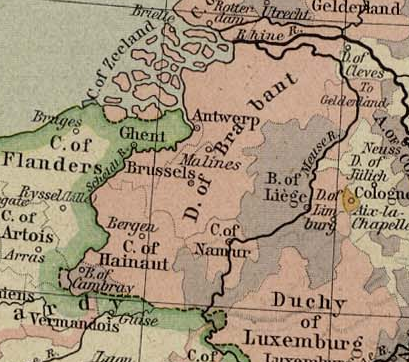
The Duchy of Brabant was a State of the Holy Roman Empire established in 1183. It developed from the Landgraviate of Brabant and formed the heart of the historic Low Countries, part of the Burgundian Netherlands from 1430 and of the Habsburg Netherlands from 1482, until it was partitioned after the Dutch revolt. Present-day North Brabant (''Noord-Brabant'') was ceded to the Generality Lands of the Dutch Republic according to the 1648 Peace of Westphalia, while the reduced duchy remained part of the Habsburg Netherlands until it was conquered by French Revolutionary forces in 1794, which was recognized by treaty in 1797. Today all the duchy's former territories, apart from exclaves, are in Belgium except for the Dutch province of North Brabant. Geography The Duchy of Brabant (adjective: ''Brabantian'' or '' Brabantine'') was historically divided into four parts, each with its own capital. The four capitals were Leuven, Brussels, Antwerp and 's-Hertogenbosch. Before 's-Hertogenb ... [...More Info...] [...Related Items...] OR: [Wikipedia] [Google] [Baidu] |
Carlisle, Cumbria
Carlisle ( , ; from xcb, Caer Luel) is a city that lies within the Northern English county of Cumbria, south of the Scottish border at the confluence of the rivers Eden, Caldew and Petteril. It is the administrative centre of the City of Carlisle district which, (along with Cumbria County Council) will be replaced by Cumberland Council in April 2023. The city became an established settlement during the Roman Empire to serve forts on Hadrian's Wall. During the Middle Ages, the city was an important military stronghold due to its proximity to the Kingdom of Scotland. Carlisle Castle, still relatively intact, was built in 1092 by William Rufus, served as a prison for Mary, Queen of Scots in 1568 and now houses the Duke of Lancaster's Regiment and the Border Regiment Museum. In the early 12th century, Henry I allowed a priory to be built. The priory gained cathedral status with a diocese in 1133, the city status rules at the time meant the settlement became a city. Fro ... [...More Info...] [...Related Items...] OR: [Wikipedia] [Google] [Baidu] |
Cumberland
Cumberland ( ) is a historic county in the far North West England. It covers part of the Lake District as well as the north Pennines and Solway Firth coast. Cumberland had an administrative function from the 12th century until 1974. From 1974 until 2023, Cumberland lay within Cumbria, a larger administrative area which also covered Westmorland and parts of Yorkshire and Lancashire. In April 2023, Cumberland will be revived as an administrative entity when Cumbria County Council is abolished and replaced by two unitary authorities; one of these is to be named Cumberland and will include most of the historic county, with the exception of Penrith and the surrounding area. Cumberland is bordered by the historic counties of Northumberland to the north-east, County Durham to the east, Westmorland to the south-east, Lancashire to the south, and the Scottish counties of Dumfriesshire and Roxburghshire to the north. Early history In the Early Middle Ages, Cumbria was part of t ... [...More Info...] [...Related Items...] OR: [Wikipedia] [Google] [Baidu] |


