|
List Of Counties In Ontario
The Province of Ontario has 51 first-level administrative divisions, which collectively cover the whole province. With two exceptions, their areas match the 49 census divisions Statistics Canada has for Ontario. The Province has four types of first-level division: single-tier municipalities, regional municipalities, counties, and districts. The first three are types of municipal government but districts are ''not''—they are defined geographic areas (some quite large) used in many contexts. The last three have within them multiple smaller, lower-tier municipalities but the single-tier municipalities do not. Regional municipalities and counties differ primarily in the services that they provide to their residents. (Lower-tier municipalities are generally treated as census subdivisions by Statistics Canada.) In some cases, an administrative division may retain its historical name even if it changes government type. For instance, Oxford County, Haldimand County, Norfolk Coun ... [...More Info...] [...Related Items...] OR: [Wikipedia] [Google] [Baidu] |
Ontario
Ontario ( ; ) is one of the thirteen provinces and territories of Canada.Ontario is located in the geographic eastern half of Canada, but it has historically and politically been considered to be part of Central Canada. Located in Central Canada, it is Canada's most populous province, with 38.3 percent of the country's population, and is the second-largest province by total area (after Quebec). Ontario is Canada's fourth-largest jurisdiction in total area when the territories of the Northwest Territories and Nunavut are included. It is home to the nation's capital city, Ottawa, and the nation's most populous city, Toronto, which is Ontario's provincial capital. Ontario is bordered by the province of Manitoba to the west, Hudson Bay and James Bay to the north, and Quebec to the east and northeast, and to the south by the U.S. states of (from west to east) Minnesota, Michigan, Ohio, Pennsylvania, and New York. Almost all of Ontario's border with the United States f ... [...More Info...] [...Related Items...] OR: [Wikipedia] [Google] [Baidu] |
Greater Sudbury
Sudbury, officially the City of Greater Sudbury is the largest city in Northern Ontario by population, with a population of 166,004 at the 2021 Canadian Census. By land area, it is the largest in Ontario and the List of the largest cities and towns in Canada by area, fifth largest in Canada. It is administratively a List of census divisions of Ontario#Single-tier municipalities, single-tier municipality and thus is not part of any district, county, or regional municipality. The City of Greater Sudbury is separate from, but entirely surrounded by the Sudbury District. The city is also referred to as "Grand Sudbury" among Franco-Ontarian, Francophones. The Sudbury region was inhabited by the Ojibwe people of the Algonquin people, Algonquin group for thousands of years prior to the founding of Sudbury after the discovery of nickel ore in 1883 during the construction of the transcontinental railway. Greater Sudbury was formed in 2001 by merging the cities and towns of the former Regi ... [...More Info...] [...Related Items...] OR: [Wikipedia] [Google] [Baidu] |
Northern Ontario
Northern Ontario is a primary geographic and quasi-administrative region of the Canadian province of Ontario, the other primary region being Southern Ontario. Most of the core geographic region is located on part of the Superior Geological Province of the Canadian Shield, a vast rocky plateau located mainly north of Lake Huron (including Georgian Bay), the French River, Lake Nipissing, and the Mattawa River. The statistical region extends south of the Mattawa River to include all of the District of Nipissing. The southern section of this district lies on part of the Grenville Geological Province of the Shield which occupies the transitional area between Northern and Southern Ontario. The extended federal and provincial quasi-administrative regions of Northern Ontario have their own boundaries even further south in the transitional area that vary according to their respective government policies and requirements. Ontario government departments and agencies such as the Growth Pl ... [...More Info...] [...Related Items...] OR: [Wikipedia] [Google] [Baidu] |
Northeastern Ontario
Northeastern Ontario is a secondary region of Northern Ontario in the Canadian province of Ontario, which lies north of Lake Huron and east of Lake Superior. Northeastern Ontario consists of the districts of Algoma, Sudbury, Cochrane, Timiskaming, Nipissing and Manitoulin. For some purposes, Parry Sound District and Muskoka District Municipality are treated as part of Northeastern Ontario although they are geographically in Central Ontario. These two divisions are coloured in green on the map. Northeastern Ontario and Northwestern Ontario may also be grouped together as Northern Ontario. An important difference between the two sub-regions is that Northeastern Ontario has a sizable Franco-Ontarian population — approximately 25 per cent of the region's population speaks French as a first language, compared with 3.2 per cent in the northwest. Virtually the entire region, except only the Manitoulin District, is designated as a French-language service area under Ontario's Frenc ... [...More Info...] [...Related Items...] OR: [Wikipedia] [Google] [Baidu] |
Regional Municipality Of Sudbury
The Regional Municipality of Sudbury was a Regional Municipality that existed in Ontario, Canada, from 1973 to 2000, and was primarily centred on the city of Sudbury. It served as an upper-tier level of municipal government, aggregating municipal services on a region-wide basis like the Counties and Regional Municipalities of Southern Ontario, and was the only upper-tier municipal government ever created in Northern Ontario. The Regional Municipality was dissolved with the creation of the amalgamated City of Greater Sudbury on January 1, 2001. Structure The Regional Municipality expanded the boundaries of the city of Sudbury to annex the community of Copper Cliff, the unincorporated geographic township of Broder, and half of the unincorporated geographic township of Dill. The other half of Dill Township — including the community of Wanup — remained unincorporated, although it was subsequently annexed into Greater Sudbury in 2001. The existing Town of Capreol also expanded its ... [...More Info...] [...Related Items...] OR: [Wikipedia] [Google] [Baidu] |
Southwestern Ontario
Southwestern Ontario is a secondary region of Southern Ontario in the Canadian province of Ontario. It occupies most of the Ontario Peninsula bounded by Lake Huron, including Georgian Bay, to the north and northwest; the St. Clair River, Lake St. Clair, and Detroit River, to the west; and Lake Erie to the south. To the east, on land, Southwestern Ontario is bounded by Central Ontario and the Golden Horseshoe. The region had a population of 2,583,544 in 2016. It is sometimes further divided into "Midwestern Ontario" covering the eastern half of the area and the heart of Southwestern Ontario encompassing the western half of the region. Definitions The Government of Ontario also classifies municipalities along the eastern side of Southwestern Ontario near the Grand River, including Wellington County (containing Guelph), the Region of Waterloo (containing Kitchener, Waterloo, and Cambridge), and Brant County (containing Brantford), as part the "Greater Golden Horseshoe" region that ... [...More Info...] [...Related Items...] OR: [Wikipedia] [Google] [Baidu] |
Kent County, Ontario
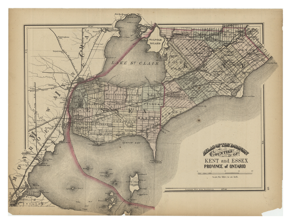
Kent County, area 2,458 km2 (949 sq mi) is a historic county in the Canadian province of Ontario. The county was created in 1792 and named by John Graves Simcoe in honour of the English County. The county is in an alluvial plain between Lake St. Clair, and Lake Erie, watered by two navigable streams, the Thames River and the Sydenham River. On January 1, 1998, the county, its townships, towns, and Chatham were amalgamated into the single-tier city of Chatham-Kent. Original townships Camden Area: . Camden Township was conceded by treaty in 1790, and the Gore was surrendered by treaty in 1819. Surveyed in 1794 and named from the Earl of Camden. Also referred to earlier as Camden Township and Gore, and in the 1861 census as Camden & Gore Township. Containing some of the best farmland in Ontario, the township was originally parcelled as a grid with Concessions 1 to 7 running north-westward, Lots 1 to 18 running north-eastward and Concession A along the road to Thames ... [...More Info...] [...Related Items...] OR: [Wikipedia] [Google] [Baidu] |
Southern Ontario
Southern Ontario is a primary region of the province of Ontario, Canada, the other primary region being Northern Ontario. It is the most densely populated and southernmost region in Canada. The exact northern boundary of Southern Ontario is disputed; however, the core region is situated south of Algonquin Park, the latter being in an area of transition between coniferous forest north of the French and Mattawa Rivers and southern deciduous forest. It covers between 14 and 15% of the province, depending on the inclusion of the Parry Sound and Muskoka districts which also lie in the transitional area between northern and southern forest regions. With approximately 13.5 million people, the region is home to approximately 36% of Canada's population of 37.0 million. Southern Ontario differs greatly from Northern Ontario, in that it has a much higher population density, a different climate, and a different culture than its northern counterpart. It is broken into smaller subregions, i ... [...More Info...] [...Related Items...] OR: [Wikipedia] [Google] [Baidu] |
List Of Ontario Separated Municipalities
Ontario is the most populous province in Canada with 14,223,942 residents as of 2021 and is third-largest in land area at . Ontario's 444 municipalities cover only of the province's land mass yet are home to of its population. These municipalities provide local or regional municipal government services within either a single-tier or shared two-tier municipal structure. A municipality in Ontario is "a geographic area whose inhabitants are incorporated" according to the ''Municipal Act, 2001''. Ontario's three municipality types include upper and lower-tier municipalities within the two-tier structure, and single-tier municipalities (unitary authorities) that are exempt from the two-tier structure. Single and lower-tier municipalities are grouped together as local municipalities. Of Ontario's 444 municipalities, 30 of them are upper-tier municipalities and 414 are local municipalities—241 lower-tier municipalities and 173 single-tier municipalities. The ''Municipal Act, ... [...More Info...] [...Related Items...] OR: [Wikipedia] [Google] [Baidu] |
Satellite Town
Satellite cities or satellite towns are smaller municipalities that are adjacent to a principal city which is the core of a metropolitan area. They differ from mere suburbs, subdivisions and especially bedroom communities in that they have municipal governments distinct from that of the core metropolis and employment bases sufficient to support their residential populations. Conceptually, satellite cities could be self-sufficient communities outside of their larger metropolitan areas. However, functioning as part of a metropolis, a satellite city experiences cross-commuting (that is, residents commuting out of and employees commuting into the city). Satellite cities versus other types of settlement Satellite cities are different from and are sometimes confused with the following related patterns of development. Suburbs Satellite cities differ from suburbs in that they have distinct employment bases, commutersheds, and cultural offerings from the central metropolis, as well as ... [...More Info...] [...Related Items...] OR: [Wikipedia] [Google] [Baidu] |


