|
List Of Cities And Towns On The Euphrates River
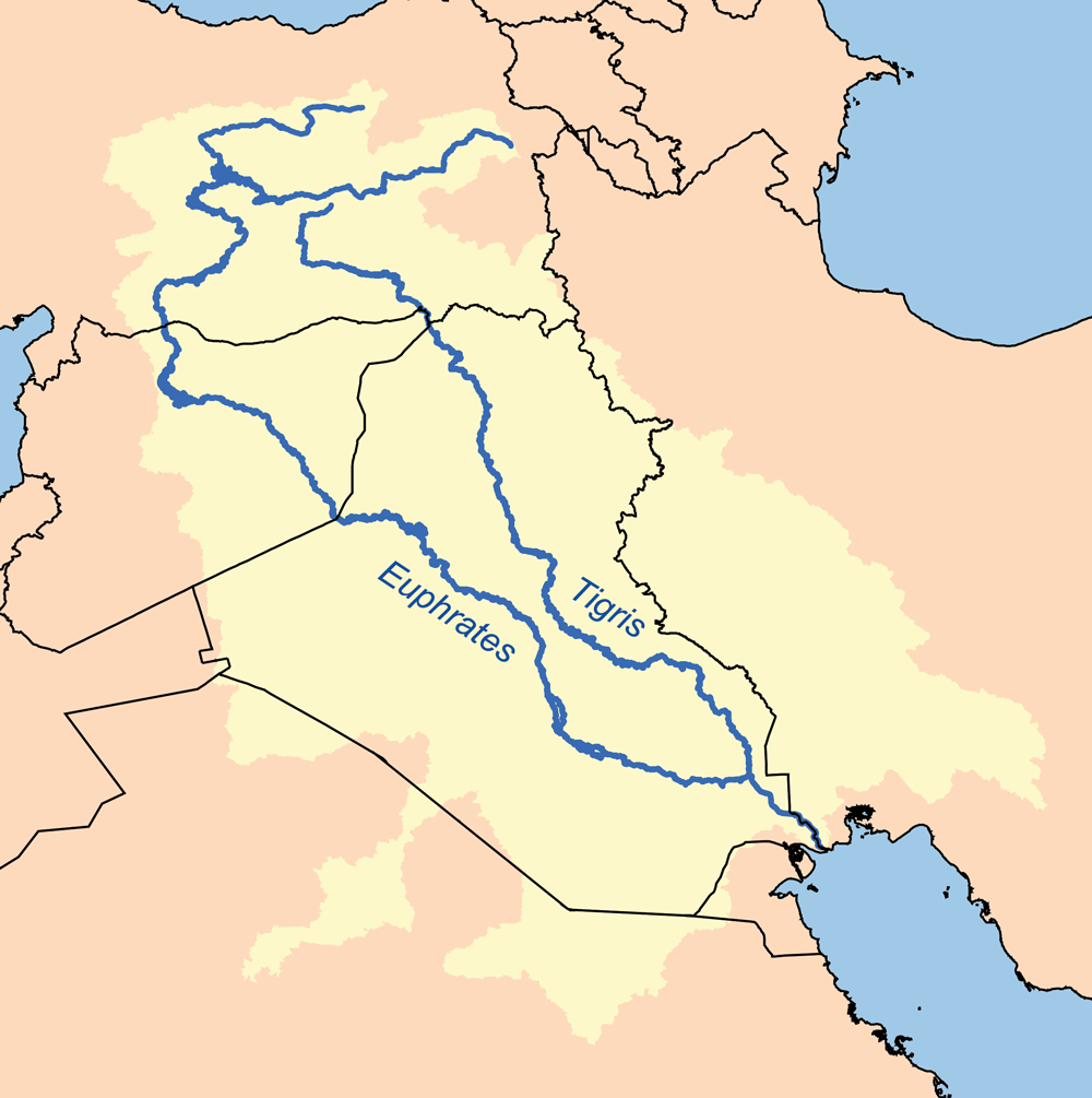
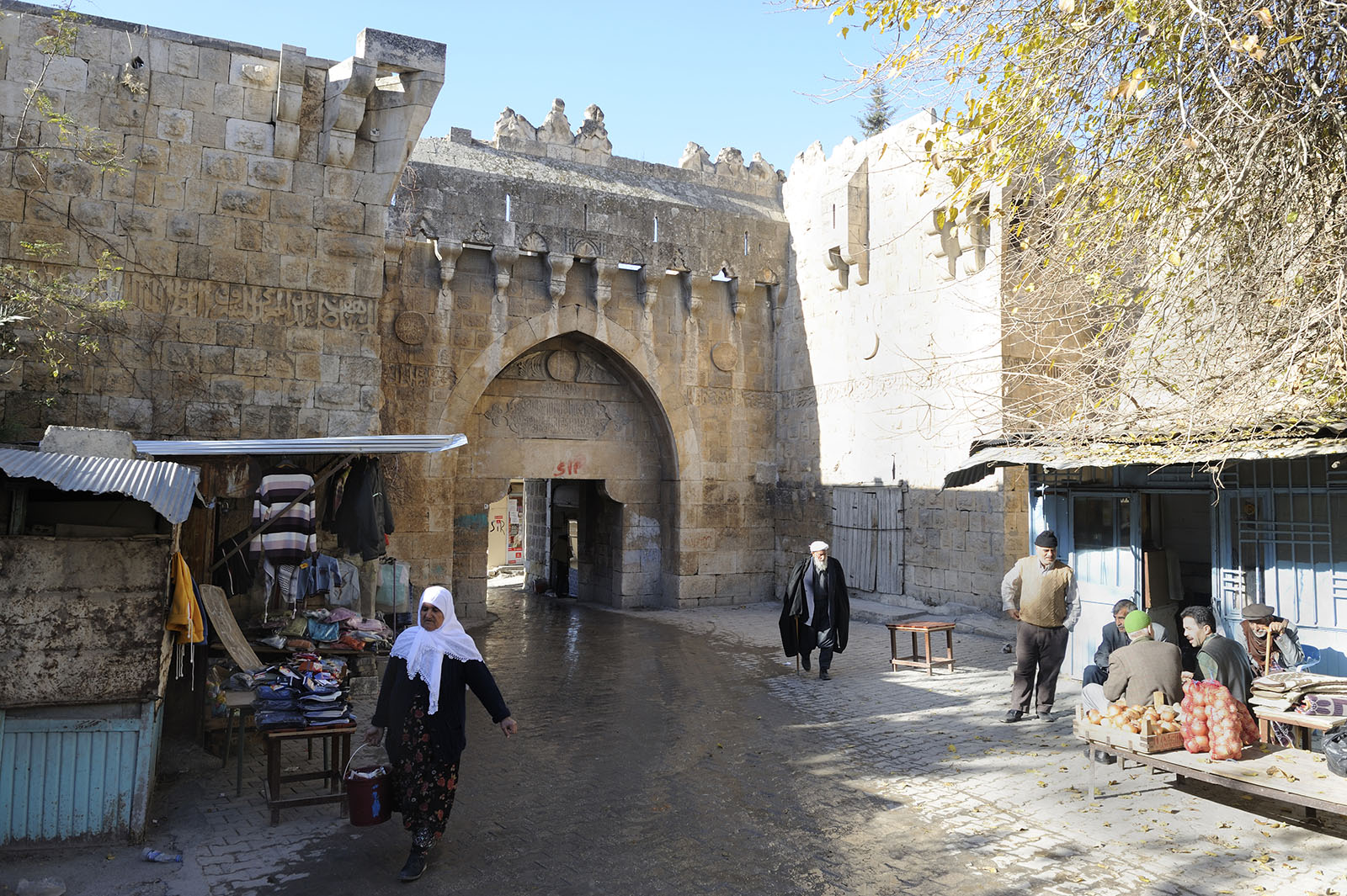
This article provides a detailed list of the cities and towns along the Euphrates River in order of country. Cities in Turkey The Euphrates is formed by the union of two branches, the Karasu or Kara River (the western Euphrates), which rises in eastern Turkey north of Erzurum, and the Murat (the eastern Euphrates). These rivers merge in the Elazığ Province of Turkey, where the river is dammed in several places such as the Keban Dam, the Karakaya Dam, Atatürk Dam, the Birecik Dam, and Karkamis Dam. Beneath the lakes of these dams are ancient towns like Samsat. Other towns like Elif, Hasanoğlu and Hisar in the Araban district of Gaziantep date back to Roman times. Halfeti, a district of Şanlıurfa Urfa, officially known as Şanlıurfa () and in ancient times as Edessa, is a city in southeastern Turkey and the capital of Şanlıurfa Province. Urfa is situated on a plain about 80 km east of the Euphrates River. Its climate features ..., mentioned as “Halpa” ... [...More Info...] [...Related Items...] OR: [Wikipedia] [Google] [Baidu] |
Arsameia
Arsameia on the Nymphaios ( hy, Արշամաշատ, Arshamashat; tr, Eski Kale – "Old Castle") is an ancient city located in Old Kâhta (Eski Kâhta) in Kâhta district, Adıyaman Province, Turkey. The site is near Kâhtaçay, known in ancient times as Nymphaios. Arsameia was a royal seat of the kingdom of Commagene. It is best known for the Hierothesion of King Mithridates I Kallinikos, built for him by his son and heir Antiochos I. History The ancient town of Nymphaios was renamed Arsameia in the third century BCE by the Armenian king Arsames (255–225 BCE). It was then taken in 235 BCE by the Seleukid Antiochus Hierax who was fleeing from his brother Seleucus II, who was later claimed as an ancestor by the Commagenian King Antiochus I. The city had already been abandoned again by Roman times, stones from local graves were used by Roman soldiers or building bridges. left, Dexiosis-Fragment at Site I, to the upper right the auriole around the head of Mithras Hierothesio ... [...More Info...] [...Related Items...] OR: [Wikipedia] [Google] [Baidu] |
Birecik
Birecik; ku, Bêrecûk is a town and district of Şanlıurfa Province of Turkey, on the Euphrates. Built on a limestone cliff 400 ft. high on the left/east bank of the Euphrates, "at the upper part of a reach of that river, which runs nearly north-south, and just below a sharp bend in the stream, where it follows that course after coming from a long reach flowing more from the west". Etymology The historical name of the town, ''al-Bīra'' in Arabic and ''Bīreh'' in Syriac, derives from the Aramaic ''Bīrthā'', meaning fortress. It later evolved to ''Birecik'' with the addition of the Turkish diminutive suffix, ''cik''. It is called ''Belejik'' amongst the local population. Archaeology Birecik Dam Cemetery is an Early Bronze Age cemetery near Birecik. It was used extensively for about 500 years at the beginning of the third millennium BC. More than 300 graves were excavated here in 1997 and 1998. The site was discovered during the building of the Birecik Dam as part of ... [...More Info...] [...Related Items...] OR: [Wikipedia] [Google] [Baidu] |
Seleukeia Euphrates
Seleucia at the Zeugma ( el, Σελεύκεια ἐπὶ τοῦ Ζεύγματος, transliterated ''Seleukeia epi tou Zeugmatos'') was a Hellenistic fortified town in the present Republic of Turkey on the left (south) bank of the Euphrates, across from ancient Samosata and not far from it. It is mentioned in isolated incidents: Antiochus III the Great married a Pontic princess there in 221 BC; the ''Oxford Classical Dictionary'' ascribed this to Zeugma. Tigranes let Cleopatra Selene, the widow of Antiochus X Eusebes, be killed there. Pompey gave the city and its surroundings to Antiochus I Theos of Commagene; Pliny the Elder nonetheless ascribes it to Coele Syria. The bishop Eusebius of Samosata ruled a day's journey from his see, even to Zeugma. The name of the city is confirmed by an inscription from Rhodes, which refers to a man "of Seleucia, of those on the Euphrates". The location of Selucia at the Zeugma is uncertain. It had a bridge of boats, like the well-known ( ... [...More Info...] [...Related Items...] OR: [Wikipedia] [Google] [Baidu] |
Seleucia At The Zeugma
Seleucia at the Zeugma ( el, Σελεύκεια ἐπὶ τοῦ Ζεύγματος, transliterated ''Seleukeia epi tou Zeugmatos'') was a Hellenistic fortified town in the present Republic of Turkey on the left (south) bank of the Euphrates, across from ancient Samosata and not far from it. It is mentioned in isolated incidents: Antiochus III the Great married a Kingdom of Pontus, Pontic princess there in 221 BC; the ''Oxford Classical Dictionary'' ascribed this to Zeugma, Commagene, Zeugma. Tigranes let Cleopatra Selene I, Cleopatra Selene, the widow of Antiochus X Eusebes, be killed there. Pompey gave the city and its surroundings to Antiochus I Theos of Commagene; Pliny the Elder nonetheless ascribes it to Coele Syria. The bishop Eusebius of Samosata ruled a day's journey from his see, even to Zeugma. The name of the city is confirmed by an inscription from Rhodes, which refers to a man "of Seleucia, of those on the Euphrates". The location of Selucia at the Zeugma is unce ... [...More Info...] [...Related Items...] OR: [Wikipedia] [Google] [Baidu] |
Arulis
Urima or Ourima, also known as Antiochia ad Euphratem and Arulis, was a town on the Euphrates River of Classical Anatolia, inhabited from Hellenistic to Byzantine times. It was in the late Roman province of Euphratensis. Urima was the seat of a bishop; no longer a residential bishopric, it remains a titular see of the Roman Catholic Church. Its site is located near , in a now-submerged portion of Gaziantep Province Gaziantep Province ( tr, ) is a province in south-central Turkey. It is located in the westernmost part of Turkey's Southeastern Anatolia Region and partially in the Mediterranean Region. Its capital is the city of Gaziantep. It neighbours Ad ... in Asiatic Turkey. References Populated places in ancient Upper Mesopotamia Former populated places in Turkey Populated places of the Byzantine Empire History of Gaziantep Province Hellenistic colonies in Anatolia Catholic titular sees in Asia {{Asia-RC-diocese-stub ... [...More Info...] [...Related Items...] OR: [Wikipedia] [Google] [Baidu] |
Hromgla
Rumkale ( ''Roman Castle''), also known as Urumgala, is a fortress on the Euphrates, located in the province of Gaziantep and 50 km west of Şanlıurfa. Its strategic location was already known to the Assyrians, although the present structure is largely Hellenistic and Roman in origin. It is said that John, an apostle of Jesus, lived in Rumkale during Roman times. The site was occupied by various Byzantine and Armenian warlords during the Middle Ages. During the 12th century, it also became the seat of an Armenian bishop. In 1179, a synod took place in Rumkale, attempting a compromise between the Greeks and the Armenians. From 1203 to 1293, it served as the residence of the Catholicos of the Armenian Church."Eastern Churches" by James Darling, London 1850, page 35, paragraph 2 In 1293, it was captured by the Mamluks of Egypt following a protracted siege who then named it ''Qal'at al-Muslimin''. Access The fortress, now situated across a peninsula created by the reservoir ... [...More Info...] [...Related Items...] OR: [Wikipedia] [Google] [Baidu] |
Rumkale
Rumkale ( ''Roman Castle''), also known as Urumgala, is a fortress on the Euphrates, located in the province of Gaziantep and 50 km west of Şanlıurfa. Its strategic location was already known to the Assyrians, although the present structure is largely Hellenistic and Roman in origin. It is said that John, an apostle of Jesus, lived in Rumkale during Roman times. The site was occupied by various Byzantine and Armenian warlords during the Middle Ages. During the 12th century, it also became the seat of an Armenian bishop. In 1179, a synod took place in Rumkale, attempting a compromise between the Greeks and the Armenians. From 1203 to 1293, it served as the residence of the Catholicos of the Armenian Church."Eastern Churches" by James Darling, London 1850, page 35, paragraph 2 In 1293, it was captured by the Mamluks of Egypt following a protracted siege who then named it ''Qal'at al-Muslimin''. Access The fortress, now situated across a peninsula created by the reservo ... [...More Info...] [...Related Items...] OR: [Wikipedia] [Google] [Baidu] |
Urartu
Urartu (; Assyrian: ',Eberhard Schrader, ''The Cuneiform inscriptions and the Old Testament'' (1885), p. 65. Babylonian: ''Urashtu'', he, אֲרָרָט ''Ararat'') is a geographical region and Iron Age kingdom also known as the Kingdom of Van, centered around Lake Van in the historic Armenian Highlands. The kingdom rose to power in the mid-9th century BC, but went into gradual decline and was eventually conquered by the Iranian Medes in the early 6th century BC. Since its re-discovery in the 19th century, Urartu, which is commonly believed to have been at least partially Armenian-speaking, has played a significant role in Armenian nationalism. Names and etymology Various names were given to the geographic region and the polity that emerged in the region. * Urartu/Ararat: The name ''Urartu'' ( hy, Ուրարտու; Assyrian: '; Babylonian: ''Urashtu''; he, אֲרָרָט ''Ararat'') comes from Assyrian sources. Shalmaneser I (1263–1234 BC) recorded a campaign in ... [...More Info...] [...Related Items...] OR: [Wikipedia] [Google] [Baidu] |


