|
List Of Toronto Transit Commission Bus Routes
This article lists all bus routes, along with their branches, on the Toronto Transit Commission bus system. The list is current . Route types The Toronto Transit Commission operates five types of bus routes: * Regular service routes have at least one branch or a section of overlapping branches that operates from 6 am (8 am on Sundays) to 1 am, 7 days per week. Some routes are part of the 10-Minute Network having one or more branches operating at a 10-minute frequency (or better) throughout the day and evening. Otherwise, service frequency varies by route and time of day. * Limited service routes do not serve all hours of the day, or not all days of the week, or not all seasons. The frequency of service varies by route. Regular service and limited service routes are collectively numbered between 7 and 189. * Blue Night Network routes (300-series) operate from 1 am to 6 am (8 am on Sundays), which are also the times that the Toronto subway system does not operate. Service frequen ... [...More Info...] [...Related Items...] OR: [Wikipedia] [Google] [Baidu] |
TTC Bus 3461 - Nova LFS Hybrid
TTC may refer to: In arts and entertainment * Tao Te Ching, the collection of sayings attributed to Lao Tzu * Tom Tom Club, an American new wave band * The Travel Channel, a cable channel devoted to travel * The Tennis Channel, a digital channel devoted to tennis * TTC (band), a French hip-hop trio Businesses and organizations * Toronto Transit Commission, a public transit operator in Toronto, Ontario, Canada * The Teaching Company, an American company that produces recordings of lectures by university professors, the distributor of ''The Great Courses'' * The Tetris Company, owner of the trademark and copyright for Tetris * Telecommunication Technology Committee, a telecommunications standards body in Japan *Trade and Technology Council, a diplomatic forum for EU-US trade and tech * Transmission Technologies Corporation, former name of automobile transmissions manufacturer TREMEC Corporation Schools * Tatung Institute of Commerce and Technology, a college in Chiayi City, Ta ... [...More Info...] [...Related Items...] OR: [Wikipedia] [Google] [Baidu] |
Victoria Park Avenue
Victoria Park Avenue is a major north-south route in eastern Toronto, Ontario, Canada. It is the western border of Scarborough, separating it from Old Toronto, East York, and North York. The common nickname for it is VP or Vic Park. History Victoria Park Avenue was originally a pioneer road for settlement of Scarborough. Except for its very southernmost section (south of Bracken Avenue), the road once formed the boundary for the former township, borough, and city of Scarborough with the former municipalities of East York, North York, and the former city of Toronto. Road was also called. Scarborough-York Town Line. Route description Victoria Park Avenue begins as a two-lane residential street near Lake Ontario at Queen Street at the east end of The Beaches community. It takes a sharp jog west just before Bracken Avenue, and then continues in a straight line northward. It remains a two-lane residential street past Bracken Avenue north to Gerrard Street, albeit one with a heav ... [...More Info...] [...Related Items...] OR: [Wikipedia] [Google] [Baidu] |
Sherway Gardens
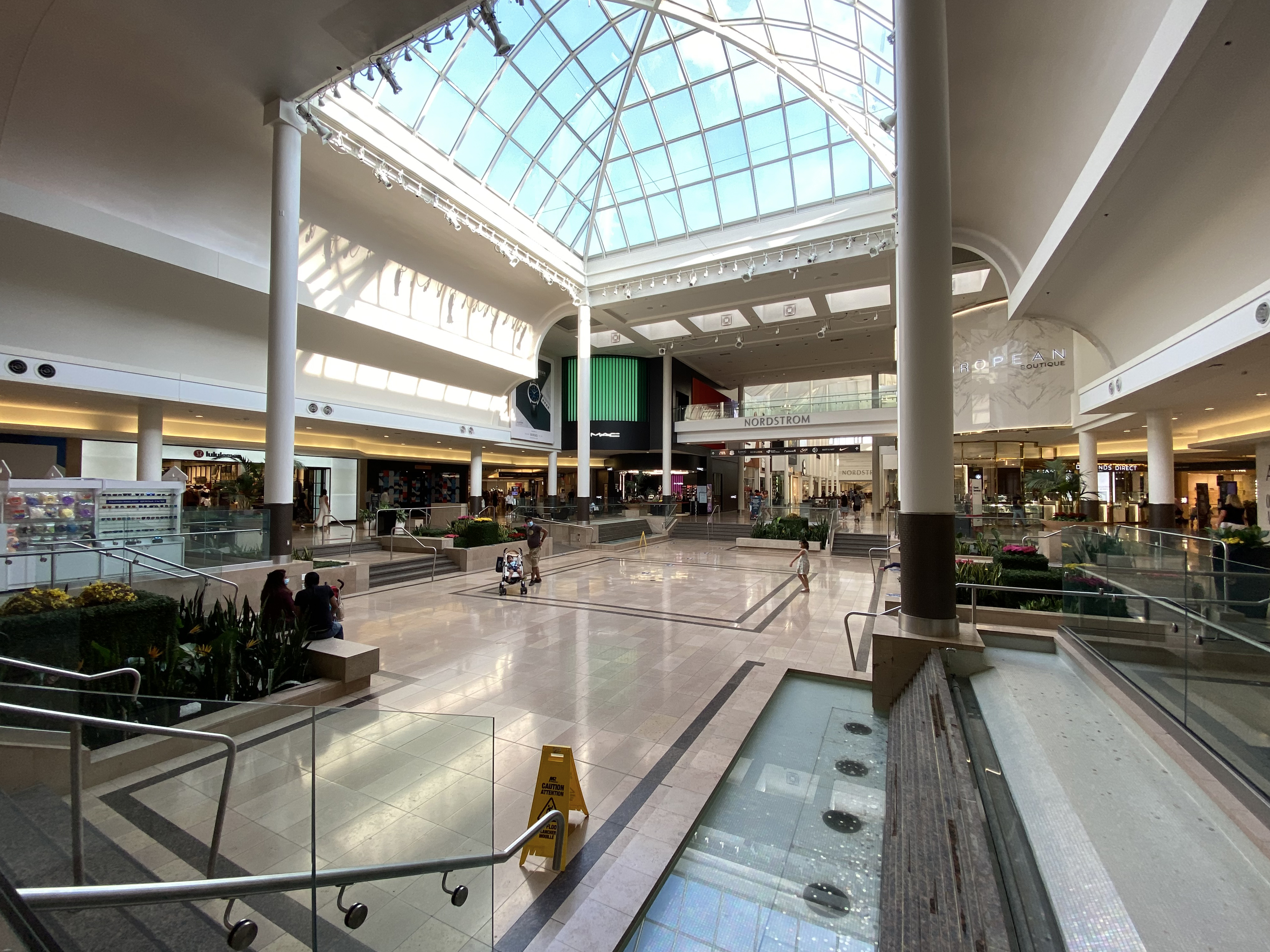
Sherway Gardens (corporately known as CF Sherway Gardens) is a large retail shopping mall in Toronto, Ontario, Canada. The mall is located west of Downtown Toronto, near the interchange of Highway 427 with the Queen Elizabeth Way and Gardiner Expressway. Opened in 1971, the mall originally covered in an S-shaped configuration and contained 127 stores. It was expanded in 1975, 1987, 1989, 2015, and 2017 to its current size of and 215 stores. It is the eighth largest mall in the Greater Toronto Area, and is the 18th largest mall in Canada. As the mall has grown, it has changed its mix of stores from a general mix of stores to add more fashion-conscious and luxury brand stores."Mall Wars: Yorkdale vs. Sherway: Inside the big-bucks ... [...More Info...] [...Related Items...] OR: [Wikipedia] [Google] [Baidu] |
Royal York Station
Royal York is a subway station on Line 2 Bloor–Danforth of the Toronto subway in Toronto, Ontario, Canada. It is located just north of Bloor Street West on the east side of Royal York Road. Wi-Fi service is available at this station. History The station was opened in 1968 in what was then the Borough of Etobicoke. The original plan for the Bloor-Danforth extension to Islington had different stations than what was eventually built. The stations were to be at "Montgomery" and "Prince Edward", instead of Islington and Royal York. This was probably because these two streets were the ends of the Kingsway shopping district. However, it was decided to include only one station in the Kingsway, at Royal York. Until 1973 the buses and the subway trains serving the station were in separate fare zones and so the turnstiles and collector booths were on the mezzanine level between the bus bays and the subway platforms. When the zones were abolished, they were moved to just inside the street ... [...More Info...] [...Related Items...] OR: [Wikipedia] [Google] [Baidu] |
Caledonia Road
Caledonia (; ) was the Latin name used by the Roman Empire to refer to the part of Great Britain () that lies north of the River Forth, which includes most of the land area of Scotland. Today, it is used as a romantic or poetic name for all of Scotland. During the Roman Empire's occupation of Scotland, the area they called Caledonia was physically separated from the rest of the island by the Antonine Wall. The Romans several times invaded and occupied it, but unlike the rest of the island, it remained outside the administration of Roman Britain. Latin historians, including Tacitus and Cassius Dio, referred to the territory north of the River Forth as "Caledonia", and described it as inhabited by the Maeatae and the Caledonians (). Other ancient authors, however, used the adjective "Caledonian" more generally to describe anything pertaining to inland or northern Britain. The name is probably derived from a word in one of the Gallo-Brittonic languages. History Etymology ... [...More Info...] [...Related Items...] OR: [Wikipedia] [Google] [Baidu] |
Gerrard Street (Toronto)
Gerrard Street is a street in Toronto, Ontario, Canada. It consists of two separate parts, historically referred to as Lower Gerrard and Upper Gerrard. The former stretches between University Avenue and Coxwell Avenue for 6 km, across Old Toronto. The latter portion starts 300 m north of Lower Gerrard's eastern terminus and runs between Coxwell Avenue and Clonmore Drive, between Victoria Park Avenue and Warden Avenue, in Scarborough for another 4 km. Gerrard Street travels through a few important districts and neighbourhoods of Toronto, most notably Discovery District, East Chinatown, and Gerrard India Bazaar, Toronto's prime South Asian ethnic enclave. History Gerrard is named for Samuel Gerrard (1767-1857), an Anglo-Irish businessman in Lower Canada and a personal friend of the Honourable John McGill, member of the Legislative Council of Upper Canada. Upper Gerrard was originally a separate street called "Lake View Avenue", which was in the town of East Toronto. ... [...More Info...] [...Related Items...] OR: [Wikipedia] [Google] [Baidu] |
Queen's Park (Toronto)
Queen's Park is an urban park in Downtown Toronto, Ontario, Canada. Opened in 1860 by Edward, Prince of Wales, it was named in honour of Queen Victoria. The park is the site of the Ontario Legislative Building, which houses the Legislative Assembly of Ontario. The phrase "Queen's Park" is regularly used as a metonym for the Government of Ontario or the Legislative Assembly of Ontario. The park is nearly an enclave of the University of Toronto, which occupies most of the surrounding lands. In 1859, the land was leased by the University of Toronto to the City of Toronto government for a 999-year term. In 1880, a "portion of the Queen's Park asselected nd given tothe Government of Ontario, as a site for the erection of new Legislative and Departmental buildings". The land that is occupied by the Legislative Assembly of Ontario is owned by the Government of Ontario. The north park is owned by the University of Toronto and leased to the city. Ministry buildings of the Ontario gove ... [...More Info...] [...Related Items...] OR: [Wikipedia] [Google] [Baidu] |
Eglinton Station
Eglinton is a subway station on Line 1 Yonge–University of the Toronto subway. Located on Eglinton Avenue, it is central to the Yonge–Eglinton neighbourhood in Midtown Toronto. Eglinton station is the seventh busiest station of the Toronto Transit Commission (TTC). Line 5 Eglinton will serve Eglinton station upon completion of the line, which is scheduled for 2023. Eglinton will then become an interchange station for the two lines. Description Line 1 station The current station is on three levels, with entrances scattered throughout the street level in the surrounding area of Yonge Street and Eglinton Avenue. The concourse, fare gates and bus terminal as well as several shops are on the second level, and the Line 1 platform is on the lower level. Eglinton station is the only one of the original 1954 subway stations (Eglinton to Union on Line 1) to retain its original vitreous marble wall tiles. The other 1954 subway stations used similar wall tiles with variations in colour ... [...More Info...] [...Related Items...] OR: [Wikipedia] [Google] [Baidu] |
University Of Toronto Scarborough
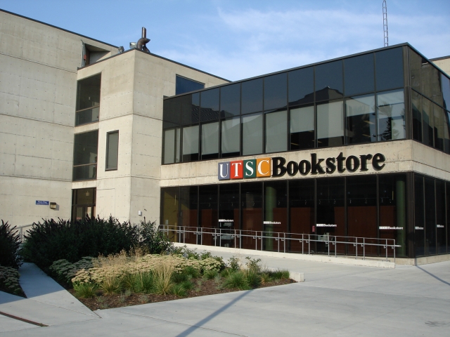
The University of Toronto Scarborough, also known as U of T Scarborough or UTSC, is one of the three campuses that make up the tri-campus system of the University of Toronto. Located in Scarborough, Toronto, Ontario, Canada, the campus is set upon suburban parkland in the residential neighbourhood of Highland Creek. It was established in 1964 as Scarborough College, a constituent college of the Faculty of Arts and Science. The college expanded following its designation as an autonomic division of the university in 1972 and gradually became an independent institution. It ranks last in area and enrolment size among the three University of Toronto campuses, the other two being the St. George campus in Downtown Toronto and the University of Toronto Mississauga. Academics of the campus are centred on a variety of undergraduate studies in the disciplines of management, arts and sciences, whilst also hosting limited postgraduate research programs. Its neuroscience program was the firs ... [...More Info...] [...Related Items...] OR: [Wikipedia] [Google] [Baidu] |
Victoria Park Station (Toronto)
Victoria Park is a station on Line 2 Bloor–Danforth of the Toronto subway system. It is located at 777 Victoria Park Avenue, one block north of Danforth Avenue in Scarborough. The station can be accessed by pedestrians directly from Victoria Park Avenue; by way of an unmanned entrance from Albion Avenue; through an automated entrance from Teesdale Place; and via a walkway that leads to the nearby Crescent Town area. A City of Toronto bicycle station is located adjacent to the main Victoria Park Avenue entrance, providing a paid secure indoor bicycle parking area. History Victoria Park Station was opened in 1968 in the Borough of Scarborough, but the access footbridge across Victoria Park Avenue, built in the 1970s, extended into the Borough of East York. Until 1973, the buses and the subway trains serving the station were in separate fare zones, and so the turnstiles and collector booths were placed between the bus bays and the subway platforms. When the zones were aboli ... [...More Info...] [...Related Items...] OR: [Wikipedia] [Google] [Baidu] |
Brimley Road
Brimley Road is a north-south street in Toronto and the Regional Municipality of York, Ontario, Canada. In Toronto, it is located entirely within Scarborough and carried 32000 vehicles daily in May 2007 Hence, it is classified as a major arterial road by the city of Toronto. Beginning at Scarborough Bluffs by Lake Ontario, Brimley goes straight through Scarborough, past Steeles Avenue and ends at 14th Avenue in Markham. The Scarborough portion is mainly residential with small strip plazas along the way, and the super-regional mall, Scarborough Town Centre. North of Finch Avenue is Brimley Woods (Macklin's Bush), a small forest patch and now city park of what the area once looked like. Past Steeles, Brimley weaves through the residential areas of the Milliken community of Markham. History The origins of the street's name is unknown, but it could be named for a village in Teignbridge in England given the origins of many of Scarborough's early settlers. The corner of Brimley R ... [...More Info...] [...Related Items...] OR: [Wikipedia] [Google] [Baidu] |
Kennedy Station
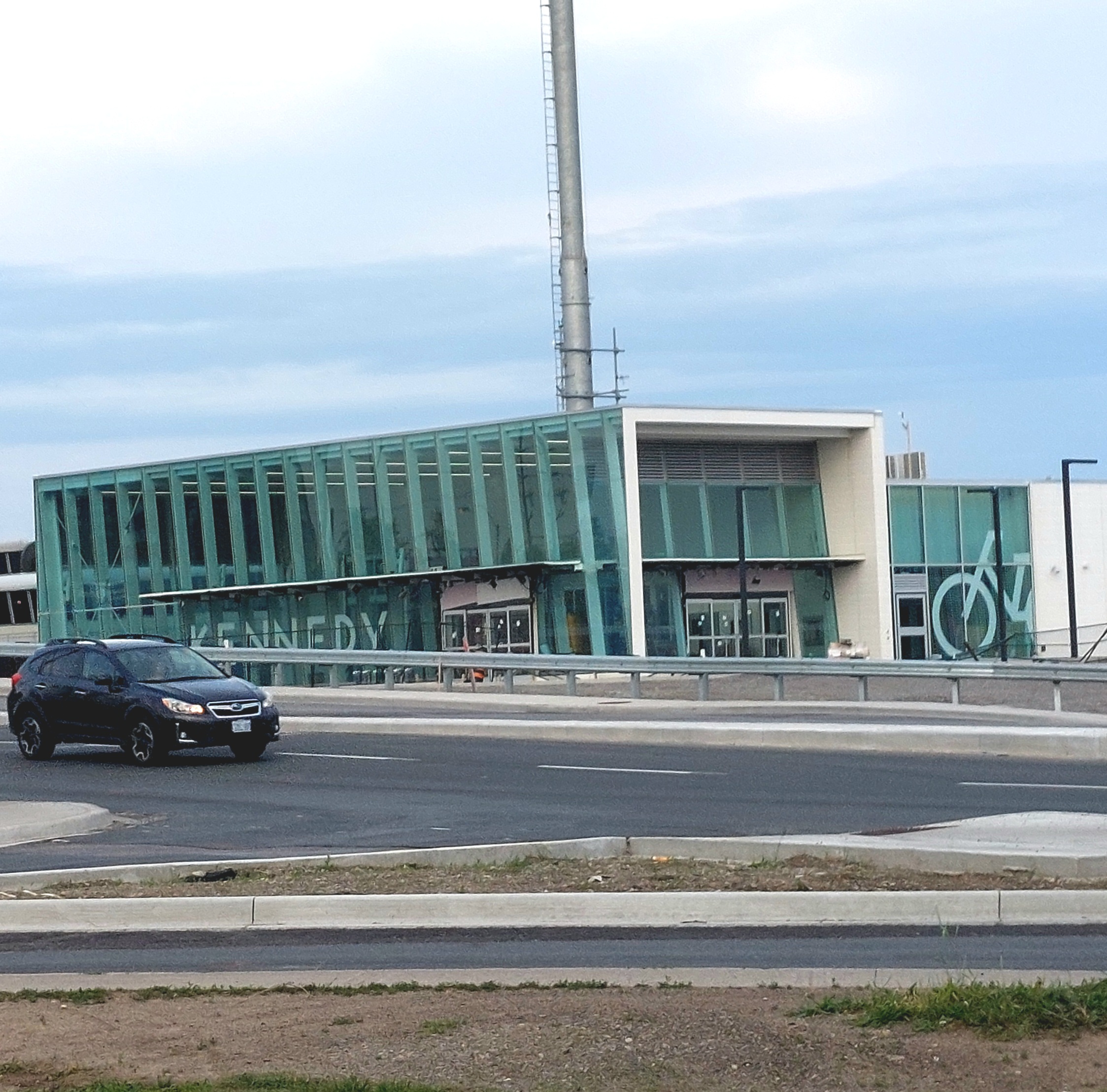
Kennedy is both a terminal and interchange station on Line 2 Bloor–Danforth and Line 3 Scarborough of the Toronto subway system. Opened in 1980, it is located east of the Kennedy Road and Eglinton Avenue intersection. With the adjacent Kennedy GO station on the Stouffville line of GO Transit, Kennedy is an intermodal transit hub and the fifth busiest station in the system, after , , , and , serving a total of approximately customer trips a day. The station's main complex consists of four floors with wheelchair accessible entrances. The ground level is the bus terminal surrounded with ten platforms that serve eleven Toronto Transit Commission (TTC) bus routes. Wi-Fi service is available at this station. Construction to expand the station began in 2017 to add a platform for the future Line 5 Eglinton, which will terminate at the station when its first phase opens in 2023. Further changes to the station are expected to take place during the 2020s as Line 3 is scheduled to b ... [...More Info...] [...Related Items...] OR: [Wikipedia] [Google] [Baidu] |


