|
List Of Areas Of Special Scientific Interest In County Antrim
__NOTOC__ This is a list of the Areas of Special Scientific Interest (ASSIs) in County Antrim in Northern Ireland, United Kingdom. In Northern Ireland the body responsible for designating ASSIs is the Northern Ireland Environment Agency – a division of the Department of Environment (DoE). Unlike the SSSIs, ASSIs include both natural environments ''and'' man-made structures. As with SSSIs, these sites are designated if they have criteria based on fauna, flora, geological or physiographical features. On top of this, structures are also covered, such as the Whitespots mines in Conlig, according to several criterion including rarity, recorded history and intrinsic appeal. For other sites in the rest of the United Kingdom, see List of SSSIs by Area of Search. The data in the table is taken from the Northern Ireland Environment Agency's website in the form of citation sheets for each ASSI.''Environment Agency'' citation sheets for each ASSI. Retrieved on 2011-12-01. (PDF files). ... [...More Info...] [...Related Items...] OR: [Wikipedia] [Google] [Baidu] |
Carrick-a-Rede Rope Bridge
The Carrick-a-Rede Rope Bridge (locally pronounced carrick-a-reed) is a rope bridge near Ballintoy in County Antrim, Northern Ireland. The bridge links the mainland to the tiny island of Carrickarede (). It spans and is above the rocks below. The bridge is mainly a tourist attraction and is owned and maintained by the National Trust. In 2018, the bridge had 485,736 visitors. The bridge is open all year round (subject to weather) and people may cross it for a fee. History It is thought salmon fishermen have been building bridges to the island for over 350 years. It has taken many forms over the years. In the 1970s it had only one handrail and large gaps between the slats. A new bridge, tested up to ten tonnes, was built with the help of local climbers and abseilers in 2000. Another was built in 2004 and offered visitors and fishermen alike a much safer passage to the island. The current wire rope and Douglas fir bridge was made by Heyn Construction in Belfast and raised early ... [...More Info...] [...Related Items...] OR: [Wikipedia] [Google] [Baidu] |
Cushendall
Cushendall (), formerly known as Newtownglens, is a coastal village and townland (of 153 acres) in County Antrim, Northern Ireland. It is located in the historic barony of Glenarm Lower and the civil parish of Layd, and is part of Causeway Coast and Glens district. Located on the A2 coast road between Glenariff and Cushendun, Cushendall is in the Antrim Coast and Glens an Area of Outstanding Natural Beauty. It lies in the shadow of the table topped Lurigethan Mountain and at the meeting point of three of the Glens of Antrim: Glenaan, Glenballyemon and Glencorp. This part of the Northern Irish coastline is separated from Scotland by the North Channel, with the Mull of Kintyre about 16 miles away. In the 2011 Census, Cushendall had a population of 1,280 people. This article contains quotations from this source, which is available under thOpen Government Licence v3.0 © Crown copyright. Much of the historic character of the 19th century settlement on the north bank of the River ... [...More Info...] [...Related Items...] OR: [Wikipedia] [Google] [Baidu] |
Glenarm
Glenarm () is a village in County Antrim, Northern Ireland. It lies on the North Channel coast north of the town of Larne and the village of Ballygalley, and south of the village of Carnlough. It is situated in the civil parish of Tickmacrevan and the historic barony of Glenarm Lower. It is part of Mid and East Antrim Borough Council and had a population of 568 people in the 2011 Census. This article contains quotations from this source, which is available under th Open Government Licence v3.0 © Crown copyright. Glenarm takes its name from the glen in which it lies, the southernmost of the nine Glens of Antrim. History The Castle dates from 1750, with early 19th century alterations. Glenarm claims to be the oldest town in Ulster, having been granted a charter in the 12th century. The Barbican Gate to Glenarm Castle was restored by the Irish Landmark Trust, a conservation charity that saves buildings that are at risk of being lost. In the 5th to 7th centuries (the beginning ... [...More Info...] [...Related Items...] OR: [Wikipedia] [Google] [Baidu] |
Glenariff Forest Park
Glenariff Forest Park is an 1185 hectare (2928 acre) forest in County Antrim, Northern Ireland. It is part of Glenariff glen itself. The forest is managed by the Northern Ireland Forest Service, the state body responsible for forestry in the province, which is part of the Department of Agriculture, Environment and Rural Affairs. Features The Waterfall Walkway, opened 80 years ago, has been significantly upgraded along its 3-mile length which passes through a National Nature Reserve. There are three waterfalls, forest trails and riverside walks, as well as a visitor centre, shop, and seasonal caravan/camping site and restaurant. Timber production As well as being a recreational resource, the forest is used for timber production centered on the clearfelling of coniferous plantation A plantation is an agricultural estate, generally centered on a plantation house, meant for farming that specializes in cash crops, usually mainly planted with a single crop, with perhaps ancillary ... [...More Info...] [...Related Items...] OR: [Wikipedia] [Google] [Baidu] |
Glenariff
Glenariff or Glenariffe ( or ) is a valley in County Antrim, Northern Ireland. It is one of the Glens of Antrim. Like other glens in that area, it was shaped during the Last Glacial Period, Ice Age by giant glaciers. It is sometimes called the 'Queen of the Glens', and is the biggest of the Glens of Antrim and visited by most tourists. The village of Waterfoot, County Antrim, Waterfoot lies on the coast at the foot of the glen. A popular tourist destination is the Glenariff Forest Park with its trails through the trees and alongside waterfalls. References Culture Northern Ireland * "A Glimpse at Glenariffe" - Book (1997) by Robert Sharpe and Charles McAllister traces the history of the glen using maps, 17th century hearth rolls and school records. Glens of County Antrim Northern Ireland coast and countryside {{Antrim-geo-stub ... [...More Info...] [...Related Items...] OR: [Wikipedia] [Google] [Baidu] |
Dunseverick
, translit_lang1 = Irish , translit_lang1_type = Derivation: , translit_lang1_info = Dún Sobhairce , translit_lang1_type1 = Meaning: , translit_lang1_info1 = Sobhairce's fort , image_skyline = DunseverickCastle.jpg , imagesize = , image_alt = , image_caption = Dunseverick Castle , image_map = , mapsize = , map_alt = , map_caption = , pushpin_map = Northern Ireland#United Kingdom , pushpin_label_position = , pushpin_label = , pushpin_map_alt = , pushpin_mapsize = , pushpin_map_caption = Dunseverick (alias Feigh) shown within Northern Ireland , coordinates = , coor_pinpoint = , coordinates_footnotes = , area_total_ha = 103.60 , area_total_acre = 256.01 [Baidu] |
Giant's Causeway
The Giant's Causeway is an area of about 40,000 interlocking basalt columns, the result of an ancient volcanic fissure eruption. It is located in County Antrim on the north coast of Northern Ireland, about three miles (5 km) northeast of the town of Bushmills. It was declared a World Heritage Site by UNESCO in 1986 and a national nature reserve by the Department of the Environment for Northern Ireland in 1987. In a 2005 poll of ''Radio Times'' readers, the Giant's Causeway was named the fourth-greatest natural wonder in the United Kingdom. The tops of the columns form stepping stones that lead from the cliff foot and disappear under the sea. Most of the columns are hexagonal, although some have four, five, seven or eight sides. The tallest are about 12 metres (39 ft) high, and the solidified lava in the cliffs is 28 metres (92 ft) thick in places. Much of the Giant's Causeway and Causeway Coast World Heritage Site is owned and managed by the Natio ... [...More Info...] [...Related Items...] OR: [Wikipedia] [Google] [Baidu] |
Garron Plateau
Garron Plateau ASSI is a 4652.18-hectare area of special scientific interest in County Antrim, Northern Ireland. Upland blanket bogs cover basalt rocks, and flushing by mineral-enriched water has resulted in the formation of alkaline fen vegetation. There are small areas of standing and running water but bogs, marshes, water fringed vegetation and fens cover 70% of the area. The remainder is heath and scrubland, humid grassland and mesophile grassland. The peatland complex is composed of a series of raised and flushed peat bog and oligotrophic lakes. Plants include ''Erica tetralix'', ''Trichophorum cespitosum'', ''Eriophorum vaginatum'', dwarf-shrubs and ''Sphagnum papillosum'', '' Sphagnum fuscum'' and '' Sphagnum imbricatum''. Garron Plateau is the main Irish location for ''Carex pauciflora'' and ''Carex magellanica''. The areas of flushed peat are floristically rich, with black bog-rush ''Schoenus nigricans'' and brown mosses. The site contains populations of ''Sax ... [...More Info...] [...Related Items...] OR: [Wikipedia] [Google] [Baidu] |
Glenarm Lower
Glenarm Lower is a barony in County Antrim, Northern Ireland. To its east runs the east-Antrim coast, and it is bordered by five other baronies: Cary to the north; Dunluce Lower and Kilconway to the west; Antrim Lower to the south-west; and Glenarm Upper to the south-east. Geographical features Geographical features of Glenarm Lower include: *Lurigethan hill *Collin Top, Tievebulliagh, and Trostan mountains *Glencloy valley List of settlements Below is a list of settlements in Glenarm Lower: Villages *Carnlough *Cushendall * Waterfoot *Glenarm Hamlets and population centres *Carnalbanagh Sheddings *Feystown *Garronpoint *Straidkelly List of civil parishes Below is a list of civil parishes in Glenarm Lower: *Ardclinis *Grange of Inispollen *Grange of Layd *Layd Layd is a civil parish and townland (of 219 acres) in County Antrim, Northern Ireland. It is situated in the historic barony of Glenarm Lower. Civil parish of Layd The civil parish contains the following villages: * ... [...More Info...] [...Related Items...] OR: [Wikipedia] [Google] [Baidu] |
Murlough Bay
Murlough Bay () in County Antrim, Northern Ireland is a bay on the north coast of Northern Ireland between Fair Head and Torr Head. It is known for its outstanding beauty and remote location, with close views of Rathlin Island and views across the sea to the Mull of Kintyre, Islay, Jura and various other Scottish islands. The local geology is typical of the Antrim topography with basalt overlaying sandstone and limestone. The area has many kilns used in the production of lime. Historical importance The original Gaelic name was Muir-bolc. According to the 11th century 'Preface to the Amra Coluim Cille', Murlough Bay was the place where Saint Columba landed after sailing from Iona to Ireland to attend the Synod of Drumceat c.595 AD. Although he is now buried in Dublin, Murlough Bay was the burial place of choice of Roger Casement, a former British Government Diplomat, knighted by King George V in 1911 and Irish Nationalist revolutionary leader who was executed by the Go ... [...More Info...] [...Related Items...] OR: [Wikipedia] [Google] [Baidu] |
Fair Head
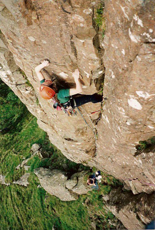
The Great Cliff , photo = Fair Head - geograph.org.uk - 817076.jpg , photo_width = , photo_caption = Fair Head's distinctive ''organ pipe'' dolerite columns, as taken from the Rathlin Island– Ballycastle ferry , map = UK Northern Ireland , map_width = , map_caption = Location of Fair Head in Northern Ireland , location = County Antrim, Northern Ireland , nearest_city = Ballycastle, , range = , coordinates = , climbing_type = , height = face is over , pitches = Single pitch, Multi pitch , ratings = , rock_type = Dolerite sill with olivine , quantity = , development = Mountain cliff area; no facilities , aspect = North and North-west , elevation = base is a.s.l , classic_climbs = , ownership = Private but access granted , camping = Paid camping; also in Ballycastle , website = Fair Head or Benmore ( ga, An Bhinn Mhór; The Great Cliff) is a long, high, mountain cliff, close to the sea, at the north-eastern corner of County Antrim, Northe ... [...More Info...] [...Related Items...] OR: [Wikipedia] [Google] [Baidu] |


