|
List Of Municipalities Of Cameroon
This is the list of cities, towns, and villages in the country of Cameroon: Villages * Bodo * Goura, Centre Region * Goura, Far North Region * Ngoila * Mmuock Leteh File:Silicon Mountain as seen in Buea, Cameroon on 26-06-2019.jpg, Buea File:Limbe Atlantic Ocean 1.jpg, Atlantic Ocean, Limbe File:Drill, Limbe wildlife centre.jpg, Drill, Limbe Wildlife Centre File:Pont du Plaisir.jpg, Dschang File:Plage Kribi38.jpg, Kribi Beach File:Beauty of the crick of idenau.jpg, View of a beautiful crick in Idenau See also * Communes of Cameroon * Departments of Cameroon * Regions of Cameroon * Subdivisions of Cameroon References External links Municipalities Municipalities Cameroon, List of municipalities in Municipalities of Cameroon Cameroon Cameroon (; french: Cameroun, ff, Kamerun), officially the Republic of Cameroon (french: République du Cameroun, links=no), is a country in west-central Africa. It is bordered by Nigeria to the west and no ... [...More Info...] [...Related Items...] OR: [Wikipedia] [Google] [Baidu] |
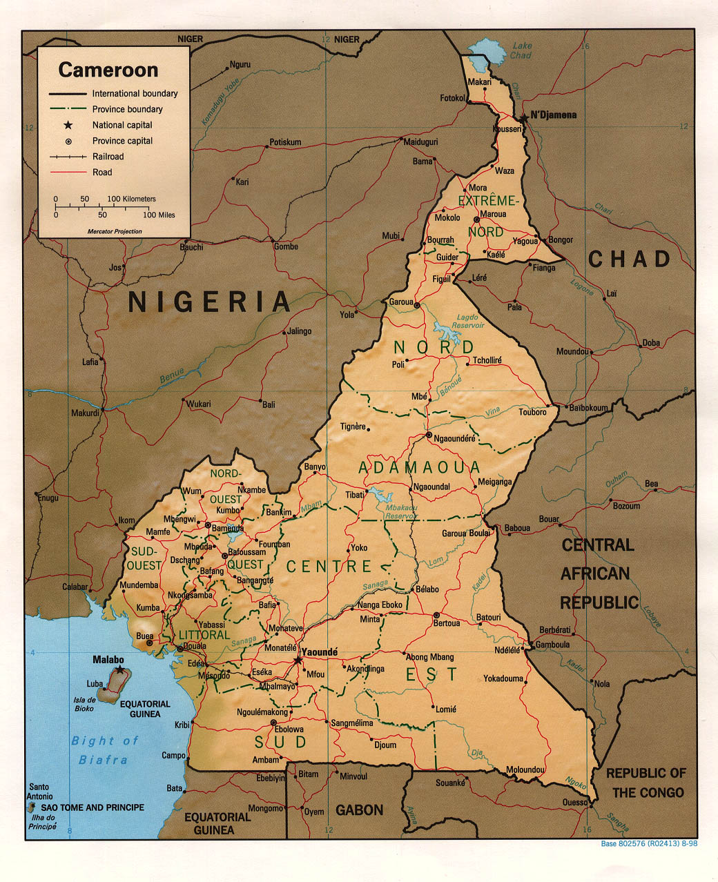
Cameroon Map
Cameroon (; french: Cameroun, ff, Kamerun), officially the Republic of Cameroon (french: République du Cameroun, links=no), is a country in west-central Africa. It is bordered by Nigeria to the west and north; Chad to the northeast; the Central African Republic to the east; and Equatorial Guinea, Gabon and the Republic of the Congo to the south. Its coastline lies on the Bight of Biafra, part of the Gulf of Guinea and the Atlantic Ocean. Due to its strategic position at the crossroads between West Africa and Central Africa, it has been categorized as being in both camps. Its nearly 27 million people speak 250 native languages. Early inhabitants of the territory included the Sao civilisation around Lake Chad, and the Baka hunter-gatherers in the southeastern rainforest. Portuguese explorers reached the coast in the 15th century and named the area ''Rio dos Camarões'' (''Shrimp River''), which became ''Cameroon'' in English. Fulani soldiers founded the Adamawa Emirate in t ... [...More Info...] [...Related Items...] OR: [Wikipedia] [Google] [Baidu] |
Bandjoun
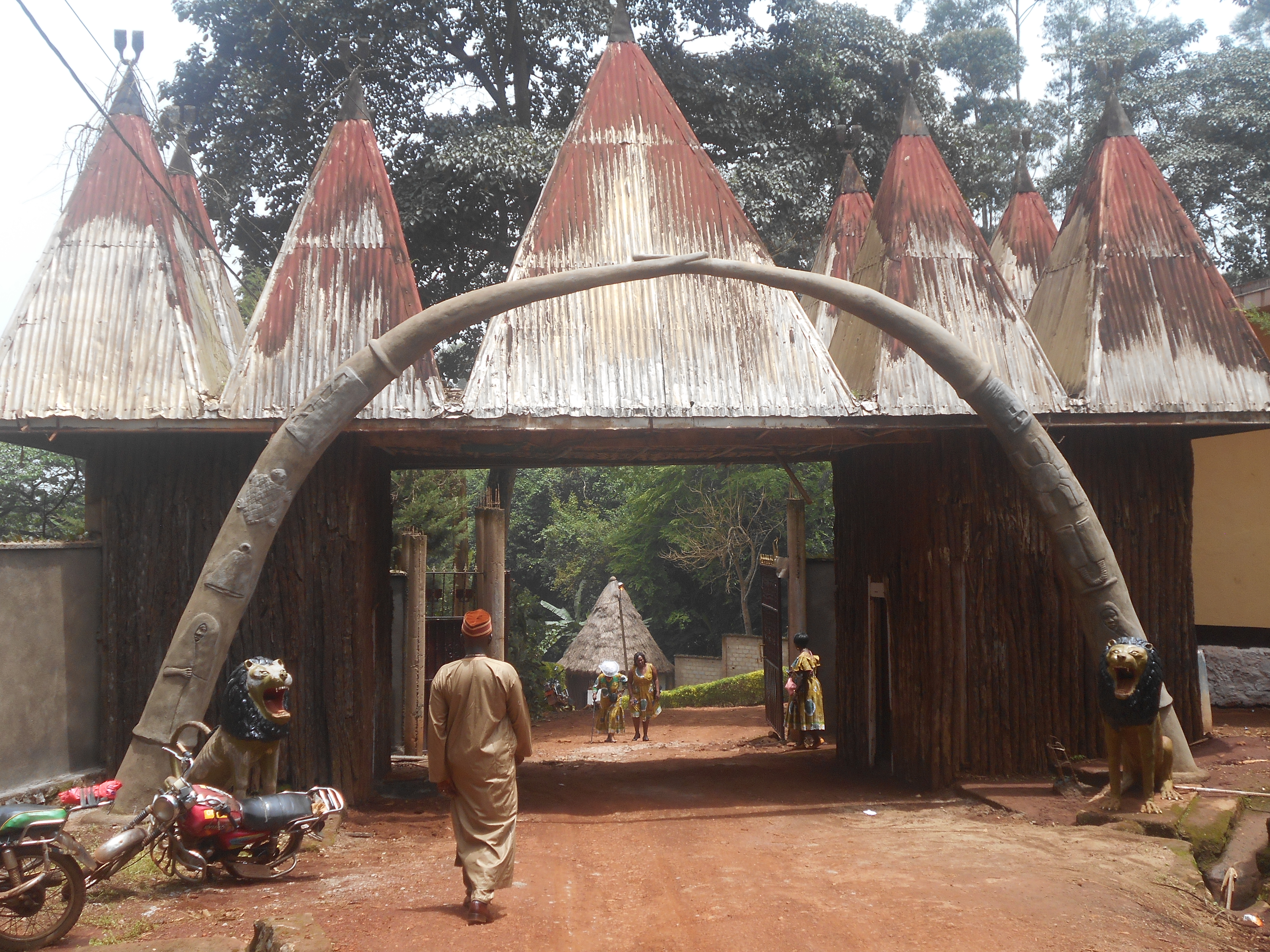
Bandjoun (''La 'Djo'' in local language) is a town and commune in the Koung-Khi Department in the West Region of Cameroon. Bandjoun is also the capital of the Koung-Khi department, and one of the largest traditional ''chefferie'' (chiefdom) in Bamiléké country. The chief dwells in Hialah, and has many wives. Its inhabitants speak '' Ghomala''' or ''Bandjoun'' which is one of the Bamiléké family of languages. Geography Bandjoun is located some 10 km south of Bafoussam and some 230 km north-east of Douala. Access to the municipality is by the N4 road from Bafoussam which passes through the municipality then goes south-east to Bayangam. The N5 road branches from the N4 in the municipality and goes south-west to Batié. The ''Route Bangou'' also branches from the N4 in the municipality and goes south through the town to Bangou. History The recent history of the Bandjoun people is relatively well known today. Recent history, however, covers only the last two ... [...More Info...] [...Related Items...] OR: [Wikipedia] [Google] [Baidu] |
Batibo
Batibo is a name that refers to a town and a subdivision in Cameroon, Africa. It is located along the Trans-African Highway, 27 miles west of Bamenda and about 100 miles east of Nigeria. Batibo is the economic, social, political and cultural heartbeat of the Moghamo speaking people as well as the Greater Widikum people, Widikum tribe. Batibo, formerly referred to as Aghwi, is home to a people including farmers, traders, and craftsmen. Batibo is the capital of Batibo Sub Division or Batibo Council and is located 40 kilometers southwest of Bamenda in the northwest region of Cameroon, along the Bamenda - Mamfe road. It is located between latitudes 575 and 590 north of the equator, longitudes 975 east of the Greenwich meridian, and at the transition between the Tropical and subtropical moist broadleaf forests, equatorial forest in the south and the savannah to the north. Villages Batibo comprises the following villages: *Ambo, Cameroon, Ambo *Angie, Cameroon, Angie *Anong, Camerou ... [...More Info...] [...Related Items...] OR: [Wikipedia] [Google] [Baidu] |
Bamenda
Bamenda, also known as Abakwa and Mankon Town, is a city in northwestern Cameroon and capital of the Northwest Region, Cameroon, Northwest Region. The city has a population of about 2 million people and is located north-west of the Cameroonian capital, Yaoundé. Bamenda is known for its cool climate and scenic hilly location. History Colonial era The origins of the city are related to the settlement of the Tikar people who culturally forged and maintained relations with the Kingdom of Bamum in the 1700s. In 1884, the city was colonized by Germany until 1916 when it became a colony administered by Great Britain and France. In 1919, the administration of Northwest Region (Cameroon), Northwest Region and thus the city of Bamenda became only British. In 1961, the region joined the Cameroon. Ambazonian aspirations Many of the city's inhabitants are English language, English-speaking, and Cameroonian Pidgin English is the main language spoken in the shops and on the streets of Bamend ... [...More Info...] [...Related Items...] OR: [Wikipedia] [Google] [Baidu] |
Bali, Cameroon
Bali is a town and commune in Cameroon, lying west of Bamenda. It has a population of 32,000 (2001 estimate). Formerly the centre of a kingdom, it is known for its palace and its regular festival A festival is an event ordinarily celebrated by a community and centering on some characteristic aspect or aspects of that community and its religion or cultures. It is often marked as a local or national holiday, mela, or eid. A festival c .... References Communes of Northwest Region (Cameroon) {{Cameroon-geo-stub ... [...More Info...] [...Related Items...] OR: [Wikipedia] [Google] [Baidu] |
Bafut, Cameroon
Bafut is a town located in a modern commune in Cameroon, it is also a traditional fondom. It is located in the Mezam Department, which in turn is located in the Northwest Province. Bafut is famous for having preserved its structure as a traditional kingdom (or " Fondom" ), under the leadership of the Fon of Bafut. Its traditional power structures operate in harmony with its modern local government council, which aims to turn Bafut into an eco-city. History The Bafut tradition traces its dynastic origins to the Ndobo or Tikari areas. From the reign of Firloo, the first Fon of Bafut, it has operated as a fondom or kingdom, using traditional power structures. Upon their arrival from Tikari at least 400 years ago, the Bafut people built the current "old palace" of Mbebeli, also known as Ntoh Firloo. It still contains the tombs of the first three Bafut kings Firloo, Nebasi Suh and Ambebi. The Fon's palace, and thus the centre of Bafut's traditional power, was later moved to its ... [...More Info...] [...Related Items...] OR: [Wikipedia] [Google] [Baidu] |
Bafoussam
Bafoussam is the capital and largest city of the West Region of Cameroon, in the Bamboutos Mountains. It is the 3rd most important (financially) city in Cameroon, after Yaoundé and Douala. The ''communauté urbaine'' (Urban Community) of Bafoussam, is a decentralized territorial collectivity. Originally called Urban Commune of Bafoussam, the communauté urbaine (Urban Community) of Bafoussam, was born after the Presidential Decree N ° 2008/022 of January 17, 2008 and composed of three communes, namely: the Commune of Bafoussam I (Bafoussam proper), the Commune of Bafoussam II (Baleng) and the Commune of Bafoussam III (Bamougoum). The city had an urban population of 347,517 inhabitants (at the 2008 Census). Bafoussam is the West Region centre of trade, and people are farming coffee, Potatoes, maize and beans. The city has also a coffee processing facility and brewery. It is the main city of the Bamiléké people and is home to the Bafoussam chief's palace. Bafoussam is a group co ... [...More Info...] [...Related Items...] OR: [Wikipedia] [Google] [Baidu] |
Bafia
Bafia () is a Cameroonian town and commune in the Centre Province region. It is the capital of the Mbam-et-Inoubou department. It lies north of the country's capital Yaoundé. Bafia has approximately 55,700 inhabitants, making it the third largest city in the province after Yaoundé and Mbalmayo. Most citizens belong to either the Bafia people or the Yambassa people. It is the see of the eponymous diocese. Origin of the name The story is told that when the Germans, once the colonial power, were crossing through the Mbam region, they stopped on the high plateau of the region which is today called Bafia to ask a native who was returning from hunting what the name of the area was. Assuming that the guests were asking his name, the hunter answered, "Ufino yame yo lomo Bofia Nkano" ("My name is Bofia Nkano"). This misunderstanding led to the name "Bafia" being given to the area. Administration Mayors of the urban district of Bafia (1962–present) * Kotouo Pierre 29 June 1 ... [...More Info...] [...Related Items...] OR: [Wikipedia] [Google] [Baidu] |
Bafang
Bafang is a town and commune in Cameroon situated in the Haut-Nkam division of the West Province. It lies at the heart of the territory of the Bamiléké people, and has a population of roughly 33,324. (2012) Religion Its cathedral, Cathédrale du Cœur-Immaculé de Marie, is the See of the Roman Catholic Diocese of Bafang, a suffragan of the Metropolitan Archdiocese of Douala, like the Roman Catholic Diocese of Nkongsamba, which it was split off from in 2011. Notable people * Tony Tchani, professional football player * Michael Ngadeu-Ngadjui, professional football player of Slavia Prague and Cameroon National Team See also *Communes of Cameroon The Arrondissements of Cameroon are the third-level units of administration in Cameroon. The arrondissements are organised by divisions and sub divisions of each province (now Regions). As of 2005 (and since 1996) there are 2 urban commu ... References External links GigaCatholic* Communes of Cameroo ... [...More Info...] [...Related Items...] OR: [Wikipedia] [Google] [Baidu] |
Ambam
Ambam is a town and commune in South Province of Cameroon on the border with Equatorial Guinea and Gabon. This frontier town is located approximately 220 km from Yaoundé and as of 2005 had a population of 1,596. Traditionally, it has traded with its neighbouring countries across the border. The Fang are the main ethnic group. History This town was once occupied by the Germans under the nation of Kamerun. The Germans built several administrative buildings in Ambam as it was of strategic importance. On 14 December 2000, the building proposal of a new road connecting Ambam to Eking on the Gabonese border was passed and signed on 2 February 2001. The building of the 27 kilometre road was funded by African Development Foundation (ADF) and the Government of Cameroon and was intended to improve socio-economic infrastructure and to improve the institutional capacities of the Ministries of Public Works (MINTP), Forestry and Wildlife (MINFOF), and Environment and Protection of Na ... [...More Info...] [...Related Items...] OR: [Wikipedia] [Google] [Baidu] |


