|
List Of Cities In Morocco
The basic unit of local government in Morocco is the commune. At the time of the 2014 population census, Morocco was divided into 1538 communes, 256 of which were classified as urban and also called municipalities. The remaining 1282 communes were classified as rural. Urban centres were defined by the High Commission for Planning for some rural communes. The following list includes all Moroccan municipalities with 50,000 or more inhabitants according to the 2014 census, as well as one urban centre of a rural commune whose population also exceeds 50,000 inhabitants. In its 2014 census report, the High Commission for Planning also published a list of the legal populations of seven major Moroccan cities, some of which comprise more than one administrative unit. Those legal population figures are incorporated into the list, and the city definitions they are based upon are provided in the notes. List of cities with 50,000 or more inhabitants See also *List of cities in Western S ... [...More Info...] [...Related Items...] OR: [Wikipedia] [Google] [Baidu] |
Map Of Morocco From CIA World Factbook
A map is a symbolic depiction emphasizing relationships between elements of some space, such as objects, regions, or themes. Many maps are static, fixed to paper or some other durable medium, while others are dynamic or interactive. Although most commonly used to depict geography, maps may represent any space, real or fictional, without regard to context or scale, such as in brain mapping, DNA mapping, or computer network topology mapping. The space being mapped may be two dimensional, such as the surface of the earth, three dimensional, such as the interior of the earth, or even more abstract spaces of any dimension, such as arise in modeling phenomena having many independent variables. Although the earliest maps known are of the heavens, geographic maps of territory have a very long tradition and exist from ancient times. The word "map" comes from the , wherein ''mappa'' meant 'napkin' or 'cloth' and ''mundi'' 'the world'. Thus, "map" became a shortened term referring to ... [...More Info...] [...Related Items...] OR: [Wikipedia] [Google] [Baidu] |
Casablanca-Settat
Casablanca-Settat ( ar, الدار البيضاء - سطات, ad-dār al-bayḍāʾ - siṭṭāt; ber, ⴰⵏⴼⴰ - ⵙⵟⵟⴰⵜ, anfa - sṭṭat) is one of the twelve administrative regions of Morocco. It covers an area of 20,166 km² and recorded a population of 6,861,739 in the 2014 Moroccan census, 69% of which lived in urban areas. The capital of the region is Casablanca. Geography Casablanca-Settat is located on the Atlantic coast. It borders the regions of Rabat-Salé-Kénitra to the northeast, Béni Mellal-Khénifra to the southeast, and Marrakesh-Safi to the south. Part of the border with Marrakesh-Safi follows the course of the Oum Er-Rbia River, which flows northwest and empties into the Atlantic at Azemmour. The river divides the region into two plains, the Doukkala in the west and the Chaouia in the east. Several reservoirs provide water for the region, including that of the Al Massira Dam on the Oum Er-Rbia and one on the Oued Mellah south of Mohammed ... [...More Info...] [...Related Items...] OR: [Wikipedia] [Google] [Baidu] |
Tanger-Tetouan-Al Hoceima
Tanger-Tetouan-Al Hoceima ( ar, طنجة - تطوان - الحسيمة, ṭanja - tiṭwān - al-ḥusayma; ber, ⵟⴰⵏⵊⴰ ⵜⵉⵟⵡⴰⵏ ⵍⵃⵓⵙⵉⵎⴰ, ṭanja tiṭwan lḥusima) is the northernmost of the twelve regions of Morocco. It covers an area of 15,090 km² and recorded a population of 3,556,729 in the 2014 Moroccan census. The capital of the region is Tangier. Geography Tanger- Tétouan-Al Hoceima is the northernmost of Morocco's twelve regions. In the north it faces the Strait of Gibraltar and the Mediterranean Sea and borders the Spanish exclave of Ceuta. It also borders the Moroccan regions of Rabat-Salé-Kénitra to the southwest, Fès-Meknès to the southeast and Oriental to the east. The Rif rises in the eastern part of the region and is the location of Al Hoceima National Park and Talassemtane National Park. The land near the Atlantic coast in the west is less rugged, and the fertile southwestern corner of the region is drained by t ... [...More Info...] [...Related Items...] OR: [Wikipedia] [Google] [Baidu] |
Bni Makada
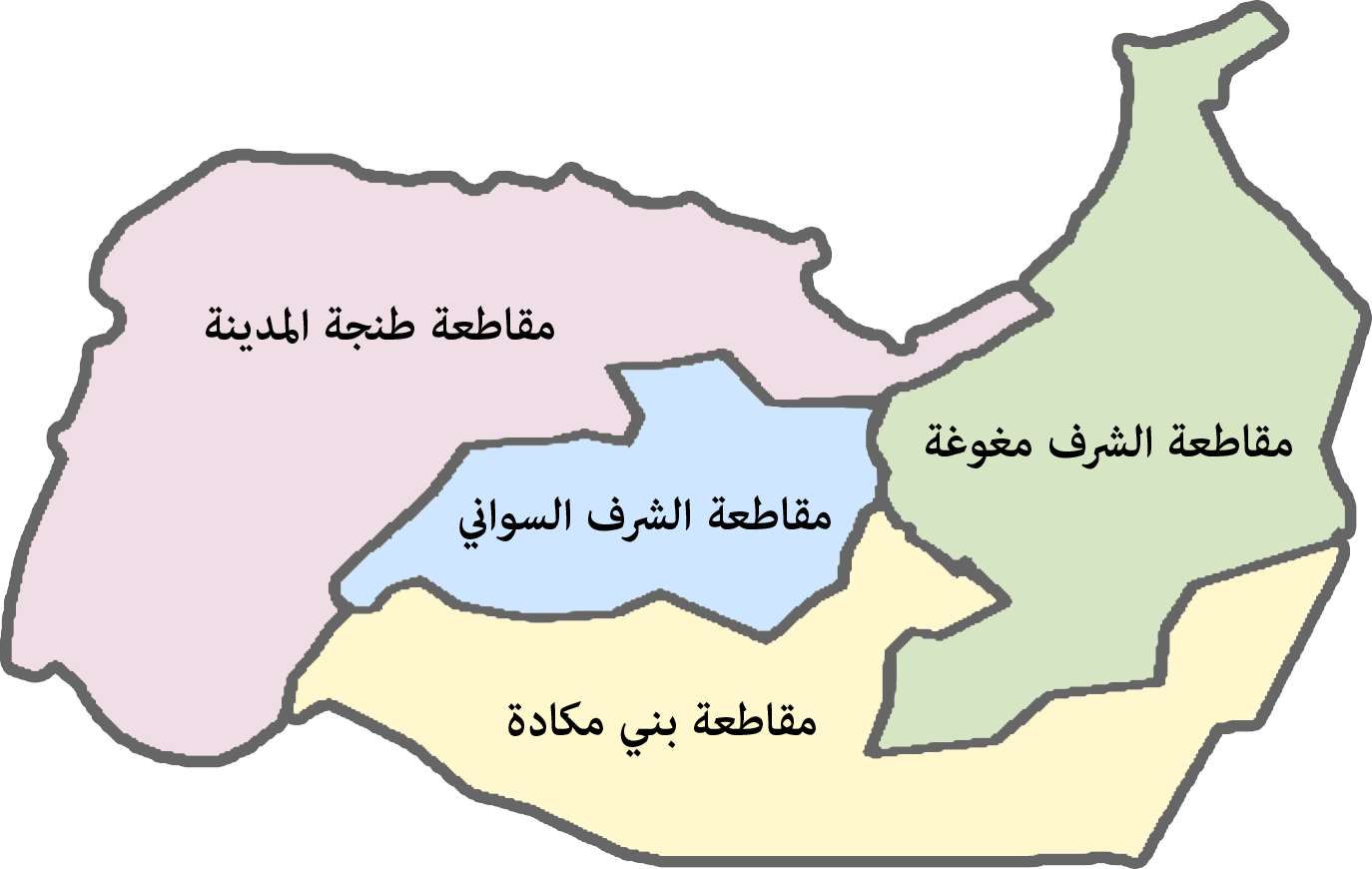
Bni Makada is one of the four ''arrondissements'' or districts of the city of Ṭanja, Morocco. Administratively it is part of the prefecture of Ṭanja-Aẓila in the region of Ṭanja-Tiṭwan-Elḥusima. The 2014 Moroccan census recorded a population of 386,191 people living in 91,737 households. Name Bni Makada is named after a tribe of the Houara Hawwara ( Berber: ''Ihuwwaren'', ), also spelled Huwwara, Howwara, Hewwara or Houara, is a large tribal confederation of Berbers and Arabized Berbers spread widely in the Maghreb, with descendants in Upper Egypt and Sudan. Hawwara are amongst th ..., who settled in the area in the late 17th century during the reign of Sultan Moulay Ismail ibn Sharif. References Tangier {{TangerTetouanAlHoceima-geo-stub ... [...More Info...] [...Related Items...] OR: [Wikipedia] [Google] [Baidu] |
List Of Municipalities, Communes, And Arrondissements Of Morocco
This is a list of municipalities (urban or rural communes), and arrondissements of Morocco, based on the 2004 census. In 2009 a new administrative division of Morocco was adopted, creating 13 new provinces: Berrechid, Driouch, Fquih Ben Salah, Guercif, Midelt, Ouezzane, Rehamna, Sidi Bennour, Sidi Ifni, Sidi Slimane, Tarfaya, Tinghir and Youssoufia. Many municipalities and communes below are now part of these new provinces. The list below is not yet updated for this change.See: Décret numéro 2-09-319 of 17 joumada II 1430 (11 June 2009) modifiant et complétant le dahir numéro 1-59-351 of 1 joumada 1379 (2 December 1959) relatif à la division administrative du Royaume. Published in: "Bulletin officiel du Royaume du Maroc", numéro 5744, 18 June 2009, page 1017-1018, see: Sources Recensement General de la Population et de l'Habitat de 2004 Royaume du Maroc Haut Commissariot au Plan (2004). Accessed April 22, 2012. {{Articles on third-level administrative divisions of count ... [...More Info...] [...Related Items...] OR: [Wikipedia] [Google] [Baidu] |

