|
Lisoneill
Lisoneill () is a townland of 145 acres in County Fermanagh, Northern Ireland. It is situated in the civil parish of Aghalurcher and the historic barony of Magherastephana. It contains the main part of the small town of Lisnaskea, with the remainder in the townland of Castle Balfour Demesne Castle Balfour Demesne is a townland of 201 acres in County Fermanagh, Northern Ireland. It is situated in the civil parish of Aghalurcher and the historic barony of Magherastephana. It contains part of the small town of Lisnaskea, with the remai .... References Townlands of County Fermanagh Civil parish of Aghalurcher {{Fermanagh-geo-stub ... [...More Info...] [...Related Items...] OR: [Wikipedia] [Google] [Baidu] |
Lisnaskea
Lisnaskea () is the second-biggest settlement in County Fermanagh, Northern Ireland. It is situated mainly in the townland of Lisoneill, with some areas in the townland of Castle Balfour Demesne, both in the civil parish of Aghalurcher and the historic barony of Magherastephana. It had a population of 2,956 people at the 2011 Census. The nearby monument of ''Sciath Ghabhra'' is where the Maguires were crowned as kings and chiefs of Fermanagh. The town developed after the Plantation of Ulster and is built around the long main street. At the middle, the old market place, formerly known as The Diamond, contains a high cross (grid ref:H364340) from an early monastery. 19th century buildings include the former market house, corn market and butter market. The Castle Park Leisure Centre is situated just off the main street. History The name Lisnaskea comes from ''Lios na Scéithe'' meaning "fort of the shield". North of the village, in the townland of Cornashee, is a large burial mo ... [...More Info...] [...Related Items...] OR: [Wikipedia] [Google] [Baidu] |
Aghalurcher
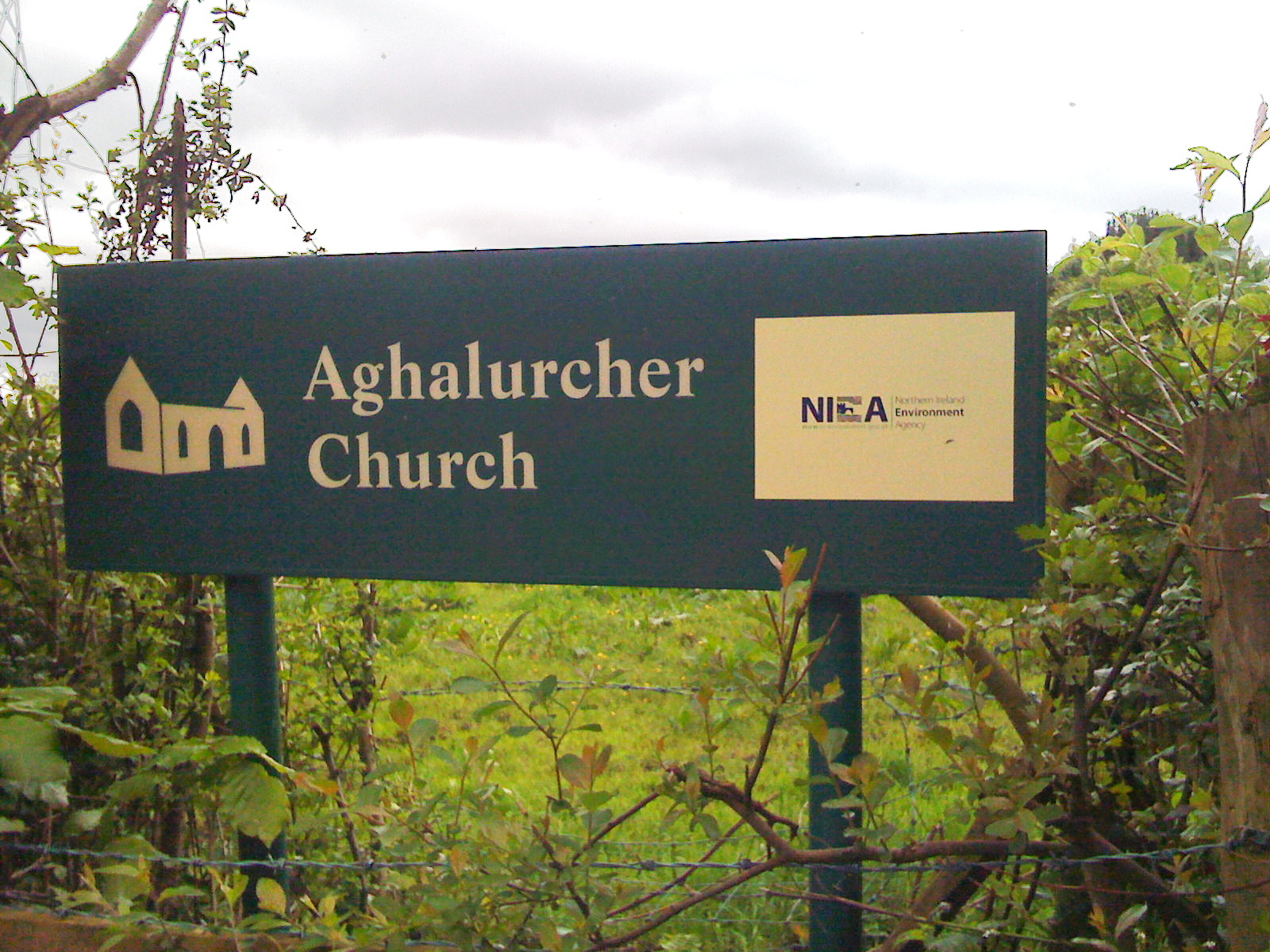
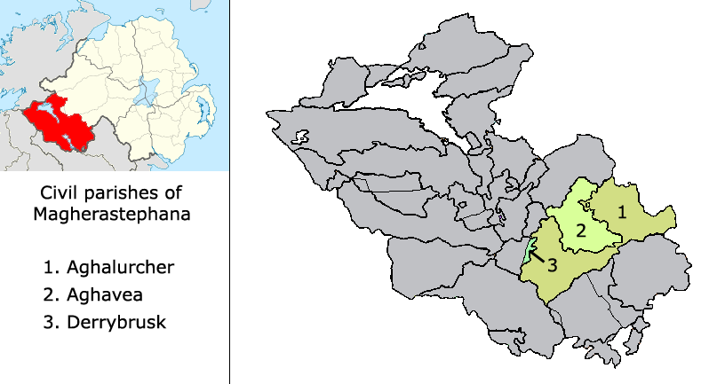
Aghalurcher is a civil parish located mainly in the barony of Magherastephana in County Fermanagh and partly in the barony of Clogher in County Tyrone, Northern Ireland. Townlands of Aghalurcher in County Fermanagh The parish comprises the following 239 townlands in County Fermanagh: *Acres *Aghacramphill *Aghalurcher Glebe *Aghamore North * Aghamore South * Aghavoory * Agheeghter * Aghinure * Aghnaskew * Altagoaghan * Altawark * Altmartin * Altnaponer * Atnamollyboy * Attybaron * Attyclannabryan * Ballymacaffry * Ballymakenny * Barnhill * Bohattan * Boleyhill * Brobrohan * Bunnahesco * Bunnahola Island * Carrickawick * Carrickmacosker * Carricknabrattoge * Carrickpolin * Carrowgarragh * Carrowhony * Castle Balfour Demesne * Cavanagarvan * Cavanaleck * Claraghy *Clay * Cleen * Cleenriss * Clonmacfelimy * Coalhill * Colebrook Demesne * Comaghy * Congo * Coolaran * Coolbeg * Coolcrannel * Coollane * Cooltrane * Cooneen * Corfannan * Corlacky *Corlough * Cornakessagh * Cornaroos ... [...More Info...] [...Related Items...] OR: [Wikipedia] [Google] [Baidu] |
Castle Balfour Demesne
Castle Balfour Demesne is a townland of 201 acres in County Fermanagh, Northern Ireland. It is situated in the civil parish of Aghalurcher and the historic barony of Magherastephana. It contains part of the small town of Lisnaskea, with the remainder in the townland of Lisoneill. The townland contains the 17th-century remains of Castle Balfour, just off the main street in Lisnaskea, built around 1618 by James, Lord Balfour of Glenawley. The castle was altered in 1652 and damaged in 1689, but remained inhabited into the 19th century. It was restored and conserved in the 1960s and 1990s. There was also evidence of a very much earlier ringfort (with radiocarbon dates of 359-428 AD) in the townland suggesting the area was inhabited from a very early date. The listed Church of Ireland Holy Trinity Church is also situated in the townland. See also *List of townlands in County Fermanagh In Ireland, counties are divided into civil parishes, and parishes are further divided into ... [...More Info...] [...Related Items...] OR: [Wikipedia] [Google] [Baidu] |
County Fermanagh
County Fermanagh ( ; ) is one of the thirty-two counties of Ireland, one of the nine counties of Ulster and one of the six counties of Northern Ireland. The county covers an area of 1,691 km2 (653 sq mi) and has a population of 61,805 as of 2011. Enniskillen is the county town and largest in both size and population. Fermanagh is one of four counties of Northern Ireland to have a majority of its population from a Catholic background, according to the 2011 census. Geography Fermanagh is situated in the southwest corner of Northern Ireland. It spans an area of 1,851 km2 (715 sq; mi), accounting for 13.2% of the landmass of Northern Ireland. Nearly a third of the county is covered by lakes and waterways, including Upper and Lower Lough Erne and the River Erne. Forests cover 14% of the landmass (42,000 hectares). It is the only county in Northern Ireland that does not border Lough Neagh. The county has three prominent upland areas: * the expansive We ... [...More Info...] [...Related Items...] OR: [Wikipedia] [Google] [Baidu] |
Townland
A townland ( ga, baile fearainn; Ulster-Scots: ''toonlann'') is a small geographical division of land, historically and currently used in Ireland and in the Western Isles in Scotland, typically covering . The townland system is of Gaelic origin, pre-dating the Norman invasion, and most have names of Irish origin. However, some townland names and boundaries come from Norman manors, plantation divisions, or later creations of the Ordnance Survey.Connolly, S. J., ''The Oxford Companion to Irish History, page 577. Oxford University Press, 2002. ''Maxwell, Ian, ''How to Trace Your Irish Ancestors'', page 16. howtobooks, 2009. The total number of inhabited townlands in Ireland was 60,679 in 1911. The total number recognised by the Irish Place Names database as of 2014 was 61,098, including uninhabited townlands, mainly small islands. Background In Ireland a townland is generally the smallest administrative division of land, though a few large townlands are further divided into h ... [...More Info...] [...Related Items...] OR: [Wikipedia] [Google] [Baidu] |
Northern Ireland
Northern Ireland ( ga, Tuaisceart Éireann ; sco, label= Ulster-Scots, Norlin Airlann) is a part of the United Kingdom, situated in the north-east of the island of Ireland, that is variously described as a country, province or region. Northern Ireland shares an open border to the south and west with the Republic of Ireland. In 2021, its population was 1,903,100, making up about 27% of Ireland's population and about 3% of the UK's population. The Northern Ireland Assembly (colloquially referred to as Stormont after its location), established by the Northern Ireland Act 1998, holds responsibility for a range of devolved policy matters, while other areas are reserved for the UK Government. Northern Ireland cooperates with the Republic of Ireland in several areas. Northern Ireland was created in May 1921, when Ireland was partitioned by the Government of Ireland Act 1920, creating a devolved government for the six northeastern counties. As was intended, Northern Ireland ... [...More Info...] [...Related Items...] OR: [Wikipedia] [Google] [Baidu] |
Civil Parishes In Ireland
Civil parishes () are units of territory in the island of Ireland that have their origins in old Gaelic territorial divisions. They were adopted by the Anglo-Norman Lordship of Ireland and then by the Elizabethan Kingdom of Ireland, and were formalised as land divisions at the time of the Plantations of Ireland. They no longer correspond to the boundaries of Roman Catholic or Church of Ireland parishes, which are generally larger. Their use as administrative units was gradually replaced by Poor_law_union#Ireland, Poor Law Divisions in the 19th century, although they were not formally abolished. Today they are still sometimes used for legal purposes, such as to locate property in deeds of property registered between 1833 and 1946. Origins The Irish parish was based on the Gaelic territorial unit called a ''túath'' or ''Trícha cét''. Following the Norman invasion of Ireland, the Anglo-Normans, Anglo-Norman barons retained the ''tuath'', later renamed a parish or manor, as a un ... [...More Info...] [...Related Items...] OR: [Wikipedia] [Google] [Baidu] |
Barony (geographic)
A barony is an administrative division of a county in Scotland, Ireland, outlying parts of England and historically France. It has a lower rank and importance than a county. Origin A geographic barony is a remnant from mediaeval times of the area of land held under the form of feudal land tenure termed feudal barony, or barony by tenure, either an English feudal barony, a Scottish feudal barony or an Irish feudal barony, which all operated under different legal and social systems. Just as modern counties are no longer under the administrative control of a noble count or earl, geographic baronies are generally no longer connected with feudal barons, certainly not in England where such tenure was abolished with the whole feudal system by the Tenures Abolition Act 1660. The position in Scotland is more complex, although the legal force of the Scottish feudal baron was abolished early in the 21st century.P. G. B. McNeill and H. L. MacQueen, eds, ''Atlas of Scottish History to 1707 ... [...More Info...] [...Related Items...] OR: [Wikipedia] [Google] [Baidu] |
Magherastephana
Magherastephana is a barony in County Fermanagh, Northern Ireland. To its south-west lies Upper Lough Erne, and it is bordered by five other baronies: Tirkennedy to the west; Knockninny to the south-west; and Coole to the south; Clankelly to the south-east; and Clogher to the north-west. History The barony of Magherastephana is first recorded in 1520 in the Annals of the Four Masters, as ''Machaire Stefanach'', and in Annals of Ulster in 1530 as ''(an) Machaire Steabhanach''. The origins of the name however are unknown. Irish scholar John O'Donovan alleged that it was named after a ''Steafán'' (Stephen) who was the son of ''Odhar'', the progenitor of the Maguires, and a figure from the 10th century. The problem however is that the name Stephen didn't arrive into Ireland until the 12th century when the Normans brought it in with them, and in which case came in the form of ''Estievne'', which became Gaelicised as ''Stiabhna'', ''Sdíomnha'', ''Stiana'', ''Steimhín'' and ''Slei ... [...More Info...] [...Related Items...] OR: [Wikipedia] [Google] [Baidu] |
Townlands Of County Fermanagh
A townland ( ga, baile fearainn; Ulster-Scots: ''toonlann'') is a small geographical division of land, historically and currently used in Ireland and in the Western Isles in Scotland, typically covering . The townland system is of Gaelic origin, pre-dating the Norman invasion, and most have names of Irish origin. However, some townland names and boundaries come from Norman manors, plantation divisions, or later creations of the Ordnance Survey.Connolly, S. J., ''The Oxford Companion to Irish History, page 577. Oxford University Press, 2002. ''Maxwell, Ian, ''How to Trace Your Irish Ancestors'', page 16. howtobooks, 2009. The total number of inhabited townlands in Ireland was 60,679 in 1911. The total number recognised by the Irish Place Names database as of 2014 was 61,098, including uninhabited townlands, mainly small islands. Background In Ireland a townland is generally the smallest administrative division of land, though a few large townlands are further divided into h ... [...More Info...] [...Related Items...] OR: [Wikipedia] [Google] [Baidu] |


