|
Linkinhorne
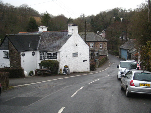
Linkinhorne (in Cornish ''Lanngynhorn'') is a civil parish and village in southeast Cornwall, England, United Kingdom. The village itself is situated at and is approximately four miles (6.5 km) northwest of Callington and seven miles (11 km) south of Launceston.Ordnance Survey: Landranger map sheet 201 ''Plymouth & Launceston'' The parish population at the 2011 census including Downgate was 1,541 Geography As well as Linkinhorne village, other settlements in the parish include (in alphabetical order) Bray Shop, Caradon Town, Downgate, Henwood, Ley Mill, Minions, Plushabridge, Rilla Mill and Upton Cross. The area is bordered by the River Inny in the north-east and Bodmin Moor to the west. The valley of the River Lynher runs through the parish. History Linkinhorne parish is within the Deanery and Hundred of East and is bounded on the north by North Hill and Lezant, on the east by Stoke Climsland and South Hill, on the south and west by St Ive and St Cleer. ... [...More Info...] [...Related Items...] OR: [Wikipedia] [Google] [Baidu] |
Bray Shop
Bray Shop ( kw, Shoppa Bre) is a village in east Cornwall, England, United Kingdom, in the civil parish of Linkinhorne, Stoke Climsland and South Hill. It is located on the B3257 approximately three miles north-northwest of Callington.Ordnance Survey: Landranger map sheet 201 ''Plymouth & Launceston'' It is in the civil parish In England, a civil parish is a type of administrative parish used for local government. It is a territorial designation which is the lowest tier of local government below districts and counties, or their combined form, the unitary authority ... of Linkinhorne, Stoke Climsland and South Hill. References External links Villages in Cornwall {{NorthCornwall-geo-stub ... [...More Info...] [...Related Items...] OR: [Wikipedia] [Google] [Baidu] |
Upton Cross, Cornwall
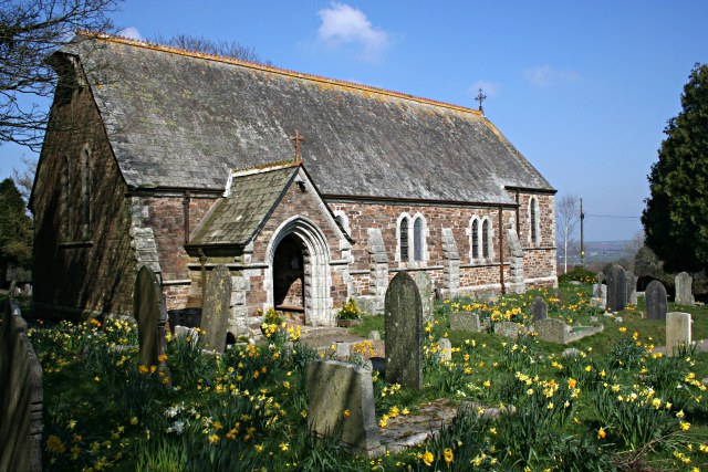
Upton Cross and Upton are hamlets a quarter of a mile apart in east Cornwall, England, United Kingdom. Upton is situated at north of Upton Cross 5 miles (8 kilometres) northwest of Callington. They are on the northeast side of Caradon Hill on the B3254 Liskeard to Launceston road. St Paul's Church at Upton Cross is a mission church built in this corner of the parish of Linkinhorne in 1887 to serve the needs of the local mining community. A little further north are the hamlets of Darleyford and North Darley below Notter Tor and a remarkable tree, the Darley Oak. At Netherton Farm Yarg Cornish Yarg is a semi-hard cow's milk cheese made in Cornwall, United Kingdom. Before being left to mature, the cheese is wrapped in nettle leaves to form an edible, though mouldy, rind. The texture varies from creamy and soft immediately unde ... cheese was produced from 1984 to 2006 by Lynher Dairies. Cornish Blue, a cheese made by the Cornish Cheese Company at Upton Cross, was the winni ... [...More Info...] [...Related Items...] OR: [Wikipedia] [Google] [Baidu] |
Plushabridge
Plushabridge is a hamlet in the parish of Linkinhorne in east Cornwall Cornwall (; kw, Kernow ) is a historic county and ceremonial county in South West England. It is recognised as one of the Celtic nations, and is the homeland of the Cornish people. Cornwall is bordered to the north and west by the Atlantic ..., England.Ordnance Survey ''One-inch Map of Great Britain; Bodmin and Launceston, sheet 186''. 1961 References Hamlets in Cornwall {{Cornwall-geo-stub ... [...More Info...] [...Related Items...] OR: [Wikipedia] [Google] [Baidu] |
Minions, Cornwall
Minions ( kw, Menyon) is a village in Cornwall, England, United Kingdom. It is situated on the eastern flank of Bodmin Moor northwest of Caradon Hill approximately four miles (6 km) north of Liskeard.Ordnance Survey: Landranger map sheet 201 ''Plymouth & Launceston'' Minions is first recorded in 1613 and its meaning is unknown. A stone circle known as the Hurlers is located on the west side of the village. Several other tumuli are also in the area, including Rillaton round barrow, where a Bronze Age gold beaker was discovered. The Cheesewring, a distinctive rock formation, is a mile northwest. The village has embraced the coincidence that its name is now shared with the characters from the ''Despicable Me'' franchise. Geography Minions is in the former Caradon administrative district and in the parish of Linkinhorne. At it is said to be the highest village in Cornwall. The village is dominated by Caradon Hill, standing at high, on which there is a TV transmission ma ... [...More Info...] [...Related Items...] OR: [Wikipedia] [Google] [Baidu] |
Downgate, Cornwall
Downgate is a hamlet in east Cornwall, England. It is between Pensilva and Upton Cross.Ordnance Survey ''One-inch Map of Great Britain; Bodmin and Launceston, sheet 186''. 1961 According to the Post Office the 2011 census population was included in the civil parish of Linkinhorne Linkinhorne (in Cornish ''Lanngynhorn'') is a civil parish and village in southeast Cornwall, England, United Kingdom. The village itself is situated at and is approximately four miles (6.5 km) northwest of Callington and seven miles (1 .... References Hamlets in Cornwall {{Cornwall-geo-stub ... [...More Info...] [...Related Items...] OR: [Wikipedia] [Google] [Baidu] |
Bodmin Moor
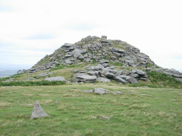
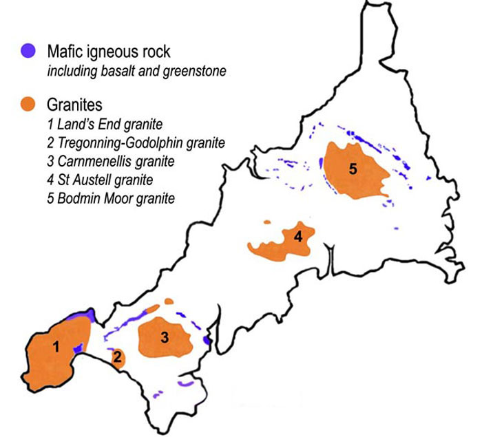
Bodmin Moor ( kw, Goon Brenn) is a granite moorland in north-eastern Cornwall, England. It is in size, and dates from the Carboniferous period of geological history. It includes Brown Willy, the highest point in Cornwall, and Rough Tor, a slightly lower peak. Many of Cornwall's rivers have their sources here. It has been inhabited since at least the Neolithic era, when primitive farmers started clearing trees and farming the land. They left their megalithic monuments, hut circles and cairns, and the Bronze Age culture that followed left further cairns, and more stone circles and stone rows. By medieval and modern times, nearly all the forest was gone and livestock rearing predominated. The name Bodmin Moor is relatively recent. An early mention is in the ''Royal Cornwall Gazette'' of 28 November 1812. The upland area was formerly known as Fowey Moor after the River Fowey, which rises within it. Geology Bodmin Moor is one of five granite plutons in Cornwall that make up pa ... [...More Info...] [...Related Items...] OR: [Wikipedia] [Google] [Baidu] |
Rilla Mill
Rilla Mill ( kw, Melin Reslegh) is a village in Cornwall, England. It is about one and half miles west of Linkinhorne Linkinhorne (in Cornish ''Lanngynhorn'') is a civil parish and village in southeast Cornwall, England, United Kingdom. The village itself is situated at and is approximately four miles (6.5 km) northwest of Callington and seven miles (1 ....Ordnance Survey ''One-inch Map of Great Britain; Bodmin and Launceston, sheet 186''. 1961. References Villages in Cornwall {{Cornwall-geo-stub ... [...More Info...] [...Related Items...] OR: [Wikipedia] [Google] [Baidu] |
North Hill, Cornwall
North Hill ( kw, Bre Gledh) is a village and civil parish in Cornwall, England, United Kingdom. The village is situated on the east side of the River Lynher approximately six miles (10 km) southwest of Launceston. North Hill is a large rural parish on the eastern flank of Bodmin Moor bisected northwest to southeast by the River Lynher. It is bounded in the north by Lewannick parish, on the east by Lezant and Linkinhorne parishes, on the south by St Cleer and on the west by Altarnun. GENUKI website; North Hill; retrieved April 2010 Settlements include the Churchtown, Cornwall, church town of North Hill and |
Henwood, Cornwall
Henwood is a hamlet in the civil parish of Linkinhorne in east Cornwall Cornwall (; kw, Kernow ) is a historic county and ceremonial county in South West England. It is recognised as one of the Celtic nations, and is the homeland of the Cornish people. Cornwall is bordered to the north and west by the Atlantic ..., England. Henwood is on the edge of Bodmin Moor and situated between Stowe Hill (southwest) and Notter Tor (northeast).Ordnance Survey ''One-inch Map of England & Wales; Bodmin and Launceston, sheet 186''. 1946 References Hamlets in Cornwall {{Cornwall-geo-stub ... [...More Info...] [...Related Items...] OR: [Wikipedia] [Google] [Baidu] |
Caradon Hill
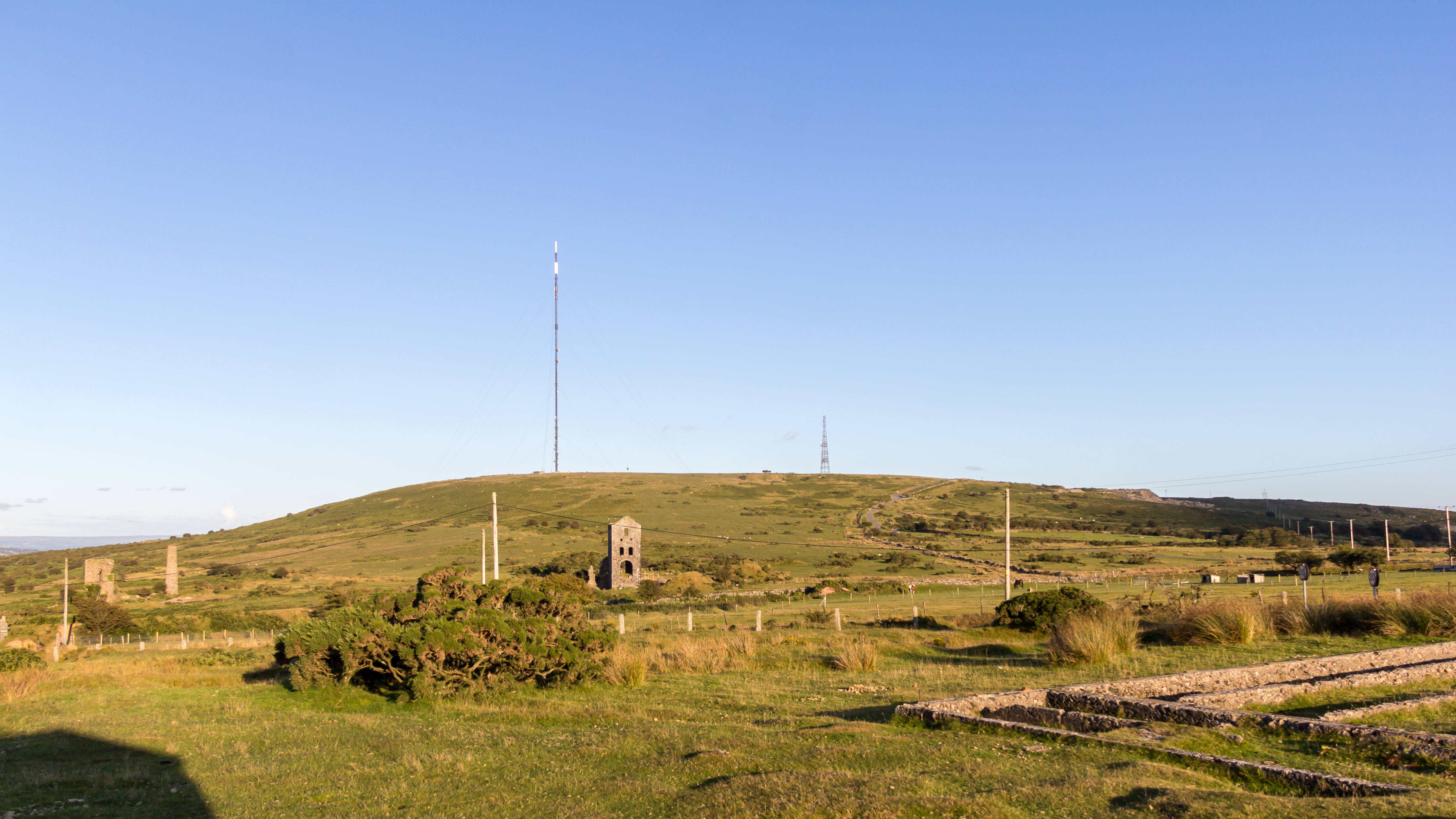
Caradon Hill ( kw, Bre Garn) is on Bodmin Moor in the former Caradon district of Cornwall, England, United Kingdom. The summit is above mean sea level. Caradon Hill is on the southeastern edge of the moor; it is between the villages of Minions (northwest), Upton Cross (northeast), Pensilva (southeast) and Darite (southwest). The hill was once famous for its copper mines but these are now closed. The South Caradon Copper Mine, 1 km to the SW of the transmitter, was the biggest copper mine in the UK in its heyday in the second half of the 19th century. Other disused copper and tin mines are scattered around the base of the hill, including the Wheal Phoenix, well known among mineral collectors. The ruins of the Prince of Wales engine house are prominent at Wheal Phoenix. at < ... [...More Info...] [...Related Items...] OR: [Wikipedia] [Google] [Baidu] |
Saint Melor
Melor (also known in Latin as Melorius; in Cornish language, Cornish as Mylor; in French language, French as Méloir; and other variations) was a 10th-century Breton people, Breton saint who, in England, was venerated in Cornwall and at Amesbury Abbey, Wiltshire, which claimed some of his relics. Identity Melor had a popular cult (religious practice), cult in Brittany, but his story has been obfuscated by a number of biographers who confused names, dates and places to the point where reality has been almost completely obscured. There actually appear to have been at least three, if not four, saints of this or similar name: *Prince Melor of Cornouaille *Saint Mylor of Cornwall *Saint Meglar of Cornwall *Bishop Melor of Redon, Ille-et-Vilaine, Redon The first and second individuals are generally believed to be the same, and the Melor commonly identified as the Amesbury saint. Breton legend Melor's legend makes him a prince who was only seven when his uncle, Rivod, murdered his fat ... [...More Info...] [...Related Items...] OR: [Wikipedia] [Google] [Baidu] |
East (Cornish Hundred)
East Wivelshire and West Wivelshire (usually known merely as East and West) are two of the ancient Hundreds of Cornwall. East and West (Wivelshire) must have originally had a Cornish name but it is not recorded. The name of nearby Lostwithiel has the second element ''gwydhyow'' meaning 'trees'; ''wivel'' may also be from the Anglo-Saxon personal name Wifel. There are also Anglican deaneries by the same names, but the modern boundaries do not correspond exactly. The area must have formed one hundred originally but had already been divided into two before the Norman Conquest: they are grouped in Domesday under the head manors of Rillaton (East) and Fawton (West). The Cornish names are Ryslegh (East) and Fawy (West). :kw:Fawy However the suggestion that 'the area must have formed one hundred originally' is disputed by the noted Cornish historian, the Rev. W. M. M. Picken, who believes the names to be derived from the Saxon twi-feald-scir, meaning 'two-fold shire.' The 'invariable pref ... [...More Info...] [...Related Items...] OR: [Wikipedia] [Google] [Baidu] |
