|
Linden Woods, Winnipeg
Linden Woods is a neighbourhood in the Fort Garry area of southwest Winnipeg, Manitoba, Canada. The first phase of the neighbourhood was designed by IDE (Interdisciplinary Engineering Company) in 1980 and the construction of houses began in 1982. The centrepiece of the neighbourhood is a lake that adjoins Van Walleghem and Muys Parks. Around 2,400 homes, set up in a curvilinear-style typical of new suburbs revolve around the lake. Wilkes Avenue and the Sterling Lyon Parkway form the northern border, McGillivray Boulevard forms the southern border, Waverley Street forms the eastern border and Kenaston Boulevard forms the western border. Demographics In 2011, the population of Linden Woods was 10,210. [...More Info...] [...Related Items...] OR: [Wikipedia] [Google] [Baidu] |
Provinces Of Canada
A province is almost always an administrative division within a country or sovereign state, state. The term derives from the ancient Roman ''Roman province, provincia'', which was the major territorial and administrative unit of the Roman Empire, Roman Empire's territorial possessions outside Roman Italy, Italy. The term ''province'' has since been adopted by many countries. In some countries with no actual provinces, "the provinces" is a metaphorical term meaning "outside the capital city". While some provinces were produced artificially by Colonialism, colonial powers, others were formed around local groups with their own ethnic identities. Many have their own powers independent of central or Federation, federal authority, especially Provinces of Canada, in Canada and Pakistan. In other countries, like Provinces of China, China or Administrative divisions of France, France, provinces are the creation of central government, with very little autonomy. Etymology The English langu ... [...More Info...] [...Related Items...] OR: [Wikipedia] [Google] [Baidu] |
Suburb
A suburb (more broadly suburban area) is an area within a metropolitan area, which may include commercial and mixed-use, that is primarily a residential area. A suburb can exist either as part of a larger city/urban area or as a separate political entity. The name describes an area which is not as densely populated as an inner city, yet more densely populated than a rural area in the countryside. In many metropolitan areas, suburbs exist as separate residential communities within commuting distance of a city (cf "bedroom suburb".) Suburbs can have their own political or legal jurisdiction, especially in the United States, but this is not always the case, especially in the United Kingdom, where most suburbs are located within the administrative boundaries of cities. In most English-speaking countries, suburban areas are defined in contrast to central or inner city areas, but in Australian English and South African English, ''suburb'' has become largely synonymous with what ... [...More Info...] [...Related Items...] OR: [Wikipedia] [Google] [Baidu] |
K–12
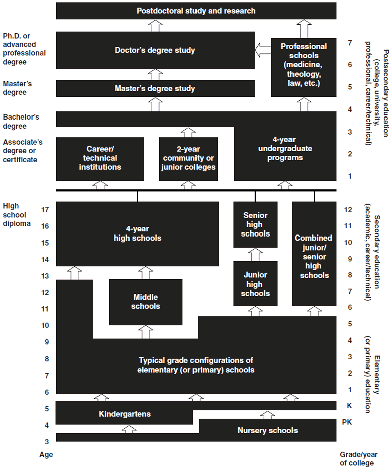
K–12, from kindergarten to 12th grade, is an American English expression that indicates the range of years of publicly supported primary and secondary education found in the United States, which is similar to publicly supported school grades before college in several other countries, such as Afghanistan, Australia, Canada, China, Ecuador, Egypt, India, Iran, the Philippines, South Korea, and Turkey. History U.S. public education was conceived of in the late 18th century. In 1790, Pennsylvania became the first state to require some form of free education for everyone regardless of whether they could afford it. New York passed similar legislation in 1805. In 1820, Massachusetts became the first state to create a tuition-free high school, Boston English. The first K–12 public school systems appeared in the early 19th century. In the 1830s and 1840s, Ohioans were taking a significant interest in the idea of public education. At that point in time, schools were commonly opera ... [...More Info...] [...Related Items...] OR: [Wikipedia] [Google] [Baidu] |
Pembina Trails School Division
Pembina Trails School Division is a school division serving the southwest communities of Winnipeg, Manitoba , image_map = Manitoba in Canada 2.svg , map_alt = Map showing Manitoba's location in the centre of Southern Canada , Label_map = yes , coordinates = , capital = Winn ..., with 35 schools. The Pembina Trails Teachers' Association represents approximately 1,200 professional staff employed by the Pembina Trails School Division. Schools References External links PembinaTrails School Division on TwitterPembina Trails School Division on FacebookPembina Trails School Division Map{{Manitoba-school-stub School divisions in Winnipeg ... [...More Info...] [...Related Items...] OR: [Wikipedia] [Google] [Baidu] |
Motor Vehicle Theft
Motor vehicle theft (also known as a car theft and, in the United States, grand theft auto) is the criminal act of stealing or attempting to steal a motor vehicle. Nationwide in the United States in 2020, there were 810,400 vehicles reported stolen, up from 724,872 in 2019. Property losses due to motor vehicle theft in 2020 were estimated at $7.4 billion. There were 505,100 car thefts in the EU in 2019, a 43% decrease from 2008. Methods Some methods used by criminals to steal motor vehicles: * Theft of an unattended vehicle without a key: the removal of a parked vehicle either by breaking and entry, followed by hotwiring or other tampering methods to start the vehicle, or else towing. In London, the police say that 50% of the annual 20,000 car thefts are now from high-tech OBD (Onboard Diagnostic Port) key-cloning kits (available online) and bypass immobilizer simulators. * Taking without owner's consent (TWOC): the unauthorized use of a car short of theft. This term is us ... [...More Info...] [...Related Items...] OR: [Wikipedia] [Google] [Baidu] |
Robbery
Robbery is the crime of taking or attempting to take anything of value by force, threat of force, or by use of fear. According to common law, robbery is defined as taking the property of another, with the intent to permanently deprive the person of that property, by means of force or fear; that is, it is a larceny or theft accomplished by an assault. Precise definitions of the offence may vary between jurisdictions. Robbery is differentiated from other forms of theft (such as burglary, shoplifting, pickpocketing, or car theft) by its inherently violent nature (a violent crime); whereas many lesser forms of theft are punished as misdemeanors, robbery is always a felony in jurisdictions that distinguish between the two. Under English law, most forms of theft are triable either way, whereas robbery is triable only on indictment. The word "rob" came via French from Late Latin words (e.g., ''deraubare'') of Germanic origin, from Common Germanic ''raub'' "theft". Among the types ... [...More Info...] [...Related Items...] OR: [Wikipedia] [Google] [Baidu] |
Southeast Asia
Southeast Asia, also spelled South East Asia and South-East Asia, and also known as Southeastern Asia, South-eastern Asia or SEA, is the geographical United Nations geoscheme for Asia#South-eastern Asia, south-eastern region of Asia, consisting of the regions that are situated south of mainland China, east of the Indian subcontinent, and north-west of mainland Australia. Southeast Asia is bordered to the north by East Asia, to the west by South Asia and the Bay of Bengal, to the east by Oceania and the Pacific Ocean, and to the south by Australia (continent), Australia and the Indian Ocean. Apart from the British Indian Ocean Territory and two out of atolls of Maldives, 26 atolls of Maldives in South Asia, Maritime Southeast Asia is the only other subregion of Asia that lies partly within the Southern Hemisphere. Mainland Southeast Asia is completely in the Northern Hemisphere. East Timor and the southern portion of Indonesia are the only parts that are south of the Equator. Th ... [...More Info...] [...Related Items...] OR: [Wikipedia] [Google] [Baidu] |
East Asia
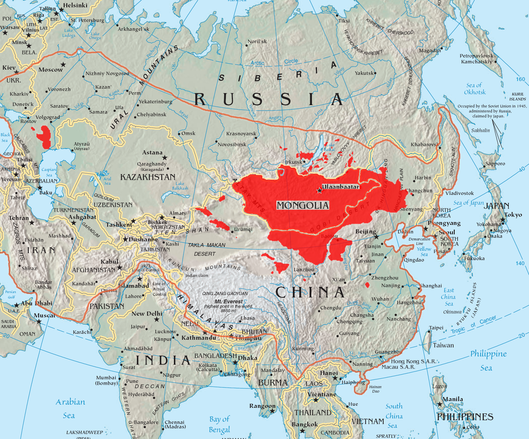
East Asia is the eastern region of Asia, which is defined in both geographical and ethno-cultural terms. The modern states of East Asia include China, Japan, Mongolia, North Korea, South Korea, and Taiwan. China, North Korea, South Korea and Taiwan are all unrecognised by at least one other East Asian state due to severe ongoing political tensions in the region, specifically the division of Korea and the political status of Taiwan. Hong Kong and Macau, two small coastal quasi-dependent territories located in the south of China, are officially highly autonomous but are under Chinese sovereignty. Japan, Taiwan, South Korea, Mainland China, Hong Kong, and Macau are among the world's largest and most prosperous economies. East Asia borders Siberia and the Russian Far East to the north, Southeast Asia to the south, South Asia to the southwest, and Central Asia to the west. To the east is the Pacific Ocean and to the southeast is Micronesia (a Pacific Ocean island group, classifi ... [...More Info...] [...Related Items...] OR: [Wikipedia] [Google] [Baidu] |
South Asian Canadian
South Asian Canadians are Canadians who were either born in or can trace their ancestry to the Indian subcontinent, which includes the nations of India, Pakistan, Bangladesh, Nepal, Sri Lanka, Bhutan, and the Maldives. The term South Asian Canadian is a subgroup of Asian Canadian and, according to Statistics Canada, can further be divided by nationality, such as Indian Canadian, Pakistani Canadian, and Bangladeshi Canadian. () As of 2016, South Asians (5.7%) comprise the third largest pan-ethnic group in Canada after Europeans (72.9%) and East Asians (6.2%). As of 2021, 2,571,400 Canadians had South Asian geographical origins, constituting approximately 7.1% of the total Canadian population and 35.1% of the total Asian Canadian population. This makes them the largest visible minority group in Canada comprising 26.7% of the visible minority population, followed by Chinese and Black Canadians respectively. The largest communities are found in Ontario, British Columbia and A ... [...More Info...] [...Related Items...] OR: [Wikipedia] [Google] [Baidu] |
Visible Minority
A visible minority () is defined by the Government of Canada as "persons, other than aboriginal peoples, who are non-Caucasian in race or non-white in colour". The term is used primarily as a demographic category by Statistics Canada, in connection with that country's Employment Equity policies. The qualifier "visible" was chosen by the Canadian authorities as a way to single out newer immigrant minorities from both Aboriginal Canadians and other "older" minorities distinguishable by language ( French vs. English) and religion ( Catholics vs. Protestants), which are "invisible" traits. The term visible minority is sometimes used as a euphemism for "non-white". This is incorrect, in that the government definitions differ: Aboriginal people are not considered to be visible minorities, but are not necessarily white either. Also, some groups that are defined as "white" in other countries (such as Middle Eastern Americans) are defined as "visible minorities" in the official Canadia ... [...More Info...] [...Related Items...] OR: [Wikipedia] [Google] [Baidu] |
Aboriginal Canadians
In Canada, Indigenous groups comprise the First Nations, Inuit and Métis. Although ''Indian'' is a term still commonly used in legal documents, the descriptors ''Indian'' and ''Eskimo'' have fallen into disuse in Canada, and most consider them to be pejorative. ''Aboriginal peoples'' as a collective noun is a specific term of art used in some legal documents, including the ''Constitution Act, 1982'', though in most Indigenous circles ''Aboriginal'' has also fallen into disfavour. Old Crow Flats and Bluefish Caves are some of the earliest known sites of human habitation in Canada. The Paleo-Indian Clovis, Plano and Pre-Dorset cultures pre-date the current Indigenous peoples of the Americas. Projectile point tools, spears, pottery, bangles, chisels and scrapers mark archaeological sites, thus distinguishing cultural periods, traditions, and lithic reduction styles. The characteristics of Indigenous culture in Canada includes a long history of permanent settlements, agricultu ... [...More Info...] [...Related Items...] OR: [Wikipedia] [Google] [Baidu] |
Winnipeg Route 90
Route 90 is a major north-south arterial route in Winnipeg, Manitoba, Canada. It begins at the South Perimeter Highway (PTH 100) and ends at the city's northwest limit, where it continues north as PTH 7. Route 90 is designated as the city's airport route, as it passes by Winnipeg James Armstrong Richardson International Airport. Route description Route 90 follows Kenaston Boulevard between the south Perimeter Highway and the Assiniboine River, through the suburbs of Waverley West, Fort Garry, and Tuxedo. North of the river, Route 90 enters St. James and follows Century Street to St. Matthews Avenue. Between St. Matthews and Dublin Avenues, it splits into separate one-way streets, with Century as the northbound and King Edward Street as the southbound. The route follows King Edward Street to the CP Carberry line underpass, after which Route 90 follows Oak Point Highway and later Brookside Boulevard before leaving the city and becoming PTH 7 approximately one kilometre south of ... [...More Info...] [...Related Items...] OR: [Wikipedia] [Google] [Baidu] |


.jpg)
