|
Leányfalu
Leányfalu is a riverside village in Pest county, Budapest metropolitan area, Hungary. It is just north of Szentendre located at . Located between the branch of the Little Danube (Kis-Duna) and the spurs of the Visegrád Mountains, Leányfalu stretches some 5 kilometres in length. It was declared a holiday resort in 1936 and became an independent municipality in 1949. To visit Leányfalu from Budapest, take the local Volán buses on the Budapest Újpest-Városkapu – Tahitótfalu – Visegrád – Esztergom Esztergom ( ; german: Gran; la, Solva or ; sk, Ostrihom, known by alternative names) is a city with county rights in northern Hungary, northwest of the capital Budapest. It lies in Komárom-Esztergom County, on the right bank of the river Danu ... line, which leaves around one to three times per hour. By automobile, take route 11 passing through Szentendre. Trivia * Some of the best Hungarian writers, artists, and musicians have retreated to Leányfalu. * T ... [...More Info...] [...Related Items...] OR: [Wikipedia] [Google] [Baidu] |
Szentendre District
Szentendre ( hu, Szentendrei járás) is a district in north-western part of Pest County. ''Szentendre'' is also the name of the town where the district seat is found. The district is located in the Central Hungary Statistical Region. Geography Szentendre District borders with Szob District to the north, Vác District and Dunakeszi District to the east, Budapest to the south, Pilisvörösvár District to the southwest, Esztergom District ''(Komárom-Esztergom County)'' to the west. The district includes the whole of Szentendre Island in the Danube. The number of the inhabited places in Szentendre District is 13. Municipalities The district has 4 towns, 1 large village and 8 villages. (ordered by population, as of 1 January 2013) The bolded municipalities are cities, ''italics'' municipality is large village. Demographics In 2011, it had a population of 77,802 and the population density was 238/km². Ethnicity Besides the Hungarian majority, the main minorities are t ... [...More Info...] [...Related Items...] OR: [Wikipedia] [Google] [Baidu] |
Budapest Metropolitan Area
The Budapest metropolitan area ( hu, budapesti agglomeráció) is a statistical area that describes the reach of commuter movement to and from Budapest and its surrounding suburbs. Created by Hungary's national statistical office HCSO to describe suburban development around centres of urban growth, the surrounding a more densely built and densely populated urban area. As of 2014 the Budapest metropolitan area, with its 7,626 km² (2,944 sq mi), extends significantly beyond Budapest's administrative region (encompasses 193 settlements around the city), a region also commonly referred to as Central Hungary. It had a population of 3,303,786 inhabitants at the January 2013 census, making it the ''tenth largest'' urban region in Europe ( |
Countries Of The World
The following is a list providing an overview of sovereign states around the world with information on their status and recognition of their sovereignty. The 206 listed states can be divided into three categories based on membership within the United Nations System: 193 member states of the United Nations, UN member states, 2 United Nations General Assembly observers#Present non-member observers, UN General Assembly non-member observer states, and 11 other states. The ''sovereignty dispute'' column indicates states having undisputed sovereignty (188 states, of which there are 187 UN member states and 1 UN General Assembly non-member observer state), states having disputed sovereignty (16 states, of which there are 6 UN member states, 1 UN General Assembly non-member observer state, and 9 de facto states), and states having a political status of the Cook Islands and Niue, special political status (2 states, both in associated state, free association with New Zealand). Compi ... [...More Info...] [...Related Items...] OR: [Wikipedia] [Google] [Baidu] |
Esztergom
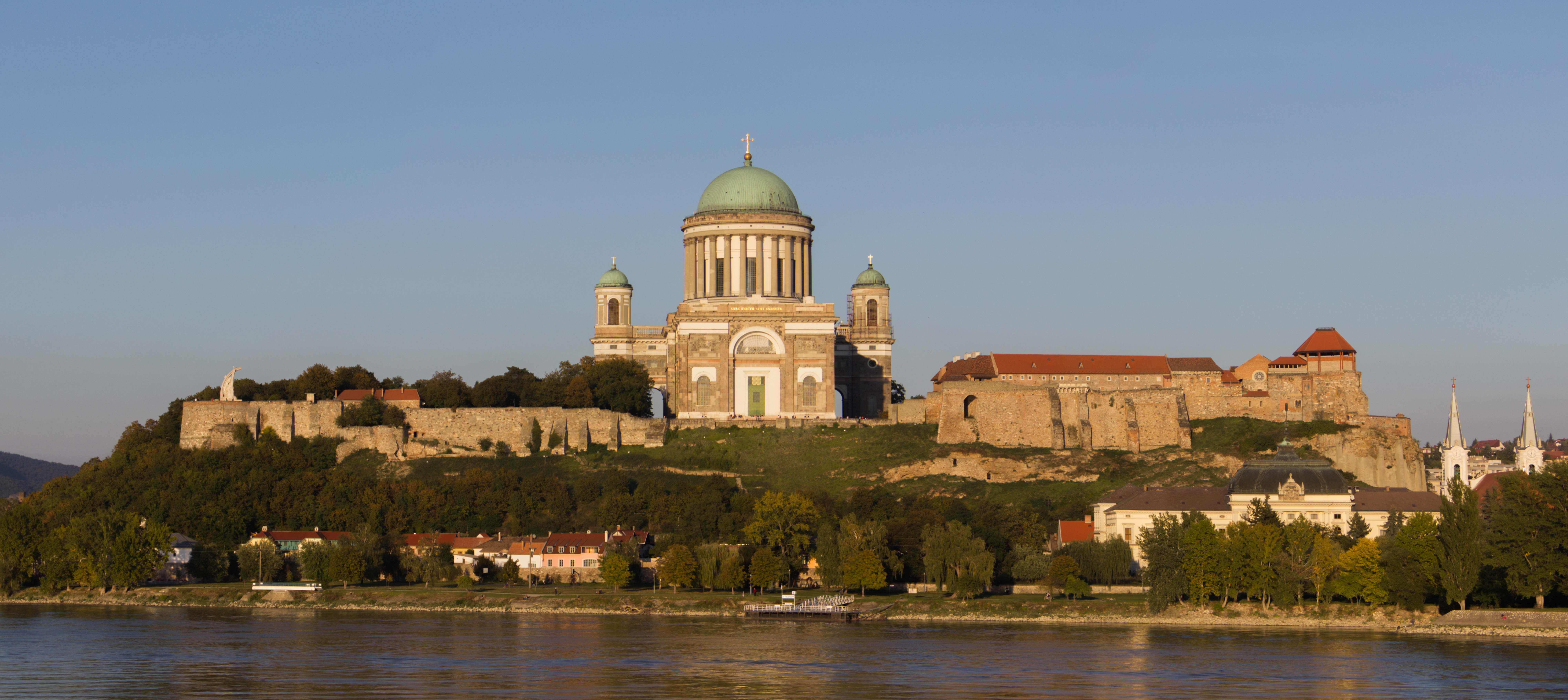
Esztergom ( ; german: Gran; la, Solva or ; sk, Ostrihom, known by alternative names) is a city with county rights in northern Hungary, northwest of the capital Budapest. It lies in Komárom-Esztergom County, on the right bank of the river Danube, which forms the border with Slovakia there. Esztergom was the capital of Hungary from the 10th until the mid-13th century when King Béla IV of Hungary moved the royal seat to Buda. Esztergom is the seat of the ''prímás'' (see Primate) of the Roman Catholic Church in Hungary, and the former seat of the Constitutional Court of Hungary. The city has a Christian Museum with the largest ecclesiastical collection in Hungary. Its cathedral, Esztergom Basilica, is the largest church in Hungary. Toponym The Roman town was called ''Solva''. The medieval Latin name was ''Strigonium''. The first early medieval mention is "''ſtrigonensis trigonensiscomes''" (1079-1080). The first interpretation of the name was suggested by Antonio ... [...More Info...] [...Related Items...] OR: [Wikipedia] [Google] [Baidu] |
Visegrád
Visegrád (; german: Plintenburg; la, Pone Navata or ; sk, Vyšehrad) is a castle town in Pest County, Hungary. It is north of Budapest on the right bank of the Danube in the Danube Bend. It had a population of 1,864 in 2010. The town is the site of the remains of the Early Renaissance summer palace of King Matthias Corvinus of Hungary and a medieval citadel. Etymology The name ''Visegrád'' (''Vyšehrad'') is of Slavic origin, meaning acropolis, literary "the upper castle" (the castle with a privileged position) or "the upper settlement". In modern Slovak and Czech, the form is ''Vyšehrad''. The castle of Visegrád is called ''Fellegvár'' (Citadel) in Hungarian,Antal Papp: Magyarország (Hungary), Panoráma, Budapest, 1982, , p. 860, pp. 229-236 In German, the town is called ''Plintenburg''. The German name ''Plintenburg'' or ''Blendenburg'' is said to come from the beautiful view that one has from the castle and is "blinded"/"dazzled" by this view. History Visegrád was ... [...More Info...] [...Related Items...] OR: [Wikipedia] [Google] [Baidu] |
Tahitótfalu
Tahitótfalu is a village in the northern part of , Hungary. The Danube of Szentendre separates into two parts, one of these is Tótfalu which laying on Szentendre Island the other one is Tahi at the foothills of Visegrád Mountains, 28 kilometers from Budapest, north of Szentendre Szentendre () is a riverside town in Pest County, Hungary, between the capital city Budapest and Pilis Mountains, Pilis-Visegrád Mountains. The town is known for its museums (most notably the :hu: Szentendrei Szabadtéri Néprajzi Múzeum, Open- ..., along Highway 11. References Populated places in Pest County {{Pest-geo-stub ... [...More Info...] [...Related Items...] OR: [Wikipedia] [Google] [Baidu] |
Volán
The Volán companies ( hu, Volán társaságok) were a network of transit companies operating intercity, international and city bus lines in Hungary. One Volán company generally served only the area of a specific county. The companies formed from the merger of regional Auto Transit Companies ( hu, links=no, Autoközlekedési Vállalat; AKÖV) and Cargo Shipping Companies ( hu, links=no, Teherfuvarozási Vállalat; TEFU). See also * Budapesti Közlekedési Központ The Budapesti Közlekedési Központ (BKK), officially ''Budapesti Közlekedési Központ Zrt.'' (), is the largest public transport company in Budapest and one of the largest in Europe. It was founded on January 1, 2011. BKK operates buses (200+ ... * BKV Zrt. References Public transport companies in Hungary {{DEFAULTSORT:Volánbusz ... [...More Info...] [...Related Items...] OR: [Wikipedia] [Google] [Baidu] |
Budapest
Budapest (, ; ) is the capital and most populous city of Hungary. It is the ninth-largest city in the European Union by population within city limits and the second-largest city on the Danube river; the city has an estimated population of 1,752,286 over a land area of about . Budapest, which is both a city and county, forms the centre of the Budapest metropolitan area, which has an area of and a population of 3,303,786; it is a primate city, constituting 33% of the population of Hungary. The history of Budapest began when an early Celtic settlement transformed into the Roman town of Aquincum, the capital of Lower Pannonia. The Hungarians arrived in the territory in the late 9th century, but the area was pillaged by the Mongols in 1241–42. Re-established Buda became one of the centres of Renaissance humanist culture by the 15th century. The Battle of Mohács, in 1526, was followed by nearly 150 years of Ottoman rule. After the reconquest of Buda in 1686, the ... [...More Info...] [...Related Items...] OR: [Wikipedia] [Google] [Baidu] |
Visegrád Mountains
The Visegrád Mountains (Hu: ''Visegrádi hegység'') is a mountain range in Hungary, not far from Budapest. Geography The Visegrád Mountains are the direct northern neighbour of the Pilis Mountains. Although the two ranges form a geographical unit as both of them officially belong to the Transdanubian Mountains, the Visegrád Mountains connect to Börzsöny and the North Hungarian Mountains. The mountain range is the southernmost part of the Inner Western Carpathians. The basic rock of these mountains is volcanic, mainly andesite, while the Transdanubian Mountains are based on sedimentary rocks. Geology Visegrád Mountains were shaped by volcanic events. History of the region The whole range served as the hunting area for the medieval kings. Notable locations The highest peak of the range is at Dobogókő (699 m above sea level), a hiking and ski resort area with a panoramic view on the Danube Bend The Danube Bend ( hu, Dunakanyar) is a curve of the Danube in ... [...More Info...] [...Related Items...] OR: [Wikipedia] [Google] [Baidu] |
Little Danube
The Little Danube ( Slovak: ''Malý Dunaj'', Hungarian: ''Kis-Duna'', German: ''Kleine Donau'') is a branch of the river Danube in Slovakia. It splits from the main river near Bratislava, and flows more or less parallel to the Danube until it flows into the river Váh in Kolárovo. It is long and its basin size is .Plán manažmentu povodňového rizikavčiastkovom povodí Váhu p. 72 The part of the Váh between Kolárovo and its confluence with the Danube in is also called ''Váh Danube'' (Slovak: ''Vážsky Dunaj'', Hungarian: ''Vág-Duna''). The |
Szentendre
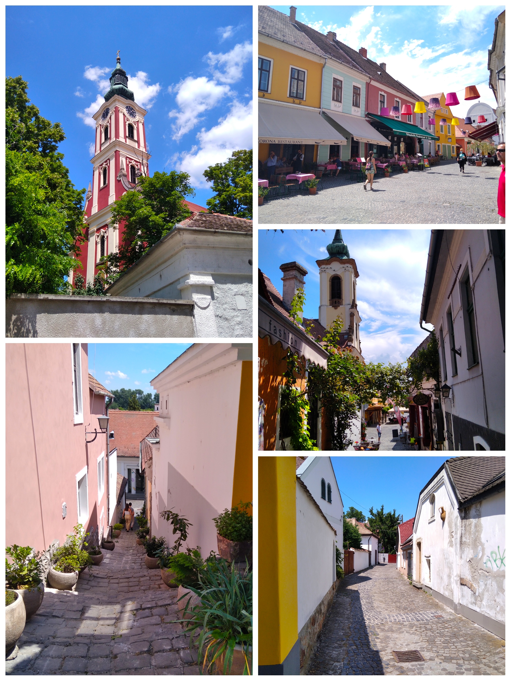
Szentendre () is a riverside town in Pest County, Hungary, between the capital city Budapest and Pilis Mountains, Pilis-Visegrád Mountains. The town is known for its museums (most notably the :hu: Szentendrei Szabadtéri Néprajzi Múzeum, Open-Air Ethnographic Museum), galleries, and artists. Due to its historic architecture and easy rail and river access, it has become a destination for tourists staying in Budapest. There are many facilities, including Gift shop, souvenir shops and restaurants, catering to these visitors. Name The name of the town is ultimately based on the Medieval Latin form ' ("St. Andrew"). Because of the diverse mix of nationalities to have once settled in Szentendre, the settlement has a variety of names according to language. The Hungarian language, Hungarian name for the town is '; the Croatian language, Croatian name is '; the German language, German name is '; in Serbian language, Serbian, the name is ' ( sr-Cyrl, Сентандреја); the Slovak ... [...More Info...] [...Related Items...] OR: [Wikipedia] [Google] [Baidu] |


