|
Lendwithcare
Lendwithcare is a microfinance lending website from the development charity CARE International UK. Launched in September 2010, it allows individuals and groups to make small loans to entrepreneurs in developing countries, and help them work their way out of poverty. It supports entrepreneurs in Cambodia, Togo, Benin, the Philippines, Bosnia and Herzegovina, Vietnam and Ecuador through partner microfinance institutions (MFIs). It does not charge any interest on the loans made to entrepreneurs by supporters - the MFIs do. By 2015, over 21,000 lenders loaned almost £6m to around 17,000 entrepreneurs. The process Lendwithcare works with a number of partner microfinance institutions (MFIs) in the countries in which it operates. If the MFI is happy with an entrepreneur's idea or business plan, they approve the proposal and provide the initial loan requested. They also help the entrepreneur construct their profile for lendwithcare.org. Lenders can browse the list of entrepreneurs on t ... [...More Info...] [...Related Items...] OR: [Wikipedia] [Google] [Baidu] |
CARE (relief Agency)
CARE (Cooperative for Assistance and Relief Everywhere, formerly Cooperative for American Remittances to Europe) is a major international humanitarian agency delivering emergency relief and long-term international development projects. Founded in 1945, CARE is nonsectarian, impartial, and non-governmental. It is one of the largest and oldest humanitarian aid organizations focused on fighting global poverty. In 2019, CARE reported working in 104 countries, supporting 1,349 poverty-fighting projects and humanitarian aid projects, and reaching over 92.3 million people directly and 433.3 million people indirectly. CARE's programmes in the developing world address a broad range of topics including emergency response, food security, water and sanitation, economic development, climate change, agriculture, education, and health. CARE also advocates at the local, national, and international levels for policy change and the rights of poor people. Within each of these areas, CARE focuses on ... [...More Info...] [...Related Items...] OR: [Wikipedia] [Google] [Baidu] |
Cotonou
Cotonou (; fon, Kútɔ̀nú) is a city in Benin. Its official population count was 679,012 inhabitants in 2012; however, over two million people live in the larger urban area. The urban area continues to expand, notably toward the west. The city lies in the southeast of the country, between the Atlantic Ocean and Lake Nokoué. In addition to being Benin's largest city, it is the seat of government, although Porto-Novo is the official capital. History The name "Cotonou" means "by the river of death" in the Fon language.Butler, Stuart (2019) ''Bradt Travel Guide - Benin'', pgs. 74-91 At the beginning of the 19th century, Cotonou (then spelled "Kutonou") was a small fishing village, and is thought to have been formally founded by King Ghezo of Dahomey in 1830. It grew as a centre for the slave trade, and later palm oil and cotton. In 1851 the French Second Republic made a treaty with King Ghezo that allowed them to establish a trading post at Cotonou. During the reign of King ... [...More Info...] [...Related Items...] OR: [Wikipedia] [Google] [Baidu] |
Negros (island)
Negros is the fourth largest and third most populous island in the Philippines, with a total land area of . Negros is one of the many islands of the Visayas, in the central part of the country. The predominant inhabitants of the island region are mainly called '' Negrenses'' (locally ''Negrosanons''). As of 2020 census, the total population of Negros is 4,656,945 people. From May 29, 2015 to August 9, 2017, the whole island was governed as an administrative region officially named the Negros Island Region, which comprised the highly urbanized city of Bacolod and the provinces of Negros Occidental and Negros Oriental, along with its corresponding outlying islands and islets within a total regional area of . It was created on May 29, 2015 by virtue of ''Executive Order No. 183'' issued by Benigno Aquino III, who was the president at that time. On August 9, 2017, President Rodrigo Duterte signed the Executive Order No. 38 dissolving the Negros Island Region. History Precolonial ... [...More Info...] [...Related Items...] OR: [Wikipedia] [Google] [Baidu] |
Panay
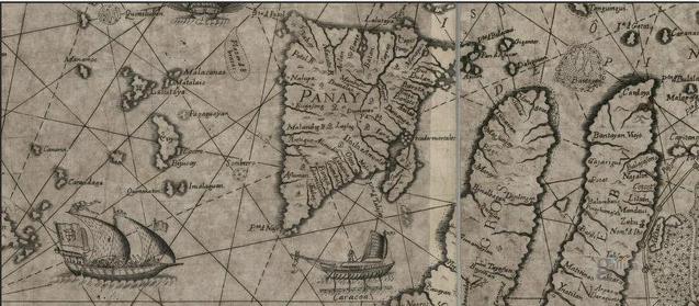
Panay is the sixth-largest and fourth-most populous island in the Philippines, with a total land area of and has a total population of 4,542,926 as of 2020 census. Panay comprises 4.4 percent of the entire population of the country. The City of Iloilo is its largest settlement with a total population of 457,626 inhabitants as of 2020 census. Panay is a triangular island, located in the western part of the Visayas. It is about across. It is divided into four Provinces of the Philippines, provinces: Aklan, Antique (province), Antique, Capiz and Iloilo, all in the Western Visayas Regions of the Philippines, Region. Just closely off the mid-southeastern coast lies the island-province of Guimaras. It is located southeast of the island of Mindoro and northwest of Negros Island, Negros across the Guimaras Strait. To the north and northeast is the Sibuyan Sea, Jintotolo Channel and the island-provinces of Romblon and Masbate; to the west and southwest is the Sulu Sea and the Palawan a ... [...More Info...] [...Related Items...] OR: [Wikipedia] [Google] [Baidu] |
Southern Leyte
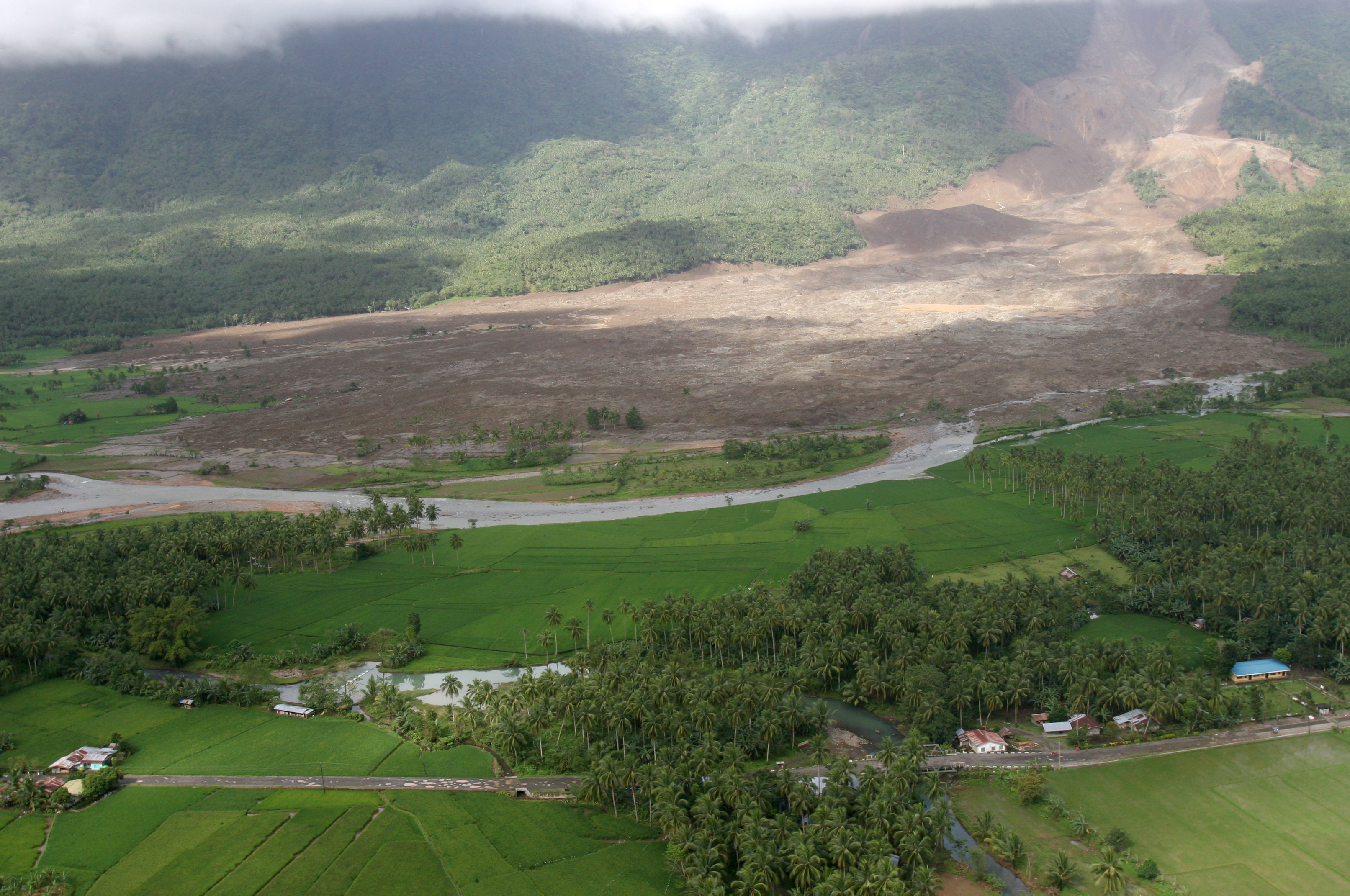
Southern Leyte ( ceb, Habagatang Leyte; Kabalian: ''Habagatan nga Leyte''; war, Salatan nga Leyte; tl, Timog Leyte), officially the Province of Southern Leyte, is a province in the Philippines located in the Eastern Visayas region. Its capital is the city of Maasin. Southern Leyte comprised the third congressional district Leyte until it was made into an independent province in 1959. Southern Leyte includes Limasawa, an island to the south where the first Roman Catholic Mass in Philippine soil is believed to have taken place and thus considered to be the birthplace of Roman Catholicism in the Philippines. The province ranks as the second least populated in the region. According to the 2020 census, the province has a population of 429,573. Southern Leyte's geological features created several issues in the province after the flooding of the Subangdaku River and the 2006 mudslide in Guinsaugon. Organizations warned the province it was susceptible to natural occurrences like la ... [...More Info...] [...Related Items...] OR: [Wikipedia] [Google] [Baidu] |
Leyte
Leyte ( ) is an island in the Visayas group of islands in the Philippines. It is eighth-largest and sixth-most populous island in the Philippines, with a total population of 2,626,970 as of 2020 census. Since the accessibility of land has been depleted, Leyte has provided countless number of migrants to Mindanao. Most inhabitants are farmers. Fishing is a supplementary activity. Rice and corn (maize) are the main food crops; cash crops include coconuts, abaca, tobacco, bananas, and sugarcane. There are some manganese deposits, and sandstone and limestone are quarried in the northwest. Politically, the island is divided into two provinces: (Northern) Leyte and Southern Leyte. Territorially, Southern Leyte includes the island of Panaon to its south. To the north of Leyte is the island province of Biliran, a former sub-province of Leyte. The major cities of Leyte are Tacloban, on the eastern shore at the northwest corner of Leyte Gulf, and Ormoc, on the west coast. Leyte to ... [...More Info...] [...Related Items...] OR: [Wikipedia] [Google] [Baidu] |
Cebu
Cebu (; ceb, Sugbo), officially the Province of Cebu ( ceb, Lalawigan sa Sugbo; tl, Lalawigan ng Cebu; hil, Kapuroan sang Sugbo), is a province of the Philippines located in the Central Visayas region, and consists of a main island and 167 surrounding islands and islets. Its capital and largest city is Cebu City, nicknamed "the Queen City of the South", the oldest city and first capital of the Philippines, which is politically independent from the provincial government. The Cebu Metropolitan Area or Metro Cebu is the second largest metropolitan area in the Philippines (after Metro Manila) with Cebu City as the main center of commerce, trade, education and industry in the Visayas. Being one of the most developed provinces in the Philippines, in a decade it has transformed into a global hub for business processing services, tourism, shipping, furniture-making, and heavy industry. Mactan–Cebu International Airport, located on Mactan Island, is the second busiest airport in ... [...More Info...] [...Related Items...] OR: [Wikipedia] [Google] [Baidu] |
Luzon
Luzon (; ) is the largest and most populous island in the Philippines. Located in the northern portion of the Philippines archipelago, it is the economic and political center of the nation, being home to the country's capital city, Manila, as well as Quezon City, the country's most populous city. With a population of 64 million , it contains 52.5% of the country's total population and is the fourth most populous island in the world. It is the 15th largest island in the world by land area. ''Luzon'' may also refer to one of the three primary island groups in the country. In this usage, it includes the Luzon mainland, the Batanes and Babuyan groups of islands to the north, Polillo Islands to the east, and the outlying islands of Catanduanes, Marinduque and Mindoro, among others, to the south. The islands of Masbate, Palawan and Romblon are also included, although these three are sometimes grouped with another of the island groups, the Visayas. Etymology The name ''Luz ... [...More Info...] [...Related Items...] OR: [Wikipedia] [Google] [Baidu] |
Metro Manila
Metropolitan Manila (often shortened as Metro Manila; fil, Kalakhang Maynila), officially the National Capital Region (NCR; fil, link=no, Pambansang Punong Rehiyon), is the capital region, seat of government and one of three List of metropolitan areas in the Philippines, defined metropolitan areas in the Philippines. It is composed of 16 Cities of the Philippines#Legal classification, highly urbanized cities: the Manila, city of Manila, Quezon City, Caloocan, Las Piñas, Makati, Malabon, Mandaluyong, Marikina, Muntinlupa, Navotas, Parañaque, Pasay, Pasig, San Juan, Metro Manila, San Juan, Taguig, and Valenzuela, Metro Manila, Valenzuela, as well as the municipality of Pateros. The region encompasses an area of and a population of as of 2020. It is the second most populous and the most densely populated Regions of the Philippines, region of the Philippines. It is also the List of metropolitan areas in Asia, 9th most populous metropolitan area in Asia and the List of larges ... [...More Info...] [...Related Items...] OR: [Wikipedia] [Google] [Baidu] |
Mandaluyong
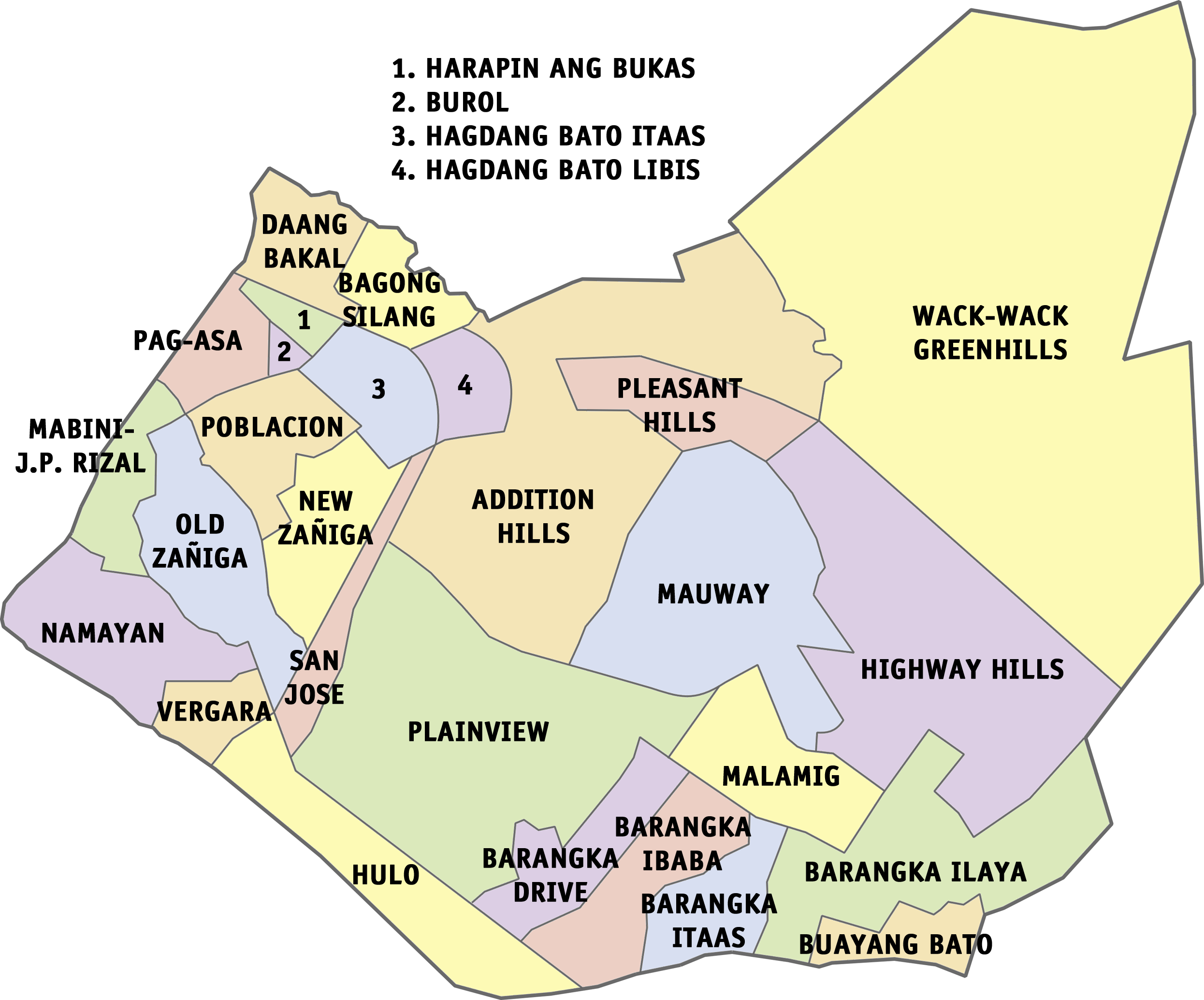
Mandaluyong, officially the City of Mandaluyong ( fil, Lungsod ng Mandaluyong), is a first class highly urbanized city in the National Capital Region of the Philippines. According to the 2020 census, it has a population of 425,758 people. Located directly east of Manila, Mandaluyong was originally a barrio of Santa Ana de Sapa (now a district of Manila) called San Felipe Neri. It separated and became its own town in 1841, and later acquired the name Mandaluyong in 1931 during the American occupation. In 1994, it became the first municipality of Metro Manila to become a city since the metropolis' establishment in 1975. At present, it is known for the Ortigas Center, a commercial and business center that it also shares with the city of Pasig. Notable institutions and establishments in the city include the Asian Development Bank, the headquarters of Banco de Oro and San Miguel Corporation and shopping malls like Shangri-La Plaza and SM Megamall. The city is bordered by Manil ... [...More Info...] [...Related Items...] OR: [Wikipedia] [Google] [Baidu] |
Loja, Ecuador
Loja (), formerly Loxa and fully City of the Immaculate Conception of Loja ( es, Ciudad de la Inmaculada Concepción de Loja), is the capital of Ecuador's Loja Province. It is located in the Cuxibamba valley in the south of the country, sharing borders with the provinces of Zamora-Chinchipe and El Oro, and with Peru in the south. Loja holds a rich tradition in the arts, and for this reason is known as the Music and Cultural Capital of Ecuador. The city is home to two major universities. The city has a population of about 181,000, and is situated 2060 m (6758 ft) above sea level. It has a mild Andean climate, ranging between 16 and 30 °C. The Pan-American Highway runs past Loja. History The city of Loja was colonized by Field Marshal Alonso de Mercadillo in 1548, and it is named for his hometown of Loja in Spain. Originally located near La Toma in the Catamayo canyon since 1546, the city was relocated to its present location (about 35 km east) after a ... [...More Info...] [...Related Items...] OR: [Wikipedia] [Google] [Baidu] |

.jpg)
.jpg)


