|
Leighfield
Leighfield is a civil parish in the county of Rutland in the East Midlands of England. There is no settlement centre in the parish, only a few isolated properties. In the 2001 census it had a population of 10, which was the fourth smallest of Rutland's parish populations. At the 2011 census the population remained less than 100 and was included in the civil parish of Ridlington. It shares its name with Leighfield Forest, a much larger area from Braunston-in-Rutland to Stockerston and from Skeffington to Ridlington, a triangle of land roughly in each direction. The village's name means 'Wood/clearing'. Spellings with the addition of the Old English word 'feld' meaning 'open land' started to appear from the 14th century. The Leighfield Way is a waymarked route joining the Leicestershire and Rutland Rounds at Belton-in-Rutland with the Hereward Way and Viking Way at Oakham. Leighfield Forest In the medieval period, Leighfield Forest was an extensive Royal forest straddling the b ... [...More Info...] [...Related Items...] OR: [Wikipedia] [Google] [Baidu] |
Sauvey Castle
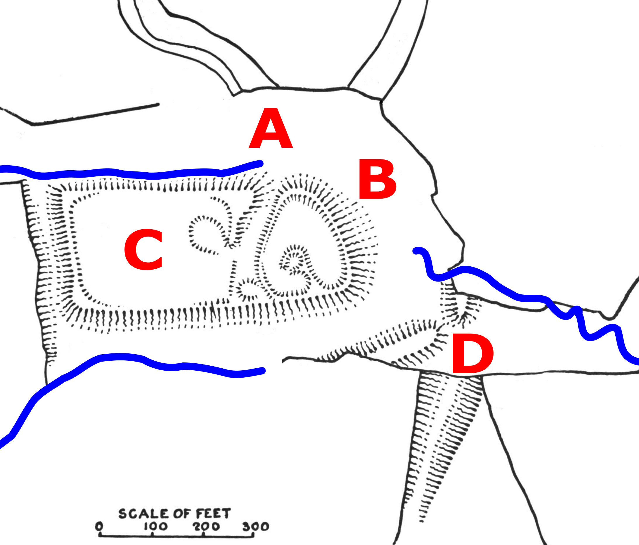
Sauvey Castle is a medieval castle, near Withcote, Leicestershire, England. It was probably built by King John in 1211 as a secluded hunting lodge in Leighfield Forest. It comprised a ringwork or shell keep, with an adjacent bailey; earthwork dams were constructed to flood the area around the castle, creating a large, shallow moat. The castle was occupied by the Count of Aumale in the early reign of Henry III, but it then remained in the control of the Crown and was used by royal foresters until it fell into disuse in the 14th century. By the end of the 17th century, its walls and buildings had been dismantled or destroyed, leaving only the earthworks, which remain in a good condition in the 21st century. Construction Historians are divided as to when Sauvey Castle was constructed; most suggest that it was built by King John in 1211 when he acquired the surrounding lands, although some sources argue it was built during the reign of King Stephen, between 1135 and 1153. ... [...More Info...] [...Related Items...] OR: [Wikipedia] [Google] [Baidu] |
Royal Forest
A royal forest, occasionally known as a kingswood (), is an area of land with different definitions in England, Wales, Scotland and Ireland. The term ''forest'' in the ordinary modern understanding refers to an area of wooded land; however, the original medieval sense was closer to the modern idea of a "preserve" – i.e. land legally set aside for specific purposes such as royal hunting – with less emphasis on its composition. There are also differing and contextual interpretations in Continental Europe derived from the Carolingian and Merovingian legal systems. In Anglo-Saxon England, though the kings were great huntsmen, they never set aside areas declared to be "outside" (Latin ''foris'') the law of the land.H. R. Loyn, ''Anglo-Saxon England and the Norman Conquest'' 2nd ed. 1991:378-82. Historians find no evidence of the Anglo-Saxon monarchs (c. 500 to 1066) creating forests. However, under the Norman kings (after 1066), by royal prerogative forest law was widely applied. ... [...More Info...] [...Related Items...] OR: [Wikipedia] [Google] [Baidu] |
Flitteriss Park
Flitteriss Park is an ancient deer park in the English Midland counties of Leicestershire and Rutland west of Oakham. It is a modern livestock farm today but has a rich history. History Flitteriss Park was enclosed by royal grant as a Medieval deer park and royal hunting ground in 1250. Henry III granted Richard, 1st Earl of Cornwall the right to enclose the park with a ditch and hedge. This was to be enclosed within the Royal forest of Leighfield. However, an inquest two years later found that "the wood is outside the said forest bordering the county of Leicester" The park remained with the Earl and formed part of his Dower to the family of Isabel Marshal, his wife. Thereafter a succession of absent landlords made illegal hunting a rife practice in the park. In 1372, William Flore was paid to provide a palisade for the park. The same Flore's House still exists today in Oakham. In 1373 the first mention is made of a hunting lodge at Flitteriss. The problem of absent ... [...More Info...] [...Related Items...] OR: [Wikipedia] [Google] [Baidu] |
Ridlington
Ridlington is a village and civil parish in Rutland in the East Midlands of England. The population of the village was 202 at the time of the 2001 census, including Ayston, Leighfield and Wardley also increasing to 260 at the 2011 census. The village's name means 'farm/settlement of Redel'. The Church of England parish church is Saint Mary Magdalene and Saint Andrew Andrew the Apostle ( grc-koi, Ἀνδρέᾱς, Andréās ; la, Andrēās ; , syc, ܐܰܢܕ݁ܪܶܐܘܳܣ, ʾAnd’reʾwās), also called Saint Andrew, was an apostle of Jesus according to the New Testament. He is the brother of Simon Peter .... It is a Grade II* listed building. The Village Hall on Main Street was originally the Ridlington Village Primary School, built in 1873. The Diocese of Peterborough made it over to the Parish Council in 1964 when the school closed. Ridlington was the home of Hugh Boyville, a landowner and Member of Parliament for Rutland in the 15th century. The prominent Haring ... [...More Info...] [...Related Items...] OR: [Wikipedia] [Google] [Baidu] |
Stockerston
Stockerston is a village and civil parish in the Harborough district of Leicestershire, England, located on the border with Rutland, by the Eye Brook. According to the 2001 census the parish had a population of 35. The population remained less than 100 at the 2011 census and is included in the civil parish of Horninghold. Topography The Parish contains various woods including the large Bolt Wood and Park Wood, and the smaller Fishpond Spinney, Great Spinney, Little Merrible Wood, and Holyoaks Wood. Bolt Wood and Park Wood are fragments of the medieval Leighfield Forest and included in the sites of special scientific interest known as the Eye Brook Valley Woods. History Analysis of the name of the village name suggests it derives from the term 'made of wood'. Archaeologists state that the scatterings of Roman and Anglo-Saxon pottery discovered at Stockerston indicate occupation during that era. The village was in the Gartree Hundred and had two mentions in the Domesday ... [...More Info...] [...Related Items...] OR: [Wikipedia] [Google] [Baidu] |
United Kingdom Census 2001
A nationwide census, known as Census 2001, was conducted in the United Kingdom on Sunday, 29 April 2001. This was the 20th UK census and recorded a resident population of 58,789,194. The 2001 UK census was organised by the Office for National Statistics (ONS) in England and Wales, the General Register Office for Scotland (GROS) and the Northern Ireland Statistics and Research Agency (NISRA). Detailed results by region, council area, ward and output area are available from their respective websites. Organisation Similar to previous UK censuses, the 2001 census was organised by the three statistical agencies, ONS, GROS, and NISRA, and coordinated at the national level by the Office for National Statistics. The Orders in Council to conduct the census, specifying the people and information to be included in the census, were made under the authority of the Census Act 1920 in Great Britain, and the Census Act (Northern Ireland) 1969 in Northern Ireland. In England and Wales these re ... [...More Info...] [...Related Items...] OR: [Wikipedia] [Google] [Baidu] |
Bailiwick
A bailiwick () is usually the area of jurisdiction of a bailiff, and once also applied to territories in which a privately appointed bailiff exercised the sheriff's functions under a royal or imperial writ. The bailiwick is probably modelled on the administrative organization which was attempted for a very small time in Sicily and has its roots in the official state of the Hohenstaufen. In English, the original French ''bailie'' combined with '-wic', the Anglo-Saxon suffix (meaning a village) to produce a term meaning literally 'bailiff's village'—the original geographic scope of a bailiwick. In the 19th century, it was absorbed into American English as a metaphor for a sphere of knowledge or activity. The term survives in administrative usage in the British Crown Dependencies of the Channel Islands, which are grouped for administrative purposes into two bailiwicks — the Bailiwick of Jersey (comprising the island of Jersey and uninhabited islets such as the Minquiers ... [...More Info...] [...Related Items...] OR: [Wikipedia] [Google] [Baidu] |
Ashby De La Zouch
Ashby-de-la-Zouch, sometimes spelt Ashby de la Zouch () and shortened locally to Ashby, is a market town and civil parish in the North West Leicestershire district of Leicestershire, England. The town is near to the Derbyshire and Staffordshire borders. Its 2001 census population of 11,410 rose to 12,370 in 2011. The castle in the town was an important fort in the 15th–17th centuries. In the 19th century the town's main industries were ribbon manufacture, coal mining, and brickmaking. The civil parish includes the hamlets of Shellbrook to the west and Boundary to the north-west. Swadlincote, Burton upon Trent, Melbourne and Coalville are within , with Derby due north. Ashby lies at the heart of The National Forest, about south of the Peak District National Park, on the A42 between Tamworth and Nottingham. In 2018, Ashby Market Street was named "Best Shopping Experience", and in 2019 it made the final of the rising-star category for UK high streets. History The town was ... [...More Info...] [...Related Items...] OR: [Wikipedia] [Google] [Baidu] |
Earl Of Huntingdon
Earl of Huntingdon is a title which has been created several times in the Peerage of England. The medieval title (1065 creation) was associated with the ruling house of Scotland (David I of Scotland, David of Scotland). The seventh and most recent creation dates to 1529. In this lineage, the current holder of the title is William Hastings-Bass, 17th Earl of Huntingdon (b. 1948). In English folklore, the title has been associated with Robin Hood, whose true name is often given as Robert Fitzooth, "Robert of Huntingdon", though alternatively Robin is said to be from Locksley or Loxley. Early history Huntingdonshire was part of the Kingdom of East Anglia, inhabited by a group known as the Gyrwas from about the 6th century. It fell to the Danelaw, Danes in the 9th century, but was re-conquered under Edward the Elder in 915. An earldom of Huntingdon was established shortly after, and it was one of the seven earldoms of Saxon England during the reign of king Edward the Confessor. I ... [...More Info...] [...Related Items...] OR: [Wikipedia] [Google] [Baidu] |
Cold Overton Park
A hill with a trig point pillar to the east of Cold Overton Park Wood is, at 197 m (646 ft), the highest point in the county of Rutland, England. The summit is southwest of the Glebe Farm radio relay mast on the road between Oakham and Knossington, and adjacent to the county boundary with Leicestershire. From the peak, there are views of Rutland Water Rutland Water is a reservoir in Rutland, England, east of Rutland's county town, Oakham. It is filled by pumping from the River Nene and River Welland, and provides water to the East Midlands. By surface area it is the largest reservoir in En .... It falls within the historic parkland of Flitteriss Park. References External linksBritish Walks Geography of Rutland Highest points of English counties Parks and open spaces in Rutland Oakham {{Rutland-geo-stub ... [...More Info...] [...Related Items...] OR: [Wikipedia] [Google] [Baidu] |
Lyddington
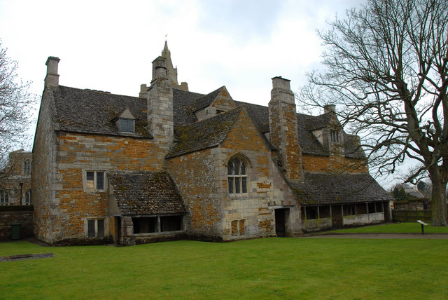
Lyddington is a village in the county of Rutland in the East Midlands of England. The population of the civil parish was 397 at the 2001 census, and had fallen to 366 at the 2011 census. The village's name origin is uncertain. Perhaps, 'farm/settlement of Hlyda' or 'farm/settlement with a noisy stream'. Lyddington Bede House, owned by English Heritage, is a Grade I listed building incorporating parts of a medieval bishop's palace. In 1547 it was seized on behalf of the king from the Bishops of Lincoln and later passed to Lord Burghley William Cecil, 1st Baron Burghley (13 September 15204 August 1598) was an English statesman, the chief adviser of Queen Elizabeth I for most of her reign, twice Secretary of State (1550–1553 and 1558–1572) and Lord High Treasurer from 1 .... In 1600 part of the palace was converted into an almshouse and it continued in this use until 1930. The remains of the fishponds of the bishop's palace are nearby. St Andrew's Church is also ... [...More Info...] [...Related Items...] OR: [Wikipedia] [Google] [Baidu] |
Deer Park (England)
In medieval and Early Modern England, Wales and Ireland, a deer park () was an enclosed area containing deer. It was bounded by a ditch and bank with a wooden park pale on top of the bank, or by a stone or brick wall. The ditch was on the inside increasing the effective height. Some parks had deer " leaps", where there was an external ramp and the inner ditch was constructed on a grander scale, thus allowing deer to enter the park but preventing them from leaving. History Some deer parks were established in the Anglo-Saxon era and are mentioned in Anglo-Saxon Charters; these were often called ''hays'' (from Old English ''heġe'' (“hedge, fence”) and ''ġehæġ'' (“an enclosed piece of land”). After the Norman conquest of England in 1066 William the Conqueror seized existing game reserves. Deer parks flourished and proliferated under the Normans, forming a forerunner of the deer parks that became popular among England's landed gentry. The Domesday Book of 1086 record ... [...More Info...] [...Related Items...] OR: [Wikipedia] [Google] [Baidu] |


