|
Lake Walen
The Walensee, also known as ''Lake Walen'' or ''Lake Walenstadt'' from Walenstadt, is one of the larger lakes in Switzerland, with about two thirds of its area in the Canton of St. Gallen and about one third in the Canton of Glarus. Other towns and villages at the lake include Weesen, Quinten, Quarten, and Murg. The three main rivers leading to the lake are the Seez, Murgbach, and Linth. The last continues its course from Walensee to Lake Zurich. The Schnittlauchinsel, at the eastern end of the lake, is the only island in the Walensee. The Churfirsten range raises steeply on the north side from the lake's level at 419 m to 2,306 m above sea level. On the south, the lake is overlooked by the Mürtschenstock Massif, whose peak is 2,441 m above sea level. The highest point of the lake's drainage basin is the Tödi The Tödi (), is a mountain massif and with the mountain peak Piz Russein the highest mountain in the Glarus Alps and the highest summit in the canton of Glarus, S ... [...More Info...] [...Related Items...] OR: [Wikipedia] [Google] [Baidu] |
Unterterzen
Quarten is a municipality in the ''Wahlkreis'' (constituency) of Sarganserland, in the canton of St. Gallen, Switzerland, above Lake Walensee. Besides Quarten itself, the municipality includes the settlements of Oberterzen, Unterterzen, Quinten, Mols, Murg, and parts of Tannenbodenalp. History Quarten is first mentioned about 840 as ''in Quarto''. Geography The municipality of Quarten stretches for some along the southern shore of the Walensee, and some from the shore inland to the Murgseen lakes and the foot of the Gufelstock mountain. On the opposite shore of the lake, a detached section of the municipality takes in of the lake shore, and stretches some up the slopes of the Leistchamm mountain. The settlements of Murg, Unterterzen and Mols lie along the southern shoreline of the Walensee, overlooked by Quarten and Oberterzen at a slightly higher altitude. The hamlet of Quinten lies on the north shore of the Walensee, and is only accessible by boat or on foot. Tan ... [...More Info...] [...Related Items...] OR: [Wikipedia] [Google] [Baidu] |
Churfirsten
Churfürsten is a mountain range in the Canton of St. Gallen, Switzerland. They form the natural boundary between the canton's Toggenburg and Sarganserland districts. They are the southernmost range of the Appenzell Alps, separated from the Glarus Alps by the Seez river and Walensee. They consist of a limestone ridge running east to west, with the individual peaks formed by erosion. The ridge is defined much more sharply to the south than to the north, with an almost vertical drop of several hundred meters towards ''Walenstadtberg'' and eventually Lake Walensee at 419 m. The southern slope of the range was significantly formed by the Rhine Glacier during the Würm glaciation. The name is a plural, indicating the peaks forming the historical boundary of the bishopric of Chur. It has historically also been folk-etymologized as '' Kurfürsten'', i.e. the 7 prince-electors of the Holy Roman Empire who in the later medieval period (until 1648) numbered seven, which in turn enco ... [...More Info...] [...Related Items...] OR: [Wikipedia] [Google] [Baidu] |
Lakes Of The Canton Of St
A lake is an area filled with water, localized in a basin, surrounded by land, and distinct from any river or other outlet that serves to feed or drain the lake. Lakes lie on land and are not part of the ocean, although, like the much larger oceans, they do form part of the Earth's water cycle. Lakes are distinct from lagoons, which are generally coastal parts of the ocean. Lakes are typically larger and deeper than ponds, which also lie on land, though there are no official or scientific definitions. Lakes can be contrasted with rivers or streams, which usually flow in a channel on land. Most lakes are fed and drained by rivers and streams. Natural lakes are generally found in mountainous areas, rift zones, and areas with ongoing glaciation. Other lakes are found in endorheic basins or along the courses of mature rivers, where a river channel has widened into a basin. Some parts of the world have many lakes formed by the chaotic drainage patterns left over from the last ice ... [...More Info...] [...Related Items...] OR: [Wikipedia] [Google] [Baidu] |
Lakes Of The Canton Of Glarus
A lake is an area filled with water, localized in a basin, surrounded by land, and distinct from any river or other outlet that serves to feed or drain the lake. Lakes lie on land and are not part of the ocean, although, like the much larger oceans, they do form part of the Earth's water cycle. Lakes are distinct from lagoons, which are generally coastal parts of the ocean. Lakes are typically larger and deeper than ponds, which also lie on land, though there are no official or scientific definitions. Lakes can be contrasted with rivers or streams, which usually flow in a channel on land. Most lakes are fed and drained by rivers and streams. Natural lakes are generally found in mountainous areas, rift zones, and areas with ongoing glaciation. Other lakes are found in endorheic basins or along the courses of mature rivers, where a river channel has widened into a basin. Some parts of the world have many lakes formed by the chaotic drainage patterns left over from the last ice ... [...More Info...] [...Related Items...] OR: [Wikipedia] [Google] [Baidu] |
Lakes Of Switzerland
This article contains a sortable table listing all major lakes of Switzerland. The table includes all still water bodies, natural or artificial, that have a surface area of at least , regardless of water volume, maximum depth or other metric. These lakes are ranked by area, the table including also the elevation above sea level and maximum depth. They are either natural (type N), natural but used as reservoirs (NR) or fully artificial (A). For a list of artificial lakes only, see List of dams and reservoirs in Switzerland. For a list of lakes above that includes smaller water bodies, see List of mountain lakes of Switzerland. Along with the mountains, lakes constitute a major natural feature of Switzerland, with over of shores within the country.Approximately (see coastline paradox) counting only the 17 lakes over (length retrieved from the Google Earth geographical information program). Lakes, large and small, can be found in almost all cantons and provide an important sou ... [...More Info...] [...Related Items...] OR: [Wikipedia] [Google] [Baidu] |
Walensee
The Walensee, also known as ''Lake Walen'' or ''Lake Walenstadt'' from Walenstadt, is one of the larger lakes in Switzerland, with about two thirds of its area in the Canton of St. Gallen and about one third in the Canton of Glarus. Other towns and villages at the lake include Weesen, Quinten, Quarten, and Murg. The three main rivers leading to the lake are the Seez, Murgbach, and Linth. The last continues its course from Walensee to Lake Zurich. The Schnittlauchinsel, at the eastern end of the lake, is the only island in the Walensee. The Churfirsten range raises steeply on the north side from the lake's level at 419 m to 2,306 m above sea level. On the south, the lake is overlooked by the Mürtschenstock Massif, whose peak is 2,441 m above sea level. The highest point of the lake's drainage basin is the Tödi (3,614 m). The lake provided the inspiration for a solo piano piece by Hungarian Romantic composer Franz Liszt, Au lac de Wallenstadt. The piece is part of a collec ... [...More Info...] [...Related Items...] OR: [Wikipedia] [Google] [Baidu] |
Flumserberg
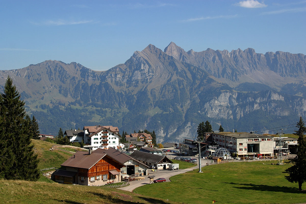
Flumserberg is a resort area in the Swiss Alps, located in the canton of St. Gallen. It is composed of several villages at elevations between above sea level. The resort sits on a terrace overlooking the Walensee, above Flums in the Sarganserland region. Flumserberg mainly belongs to the municipality of Flums, with a small part belonging to the municipality of Quarten. The three main villages composing the resort of Flumserberg are: ''Tannenbodenalp'' (), ''Flumserberg'' () and ''Tannenheim'' (). References *Swisstopo Swisstopo is the official name for the Swiss Federal Office of Topography (in German language, German: ''Bundesamt für Landestopografie''; French language, French: ''Office fédéral de topographie''; Italian language, Italian: ''Ufficio fed ... topographic maps External links Flumserberg.ch (official website) [...More Info...] [...Related Items...] OR: [Wikipedia] [Google] [Baidu] |
Années De Pèlerinage
''Années de pèlerinage'' (French for ''Years of Pilgrimage'') ( S.160, S.161, S.162, S.163) is a set of three suites for solo piano by Franz Liszt. Much of it derives from his earlier work, ''Album d'un voyageur'', his first major published piano cycle, which was composed between 1835 and 1838 and published in 1842. ''Années de pèlerinage'' is widely considered as the masterwork and summation of Liszt's musical style. The third volume is notable as an example of his later style. Composed well after the first two volumes, it displays less virtuosity and more harmonic experimentation. The title ''Années de pèlerinage'' refers to Goethe's famous novel of self-realization, ''Wilhelm Meister's Apprenticeship'', and especially its sequel ''Wilhelm Meister's Journeyman Years'' (whose original title ''Wilhelm Meisters Wanderjahre'' meant ''Years of Wandering'' or ''Years of Pilgrimage'', the latter being used for its first French translation). Liszt clearly places these compositio ... [...More Info...] [...Related Items...] OR: [Wikipedia] [Google] [Baidu] |
Franz Liszt
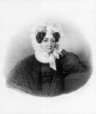
Franz Liszt, in modern usage ''Liszt Ferenc'' . Liszt's Hungarian passport spelled his given name as "Ferencz". An orthographic reform of the Hungarian language in 1922 (which was 36 years after Liszt's death) changed the letter "cz" to simply "c" in all words except surnames; this has led to Liszt's given name being rendered in modern Hungarian usage as "Ferenc". From 1859 to 1867 he was officially Franz Ritter von Liszt; he was created a ''Ritter'' (knight) by Emperor Franz Joseph I of Austria, Francis Joseph I in 1859, but never used this title of nobility in public. The title was necessary to marry the Princess Carolyne zu Sayn-Wittgenstein without her losing her privileges, but after the marriage fell through, Liszt transferred the title to his uncle Eduard in 1867. Eduard's son was Franz von Liszt., group=n (22 October 1811 – 31 July 1886) was a Hungarian composer, pianist and teacher of the Romantic music, Romantic period. With a diverse List of compositions by Franz L ... [...More Info...] [...Related Items...] OR: [Wikipedia] [Google] [Baidu] |
Hungarians
Hungarians, also known as Magyars ( ; hu, magyarok ), are a nation and ethnic group native to Hungary () and historical Hungarian lands who share a common culture, history, ancestry, and language. The Hungarian language belongs to the Uralic language family. There are an estimated 15 million ethnic Hungarians and their descendants worldwide, of whom 9.6 million live in today's Hungary. About 2–3 million Hungarians live in areas that were part of the Kingdom of Hungary before the Treaty of Trianon in 1920 and are now parts of Hungary's seven neighbouring countries, Slovakia, Ukraine, Romania, Serbia, Croatia, Slovenia, and Austria. Significant groups of people with Hungarian ancestry live in various other parts of the world, most of them in the United States, Canada, Germany, France, the United Kingdom, Chile, Brazil, Australia, and Argentina. Hungarians can be divided into several subgroups according to local linguistic and cultural characteristics; subgroups with distinc ... [...More Info...] [...Related Items...] OR: [Wikipedia] [Google] [Baidu] |
Swisstopo
Swisstopo is the official name for the Swiss Federal Office of Topography (in German language, German: ''Bundesamt für Landestopografie''; French language, French: ''Office fédéral de topographie''; Italian language, Italian: ''Ufficio federale di topografia''; Romansh language, Romansh: ''Uffizi federal da topografia''), Switzerland's national mapping agency. The current name was made official in 2002. It had been in use as the domain name for the institute's homepage, swisstopo.ch, since 1997. Maps The main class of products produced by Swisstopo are topographical maps on seven different Scale (map), scales. Swiss maps have been praised for their accuracy and quality. Regular maps * 1:25.000. This is the most detailed map, useful for many purposes. Those are popular with tourists, especially for famous areas like Zermatt and St. Moritz. These maps cost CHF 13.50 each (2004). 208 maps on this scale are published at regular intervals. The first map published on this scale ... [...More Info...] [...Related Items...] OR: [Wikipedia] [Google] [Baidu] |
Tödi
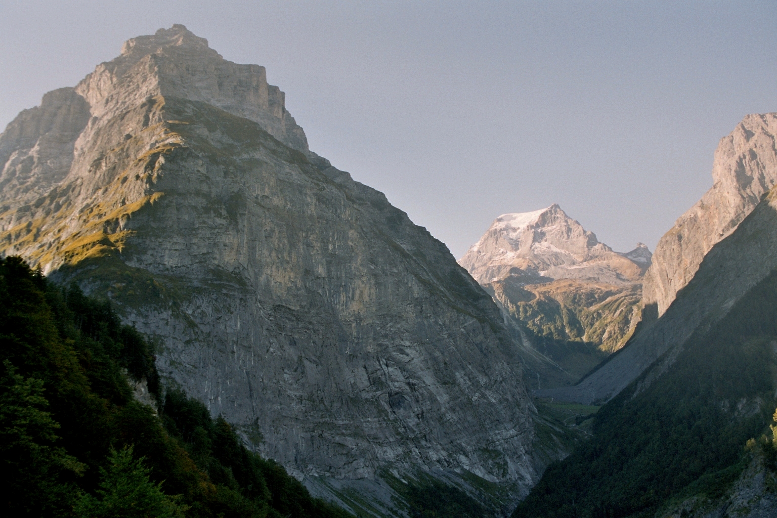
The Tödi (), is a mountain massif and with the mountain peak Piz Russein the highest mountain in the Glarus Alps and the highest summit in the canton of Glarus, Switzerland. It is located on the border between the cantons of Graubünden, to the south, and Glarus, to the north, close to the point where those two cantons meet the canton of Uri, to the west. Although not the culminating point of Graubünden, it is its highest peak outside the Bernina range. Geography The Tödi lies in the west part of the Glarus Alps, between Linthal on the north and Disentis on the south. The Tödi is a vast mountain massif projecting as a promontory to the north from the range that divides the basin of the Linth from that of the Rhine. There are three principal peaks. The lowest, and northernmost, which is that seen from the Ober Sand Alp, is called ''Sandgipfel'' (). The ''Glarner Tödi'' (), long supposed to be the highest, and most conspicuous from Stachelberg and other points of view to ... [...More Info...] [...Related Items...] OR: [Wikipedia] [Google] [Baidu] |


_2020.jpg)


