|
Lake Iliamna
Iliamna Lake or Lake Iliamna (Yup'ik: ''Nanvarpak''; Dena'ina Athabascan: ''Nila Vena'') is a lake in southwest Alaska, at the north end of the Alaska Peninsula, between Kvichak Bay and Cook Inlet, about west of Seldovia, Alaska. It shares a name with the Iliamna River, which flows into it, and the nearby community of Iliamna, Alaska. It is the largest lake in Alaska, 3rd largest lake entirely in the United States, and twenty-fourth in North America. Covering about , Iliamna Lake is long and up to wide, with a maximum depth of . Through the Kvichak River, its waters drain into Bristol Bay. History Name The lake is marked as 'Oz roBolhoyIlyamna' (Big Ilyamna Lake) on the Russian Hydrographical Department's Chart 1455, published in 1852. On an earlier Russian map, from 1802, the lake was named 'Oz roShelekhovo' (Lake Shelekov) after Russian explorer Grigory Shelekhov. According to G.C. Martin, of the United States Geological Survey, Iliamna is said to be "the name of a myt ... [...More Info...] [...Related Items...] OR: [Wikipedia] [Google] [Baidu] |
Lake And Peninsula Borough, Alaska
Lake and Peninsula Borough (russian: Лейк-энд-Пенинсула, ''Leyk-end-Peninsula'') is a borough in the state of Alaska. As of the 2020 census, the population was 1,476, down from 1,631 in 2010. The borough seat of King Salmon is located in neighboring Bristol Bay Borough, although is not the seat of that borough. The most populous community in the borough is the census-designated place of Port Alsworth. With an average of 0.017 inhabitants/km2 (0.045/sq mi), the Lake and Peninsula Borough is the second least densely populated organized county-equivalent in the United States; only the unorganized Yukon-Koyukuk Census Area has a lower density. Geography The borough has an area of , of which is land and (28.2%) is water. The borough occupies most of the Alaska Peninsula. Its land area is larger than that of San Bernardino County, California, the largest county in the contiguous Lower 48 states, and slightly larger than the state of South Carolina. Adjacent boro ... [...More Info...] [...Related Items...] OR: [Wikipedia] [Google] [Baidu] |
Cook Inlet
Cook Inlet ( tfn, Tikahtnu; Sugpiaq: ''Cungaaciq'') stretches from the Gulf of Alaska to Anchorage in south-central Alaska. Cook Inlet branches into the Knik Arm and Turnagain Arm at its northern end, almost surrounding Anchorage. On its southern end, it merges with Shelikof Strait, Stevenson Entrance, Kennedy Entrance and Chugach Passage. The Cook Inlet watershed is the most populated watershed in Alaska. The watershed covers about of southern Alaska, east of the Aleutian Range, south and east of the Alaska Range, receiving water from its tributaries, the Knik River, the Little Susitna River, and the Susitna and Matanuska rivers. The watershed includes the drainage areas of Denali (formerly named Mount McKinley). Within the watershed there are several national parks and the active volcano Mount Redoubt, along with three other historically active volcanoes. Cook Inlet provides navigable access to the port of Anchorage at the northern end, and to the smaller Homer port fu ... [...More Info...] [...Related Items...] OR: [Wikipedia] [Google] [Baidu] |
Alaska Road Commission
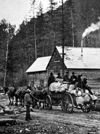
The Board of Road Commissioners for Alaska, more commonly known as the Alaska Road Commission or ARC, was created in 1905 as a board of the U.S. War Department. It was responsible for the construction and improvement of many important Alaska highways, such as the Richardson Highway, Steese Highway, Elliot Highway and Edgerton Highway, among others. The commission was transferred to the Department of the Interior in 1932, and was absorbed by the Bureau of Public Roads, a division of the Commerce Department in 1956. Today, responsibility for road development and maintenance in Alaska lies with the Alaska Department of Transportation & Public Facilities. Background and Motivation The Alaska Interior was largely roadless up until about the 1870s, with only a network of trails established by the native people of Alaska, which Russian, and later American, traders and prospectors used as well. The Russians in Alaska stuck to coastal regions, and built almost no new trails or road ... [...More Info...] [...Related Items...] OR: [Wikipedia] [Google] [Baidu] |
Eskimos With Reindeer, Iliamna Lake, Alaska, July 26, 1917 (COBB 138)
Eskimo () is an exonym used to refer to two closely related Indigenous peoples: the Inuit (including the Alaska Native Iñupiat, the Greenlandic Inuit, and the Canadian Inuit) and the Yupik (or Yuit) of eastern Siberia and Alaska. A related third group, the Aleut, which inhabit the Aleutian Islands, are generally excluded from the definition of Eskimo. The three groups share a relatively recent common ancestor, and speak related languages belonging to the Eskaleut language family. These circumpolar peoples have traditionally inhabited the Arctic and subarctic regions from eastern Siberia (Russia) to Alaska (United States), Northern Canada, Nunavik, Nunatsiavut, and Greenland. Many Inuit, Yupik, Aleut, and other individuals consider the term ''Eskimo'', which is of a disputed etymology, to be unacceptable and even pejorative. Eskimo continues to be used within a historical, linguistic, archaeological, and cultural context. The governments in Canada and the United States have mad ... [...More Info...] [...Related Items...] OR: [Wikipedia] [Google] [Baidu] |


