|
Lake Engolasters
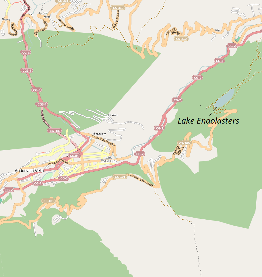
Lake Engolasters, in the Encamp parish of Andorra, is an oblong shaped lake at an elevation of . formed in a glacial depression. It is located close to Andorra La Vella, the capital of Andorra. The lake water is deep blue and is drained by a drainage basin formed by the Pyrenees mountain ranges, which are snow-covered. The valley formed by the rivers draining the catchment provides an enchanting view with green meadows and rich forest of pine trees nearer to the lake periphery. The water source to the lake is from the East Valira and Madriu rivers. The stored water in the reservoir is utilized for generating hydroelectric power at the power station located near Encamp village. There is a cable car rope way from Encamp to the lake area, which is a line. Legend A legend related to the history and formation of the lake claims that Engolasters was formed by a sudden gush of water unleashed by divine powers in order to chastise the impiety of a beautiful woman, who was said to be an ... [...More Info...] [...Related Items...] OR: [Wikipedia] [Google] [Baidu] |
Encamp
Encamp () is one of the parishes of Andorra, located on the Valira d'Orient river. It is also the name of the main town in the parish. Other settlements include Vila, El Pas de la Casa, Grau Roig, El Tremat, La Mosquera and Les Bons. As of 2004, it has about 11,800 inhabitants. The centre of the municipality lies above sea level. The highest mountain in the parish is Pic dels Pessons (). Geography Climate Encamp has a oceanic climate (Köppen climate classification ''Cfb''). The average annual temperature in Encamp is . The average annual rainfall is with May as the wettest month. The temperatures are highest on average in July, at around , and lowest in January, at around . The highest temperature ever recorded in Encamp was on 29 June 1935; the coldest temperature ever recorded was on 2 February 1956. Radio transmitter Radio Andorra operated a transmitter at Lake Engolasters in Encamp from 7 August 1939 until 9 April 1981. The antenna still exists at an elevati ... [...More Info...] [...Related Items...] OR: [Wikipedia] [Google] [Baidu] |
Andorra La Vella
Andorra la Vella french: Andorre-la-Vieille is the capital (political), capital of the Andorra, Principality of Andorra. It is located high in the east Pyrenees, between France and Spain. It is also the name of the parishes of Andorra, parish that surrounds the capital. , the city has a population of 22,886, and the urban area, which includes Escaldes-Engordany plus satellite villages, has over 40,000 inhabitants. The principal industry is tourism, although the country also earns foreign income from being a tax haven. Furniture and Brandy, brandies are local products. Being at an elevation of , it is the highest capital city in Europe and a popular ski resort. Name ''Andorra la Vella'' means "Andorra the Town", to distinguish it from the Principality of Andorra as a whole. Although in Catalan the word ''vella'' (like French ''vieille'') is derived from the Latin word ''vetula'' which means "old", the ''Vella'' here (like French ''ville'' and Catalan ''vila'') is derived fr ... [...More Info...] [...Related Items...] OR: [Wikipedia] [Google] [Baidu] |
Lakes Of Andorra
A lake is an area filled with water, localized in a basin, surrounded by land, and distinct from any river or other outlet that serves to feed or drain the lake. Lakes lie on land and are not part of the ocean, although, like the much larger oceans, they do form part of the Earth's water cycle. Lakes are distinct from lagoons, which are generally coastal parts of the ocean. Lakes are typically larger and deeper than ponds, which also lie on land, though there are no official or scientific definitions. Lakes can be contrasted with rivers or streams, which usually flow in a channel on land. Most lakes are fed and drained by rivers and streams. Natural lakes are generally found in mountainous areas, rift zones, and areas with ongoing glaciation. Other lakes are found in endorheic basins or along the courses of mature rivers, where a river channel has widened into a basin. Some parts of the world have many lakes formed by the chaotic drainage patterns left over from the last ice ... [...More Info...] [...Related Items...] OR: [Wikipedia] [Google] [Baidu] |
Tower
A tower is a tall Nonbuilding structure, structure, taller than it is wide, often by a significant factor. Towers are distinguished from guyed mast, masts by their lack of guy-wires and are therefore, along with tall buildings, self-supporting structures. Towers are specifically distinguished from buildings in that they are built not to be habitable but to serve other functions using the height of the tower. For example, the height of a clock tower improves the visibility of the clock, and the height of a tower in a fortified building such as a castle increases the visibility of the surroundings for defensive purposes. Towers may also be built for observation tower, observation, leisure, or telecommunication purposes. A tower can stand alone or be supported by adjacent buildings, or it may be a feature on top of a larger structure or building. Etymology Old English ''torr'' is from Latin ''turris'' via Old French ''tor''. The Latin term together with Greek language, Greek τύ ... [...More Info...] [...Related Items...] OR: [Wikipedia] [Google] [Baidu] |
Radio Andorra
Radio Andorra (Ràdio Andorra in Catalan or Radio Andorre in French) was a commercial radio that broadcast by concession of the authorities from the Andorra, Principality of Andorra between 1939 and 1981. Thanks to the neutrality of the Principality during World War II, Radio Andorra became the only private European radio station broadcasting in French during the conflict without being under direct orders from France or Germany. Likewise it became the only radio station to conserve its independence after the war ended, despite the strong pressure from the Gallic authorities received by the Andorran government. History Beginnings and early years Broadcasting began on 7 August 1939. Jacques Trémoulet, who was also the owner of the broadcasting company ''Radiophonie du Midi'' and had already broadcast in Toulouse, Montpellier, Bordeaux and Agen, created Radio Andorra fearing the civil interdiction of the private radio in French territory, due to the fact that, if it had been produce ... [...More Info...] [...Related Items...] OR: [Wikipedia] [Google] [Baidu] |
Encamp(Andorra)
Encamp () is one of the parishes of Andorra, located on the Valira d'Orient river. It is also the name of the main town in the parish. Other settlements include Vila, El Pas de la Casa, Grau Roig, El Tremat, La Mosquera and Les Bons. As of 2004, it has about 11,800 inhabitants. The centre of the municipality lies above sea level. The highest mountain in the parish is Pic dels Pessons (). Geography Climate Encamp has a oceanic climate (Köppen climate classification ''Cfb''). The average annual temperature in Encamp is . The average annual rainfall is with May as the wettest month. The temperatures are highest on average in July, at around , and lowest in January, at around . The highest temperature ever recorded in Encamp was on 29 June 1935; the coldest temperature ever recorded was on 2 February 1956. Radio transmitter Radio Andorra operated a transmitter at Lake Engolasters in Encamp from 7 August 1939 until 9 April 1981. The antenna still exists at an elevation ... [...More Info...] [...Related Items...] OR: [Wikipedia] [Google] [Baidu] |
Lake Engolasters
Lake Engolasters, in the Encamp parish of Andorra, is an oblong shaped lake at an elevation of . formed in a glacial depression. It is located close to Andorra La Vella, the capital of Andorra. The lake water is deep blue and is drained by a drainage basin formed by the Pyrenees mountain ranges, which are snow-covered. The valley formed by the rivers draining the catchment provides an enchanting view with green meadows and rich forest of pine trees nearer to the lake periphery. The water source to the lake is from the East Valira and Madriu rivers. The stored water in the reservoir is utilized for generating hydroelectric power at the power station located near Encamp village. There is a cable car rope way from Encamp to the lake area, which is a line. Legend A legend related to the history and formation of the lake claims that Engolasters was formed by a sudden gush of water unleashed by divine powers in order to chastise the impiety of a beautiful woman, who was said to be an ... [...More Info...] [...Related Items...] OR: [Wikipedia] [Google] [Baidu] |
Andorra
, image_flag = Flag of Andorra.svg , image_coat = Coat of arms of Andorra.svg , symbol_type = Coat of arms , national_motto = la, Virtus Unita Fortior, label=none (Latin)"United virtue is stronger" , national_anthem = "The Great Charlemagne" , image_map = Location Andorra Europe.png , map_caption = , image_map2 = , capital = Andorra la Vella , coordinates = , largest_city = capital , official_languages = Catalan , ethnic_groups = , ethnic_groups_year = 2017 , religion = Christianity (Catholicism) , religion_ref = , demonym = Andorran , government_type = constitutional elective diarchy , leader_title1 = Co-Princes , leader_name1 = , leader_title2 = Representatives , leader_name2 = , leader_title3 = Prime Minister ... [...More Info...] [...Related Items...] OR: [Wikipedia] [Google] [Baidu] |
Madriu (river)
Madriu may refer to: * Madriu-Perafita-Claror Valley (aka ''Valley of Madriu'' or "Madriu"), a glacial valley, and UNESCO World Heritage Site, in Andorra * Madriu River (or "Madriu"), a river in Andorra that flows into Lake Engolasters Lake Engolasters, in the Encamp parish of Andorra, is an oblong shaped lake at an elevation of . formed in a glacial depression. It is located close to Andorra La Vella, the capital of Andorra. The lake water is deep blue and is drained by a drai ... * HD 131496 b (planet), Star Arcalis, Constellation Bootes; an exoplanet named after the glacial valley in Andorra * FC ''Madriu'' (futsal), a futsal team in Andorra; see List of top-division futsal clubs in UEFA countries See also {{dab ... [...More Info...] [...Related Items...] OR: [Wikipedia] [Google] [Baidu] |
Valira River
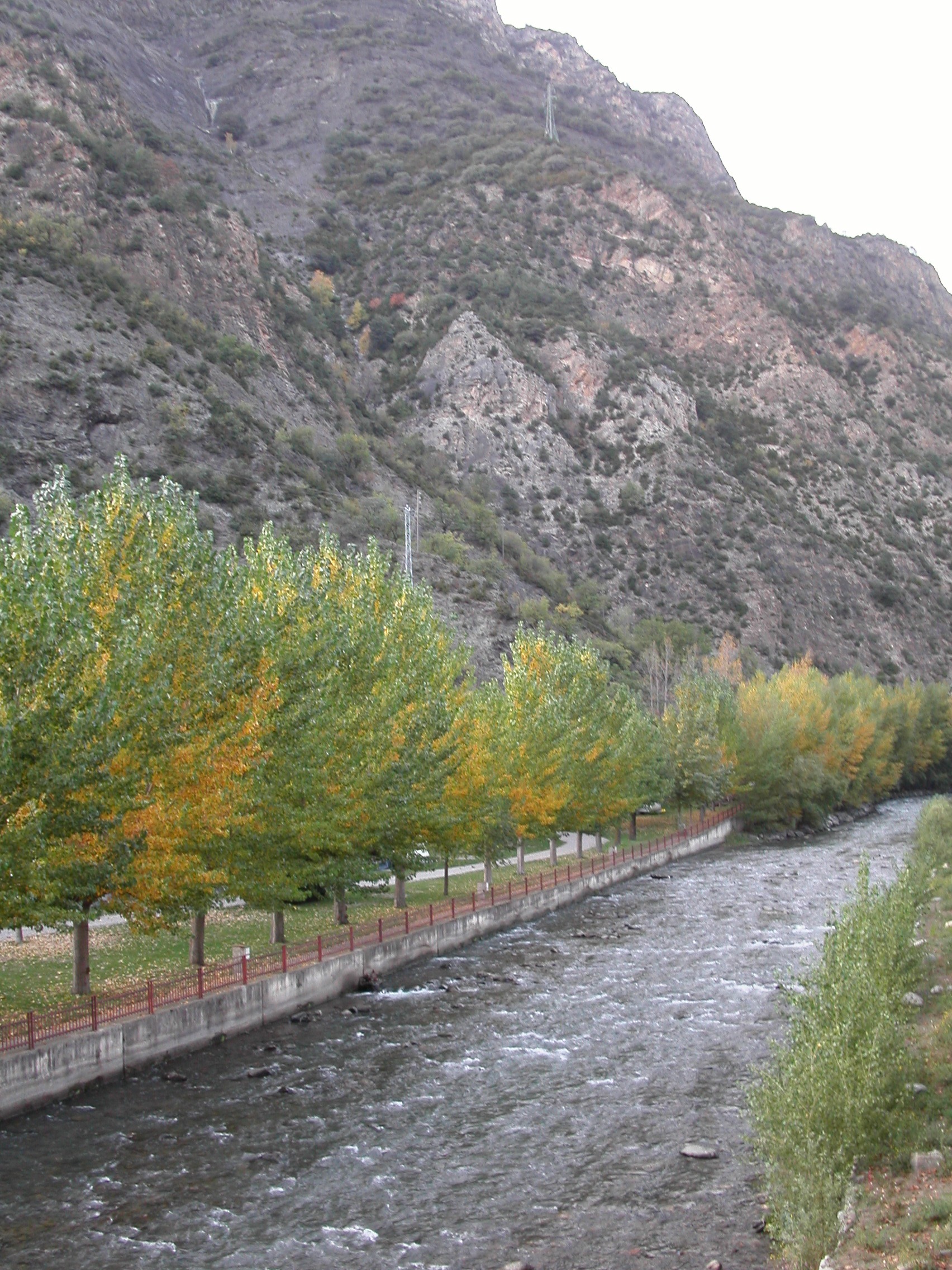
The Gran Valira (, es, Río Valira) is the largest river in Andorra. It flows through the capital, Andorra la Vella, and exits the country in the south near the Spain–Andorra road border crossing. The Gran Valira is a tributary to the Segre, which in turn is a tributary to the Ebro. It flows into the Segre in La Seu d'Urgell. Its main tributaries are the Valira d'Orient, the Valira del Nord Valira may refer to: * Valira, Greece * Gran Valira, the largest river in Andorra , image_flag = Flag of Andorra.svg , image_coat = Coat of arms of Andorra.svg , symbol_type = Coat of arms , national_mo ... and the Madriu. The Valira river system is long.Atlas of Andorra (1991), Andorran Government. . The map service of the Andorran government calls it the Gran Valira. In certain sources, especially those with a Spanish influence such as maps published in Spain, it is sometimes referred to as the Valira because in the territory of Spai ... [...More Info...] [...Related Items...] OR: [Wikipedia] [Google] [Baidu] |


.jpg)
