|
Lac-John
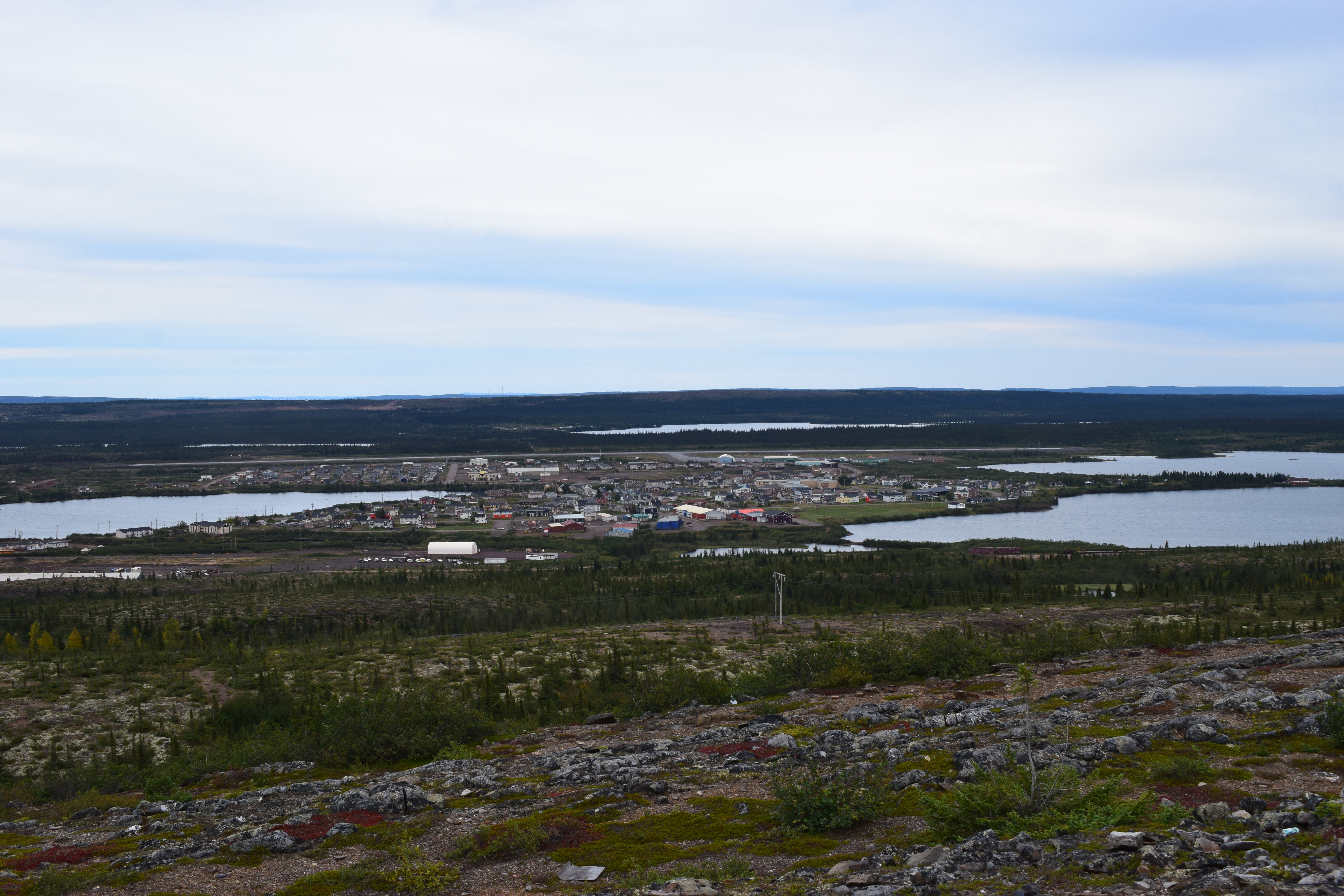
Lac-John is a First Nations reserve on John Lake in the Côte-Nord region of Quebec, Canada, about north-east from the centre of Schefferville. Together with the Matimekosh Reserve, it belongs to the Innu Nation of Matimekush-Lac John. It is geographically within the Caniapiscau Regional County Municipality but administratively not part of it. The reserve is named after the adjacent John Lake. That name was assigned by the Labrador Mining and Smelting Company, which used it on one of its geological maps a little before 1947. History The region was the northern limit of the hunting and trapping grounds of the Innu indigenous people, but they never had resided there permanently. Because of mining development in the early 1950s, the Naskapi from Fort Chimo and a dozen Innu families from Maliotenam arrived at Schefferville to serve as guides for geological exploration work, and help on the railway construction from Sept-Iles. In 1957, the Schefferville municipal authorities mov ... [...More Info...] [...Related Items...] OR: [Wikipedia] [Google] [Baidu] |
Caniapiscau Regional County Municipality
Caniapiscau is a regional county municipality in the Côte-Nord region of Quebec, Canada. The seat is Fermont. The census groups Caniapiscau RCM with neighbouring Sept-Rivières into the single census division of Sept-Rivières—Caniapiscau. In the Canada 2011 Census, the combined population was 39,500. The population of Caniapiscau RCM itself was 4260, about two-thirds of whom live in its largest city of Fermont. Subdivisions There are 6 subdivisions and 3 native reserves within the RCM: ;Cities & Towns (2) * Fermont * Schefferville ;Unorganized territories (4) *Caniapiscau Caniapiscau () is a vast unorganized territory in the Côte-Nord region of Quebec, Canada, part of Caniapiscau Regional County Municipality. The territory is home to the huge Caniapiscau Reservoir, the largest body of water in Quebec. The res ... * Lac-Juillet * Lac-Vacher * Rivière-Mouchalagane ;Native Reserves (2) * Lac-John * Matimekosh ;Naskapi Reserve (1) * Kawawachikamach Demo ... [...More Info...] [...Related Items...] OR: [Wikipedia] [Google] [Baidu] |
Schefferville
Schefferville is a town in the Canadian province of Quebec. Schefferville is in the heart of the Naskapi and Innu territory in northern Quebec, less than 2 km (1¼ miles) from the border with Labrador on the north shore of Knob Lake. It is located within the Caniapiscau Regional County Municipality and has an area of . Schefferville completely surrounds the autonomous Innu community of Matimekosh, and it abuts the small community of Lac-John Reserve. Both of the latter communities are First Nations Innu reserves. Schefferville is also close to the Naskapi reserved land of Kawawachikamach. The isolated town is not connected to the provincial road network but is accessible by airplane via the Schefferville Airport or by train. Schefferville is the northern terminus of Tshiuetin Rail Transportation (formerly operated by the Quebec North Shore and Labrador Railway) with service to Sept-Îles. McGill University operates the McGill Subarctic Research Station in Scheffervill ... [...More Info...] [...Related Items...] OR: [Wikipedia] [Google] [Baidu] |
Schefferville, Quebec
Schefferville is a town in the Canadian province of Quebec. Schefferville is in the heart of the Naskapi and Innu territory in northern Quebec, less than 2 km (1¼ miles) from the border with Labrador on the north shore of Knob Lake. It is located within the Caniapiscau Regional County Municipality and has an area of . Schefferville completely surrounds the autonomous Innu community of Matimekosh, and it abuts the small community of Lac-John Reserve. Both of the latter communities are First Nations Innu reserves. Schefferville is also close to the Naskapi reserved land of Kawawachikamach. The isolated town is not connected to the provincial road network but is accessible by airplane via the Schefferville Airport or by train. Schefferville is the northern terminus of Tshiuetin Rail Transportation (formerly operated by the Quebec North Shore and Labrador Railway) with service to Sept-Îles. McGill University operates the McGill Subarctic Research Station in Schef ... [...More Info...] [...Related Items...] OR: [Wikipedia] [Google] [Baidu] |
Innu Nation Of Matimekush-Lac John
Innu Nation of Matimekush-Lac John (or La Nation Innu Matimekush-Lac John in French) is a First Nation band government based out of Schefferville, Quebec, Canada. The members of the band are Innu people and speak the Innu language, an Algonquian language which is a member of the Cree–Montagnais–Naskapi dialect continuum. Location Schefferville is in northern Quebec less than from the border with Labrador. It is located within the Caniapiscau Regional County Municipality in the ''Côte-Nord'' (or North Coast) region of Quebec. The Nation controls two Indian reserves: Matimekosh 3 is a enclave in the center of the Town of Schefferville; and Lac-John is located about north of Schefferville. Schefferville, and hence the reserves, is not connected to the North American highway system. The community is accessible via air through Schefferville Airport or via rail on Tshiuetin Rail Transportation which is partially owned by the band. Population , the Nation had a registered ... [...More Info...] [...Related Items...] OR: [Wikipedia] [Google] [Baidu] |
Matimekosh
Matimekosh (or Matimekush, officially Matimekosh 3) is a First Nations reserve on Lake Pearce in the Côte-Nord region of Quebec, Canada. Together with the Lac-John Reserve, it belongs to the Innu Nation of Matimekush-Lac John. It is an enclave in the centre of the Municipality of Schefferville, and geographically within the Caniapiscau Regional County Municipality but administratively not part of it. ''Matimekosh'' means "small trout". Matimekosh is only accessible by airplane via the Schefferville Airport or by train via Tshiuetin Rail Transportation from Sept-Îles. It is serviced by a nursing station, community radio station, library, arena, community centre, and an aboriginal police force, while water, sewer, and fire protection services are provided by the municipality of Schefferville. History The region was regularly visited by Innu indigenous people for hunting and trapping, but they did not permanently reside there. Because of mining development in the early 1950s, s ... [...More Info...] [...Related Items...] OR: [Wikipedia] [Google] [Baidu] |
Côte-Nord
Côte-Nord (, ; ; land area ) is the second-largest administrative region by land area in Quebec, Canada, after Nord-du-Québec. It covers much of the northern shore of the Saint Lawrence River estuary and the Gulf of Saint Lawrence past Tadoussac. While most of the region is in the same time zone as the rest of Quebec, the far eastern portion east of the 63rd meridian, excluding the Minganie Regional County Municipality, is officially in the Atlantic Time Zone and does not observe daylight saving time. Population At the 2016 Canadian Census, the population amounted to 92,518, approximately 1.1% of the province's population, spread across 33 municipalities, various Indian reserves and a Naskapi reserved land. The towns of Baie-Comeau and Sept-Îles combined amount to a little more than half of the population of the region. Geography and economy Côte-Nord was created as an administrative region in 1966. Important landmarks of Côte-Nord include Anticosti Island, the ... [...More Info...] [...Related Items...] OR: [Wikipedia] [Google] [Baidu] |
Lac-Vacher, Quebec
Lac-Vacher is an unorganized territory in the Côte-Nord region of Quebec, Canada, part of Caniapiscau Regional County Municipality. It is named after Lake Vacher that is within the territory. It is enclaved within it is the Naskapi reserved land of Kawawachikamach. Demographics Population trend:Statistics Canada: 1996, 2001, 2006, 2011, 2016, 2021 File:2021 collage V2.png, From top left, clockwise: the James Webb Space Telescope was launched in 2021; Protesters in Yangon, Myanmar following the coup d'état; A civil demonstration against the October 2021 coup in Sudan; Crowd shortly after t ... census * Population in 2021: 44 * Population in 2016: 0 * Population in 2011: 0 * Population in 2006: 0 * Population in 2001: 0 * Population in 1996: 0 * Population in 1991: 0 References Unorganized territories in Côte-Nord {{Quebec-geo-stub ... [...More Info...] [...Related Items...] OR: [Wikipedia] [Google] [Baidu] |
Uashat-Maliotenam
Innu Takuaikan Uashat Mak Mani-Utenam is an Innu First Nations band government in Quebec, Canada. It is based in Sept-Îles in the Côte-Nord region on the North shore of the Saint Lawrence River. It owns two reserves: Maliotenam 27A and Uashat 27 located at both ends of Sept-Îles. It is governed by a band council and is a member of the Mamuitun Tribal Council. Population , the band has a total registered population of 4,781 members. According to Statistics Canada's 2016 Canadian Census, Uashat had a population of 1,592 up 7.2% from 1,485 found in the 2011 Census. Maliotenam had a population of 1,542 in 2016, up 17.2% from 1,316 in 2011. Politics The Nation is governed by a chief and band council of six members. For the 2019–2022 tenure, the chief of the band council of Uasuat-Maliotenam is Mike (Pelash) McKenzie. The Innu of Uashat-Maliotenam and those of Matimekosh-Lac-John are represented in land claims negotiations by the ''Corporation Ashuanipi''. Languages The l ... [...More Info...] [...Related Items...] OR: [Wikipedia] [Google] [Baidu] |
Innu
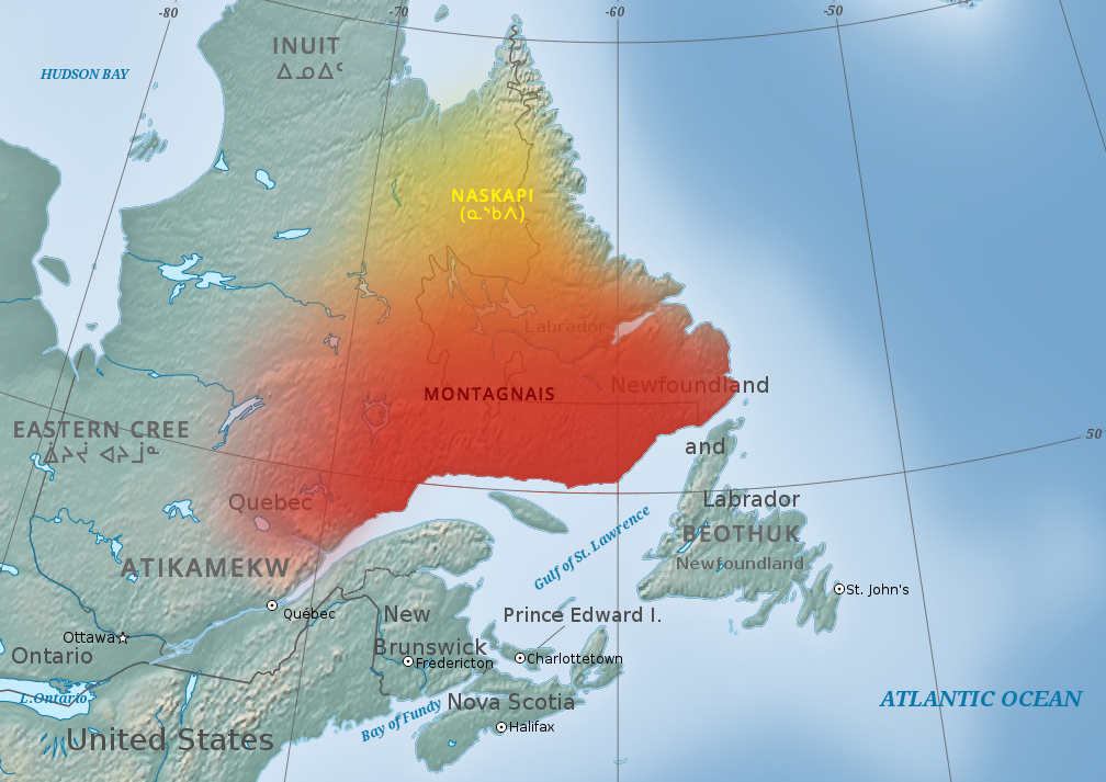
The Innu / Ilnu ("man", "person") or Innut / Innuat / Ilnuatsh ("people"), formerly called Montagnais from the French colonial period ( French for "mountain people", English pronunciation: ), are the Indigenous inhabitants of territory in the northeastern portion of the present-day province of Labrador and some portions of Quebec. They refer to their traditional homeland as ''Nitassinan'' ("Our Land", ᓂᑕᔅᓯᓇᓐ) or ''Innu-assi'' ("Innu Land"). The Innu are divided into several bands, with the Montagnais being the southernmost group and the Naskapi being the northernmost. Their ancestors were known to have lived on these lands as hunter-gatherers for several thousand years. To support their seasonal hunting migrations, they created portable tents made of animal skins. Their subsistence activities were historically centred on hunting and trapping caribou, moose, deer, and small game. Their language, Ilnu-Aimun or Innu-Aimun (popularly known since the French colonia ... [...More Info...] [...Related Items...] OR: [Wikipedia] [Google] [Baidu] |
Duplessis (electoral District)
Duplessis is a provincial electoral district in the Côte-Nord region of Quebec, Canada, that elects members to the National Assembly of Quebec. It notably includes the municipalities of Sept-Îles, Port-Cartier, Havre-Saint-Pierre, Fermont and the community of Maliotenam. It also includes a single municipality from the Nord-du-Québec region: the Naskapi village municipality of Kawawachikamach (not to be confused with the Naskapi reserved land of the same name, which Duplessis also includes, but is in Côte-Nord). It was created for the 1960 election from parts of the Saguenay provincial electoral district. In the change from the 2001 to the 2011 electoral map, it gained the unorganized territories of Caniapiscau and Lac-Juillet from Ungava electoral district. The riding was named after former Quebec Premier Maurice Duplessis who led the province from 1936 to 1939 and from 1944 to 1959 as leader of the Union Nationale. Members of the Legislative Assembly / National A ... [...More Info...] [...Related Items...] OR: [Wikipedia] [Google] [Baidu] |
Area Codes 418 And 581
Area codes 418, 581, and 367 are telephone area codes in the North American Numbering Plan (NANP) for the eastern portion of the Canadian province of Quebec. Area code 418 was originally assigned to the numbering plan area, but all three area codes now form an overlay plan for this territory. Cities in the numbering plan area include Quebec City, Saguenay, Lévis, Rimouski, Saint-Georges, Alma, Thetford Mines, Sept-Îles, Baie-Comeau and Rivière-du-Loup. Also served are the Gaspé Peninsula, Côte-Nord, southeastern Mauricie, and the tiny hamlet of Estcourt Station, in the U.S. state of Maine. History Ontario and Quebec were the only provinces that received assignments of multiple area codes by the American Telephone and Telegraph Company (AT&T) when the original North American area codes were created in 1947. The eastern part of Quebec received area code 418, while area code 514 was assigned for the western part. Nominally, northwestern Quebec, one of the few areas o ... [...More Info...] [...Related Items...] OR: [Wikipedia] [Google] [Baidu] |
Quebec
Quebec ( ; )According to the Canadian government, ''Québec'' (with the acute accent) is the official name in Canadian French and ''Quebec'' (without the accent) is the province's official name in Canadian English is one of the thirteen provinces and territories of Canada. It is the largest province by area and the second-largest by population. Much of the population lives in urban areas along the St. Lawrence River, between the most populous city, Montreal, and the provincial capital, Quebec City. Quebec is the home of the Québécois nation. Located in Central Canada, the province shares land borders with Ontario to the west, Newfoundland and Labrador to the northeast, New Brunswick to the southeast, and a coastal border with Nunavut; in the south it borders Maine, New Hampshire, Vermont, and New York in the United States. Between 1534 and 1763, Quebec was called ''Canada'' and was the most developed colony in New France. Following the Seven Years' War, ... [...More Info...] [...Related Items...] OR: [Wikipedia] [Google] [Baidu] |


