|
Luisenstadt
Luisenstadt () is a former quarter (''Stadtteil'') of central Berlin, now divided between the present localities of Mitte and Kreuzberg. It gave its name to the Luisenstadt Canal and the Luisenstädtische Kirche. History The area of the neighbourhood was originally named ''Myrica'' and was acquired in 1261 by the city of Cölln. Geography Luisenstadt is bounded on the north by the river Spree, in the west by the Lindenstraße (in Friedrichstadt), and in the south by the Landwehrkanal. A smaller part of the zone now belongs to Mitte (in the same-named district) and the greater part to Kreuzberg (in Friedrichshain-Kreuzberg district). Main sights *Emmaus Church * Evangelical-Lutheran (Old-Lutheran) Church * Görlitzer Bahnhof * St. Jacob's Church *Jannowitzbrücke Jannowitz Bridge (German: Jannowitzbrücke) is a bridge over the Spree River in Berlin. The bridge connects Heinrich Heine Straße and Brückenstraße in Mitte with Alexanderplatz. History The bridge was bu ... [...More Info...] [...Related Items...] OR: [Wikipedia] [Google] [Baidu] |
Luisenstädtische Kirche
The Luisenstädtische Kirche was a church building in Berlin, in the former Luisenstadt district (now part of the Berlin-Mitte and Friedrichshain-Kreuzberg districts), on Alte Jacobstraße between Sebastianstraße and Stallschreiberstraße. It was originally known as the ''Kirche in der Cöpenicker Vorstadt'' (church in the Köpenick suburb), then from 1785 to 1795 as the ''Köllnische Vorstadtkirche'' (Cöllnian suburb church), then from 1795 to 1837 as the ''Sebastiankirche'', after presbyter and city-councillor Sebastian Nethe, taking its final name in 1837. History The first church on the site was a simple half-timbered Baroque building designed by Martin Grünberg and constructed in 1694–95, when the outside the Köpenick Gate became a parish of its own. This quickly became dilapidated and was demolished for a new building on the same site, built from 1751 to 1753 and designed by Christian August Naumann (died after 1757) and Johann Gottfried Büring (1723 and after 1788). ... [...More Info...] [...Related Items...] OR: [Wikipedia] [Google] [Baidu] |
Saint Michael's Church, Berlin
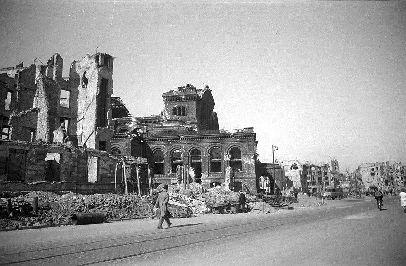
Saint Michael's (german: Sankt-Michael-Kirche) is a former Roman Catholic parish in Berlin, Germany, dedicated to the Archangel Michael. It is noted for its historic church in Mitte (former Luisenstadt), near the border between Berlin-Mitte locality and Kreuzberg. The church was built between 1851 and 1861, and also served as a garrison church for Catholic soldiers. It was heavily damaged by bombing during the Second World War and partially reconstructed in the 1950s. It is protected as a historical monument in Berlin. Site Saint Michael's is located on the Michaelkirchplatz in Engelbecken, which was part of the old Luisenstadt Canal, along which the Berlin Wall ran until German reunification. After the canal's closure in 1926, the space was converted into a park, which offered an uninterrupted view of St Michael's from the south. This view was opened up after the fall of the Berlin Wall, such that the church is once more seen in the way it was originally conceived. ... [...More Info...] [...Related Items...] OR: [Wikipedia] [Google] [Baidu] |
Luisenstadt Canal
The Luisenstadt Canal, or Luisenstädtischer Kanal, is a former canal in Berlin, Germany. It is named after the Luisenstadt district and ran through today's districts of Kreuzberg and Mitte, linking the Landwehr Canal with the Spree River, and serving a central canal basin known as the Engelbecken or Angel's Pool. The canal is named after Queen Louise, the wife of King Friedrich Wilhelm III. The canal was designed by Peter Joseph Lenné based on earlier plans by Johann Carl Ludwig Schmid and was built between 1848 and 1852. Besides its water transport and land drainage and sewage roles, it was also conceived as a design element in the development of the surrounding area, and was designed as a decorative strip, flanked by quays lined with neoclassical buildings. The canal never achieved significant boat traffic, and due to low flow levels its water became stagnant and severely nauseant, also due to the increasing quantity of water coming from sewage network. Between 1926 and 1 ... [...More Info...] [...Related Items...] OR: [Wikipedia] [Google] [Baidu] |
Friedrichstadt (Berlin)
Friedrichstadt was an independent suburb of Berlin, and is now a historical neighbourhood of the city itself. The neighbourhood is named after the Prussian king Frederick I. Geography Friedrichstadt is located south of the Dorotheenstadt neighbourhood, and southwest of the historical suburb of Friedrichswerder. It is located south of the twin-city zone of Berlin and Cölln. Today, the northern part of the neighbourhood is located in the borough of Berlin-Mitte, while the southern part of the neighbourhood is located in borough of Friedrichshain-Kreuzberg. The border between the two boroughs runs along the southern side of Niederkirchnerstraße and Zimmerstraße. The official boundaries of Friedrichstadt extend from the Spittelmarkt starting between northbound streets Niederwall- and Oberwallstraße, along Behrenstraße west to Ebertstraße, and then south over the Potsdamer Platz, Stresemann- and Gitschiner Straße, ending at the Hallesches Tor, and then again north over ... [...More Info...] [...Related Items...] OR: [Wikipedia] [Google] [Baidu] |
Kreuzberg
Kreuzberg () is a district of Berlin, Germany. It is part of the Friedrichshain-Kreuzberg borough located south of Mitte. During the Cold War era, it was one of the poorest areas of West Berlin, but since German reunification in 1990 it has become more gentrified and known for its arts scene. The borough is known for its large percentage of immigrants and descendants of immigrants, many of whom are of Turkish ancestry. As of 2006, 31.6% of Kreuzberg's inhabitants did not have German citizenship. Kreuzberg is noted for its diverse cultural life and experimental alternative lifestyles, and is an attractive area for many, however, some parts of the district are still characterized by higher levels of unemployment. The counterculture tradition of Kreuzberg led to a plurality of votes for the Green Party, which is unique among all Berlin boroughs. Geography Layout Kreuzberg is bounded by the river Spree in the east. The Landwehrkanal flows through Kreuzberg from east to ... [...More Info...] [...Related Items...] OR: [Wikipedia] [Google] [Baidu] |
Berlin
Berlin is Capital of Germany, the capital and largest city of Germany, both by area and List of cities in Germany by population, by population. Its more than 3.85 million inhabitants make it the European Union's List of cities in the European Union by population within city limits, most populous city, as measured by population within city limits having gained this status after the United Kingdom's, and thus London's, Brexit, departure from the European Union. Simultaneously, the city is one of the states of Germany, and is the List of German states by area, third smallest state in the country in terms of area. Berlin is surrounded by the state of Brandenburg, and Brandenburg's capital Potsdam is nearby. The urban area of Berlin has a population of over 4.5 million and is therefore the most populous urban area in Germany. The Berlin/Brandenburg Metropolitan Region, Berlin-Brandenburg capital region has around 6.2 million inhabitants and is Germany's second-largest metropolitan reg ... [...More Info...] [...Related Items...] OR: [Wikipedia] [Google] [Baidu] |
Mitte (locality)
Mitte () (German for "middle" or "center") is a central locality () of Berlin in the eponymous district () of Mitte. Until 2001, it was itself an autonomous district. Mitte proper comprises the historic center of Alt-Berlin centered on the churches of St. Nicholas and St. Mary, the Museum Island, the city hall Rotes Rathaus, the city administrative building Altes Stadthaus, the Fernsehturm, Brandenburg Gate at the end of the central boulevard Unter den Linden and other tourist attractions. For these reasons, Mitte is considered the "heart" of Berlin. History Mitte comprises the historic center of Berlin ( and ). Its history thus corresponds to the history of the entire city until the early 20th century, and with the Greater Berlin Act in 1920 it became the first district of the city. It was among the areas of the city most heavily damaged in World War II. Following a territorial redeployment by the Soviet Union and the United Kingdom that reshaped the borders of W ... [...More Info...] [...Related Items...] OR: [Wikipedia] [Google] [Baidu] |
Cölln
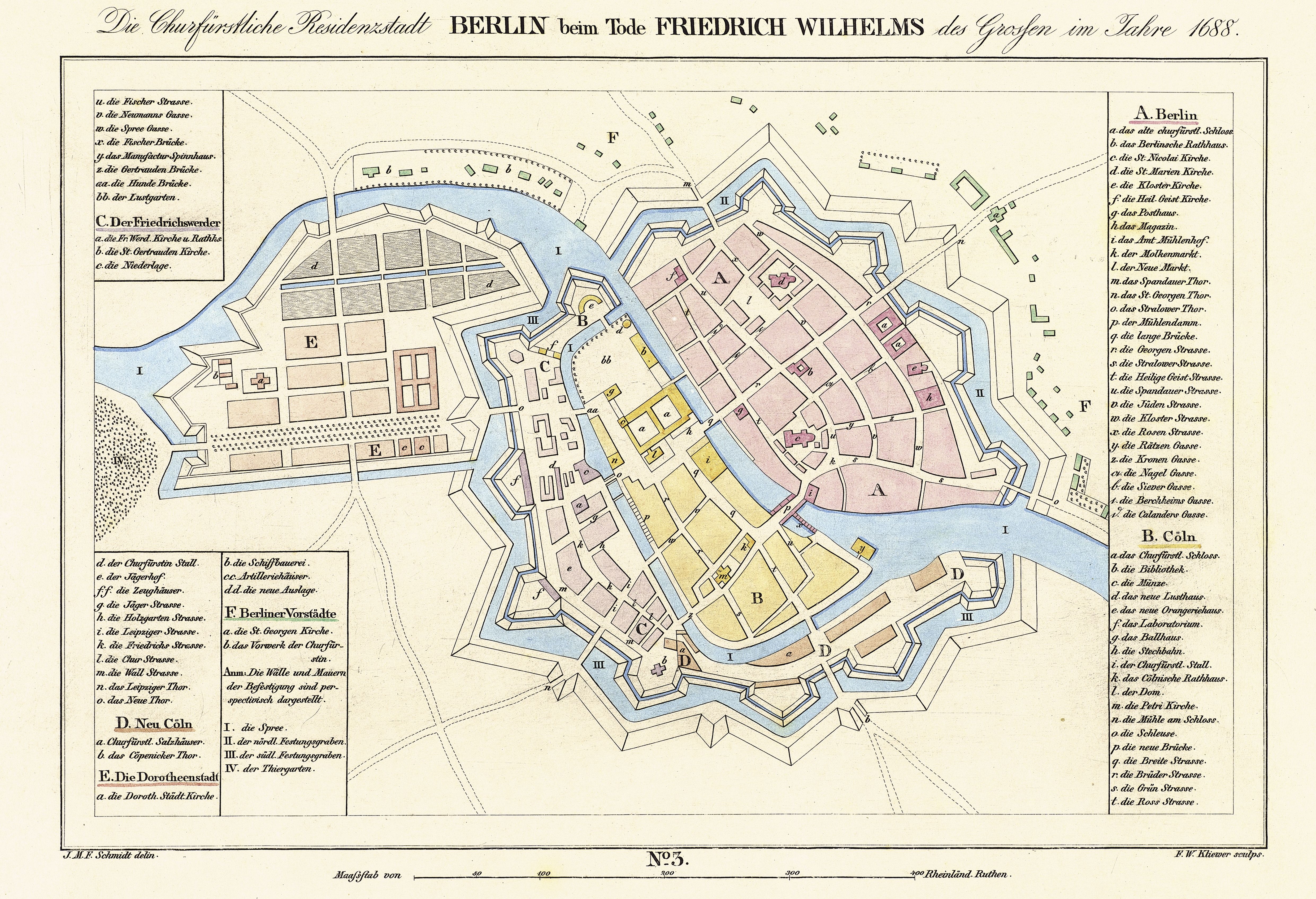
Cölln () was the twin city of Old Berlin ( Altberlin) from the 13th century to the 18th century. Cölln was located on the Fisher Island section of Spree Island, opposite Altberlin on the western bank of the River Spree, until the cities were merged by Frederick I of Prussia to form Berlin in 1710. Today, the former site of Cölln is the historic core of the modern Mitte locality of the Berlin-Mitte borough in central Berlin. History Cölln is first mentioned in a 1237 deed, denoting a priest Symeon of Cölln's (Symeon de Colonia) Saint Peter's Church as a witness. This date is commonly regarded as the origin of Berlin, though Altberlin on the eastern bank of the Spree river was not mentioned before 1244 and parts of modern Greater Berlin, such as Spandau and Köpenick, are even older. Cölln and Altberlin were separated only by the river Spree, linked by the ''Mühlendamm'' causeway, hence there was a close connection right from the start. Since the trade route from Ma ... [...More Info...] [...Related Items...] OR: [Wikipedia] [Google] [Baidu] |
Berlin Görlitzer Bahnhof
Görlitzer Bahnhof was the name of the Berlin railway terminus for the mainline link between the capital, Cottbus in Brandenburg and Görlitz in Lower Silesia (since 1945 Saxony). It stood overlooking Spreewaldplatz in the Outer Luisenstadt, the eastern part of Kreuzberg but wartime bombing and Cold War tensions led to its closure and eventual demolition. The Görlitzer Bahnhof (Berlin U-Bahn) station was named after this historic station and is located on a different site nearby. The rise The station was designed by August Orth, an architect later responsible for the Emmauskirche in nearby Lausitzer Platz, and built between 1865 and 1867 in the Palazzo style of the Italian Renaissance. It formed part of a railway expansion project that would link Berlin with Cottbus and Görlitz, and then ultimately with cities such as Sagan (Żagań) and Breslau (Wrocław) (both in Poland since 1945) and Vienna in Austria. On 13 June 1866 a military train bound for the Austro-Prussian wa ... [...More Info...] [...Related Items...] OR: [Wikipedia] [Google] [Baidu] |
Landwehrkanal
The Landwehr Canal (german: Landwehrkanal), is a canal parallel to the Spree river in Berlin, Germany, built between 1845 and 1850 to plans by Peter Joseph Lenné. It connects the upper part of the Spree at the eastern harbour () in Friedrichshain with its lower part in Charlottenburg, flowing through Kreuzberg and Tiergarten. History Lenné designed a canal with sloped walls, an average width of at the surface and locks near both ends to control the water depth. In the course of two enlargements (1883–1890 and 1936–1941), it reached a breadth of and a depth of . Today the waterway is mainly used by tourist boats and pleasure craft. About The Landwehr Canal leaves the Spree River in the eastern harbour in Friedrichshain, east of the city centre. It immediately descends through the upper lock () and heads in a straight line south west to its junction with the Neukölln Ship Canal, which provides a connection to the Teltow Canal. Here the Landwehr Canal turns no ... [...More Info...] [...Related Items...] OR: [Wikipedia] [Google] [Baidu] |


