|
Lower Saxon Asparagus Road
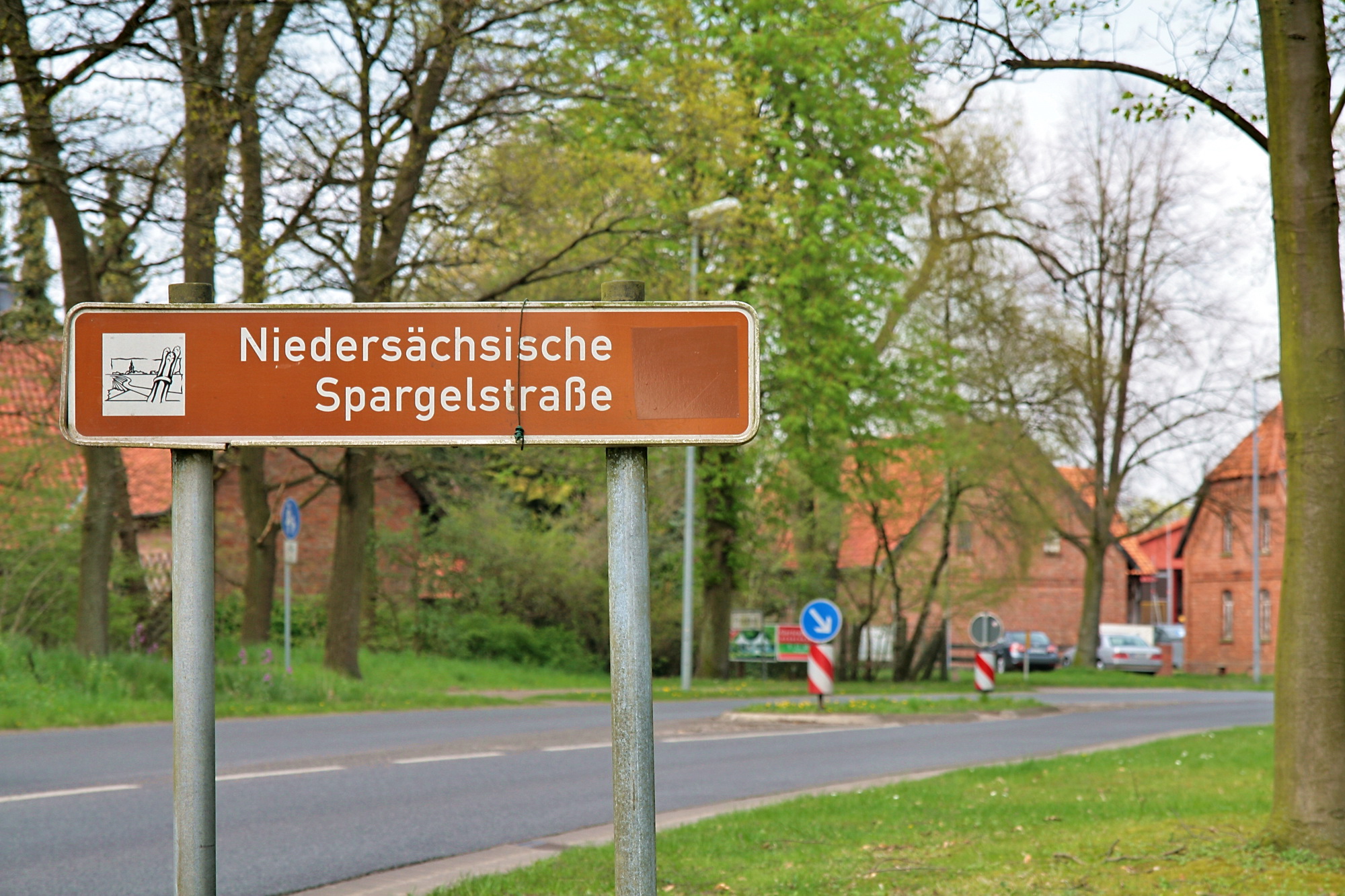
The Lower Saxon Asparagus Road (german: Niedersächsische Spargelstraße) is a tourist route in North Germany that confers recognition of the asparagus as a delicacy in the region. The vegetable is grown in the areas between Brunswick and Lüneburg, between Bremen, Cloppenburg and Vechta, and from Nienburg/Weser via Hoya to Soltau. The Asparagus Road is about long and links the tourist regions of the Lüneburg Heath, Hanover and its environs, Brunswick Land, Middle Weser and the Oldenburg Münsterland. It was initiated by the Lower Saxon Asparagus Road Society (''Verein Niedersächsische Spargelstraße'') and is the equivalent of the German Wine Road, the Lower Saxon Mill Road or the German Fairy Tale Route. Part of the Lower Saxon Asparagus Road runs from Burgdorf via Nienburg/Weser, Bruchhausen-Vilsen and Bassum Bassum (; Northern Low Saxon: ''Bassen'') is a town in the district of Diepholz, Lower Saxony, Germany. It is situated approximately 35 km northeast of ... [...More Info...] [...Related Items...] OR: [Wikipedia] [Google] [Baidu] |
Middle Weser
The Weser () is a river of Lower Saxony in north-west Germany. It begins at Hannoversch Münden through the confluence of the Werra and Fulda. It passes through the Hanseatic city of Bremen. Its mouth is further north against the ports of Bremerhaven and Nordenham. The latter is on the Butjadingen Peninsula. It then merges into the North Sea via two highly saline, estuarine mouths. It connects to the canal network running east-west across the North German Plain. The river, when combined with the Werra (a dialectal form of "Weser"), is long and thus, the longest river entirely situated within Germany (the Main, however, is the longest if the Weser and Werra are not combined). The Weser itself is long. The Werra rises in Thuringia, the German state south of the main projection (tongue) of Lower Saxony. Etymology "Weser" and "Werra" are the same words in different dialects. The difference reflects the old linguistic border between Central and Low German, passing through ... [...More Info...] [...Related Items...] OR: [Wikipedia] [Google] [Baidu] |
Roads In Lower Saxony
A road is a linear way for the conveyance of traffic that mostly has an improved surface for use by vehicles (motorized and non-motorized) and pedestrians. Unlike streets, the main function of roads is transportation. There are many types of roads, including parkways, avenues, controlled-access highways (freeways, motorways, and expressways), tollways, interstates, highways, thoroughfares, and local roads. The primary features of roads include lanes, sidewalks (pavement), roadways (carriageways), medians, shoulders, verges, bike paths (cycle paths), and shared-use paths. Definitions Historically many roads were simply recognizable routes without any formal construction or some maintenance. The Organization for Economic Co-operation and Development (OECD) defines a road as "a line of communication (travelled way) using a stabilized base other than rails or air strips open to public traffic, primarily for the use of road motor vehicles running on their own wheels", wh ... [...More Info...] [...Related Items...] OR: [Wikipedia] [Google] [Baidu] |
German Tourist Routes
German(s) may refer to: * Germany (of or related to) ** Germania (historical use) * Germans, citizens of Germany, people of German ancestry, or native speakers of the German language ** For citizens of Germany, see also German nationality law **Germanic peoples (Roman times) * German language **any of the Germanic languages * German cuisine, traditional foods of Germany People * German (given name) * German (surname) * Germán, a Spanish name Places * German (parish), Isle of Man * German, Albania, or Gërmej * German, Bulgaria * German, Iran * German, North Macedonia * German, New York, U.S. * Agios Germanos, Greece Other uses * German (mythology), a South Slavic mythological being * Germans (band), a Canadian rock band * "German" (song), a 2019 song by No Money Enterprise * ''The German'', a 2008 short film * "The Germans", an episode of ''Fawlty Towers'' * ''The German'', a nickname for Congolese rebel André Kisase Ngandu See also * Germanic (other) ... [...More Info...] [...Related Items...] OR: [Wikipedia] [Google] [Baidu] |
Straße Der Megalithkultur
The Route of Megalithic Culture (german: Straße der Megalithkultur) was first created as a tourist route that meanders from Osnabrück to Oldenburg in North-West Germany. Signposted with brown road signs it links many places of archaeological interest from the Megalithic era. Signs for the route started going up in 2008 and 2009. The whole 310-kilometre-long route was officially opened on 14 May 2009. The route links many sites of archaeological investigation and 33 stations where the public can visit archaeological sites, for example, with standing stones. On the 27th of August 2013, the route became part of the Cultural Route of the Council of Europe initiative, with sections in a growing number of countries, including Denmark, England, Netherlands, Portugal, and Sweden. Route The founding section of the Route of Megalithic Culture runs through the territories of Osnabrück, Ostercappeln, Belm-Vehrte, Wallenhorst, Bramsche, Ankum, Berge, Bippen, Fürstenau, Frere ... [...More Info...] [...Related Items...] OR: [Wikipedia] [Google] [Baidu] |
Sulingen
Sulingen is a town in the district of Diepholz, Lower Saxony, Germany. It is situated approximatively 30 km east of Diepholz, and 45 km south of Bremen. Sister cities * Joniškis, Lithuania People from Sulingen * Walter Momper (born 1945), German politician (SPD) * Liesel Westermann Lieselotte "Liesel" Westermann-Krieg (born Westermann on 2 November 1944; ) is a retired German discus thrower. She held the world record from 5 November 1967 to 12 August 1971, with a two-months break in 1968. She competed for West Germany at ... (born 1944), German discus thrower References Towns in Lower Saxony Diepholz (district) {{Diepholz-geo-stub ... [...More Info...] [...Related Items...] OR: [Wikipedia] [Google] [Baidu] |
Bassum
Bassum (; Northern Low Saxon: ''Bassen'') is a town in the district of Diepholz, Lower Saxony, Germany. It is situated approximately 35 km northeast of Diepholz, and 25 km south of Bremen. Geography Subdivision Besides Bassum proper, the town consists of the following ''Ortschaften'' (villages): * Albringhausen * Apelstedt (with Pannstedt) * Bramstedt (with Bünte and Röllinghausen) * Eschenhausen * Groß Henstedt * Great Ringmar * Hallstedt * Hollwedel (with Dimhausen, Möhlenhof, Hilken, Katenkamp, Nüstedt, Klein and Groß Hollwedel) * Neubruchhausen (with Freidorf) * Nienstedt * Nordwohlde (with Stütelberg, Fesenfeld, Kastendiek, Steinforth, Högenhausen, Kätingen and Pestinghausen) * Osterbinde * Schorlingborstel (with Ebersheide, Lowe and Kolloge) * Stühren * Wedehorn * ''Bassum'' (with Loge, Freudenberg, Klenkenborstel, Hassel, Nienhaus and Nienhaus) Neighbouring municipalities Politics Town council , -style="background:#E9E9E9; ... [...More Info...] [...Related Items...] OR: [Wikipedia] [Google] [Baidu] |
Bruchhausen-Vilsen
Bruchhausen-Vilsen is a municipality in the Diepholz district, in Lower Saxony, Germany. It is situated southeast of Bremen. The nearby communities of Berxen, Bruchhöfen, Bruchmühlen, Dille, Gehlbergen, Heiligenberg, Homfeld, Nenndorf, Riethausen, Stapelshorn, Wöpse, Oerdinghausen, Scholen, Weseloh, Süstedt and Engeln all belong to Bruchhausen-Vilsen. Bruchhausen-Vilsen is also the seat of the ''Samtgemeinde'' ("collective municipality") Bruchhausen-Vilsen. History Bruchhausen-Vilsen originated from the 3 communities of Bruchhausen, Moor and Vilsen. Bruchhausen was first mentioned in 1189, and Vilsen in 1227. In 1870 Moor and Bruchhausen were united. In 1929 Bruchhausen and Vilsen were merged into the community of Bruchhausen-Vilsen. Since 1974 Bruchhausen-Vilsen has been the administrative center of the Samtgemeinde Bruchhausen-Vilsen. In 1976 Bruchhausen-Vilsen was recognized as a health resort. Politics Community Council Municipal Elections of 10 September 2006: * ... [...More Info...] [...Related Items...] OR: [Wikipedia] [Google] [Baidu] |
Burgdorf (Region Hannover)
Burgdorf (Standard German pronunciation: ['bʊʁk.dɔʁf], Low German: Bortörp) is a town in the Hanover Region, in Lower Saxony, Germany. It is situated approximately 22 km northeast of Hanover. Until 1974, Burgdorf was the capital of the Burgdorf district. The town and its surrounding areas are known for the tradition of growing white Asparagus and for breeding Hanoverian horses. Burgdorf hosts a monthly horse market from April to September every year. Geography Burgdorf lies between the city of Hanover and the towns Celle and Peine. It shares borders with Uetze, Lehrte, Isernhagen, Burgwedel and the Celle (district), Celle district. The river Burgdorfer Aue, Aue flows through the town. The landscape is shaped by the Burgdorf-Peine Geest, a mostly flat landscape with low hills and sandy soil. Forests consist mostly of Scots pines, Birch, birch trees and English oaks. The municipal area is surrounded by the Altwarmbüchener and Oldhorster Moor in the west, and the Burgdorf ... [...More Info...] [...Related Items...] OR: [Wikipedia] [Google] [Baidu] |
German Fairy Tale Route
The German Fairy Tale RouteThis is the official name used on the website - se''Portrait'' However, many English sources also call it the "German Fairy Tale Road". (german: Deutsche Märchenstraße) is a tourist attraction in Germany originally established in 1975. With a length of , the route runs from Hanau in central Germany to Bremen in the north. Tourist attractions along the route are focused around the brothers Wilhelm and Jacob Grimm, including locations where they lived and worked at various stages in their life, as well as regions which are linked to the fairy tales found in the Grimm collection, such as The Town Musicians of Bremen. The ''Verein Deutsche Märchenstraße'' society, headquartered in the city of Kassel, is responsible for the route, which travellers can recognize with the help of road signs depicting the heart-shaped body and head of a pretty, princess-like creature. Tourist attractions The German Fairy Tale Route passes through various scenic regions, wh ... [...More Info...] [...Related Items...] OR: [Wikipedia] [Google] [Baidu] |
Lower Saxon Mill Road
The Lower Saxon Mill Road (german: Niedersächsische Mühlenstrasse) is a holiday route that guides visitors to watermills and windmills in the north German state of Lower Saxony and thus links the interests of historic monument conservation with those of the tourist industry. Emblem The mills of the Lower Saxon Mill Road are marked with the emblem (a sketch of the Hüven Mill in the Emsland) of the Lower Saxony and Bremen Mill Association (''Mühlenvereinigung Niedersachsen-Bremen'') and are furnished with an information board that describes both the history and the features of the individual mill. Range The mills on the Lower Saxon Mill Road are of various types: Most of them are watermills and windmills. Some have been converted into homes, others are used as museums or are still in service. Several of the mills can only be viewed externally. In the International Wind- and Watermill Museum at Gifhorn a ship mill may also be visited. There are horse mills in the Cloppenburg an ... [...More Info...] [...Related Items...] OR: [Wikipedia] [Google] [Baidu] |
German Wine Road
The German Wine RouteScheunemann J., Stewart J., Walker N. and Williams C. (2011), ''Back Roads Germany'', Dorling Kindersley, London. . or Wine Road (german: Deutsche Weinstraße) is the oldest of Germany's tourist wine routes. Located in the Palatinate region of the federal state of Rhineland-Palatinate, the route was established in 1935. Geography The German Wine Gate (''Deutsches Weintor'') in Schweigen-Rechtenbach on the French border adjacent to Wissembourg (Weißenburg) in France marks the start of the route. Built in 1936, the gate is an imposing ceremonial gatehouse made of sandstone. , the route traverses the Palatinate wine region (''Pfalz'', formerly ''Rheinpfalz'') which lies in the lee of the Haardt Mountains, an area known as Anterior Palatinate (''Vorderpfalz''). The route runs northward, beside the path of Bundesstraßen B 38 and B 271 for 85 km, passing through towns like Bad Bergzabern, Edenkoben, Neustadt an der Weinstraße, Deidesheim, ... [...More Info...] [...Related Items...] OR: [Wikipedia] [Google] [Baidu] |


