|
Lourinhã Formation
The Lourinhã Formation () is a fossil rich geological formation in western Portugal, named for the municipality of Lourinhã. The formation is mostly Late Jurassic in age (Kimmeridgian/Tithonian), with the top of the formation extending into the earliest Cretaceous (Berriasian). It is notable for containing a fauna especially similar to that of the Morrison Formation in the United States and a lesser extent to the Tendaguru Formation in Tanzania. There are also similarities to the nearby Villar del Arzobispo Formation. The stratigraphy of the formation and the basin in general is complex and controversial, with the constituent member beds belonging to the formation varying between different authors. Besides the fossil bones, Lourinhã Formation is well known for the fossil tracks and fossilized dinosaur eggs. The Lourinhã Formation includes several lithostratigraphic units, such as Praia da Amoreira-Porto Novo Members and Praia Azul Member and the Assenta Member. Lithology and ... [...More Info...] [...Related Items...] OR: [Wikipedia] [Google] [Baidu] |
Geological Formation
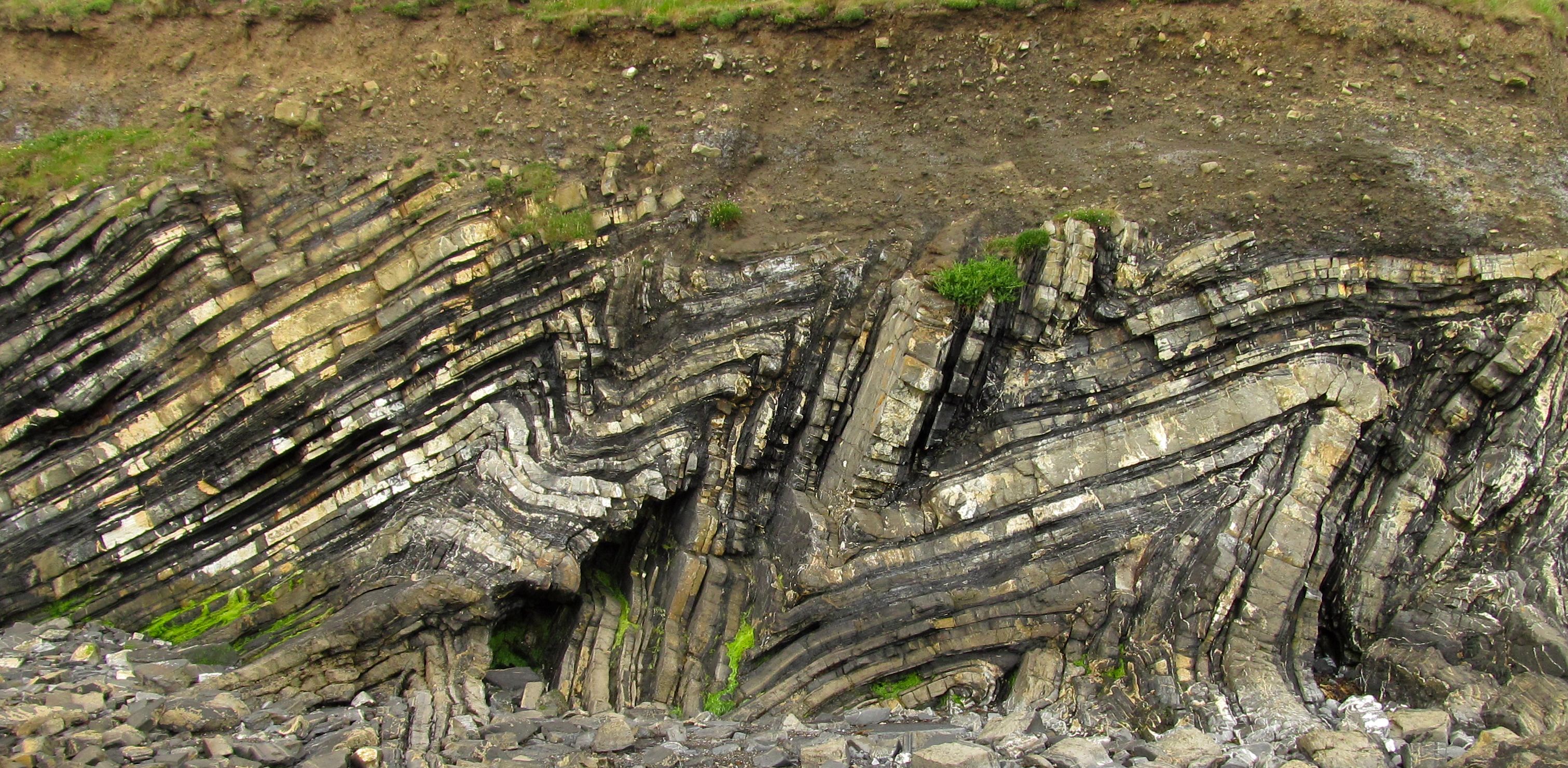
A geological formation, or simply formation, is a body of rock having a consistent set of physical characteristics ( lithology) that distinguishes it from adjacent bodies of rock, and which occupies a particular position in the layers of rock exposed in a geographical region (the stratigraphic column). It is the fundamental unit of lithostratigraphy, the study of strata or rock layers. A formation must be large enough that it can be mapped at the surface or traced in the subsurface. Formations are otherwise not defined by the thickness of their rock strata, which can vary widely. They are usually, but not universally, tabular in form. They may consist of a single lithology (rock type), or of alternating beds of two or more lithologies, or even a heterogeneous mixture of lithologies, so long as this distinguishes them from adjacent bodies of rock. The concept of a geologic formation goes back to the beginnings of modern scientific geology. The term was used by Abraham Gottlob Wer ... [...More Info...] [...Related Items...] OR: [Wikipedia] [Google] [Baidu] |
Tendaguru Formation
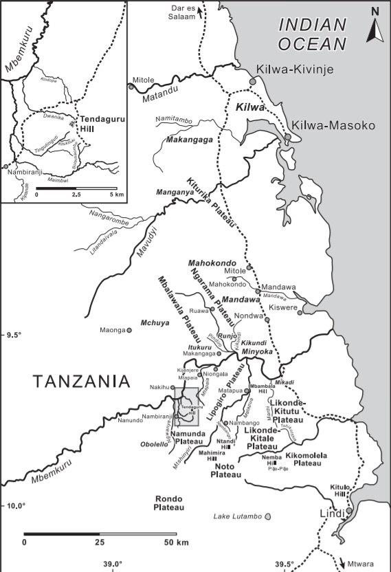
The Tendaguru Formation, or Tendaguru Beds are a highly fossiliferous formation and Lagerstätte located in the Lindi Region of southeastern Tanzania. The formation represents the oldest sedimentary unit of the Mandawa Basin, overlying Neoproterozoic basement, separating by a long hiatus and unconformity. The formation reaches a total sedimentary thickness of more than . The formation ranges in age from the late Middle Jurassic to the Early Cretaceous, Oxfordian to Hauterivian stages, with the base of the formation possibly extending into the Callovian. The Tendaguru Formation is subdivided into six members; from oldest to youngest Lower Dinosaur Member, the ''Nerinella'' Member, the Middle Dinosaur Member, ''Indotrigonia africana'' Member, the Upper Dinosaur Member, and the ''Rutitrigonia bornhardti-schwarzi'' Member. The succession comprises a sequence of sandstones, shales, siltstones, conglomerates with minor oolitic limestones, deposited in an overall shallow marine to c ... [...More Info...] [...Related Items...] OR: [Wikipedia] [Google] [Baidu] |
Ridge
A ridge or a mountain ridge is a geographical feature consisting of a chain of mountains or hills that form a continuous elevated crest for an extended distance. The sides of the ridge slope away from the narrow top on either side. The lines along the crest formed by the highest points, with the terrain dropping down on either side, are called the ridgelines. Ridges are usually termed hills or mountains as well, depending on size. Smaller ridges, especially those leaving a larger ridge, are often referred to as spurs. Types There are several main types of ridges: ;Dendritic ridge: In typical dissected plateau terrain, the stream drainage valleys will leave intervening ridges. These are by far the most common ridges. These ridges usually represent slightly more erosion resistant rock, but not always – they often remain because there were more joints where the valleys formed or other chance occurrences. This type of ridge is generally somewhat random in orientation, often ... [...More Info...] [...Related Items...] OR: [Wikipedia] [Google] [Baidu] |
Horst (geology)
In physical geography and geology, a horst is a raised fault block bounded by Fault (geology), normal faults. Horsts are typically found together with Graben, grabens. While a horst lifted or remains stationary, the grabens on either side Subsidence, subside. This is often caused by Extensional tectonics, extensional forces pulling apart the crust. Horsts may represent features such as plateaus, mountains, or ridges on either side of a valley. Horsts can range in size from small fault-blocks, up to large regions of stable continent that have not been not folded or warped by tectonic forces. The word ''Horst'' in German language, German means "mass" or "heap," and was first used in the geological sense in 1883 by Eduard Suess in ''The Face of the Earth.''Originally published in 1883 in German as "Das Antlitz der Erde", translated and published in English in 1904 Geomorphology Horsts may have either symmetrical or asymmetrical cross-sections. If the normal faults to either side ... [...More Info...] [...Related Items...] OR: [Wikipedia] [Google] [Baidu] |
Berlengas
The Berlengas are a Portuguese archipelago consisting of small Atlantic islands off the coast of Peniche, Portugal, in the Oeste region. These islands were traditionally known to British mariners as "the Burlings". The only inhabited island is its largest island, Berlenga Grande, although there is currently no permanent habitation in the archipelago. The other islands are grouped into two groups of islets, the Estelas Islets and the Farilhões-Forcados Islets. History Human occupation on Berlenga Grande dates back to antiquity: the islands are referred to in Ptolemy's ''Geography'' as Λονδοβρίς (''Londobris''). Much later it was referred to as the island of ''Saturno'' by Roman geographers, and was visited successively by Muslims, Vikings and privateers. The islands are thought to be a former sacred place adopted by the Phoenicians in the first millennium BC where the cult of Baal- Melqart was celebrated. In 1513, with the support of Queen Eleanor of Viseu, monks ... [...More Info...] [...Related Items...] OR: [Wikipedia] [Google] [Baidu] |
Galicia (Spain)
Galicia (; gl, Galicia or ; es, Galicia}; pt, Galiza) is an autonomous community of Spain and historic nationality under Spanish law. Located in the northwest Iberian Peninsula, it includes the provinces of A Coruña, Lugo, Ourense, and Pontevedra. Galicia is located in Atlantic Europe. It is bordered by Portugal to the south, the Spanish autonomous communities of Castile and León and Asturias to the east, the Atlantic Ocean to the west, and the Cantabrian Sea to the north. It had a population of 2,701,743 in 2018 and a total area of . Galicia has over of coastline, including its offshore islands and islets, among them Cíes Islands, Ons, Sálvora, Cortegada Island, which together form the Atlantic Islands of Galicia National Park, and the largest and most populated, A Illa de Arousa. The area now called Galicia was first inhabited by humans during the Middle Paleolithic period, and takes its name from the Gallaeci, the Celtic people living north of the Douro Rive ... [...More Info...] [...Related Items...] OR: [Wikipedia] [Google] [Baidu] |
Intercalation (geology)
In geology, interbedding occurs when beds (layers of rock) of a particular lithology lie between or alternate with beds of a different lithology. For example, sedimentary rocks may be interbedded if there were sea level variations in their sedimentary depositional environment. Intercalation is a special case of interbedding where a layer is variably inserted into an already existing sequence; or where two separate depositional environments in close spatial proximity migrate alternately across the contact. While interbedding has layers that are horizontally flat (or aligned with the angle of the entire stratum), intercalated rock on the other hand has slanted layers that streak through each other (even when it aligns with the stratum). For example intercalated conglomerate and sandstone looks like ripples of different material networked through each other somewhat off the horizontal, as the beds are deposited in a gradient. This is likely due to differing fluvial conditions a ... [...More Info...] [...Related Items...] OR: [Wikipedia] [Google] [Baidu] |
Siliciclastic
Siliciclastic (or ''siliclastic'') rocks are clastic noncarbonate sedimentary rocks that are composed primarily of silicate minerals, such as quartz or clay minerals. Siliciclasic rock types include mudrock, sandstone Sandstone is a clastic sedimentary rock composed mainly of sand-sized (0.0625 to 2 mm) silicate grains. Sandstones comprise about 20–25% of all sedimentary rocks. Most sandstone is composed of quartz or feldspar (both silicates) ..., and conglomerate. Siliciclastic sediments are silica-based sediments, lacking carbon compounds, which are formed from pre-existing rocks, by breakage, transportation and redeposition to form sedimentary rock.Oilfield Glossary: siliciclastic sediment. Retrieved 23 August 2018. References ...[...More Info...] [...Related Items...] OR: [Wikipedia] [Google] [Baidu] |
Syn-rift
In geology, a rift is a linear zone where the lithosphere is being pulled apart and is an example of extensional tectonics. Typical rift features are a central linear downfaulted depression, called a graben, or more commonly a half-graben with normal faulting and rift-flank uplifts mainly on one side. Where rifts remain above sea level they form a rift valley, which may be filled by water forming a rift lake. The axis of the rift area may contain volcanic rocks, and active volcanism is a part of many, but not all, active rift systems. Major rifts occur along the central axis of most mid-ocean ridges, where new oceanic crust and lithosphere is created along a divergent boundary between two tectonic plates. ''Failed rifts'' are the result of continental rifting that failed to continue to the point of break-up. Typically the transition from rifting to spreading develops at a triple junction where three converging rifts meet over a hotspot. Two of these evolve to the point of ... [...More Info...] [...Related Items...] OR: [Wikipedia] [Google] [Baidu] |
Early Jurassic
The Early Jurassic Epoch (geology), Epoch (in chronostratigraphy corresponding to the Lower Jurassic series (stratigraphy), Series) is the earliest of three epochs of the Jurassic Period. The Early Jurassic starts immediately after the Triassic-Jurassic extinction event, 201.3 Ma (million years ago), and ends at the start of the Middle Jurassic 174.1 Ma. Certain rocks of marine origin of this age in Europe are called "Lias Group, Lias" and that name was used for the period, as well, in 19th-century geology. In southern Germany rocks of this age are called Black Jurassic. Origin of the name Lias There are two possible origins for the name Lias: the first reason is it was taken by a geologist from an England, English quarryman's dialect pronunciation of the word "layers"; secondly, sloops from north Cornwall, Cornish ports such as Bude would sail across the Bristol Channel to the Vale of Glamorgan to load up with rock from coastal limestone quarries (lias limestone from S ... [...More Info...] [...Related Items...] OR: [Wikipedia] [Google] [Baidu] |
Late Triassic
The Late Triassic is the third and final epoch (geology), epoch of the Triassic geologic time scale, Period in the geologic time scale, spanning the time between annum, Ma and Ma (million years ago). It is preceded by the Middle Triassic Epoch and followed by the Early Jurassic Epoch. The corresponding series (stratigraphy), series of rock beds is known as the Upper Triassic. The Late Triassic is divided into the Carnian, Norian and Rhaetian Geologic time scale, Ages. Many of the first dinosaurs evolved during the Late Triassic, including ''Plateosaurus'', ''Coelophysis'', and ''Eoraptor''. The Triassic–Jurassic extinction event began during this epoch and is one of the five major mass extinction events of the Earth. Etymology The Triassic was named in 1834 by Friedrich August von Namoh, Friedrich von Alberti, after a succession of three distinct rock layers (Greek meaning 'triad') that are widespread in southern Germany: the lower Buntsandstein (colourful sandstone'')'', t ... [...More Info...] [...Related Items...] OR: [Wikipedia] [Google] [Baidu] |
Opening Of The North Atlantic Ocean
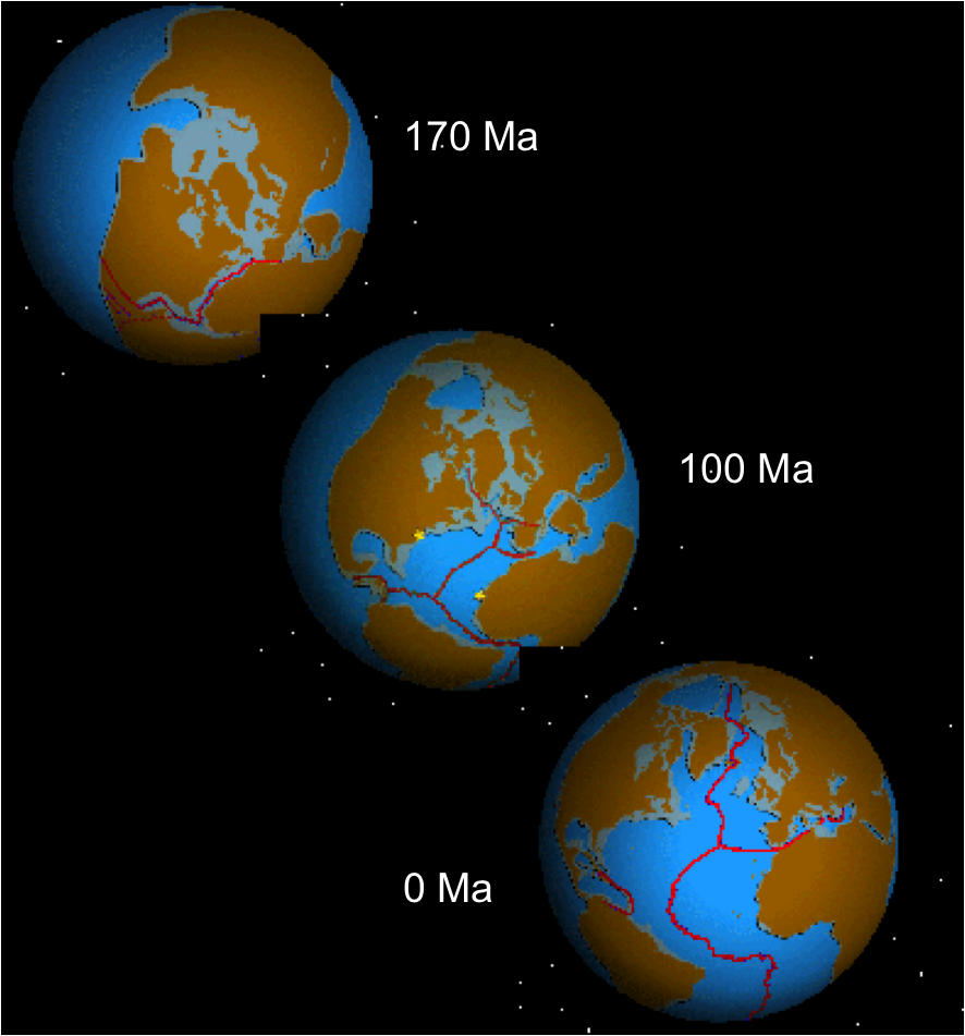
The opening of the North Atlantic Ocean is a geological event that has occurred over millions of years, during which the supercontinent Pangea broke up. As modern-day Europe (Eurasian plate) and North America (North American Plate) separated during the final breakup of Pangea in the early Cenozoic Era, they formed the North Atlantic Ocean. Geologists believe the breakup occurred either due to primary processes of the Iceland plume or secondary processes of lithospheric extension from plate tectonics. Description Rocks from the North Atlantic Igneous Province have been found in Greenland, the Irminger Basin, Faroe Islands, Vøring Plateau (off Norway), Faroe-Shetland Basin, Hebrides, Outer Moray Firth and Denmark. The supercontinent known as Pangea existed during the late Paleozoic and early Mesozoic eras and began to rift around 200 million years ago. Pangea had three major phases of breakup. The first major phase began in the Early-Middle Jurassic, taking place between North A ... [...More Info...] [...Related Items...] OR: [Wikipedia] [Google] [Baidu] |


