|
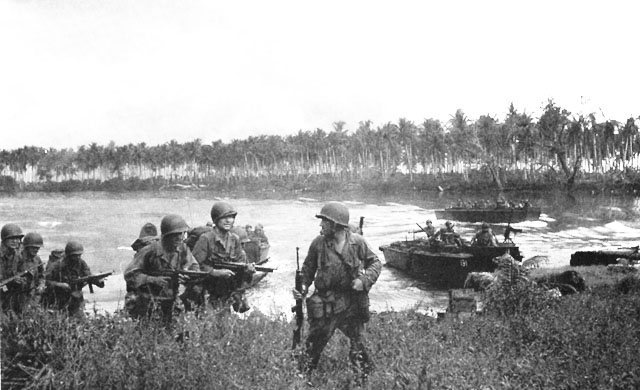
Lou Island
Lou Island is an island of the Admiralty Islands, part of the Bismarck Archipelago, located in northern Papua New Guinea Papua New Guinea (abbreviated PNG; , ; tpi, Papua Niugini; ho, Papua Niu Gini), officially the Independent State of Papua New Guinea ( tpi, Independen Stet bilong Papua Niugini; ho, Independen Stet bilong Papua Niu Gini), is a country i .... Lou Island has four main villages: Rei, Lako, Baon and Solang. Admiralty Islands Islands of Papua New Guinea {{ManusProvince-geo-stub ... [...More Info...] [...Related Items...] OR: [Wikipedia] [Google] [Baidu] |
Admiralty Islands
The Admiralty Islands are an archipelago group of 18 islands in the Bismarck Archipelago, to the north of New Guinea in the South Pacific Ocean. These are also sometimes called the Manus Islands, after the largest island. These rainforest-covered islands form part of Manus Province, the smallest and least-populous province of Papua New Guinea, in its Islands Region. The total area is . Many of the Admiralty Islands are atolls and uninhabited. Islands The larger islands in the center of the group are Manus Island and Los Negros Island. The other larger islands are Tong Island, Pak Island, Rambutyo Island, Lou Island, and Baluan Island to the east, Mbuke Island to the south and Bipi Island to the west of Manus Island. Other islands that have been noted as significant places in the history of Manus include Ndrova Island, Pitylu Island and Ponam Island. Geography The temperature of the Admiralty Islands varies little throughout the year, reaching daily highs of and at night. ... [...More Info...] [...Related Items...] OR: [Wikipedia] [Google] [Baidu] |
Bismarck Archipelago
The Bismarck Archipelago (, ) is a group of islands off the northeastern coast of New Guinea in the western Pacific Ocean and is part of the Islands Region of Papua New Guinea. Its area is about 50,000 square km. History The first inhabitants of the archipelago arrived around 30–40,000 years ago. They may have traveled from New Guinea, by boat across the Bismarck Sea or via a temporary land bridge, created by an uplift in the Earth's Crust (geology), crust. Later arrivals included the Lapita people. The first European to visit these islands was Dutch explorer Willem Schouten in 1616. The islands remained unsettled by western Europeans until they were annexed as part of the German protectorate of German New Guinea in 1884. The area was named in honour of the Chancellor of Germany (German Reich), Chancellor Otto von Bismarck. On 1888 Ritter Island eruption and tsunami, 13 March 1888, a volcano erupted on Ritter Island causing a megatsunami. Almost the entire volcano fell into t ... [...More Info...] [...Related Items...] OR: [Wikipedia] [Google] [Baidu] |
Papua New Guinea
Papua New Guinea (abbreviated PNG; , ; tpi, Papua Niugini; ho, Papua Niu Gini), officially the Independent State of Papua New Guinea ( tpi, Independen Stet bilong Papua Niugini; ho, Independen Stet bilong Papua Niu Gini), is a country in Oceania that comprises the eastern half of the island of New Guinea and its offshore islands in Melanesia (a region of the southwestern Pacific Ocean north of Australia). Its capital, located along its southeastern coast, is Port Moresby. The country is the world's third largest island country, with an area of . At the national level, after being ruled by three external powers since 1884, including nearly 60 years of Australian administration starting during World War I, Papua New Guinea established its sovereignty in 1975. It became an independent Commonwealth realm in 1975 with Elizabeth II as its queen. It also became a member of the Commonwealth of Nations in its own right. There are 839 known languages of Papua New Guinea, one of ... [...More Info...] [...Related Items...] OR: [Wikipedia] [Google] [Baidu] |
Manus Province
Manus Province is the smallest province in Papua New Guinea in terms of both land area and population, with a land area of , but with more than of water, and the total population is 60,485 (2011 census). The provincial town of Manus is Lorengau. The province consists of only one district (Manus District; with identical boundaries to those of the province), 12 Local Level Governments (LLGs) and 127 Wards. The province is made up of the Admiralty Islands (a group of 18 islands in the Bismarck Archipelago), as well as Wuvulu Island and nearby atolls in the west, which collectively are referred to as the Western Islands. The largest island in the group is Manus Island, where Lorengau and a former Australian immigration detention centre are located. Flag The Manus friarbird, known locally as the chauka, is represented on the Manus provincial flag. Designer of the Manus Province flag Luke Bulei explained his reasons for its design in 1977: chauka is only found in the Manus provinc ... [...More Info...] [...Related Items...] OR: [Wikipedia] [Google] [Baidu] |

