|
Longstone, Edinburgh
Longstone is a suburb of Edinburgh in Scotland. The area is primarily residential in nature, although the area includes several small shops, eateries and supermarkets, as well as one of the main bus depots for the city's buses. The population of Longstone (including Saughton) was 4,678 in 2019. History For much of its early history, Longstone was used for agricultural purposes, with three farms being recorded in the 18th century. Inglis Green Road and manor house lie on the border between Longstone and Slateford. The name Inglis Green was given in 1773 when George Inglis of Redhall leased the land to a local businessman for use as a cloth Bleaching Green. The area was formerly the site of a pre-18th century farmstead known as Gray's Mill Farm (used very briefly as a temporary headquarters by Charles Edward Stuart in September 1745) and subsequently developed as a mill and then as a laundry until closing in 1983. In the Victorian period, Longstone was classed as a hamlet in the ... [...More Info...] [...Related Items...] OR: [Wikipedia] [Google] [Baidu] |
City Of Edinburgh
The City of Edinburgh Council is the local government authority for the city of Edinburgh, capital of Scotland. With a population of in mid-2019, it is the second most populous local authority area in Scotland. In its current form, the council was created in 1996 under the Local Government etc. (Scotland) Act 1994, to replace the City of Edinburgh District Council of the Lothian region, which had, itself, been created in 1975. The history of local government in Edinburgh, however, stretches back much further. Around 1130, David I made the town a royal burgh and a burgh council, based at the Old Tolbooth is recorded continuously from the 14th century. The council is currently based in Edinburgh City Chambers with a main office nearby at Waverley Court. History Before 1368 the city was run from a pretorium (a Latin term for Tolbooth), and later from around 1400 from the Old Tolbooth next to St Giles' Cathedral. A Tolbooth is the main municipal building of a Scottish bur ... [...More Info...] [...Related Items...] OR: [Wikipedia] [Google] [Baidu] |
HM Prison Edinburgh
His Majesty's Prison Edinburgh is located in the west of Edinburgh on the main A71, in an area now known as Stenhouse, and, although never named as such, has commonly been known as Saughton Prison from the old name for the general area. The prison is situated on the edge of a predominantly residential area and has good transport and road links to the city centre, which provides good access both for local courts and prison visitors. The building of the prison began on 31 July 1914 with the first prisoner being received in 1919. The prison consists of four halls: Glenesk, Hermiston, Ingliston and Ratho. The prison receives inmates from the courts in Edinburgh, the Lothians and the Borders. The prison manages adult male and female individuals including those on remand, short term sentences (serving less than 4 years), long term sentences (serving 4 years or more), life sentence prisoners and extended sentence prisoners (Order of Life Long Restrictions). Healthcare As of 1 No ... [...More Info...] [...Related Items...] OR: [Wikipedia] [Google] [Baidu] |
Lothian Buses
Lothian Buses is a major bus operator based in Edinburgh, Scotland. It is the largest municipal bus company in the United Kingdom: the City of Edinburgh Council (through Transport for Edinburgh) owns 91%, Midlothian Council 5%, East Lothian Council 3% and West Lothian Council 1%. Lothian operates the majority of bus services in Edinburgh, and is a significant operator in East Lothian, Midlothian and most recently West Lothian. It operates a comprehensive night bus network, three routes to Edinburgh Airport, and owns the subsidiary companies Lothian Country, East Coast Buses, Edinburgh Bus Tours and Lothian Motorcoaches. History The company can trace its history back to the ''Edinburgh Street Tramways Company'' of 1871, also involving at various times the tramway companies of ''Leith'', ''Musselburgh'' and ''Edinburgh North''. The City Council (''Edinburgh Corporation Tramways'' Department) took over operation of the tramways in 1919, at which time most of the system was c ... [...More Info...] [...Related Items...] OR: [Wikipedia] [Google] [Baidu] |
Longstone Bus Depot - Geograph
Longstone or Long Stone may refer to Places *Longstone, Edinburgh, a suburb of Edinburgh, Scotland * Longstone, County Armagh, a townland in County Armagh, Northern Ireland * Longstone, Cornwall, a hamlet in Cornwall, England * Longstone, Isles of Scilly, a place in the Isles of Scilly, Cornwall, England * Longstone, Somerset, a location in England * Longstone, St Ives, a location in Cornwall, England *Great Longstone and Little Longstone, two villages in Derbyshire, England *Longstone Lighthouse, a lighthouse on Longstone Rock, Farne Islands, Northumberland, England Prehistoric * The Longstone, Mottistone, a standing stone on the Isle of Wight, England *The Longstones, two standing stones near Beckhampton, Wiltshire, England * Longstone Rath, a prehistoric ringfort with a standing stone near Cullen, Co. Tipperary, Ireland *Boswens Menhir, Cornwall, England, also known as the Long Stone *The Long Stone, a standing stone on Shovel Down, Dartmoor, England Other *Longstone (band), an ... [...More Info...] [...Related Items...] OR: [Wikipedia] [Google] [Baidu] |
Sighthill/Gorgie (Edinburgh Ward)
Sighthill/Gorgie is one of the seventeen wards used to elect members of the City of Edinburgh Council, established in 2007 along with the other wards. Its territory comprises a corridor of land in the west of the city with a northern boundary formed by the railway lines between the and stations, encompassing the Broomhouse, Dalry, Gorgie, Longstone, Parkhead, Saughton, Sighthill and Stenhouse neighbourhoods. It elects four Councillors (a minor boundary change in 2017 caused the loss of the Calders neighbourhood and the northern parts of Wester Hailes, with a small decrease in population but no change to the number of councillors). In 2019, the ward had a population of 33,826. Councillors Election Results 2022 Election 2022 City of Edinburgh Council election 2017 Election 2017 City of Edinburgh Council election On 4 July 2018, Conservative councillor Ashley Graczyk resigned from the party and became an Independent, saying the UK government's policie ... [...More Info...] [...Related Items...] OR: [Wikipedia] [Google] [Baidu] |
Water Of Leith
The Water of Leith (Scottish Gaelic: ''Uisge Lìte'') is the main river flowing near central Edinburgh, Scotland, and flows into the port of Leith where it flows into the sea via the Firth of Forth. Name The name ''Leith'' may be of Brittonic origin and derived from ''*lejth'' meaning 'damp, moist' (Welsh ''llaith''). It is less likely that the name derives from the Old Norse ''lodda'' meaning a river. The Gaelic form of the name is ''Lìte'' (Leith), with ''Uisge Lìte'' being the full translation of "Water of Leith". The ''Dictionary of the Scots Language'' defines the term "water" here as "''A large stream, usu. thought of as intermediate in size between a Burn and a river''" Course It is long and rises in the Colzium Springs at Millstone Rig of the Pentland Hills. It travels through Harperrig Reservoir, past the ruins of Cairns Castle, through Balerno, Currie, Juniper Green, Colinton, Slateford, Longstone, Saughton, Balgreen, Roseburn, West Coates a ... [...More Info...] [...Related Items...] OR: [Wikipedia] [Google] [Baidu] |
Union Canal (Scotland)
The Union Canal, full name the Edinburgh and Glasgow Union Canal, is a canal in Scotland, running from Falkirk to Edinburgh, constructed to bring minerals, especially coal, to the capital. It was opened in 1822 and was initially successful, but the construction of railways, particularly the Edinburgh and Glasgow Railway, which opened in 1842, diminished its value as a transport medium. It fell into slow commercial decline and was closed to commercial traffic in 1933. It was officially closed in 1965. The canal is listed as three individual scheduled monuments by Historic Scotland according to the three former counties, Midlothian, West Lothian and Stirlingshire, through which it flows. It has benefited from a general revival of interest in canals and, as a result of the Millennium Link, was reopened in 2001 and reconnected to the Forth and Clyde Canal in 2002 by the Falkirk Wheel. It is now in popular use for leisure purposes. History Proposal The canal was conceived with ... [...More Info...] [...Related Items...] OR: [Wikipedia] [Google] [Baidu] |
Slateford Aqueduct
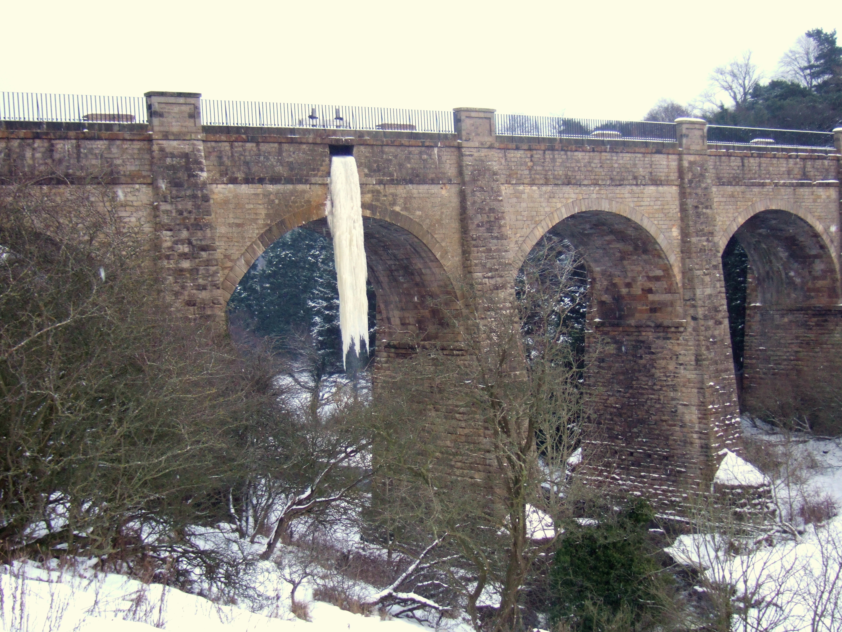
The Slateford Aqueduct is a navigable aqueduct that carries the Union Canal over the Water of Leith at Slateford, Edinburgh, Scotland. Completed in 1822, it has eight arches and spans a length of . History It was designed by Hugh Baird with advice from Thomas Telford and is modelled on Telford's Chirk Aqueduct. Different parts of the canal were tendered to contractors at different times, and the masonry for the Slateford Aqueduct was advertised to builders on 2 March 1818. Baird wrote to Telford regarding the ironwork, as he had received a visit from James Thomson, representing the company of William Hazledine, who had worked on the Pontcysyllte Aqueduct. Baird was unsure about using a contractor based so far away, and also as to whether the contract should just be for the delivery of the plates or the delivery and assembly. On 3 April 1818, Hugh McIntosh was chosen to construct the aqueduct, as he was the contractor for the east end of the canal. After Thomson sent an es ... [...More Info...] [...Related Items...] OR: [Wikipedia] [Google] [Baidu] |
Slateford
Slateford ( gd, Àth na Sglèata) is an area of Edinburgh, the capital of Scotland. It is east of the Water of Leith. The former village of Slateford lies on the Lanark Road where it crosses the Water of Leith, south west of Slateford Station. The name "Slateford" comes from local rock found in the area and the old fording point on the Water of Leith that the village grew round. In 1882 it had a post office with money order savings bank and telegraph departments, a police station, a Good Templars Hall, School, U.P. Church and the extensive bleachfields of Inglis Green. The village was crossed by the Union Canal Slateford Aqueduct in 1822 and a few years later the 14-arch viaduct carrying the Caledonian railway line. The situe of the Canal, Road and Rail bridges capture all three modes of transport together still to this day. In 1952 and later in 1967 major road widening projects removed all but a few of the original cottages, though Slateford House, School (Now the headquarte ... [...More Info...] [...Related Items...] OR: [Wikipedia] [Google] [Baidu] |
Stenhouse, Edinburgh
Stenhouse is a suburb of Edinburgh, the capital of Scotland. It lies to the west of the City Centre, adjacent to Whitson and Saughton Mains and close to Broomhouse and Chesser. It is a mainly residential area. The area derives its name from the Stanhope or Stenhope family who held land and mills near the Water of Leith from 1511 to 1621. Early references are variously to Stennop Milne (1576), Stanehope mylnes (1578), Stanehopps (1585), Stenhopmilne (1630) until, in 1773, the name Stenhouse Mill appears. The oldest building, now known as Stenhouse Mansion, lies to the south of the area. The house was probably originally built by the Stenhopes but it was substantially rebuilt and extended by Patrick Ellis, an Edinburgh burgess and merchant, in 1623 according to datestone over the main entrance with his initials and the Ellis heraldry as described by George Mackenzie. It was restored in 1965 and used as a centre for conservation of paintings and carved stones for Historic Sco ... [...More Info...] [...Related Items...] OR: [Wikipedia] [Google] [Baidu] |
Saughton
Saughton () ( sco, Sauchtoun) ( gd, Baile nan Seileach) is a suburb of the west of Edinburgh, Scotland, bordering Broomhouse, Stenhouse, Longstone and Carrick Knowe. In Lowland Scots, a "sauch" is a willow. The Water of Leith flows by here. It is best known for its prison, known officially as "HM Prison Edinburgh", but colloquially as "Saughton Prison", which lies to the south of the district. The Calder Road, one of the main city arteries, runs through it. More recently Saughton Park has become home to an acclaimed outdoor concrete skatepark Actually situated in the Broomhouse area and fronting on Broomhouse Drive, Saughton House is a large Government office, said to have been built in the 1950s, which houses the Scottish Government, Scottish Courts Service and a number of other Government offices. Transport Tram Saughton tram stop is adjacently south of the main Glasgow to Edinburgh railway line, close to the junction of Broomhouse Drive and Saughton Road Nort ... [...More Info...] [...Related Items...] OR: [Wikipedia] [Google] [Baidu] |
Parkhead, Edinburgh
Parkhead is a residential area of Edinburgh, the capital of Scotland. It was one of the smallest wards Ward may refer to: Division or unit * Hospital ward, a hospital division, floor, or room set aside for a particular class or group of patients, for example the psychiatric ward * Prison ward, a division of a penal institution such as a priso ... in the Edinburgh City Council before a reorganisation into larger multi-member wards in 2007; since then it has been part of the Sighthill/Gorgie ward. Located about south-west of the city centre, the area was built in 1940s and contains low-rise houses, mainly in the cottage flat (four-in-a-block) format with Art Deco features and unique red roofs. Parkhead is bounded to the north by the A71 Calder Road (with the Fairbrae and Broomhouse neighbourhoods beyond), to the east by Longstone Road and a development at 'The Green' completed in 2021, to the west by Sighthill, and to the south by Murrayburn Road (opposite the Lothia ... [...More Info...] [...Related Items...] OR: [Wikipedia] [Google] [Baidu] |


.jpg)


