|
Loe Nekan
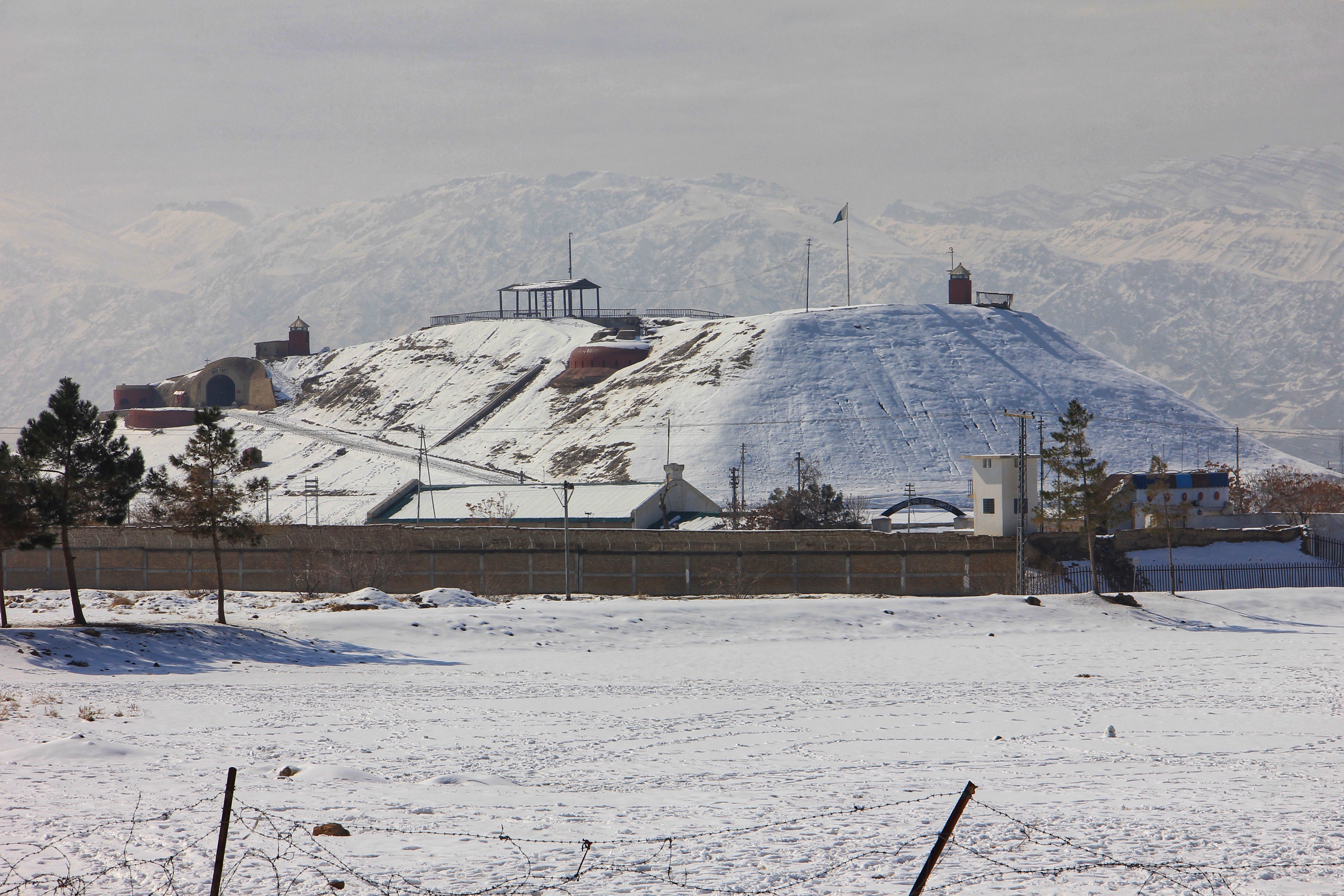
Loe sar Nekan ( ps, لوي سرنيکان) is the highest mountain peak in the province of Baluchistan in the southwest of Pakistan. Loe sar Nekan is located 30 km east-north-east of the city of Quetta in the Zarghun Ghar mountain massif. Loe sar Nekan peak has a height of 3575 m (according to other sources 3578 m). See also * Sulaiman Mountains The Sulaiman Mountains, also known as Kōh-e Sulaymān ( Balochi/Urdu/ fa, ; "Mountains of Solomon") or Da Kasē Ghrūna ( ps, د كسې غرونه; "Mountains of Kasi"), are a north–south extension of the southern Hindu Kush mountain system i ... External links ''Loe Nekan''nbsp; Zarghun Mountain and the Water Supply of Quetta (PDF, engl.) Mountains of Balochistan (Pakistan) {{Balochistan-geo-stub ... [...More Info...] [...Related Items...] OR: [Wikipedia] [Google] [Baidu] |
Balochistan (Pakistan)
Balochistan (; bal, بلۏچستان; ) is one of the four provinces of Pakistan. Located in the southwestern region of the country, Balochistan is the largest province of Pakistan by land area but is the least populated one. It shares land borders with the Pakistani provinces of Khyber Pakhtunkhwa and Punjab to the north-east and Sindh to the south-east. It shares International borders with Iran to the west and Afghanistan to the north; It is also bound by the Arabian Sea to the south. Balochistan is an extensive plateau of rough terrain divided into basins by ranges of sufficient heights and ruggedness. It has the world's largest deep sea port, The Port of Gwadar lying in the Arabian Sea. Balochistan shares borders with Punjab and the Khyber Pakhtunkhwa to the northeast, Sindh to the east and southeast, the Arabian Sea to the south, Iran ( Sistan and Baluchestan) to the west and Afghanistan (Helmand, Nimruz, Kandahar, Paktika and Zabul Provinces) to the north and northwe ... [...More Info...] [...Related Items...] OR: [Wikipedia] [Google] [Baidu] |
Pakistan
Pakistan ( ur, ), officially the Islamic Republic of Pakistan ( ur, , label=none), is a country in South Asia. It is the world's List of countries and dependencies by population, fifth-most populous country, with a population of almost 243 million people, and has the world's Islam by country#Countries, second-largest Muslim population just behind Indonesia. Pakistan is the List of countries and dependencies by area, 33rd-largest country in the world by area and 2nd largest in South Asia, spanning . It has a coastline along the Arabian Sea and Gulf of Oman in the south, and is bordered by India to India–Pakistan border, the east, Afghanistan to Durand Line, the west, Iran to Iran–Pakistan border, the southwest, and China to China–Pakistan border, the northeast. It is separated narrowly from Tajikistan by Afghanistan's Wakhan Corridor in the north, and also shares a maritime border with Oman. Islamabad is the nation's capital, while Karachi is its largest city and fina ... [...More Info...] [...Related Items...] OR: [Wikipedia] [Google] [Baidu] |
Quetta
Quetta (; ur, ; ; ps, کوټه) is the tenth List of cities in Pakistan by population, most populous city in Pakistan with a population of over 1.1 million. It is situated in Geography of Pakistan, south-west of the country close to the Durand line, International border with Afghanistan. It is the capital of the Administrative units of Pakistan, province of Balochistan, Pakistan, Balochistan where it is the largest city. Quetta is at an average elevation of above sea level, making it Pakistan's only high-altitude major city. The city is known as the ''"Fruit Garden of Pakistan"'' due to the numerous fruit orchards in and around it, and the large variety of fruits and dried fruit products produced there. Located in northern Balochistan near the Durand line, Pakistan-Afghanistan border and the road across to Kandahar, Quetta is a trade and communication centre between the two countries. The city is near the Bolan Pass route which was once one of the major gateways from Ce ... [...More Info...] [...Related Items...] OR: [Wikipedia] [Google] [Baidu] |
Zarghun Ghar
Zarghun Ghar ( ps, زرغون غر, lit. "Green Mountain"), or Zarghoon Mountains, is a mountain range located in the east of the Quetta District, in Balochistan Province, western Pakistan. It contains the tallest mountain in the Balochistan region. The range is home to a broad swathe of flora and fauna. Peaks The Zarghun Ghar range's highest peak is Loy saar Naikan, at 3,578 meters (11738. ft) which is also consider as the highest mountain peak in Balochistan Province, while the second highest peak is Kuchnai Saar, at 3,404 meters (11,170. ft). At , The "Loy Saar Naikan" of the Zarghun Ghar mountain range is the highest mount peak of Baluchistan.http://www.caab.20m.com , Chiltan Adventurers Association Balochistan Flora The base of the Zarghoon Ghar up to Ziarat is densely covered by Pashtun juniper (''Juniperus seravschanica'') trees, a forest of about 200,000 acres (810 km2). The Pashtun Juniper forest in the adjacent Ziarat District covers an area of about 247,000 ac ... [...More Info...] [...Related Items...] OR: [Wikipedia] [Google] [Baidu] |
Sulaiman Mountains
The Sulaiman Mountains, also known as Kōh-e Sulaymān ( Balochi/Urdu/ fa, ; "Mountains of Solomon") or Da Kasē Ghrūna ( ps, د كسې غرونه; "Mountains of Kasi"), are a north–south extension of the southern Hindu Kush mountain system in Pakistan and Afghanistan. They rise to form the eastern edge of the Iranian plateau. They are located in the Kandahar, Zabul, Paktika and Paktia provinces of Afghanistan, and in Pakistan they extend over the northern part of Balochistan and some southern parts of Khyber Pakhtunkhwa. In southwestern Punjab, the mountains extend into the two districts of Dera Ghazi Khan and Rajanpur, which are located west of the Indus River on the boundary with Balochistan. Bordering the mountains to the east are the plains of the Indus River valley, and to the north are the arid highlands of the Central Hindu Kush whose heights extend up to . Together with the Kirthar Mountains on the border between Balochistan and Sindh, the Sulaiman Mountains form what ... [...More Info...] [...Related Items...] OR: [Wikipedia] [Google] [Baidu] |


