|
Loch Carron
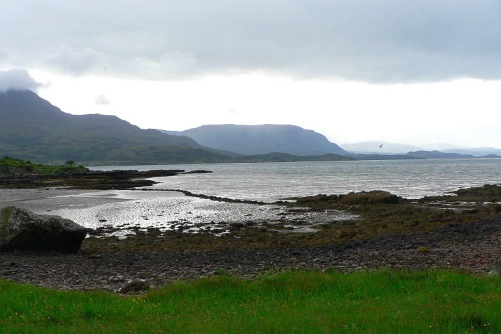
Loch Carron (Scottish Gaelic: "Loch Carrann") is a sea loch on the west coast of Ross and Cromarty in the Scottish Highlands, which separates the Lochalsh peninsula from the Applecross peninsula, and from the Stomeferry headland east of Loch Kishorn. It is the point at which the River Carron enters the North Atlantic Ocean. According to the marine charts, the tidal currents reach in the narrows, although not much water disturbance is visible in the flow. At the narrows, the depth of water is less than 20 metres, but in the basins on either side, it extends to a depth of more than 100 metres. Beneath the cliffs at Strome Castle is a colony of flame shells; with a population of over 250 million the loch is the world's largest flame shell bed, and was designated as a Nature Conservation Marine Protected Area (NCMPA) in 2017, with the protection being made permanent in 2018. The new MPA of 23 km2 took effect on 19 May 2019. Within the MPA the use of fishing gear that m ... [...More Info...] [...Related Items...] OR: [Wikipedia] [Google] [Baidu] |
Applecross
Applecross ( gd, A' Chomraich) is a peninsula north-west of Kyle of Lochalsh in the council area of Highland, Scotland. The name Applecross is at least 1,300 years old and is ''not'' used locally to refer to the 19th century village (which is correctly called 'Shore Street', or simply 'The Street') with the Applecross Inn, lying on the Applecross Bay, facing the Inner Sound, on the opposite side of which lies the Inner Hebridean island of Raasay. The monastery of Applecross was established by St Maelrubha, in the 7th century. A sculptured stone is the only remaining relic of Maelrubha, who built a chapel there. The Applecross peninsula ( gd, A' Chomraich, 'The Sanctuary') is a peninsula in Wester Ross, Highland, on the north west coast of Scotland. Geography This row of houses which is often referred to as 'Applecross', and is marked as Applecross on some maps, is actually called 'Shore Street' and is referred to locally just as 'The Street'. The name Applecross applies to ... [...More Info...] [...Related Items...] OR: [Wikipedia] [Google] [Baidu] |
Marine Protected Areas In Scotland
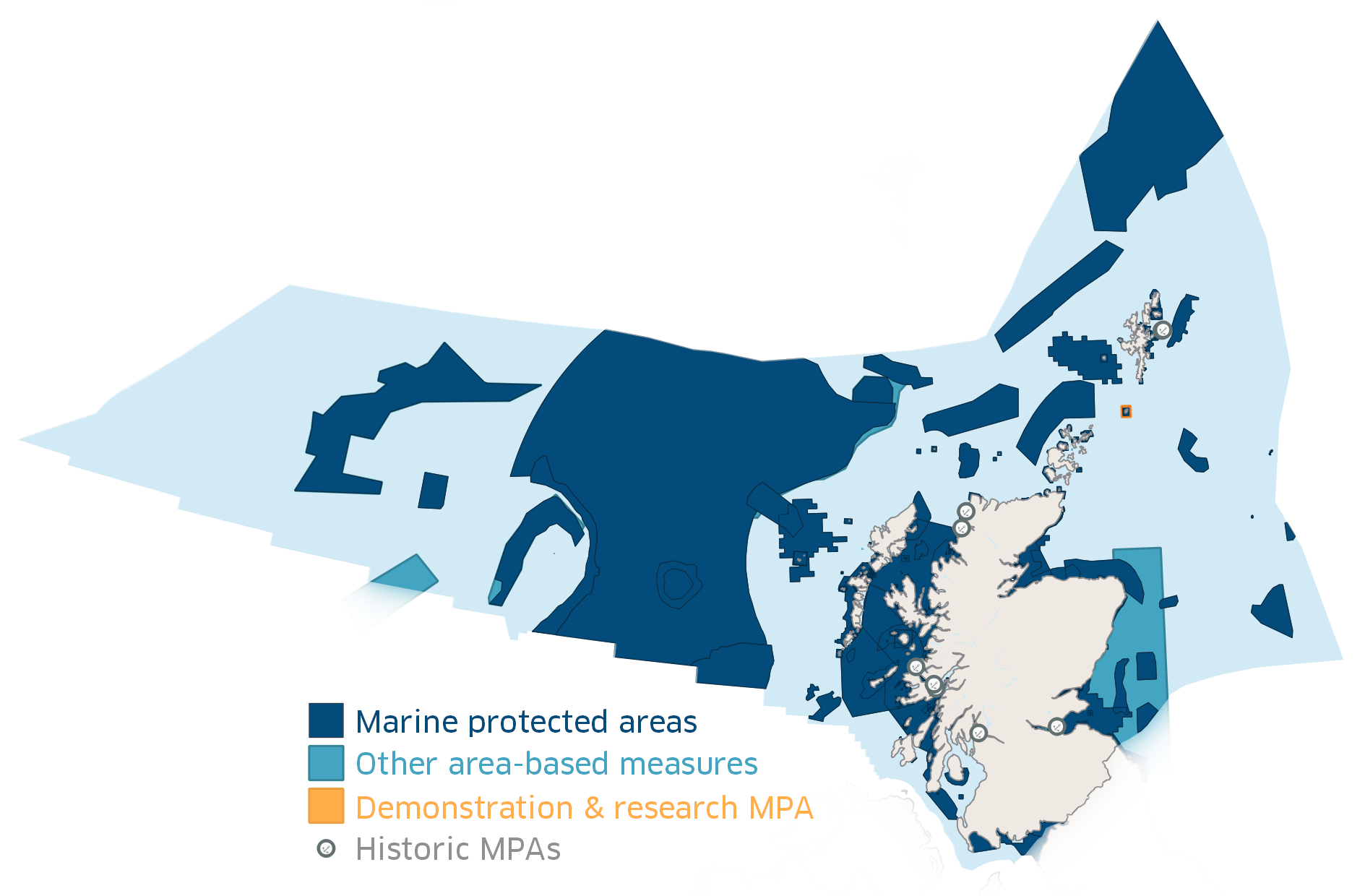
In Scotland, Marine Protected Areas (MPAs) are areas of sea defined so as to protect to habitats, wildlife, geology, undersea landforms, historic shipwrecks, and to demonstrate sustainable management of the sea. As of December 2020, approximately 37% of Scotland's seas are covered by the Scottish MPA network, which comprises 244 sites in total. Designation As of December 2020 Scotland's MPA network comprises 244 sites protected by a variety of different conservation designations, many of which are the same as those used on land, such as Special Protection Areas (SPA) and Sites of Special Scientific Interest (SSSI).Scottish MPA network - Parliamentary Report. p. 11.Scottish MPA network - Parliamentary Report. p. 32. This figure includes four sites designated in December 2020: North-east Lewis; Shiant East Bank; Sea of the Hebrides; and the Southern Trench. The legal framework for designating MPAs depends on the designation: for example SSSIs are designated under the Nature Cons ... [...More Info...] [...Related Items...] OR: [Wikipedia] [Google] [Baidu] |
Stromeferry
Stromeferry ( gd, Port an t-Sròim) is a village, located on the south shore of the west coast sea loch, Loch Carron, in western Ross-shire, Scottish Highlands and is in the Scottish council area of Highland. Its name reflects its former role as the location of one of the many coastal ferry services which existed prior to the expansion of the road network in the 20th century. It is served by Stromeferry railway station and is close to the A890 road. Stromeferry is on the southern bank of Loch Carron; Strome Castle is opposite on the northern bank. The village is referred to in Iain Banks's novel ''Complicity'', where the narrator describes the road sign marking the village, which states "Strome Ferry (No ferry)". Some local shinty players once competed as "Stromeferry (No Ferry) United". The village has been subject of various development proposals focussing on the derelict hotel. In November 2007, W.A. Fairhurst & Partners, on behalf of the Helmsley Group, secured an outli ... [...More Info...] [...Related Items...] OR: [Wikipedia] [Google] [Baidu] |
Lochcarron
Lochcarron ( gd, Loch Carrann) is a village, community and civil parish in the Wester Ross area of Highland, Scotland. It has a population of 923. Locality The name Lochcarron is also applied to the collection of small settlements strung out along Loch Carron, a sea loch on the west coast of Ross and Cromarty. The village stretches for almost , meandering along the shore of the loch. It means "Loch of rough water". In the 19th Century the village was named Janetown, then Jeantown. The local newspaper, ''An Carrannach'', is published on a monthly basis. Lochcarron is a central location for hillwalking and touring the West Coast Highlands, including the Torridon, Plockton and Skye regions. Close to the village lies the Bealach na Bà road (Gaelic: ''Pass of the cattle''), which links Applecross to the rest of the mainland. It is a road popular with tourists, drivers, and motorcyclists alike for its scenery and hairpin bends. Amenities Lochcarron contains a variety of local ser ... [...More Info...] [...Related Items...] OR: [Wikipedia] [Google] [Baidu] |
Loch Torridon
Loch Torridon ( gd, Loch Thoirbheartan) is a sea loch on the west coast of Scotland in the Northwest Highlands. The loch was created by glacial processes and is in total around 15 miles (25 km) long. It has two sections: Upper Loch Torridon to landward, east of Rubha na h-Airde Ghlaise, at which point it joins Loch Sheildaig; and the main western section of Loch Torridon proper. Loch a' Chracaich and Loch Beag are small inlets on the southern shores of the outer Loch, which joins the Inner Sound between the headlands of Rubha na Fearna to the south and Red Point to the north. The name ''Thoirbhearta'' has a similar root to '' Tarbert'' and indicates a place where boats were dragged overland. Islands The islets in the loch include: * in Loch Shieldaig: Eilean an Inbhire Bhàin, Eilean Dùghaill and Shieldaig Island. * in Upper Loch Torridon: Eilean à Chaoil, Eilean Cnapach, both of which are tidal. * in outer Loch Torridon: Eilean Mòr, Eilean Tioram, Sgeir Ghlas, ... [...More Info...] [...Related Items...] OR: [Wikipedia] [Google] [Baidu] |
Inner Sound, Scotland
The Inner Sound ( gd, An Lighe Rathairseach) is a strait separating the Inner Hebridean islands of Skye, Raasay and South Rona from the Applecross peninsula on the Scottish mainland. The Inner Sound is the location of BUTEC, a Royal Navy submarine sensor and emissions range. Deepest Point in the UK The Inner Sound includes the deepest section of the UK's territorial waters, with a maximum depth of . An area, over long and up to wide, exists below a depth of , with a relatively flat bottom. There is another cleft deep, separated from the deeper bowl by an area of shallower water. A dive to examine the deeper trench found the bottom to be made up of bioturbated mud, with a steep slope towards the west of up to 60°. Islands in the Strait * South Rona * Raasay * Scalpay * Pabay * Longay * Crowlin Wildlife In 2020, over a hundred eggs belonging to the critically endangered flapper skate were discovered in the strait. This led to calls for the government to prote ... [...More Info...] [...Related Items...] OR: [Wikipedia] [Google] [Baidu] |
Mesolithic
The Mesolithic (Greek: μέσος, ''mesos'' 'middle' + λίθος, ''lithos'' 'stone') or Middle Stone Age is the Old World archaeological period between the Upper Paleolithic and the Neolithic. The term Epipaleolithic is often used synonymously, especially for outside northern Europe, and for the corresponding period in the Levant and Caucasus. The Mesolithic has different time spans in different parts of Eurasia. It refers to the final period of hunter-gatherer cultures in Europe and Western Asia, between the end of the Last Glacial Maximum and the Neolithic Revolution. In Europe it spans roughly 15,000 to 5,000 BP; in Southwest Asia (the Epipalaeolithic Near East) roughly 20,000 to 10,000 BP. The term is less used of areas farther east, and not at all beyond Eurasia and North Africa. The type of culture associated with the Mesolithic varies between areas, but it is associated with a decline in the group hunting of large animals in favour of a broader hunter-g ... [...More Info...] [...Related Items...] OR: [Wikipedia] [Google] [Baidu] |
Plockton Railway Station
, symbol_location = gb , symbol = rail , image = Plockton Station (geograph 4949712).jpg , caption = , borough = Plockton, Highland , country = Scotland , coordinates = , grid_name = Grid reference , grid_position = , manager = ScotRail , platforms = 1 , code = PLK , original = Highland Railway , pregroup = Highland Railway , postgroup = LMSR , years = 2 November 1897 , events = Opened , mpassengers = , footnotes = Passenger statistics from the Office of Rail and Road , embedded = Plockton railway station is a railway station on the Kyle of Lochalsh Line, serving the village of Plockton in the Highlands, north-west Scotland. The station is from , between Duncraig and Duirinish. ScotRail, who manage the station, operate all services here. History The station was built by the Kyle of Lochalsh Extension (Highland Railway) between Stromeferry and Kyle of Lochalsh, opening on 2 November 1897. The station building was built by the Highland Railway, ... [...More Info...] [...Related Items...] OR: [Wikipedia] [Google] [Baidu] |
Duncraig Railway Station
, symbol_location = gb , symbol = rail , image = Duncraig Loch Carron.jpg , caption = The platform alongside Loch Carron, looking northeast , borough = Duncraig Castle, near Plockton, Highland , country = Scotland , coordinates = , grid_name = Grid reference , grid_position = , manager = ScotRail , platforms = 1 , code = DCG , original = Highland Railway , pregroup = Highland Railway , postgroup = LMSR , years = 1897 , events = Opened as private station Duncraig Platform , years2 = 23 May 1949 , events2 = Opened to the public , years3 = 10 September 1962 , events3 = Renamed , years4 = 7 December 1964 , events4 = Closed , years5 = 5 January 1976 , events5 = Reopened , mpassengers = , footnotes = Passenger statistics from the Office of Rail and Road Duncraig railway station is a remote railway station by the shore of Loch Carron on the Kyle of Lochalsh Line, originally (privately) serving Duncraig Castle, a mansion near Plockton, in the Hi ... [...More Info...] [...Related Items...] OR: [Wikipedia] [Google] [Baidu] |
Stromeferry Railway Station
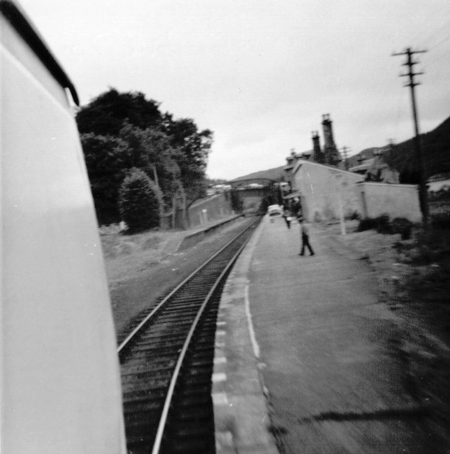
, symbol_location = gb , symbol = rail , image = Platform at Stromeferry station - geograph.org.uk - 2571610.jpg , borough = Stromeferry, Highland , country = Scotland , coordinates = , grid_name = Grid reference , grid_position = , manager = ScotRail , platforms = 1 , code = STF , original = Dingwall and Skye Railway , pregroup = Highland Railway , postgroup = LMSR , years = 19 August 1870 , events = Opened , mpassengers = , footnotes = Passenger statistics from the Office of Rail and Road Stromeferry railway station is a station on the Kyle of Lochalsh Line, serving the village of Stromeferry in the Highlands, northern Scotland. Stromeferry lies on the southern shore of Loch Carron, across from the ruined Strome Castle, near the west coast. The station is from , between Attadale and Duncraig. ScotRail, who manage the station, operate all services. History The station opened for passenger traffic on 19 August 1870. For the first 27 years of ... [...More Info...] [...Related Items...] OR: [Wikipedia] [Google] [Baidu] |
Attadale Railway Station
, symbol_location = gb , symbol = rail , image = Attadale railway station (geograph 4922246).jpg , caption = , borough = Attadale, Highland , country = Scotland , coordinates = , grid_name = Grid reference , grid_position = , manager = ScotRail , platforms = 1 , code = ATT , original = Dingwall and Skye Railway , pregroup = Highland Railway , postgroup = LMSR , years = 1880 , events = Station opened , mpassengers = , footnotes = Passenger statistics from the Office of Rail and Road Attadale railway station is a remote railway station on the Kyle of Lochalsh Line, serving the village of Attadale on Loch Carron in the Highlands, northern Scotland. The station is from , between Strathcarron and Stromeferry. ScotRail, who manage the station, operate all services. History The station was opened in 1880 by the Dingwall and Skye Railway, but operated from the outset by the Highland Railway. When the D&SR were forced to cut back the railway duri ... [...More Info...] [...Related Items...] OR: [Wikipedia] [Google] [Baidu] |


