|
Lobivia Chrysochete
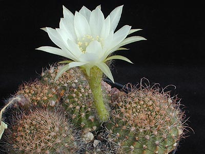
''Lobivia chrysochete'' is a species of ''Lobivia'' found in Bolivia and Argentina. Description ''Lobivia chrysochete'' grows singly or forms groups. The flattened, spherical to spherical, green shoots have a diameter of up to 25 centimeters. There are around 20 slightly crooked ribs that are humps. The yellow to brownish thorns that emerge from the areoles are thin and bristle-like. The three to five central spines are up to 8 centimeters long. The number of marginal spines is up to approximately 30. The broad and short funnel-shaped flowers are shiny orange to red and have a whitish throat. The flowers reach a diameter of 2.5 to 4 centimeters. Distribution ''Lobivia chrysochete'' is distributed in the Bolivian departments of Chuquisaca, Tarija and possibly Potosí as well as the Argentine provinces of Jujuy and Salta Salta () is the capital and largest city in the Argentine province of the same name. With a population of 618,375 according to the 2010 census, it is als ... [...More Info...] [...Related Items...] OR: [Wikipedia] [Google] [Baidu] |
Lobivia
''Lobivia'' is a genus of Cactus, cacti native species, native to South America from Bolivia, Peru to northwestern Argentina and Northern Chile. Species Species of the genus ''Lobivia'' according to Plants of the World Online : References External links * * {{Authority control Lobivia, Cacti of South America Endemic flora of Argentina Endemic flora of Bolivia Endemic flora of Peru Cactoideae genera ... [...More Info...] [...Related Items...] OR: [Wikipedia] [Google] [Baidu] |
Bolivia
, image_flag = Bandera de Bolivia (Estado).svg , flag_alt = Horizontal tricolor (red, yellow, and green from top to bottom) with the coat of arms of Bolivia in the center , flag_alt2 = 7 × 7 square patchwork with the (top left to bottom right) diagonals forming colored stripes (green, blue, purple, red, orange, yellow, white, green, blue, purple, red, orange, yellow, from top right to bottom left) , other_symbol = , other_symbol_type = Dual flag: , image_coat = Escudo de Bolivia.svg , national_anthem = " National Anthem of Bolivia" , image_map = BOL orthographic.svg , map_width = 220px , alt_map = , image_map2 = , alt_map2 = , map_caption = , capital = La Paz Sucre , largest_city = , official_languages = Spanish , languages_type = Co-official languages , languages ... [...More Info...] [...Related Items...] OR: [Wikipedia] [Google] [Baidu] |
Argentina
Argentina (), officially the Argentine Republic ( es, link=no, República Argentina), is a country in the southern half of South America. Argentina covers an area of , making it the second-largest country in South America after Brazil, the fourth-largest country in the Americas, and the eighth-largest country in the world. It shares the bulk of the Southern Cone with Chile to the west, and is also bordered by Bolivia and Paraguay to the north, Brazil to the northeast, Uruguay and the South Atlantic Ocean to the east, and the Drake Passage to the south. Argentina is a federal state subdivided into twenty-three provinces, and one autonomous city, which is the federal capital and largest city of the nation, Buenos Aires. The provinces and the capital have their own constitutions, but exist under a federal system. Argentina claims sovereignty over the Falkland Islands, South Georgia and the South Sandwich Islands, and a part of Antarctica. The earliest recorded human prese ... [...More Info...] [...Related Items...] OR: [Wikipedia] [Google] [Baidu] |
Areole
In botany, areoles are small light- to dark-colored bumps on cacti out of which grow clusters of spines. Areoles are important diagnostic features of cacti, and identify them as a family distinct from other succulent plants. Gordon Rowley - What is an Areole The spines are not easily detachable, but on certain cacti, members of the subfamily Opuntioideae, smaller, detachable bristles, glochids, also grow out of the areoles and afford additional protection. Areoles represent highly specialized branches on cacti. Apparently, they evolved as abortive branch buds while their spines evolved as vestigial leaves. In branched cacti, such as Opuntioidiae and the saguaro, new branches grow from areoles, because that is where the buds are. The development of the areole seems to have been an important element in the adaptation of cacti to niches in desert ecology. Some of the Opuntioideae have spines, as well as glochids, on their areoles; some have only glochids. Structurally, the gloc ... [...More Info...] [...Related Items...] OR: [Wikipedia] [Google] [Baidu] |
Chuquisaca Department
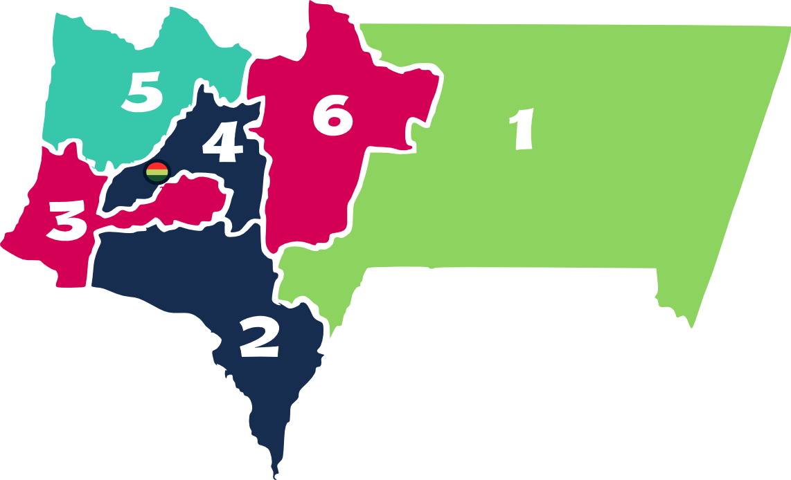
Chuquisaca () ( ay, Chuqisaka; qu, Chuqichaka) is a department of Bolivia located in the center south. It borders on the departments of Cochabamba, Tarija, Potosí, and Santa Cruz. The departmental capital is Sucre, which is also the constitutional capital of Bolivia. Geography The department is traversed by the main cordillera of the Andes mountain range and lesser cordilleras. Parts of it lay within the basin of the Amazon River, and other parts within the basin of the Río de La Plata. The surface area of the department is 51,524 square kilometers. The topography of central Chuquisaca consists of a series of ridges rising up to 1500 m that run north and south with flat valleys between the ridges. To the west of these ridges abruptly rise the Andes Mountains to 3000 m forming a prepuna landmass that is cut into by large river valleys that drain into the Amazon or Rio de la Plata river basins. To the east of the central ridges lies a stretch of territory containing low e ... [...More Info...] [...Related Items...] OR: [Wikipedia] [Google] [Baidu] |
Tarija Department
Tarija () is a department in Bolivia. It is located in south-eastern Bolivia bordering with Argentina to the south and Paraguay to the east. According to the 2012 census, it has a population of 482,196 inhabitants. It has an area of . The city of Tarija is the capital of the department. Subdivisions The department is divided into five provinces and one autonomous region: # Gran Chaco Province (autonomous region) # Aniceto Arce Province # José María Avilés Province # Cercado Province # Eustaquio Méndez Province # Burdett O'Connor Province Notable places in Tarija include: * Villamontes in the department's oil-producing eastern scrubland. Villamontes has recorded the hottest temperature ever in Bolivia, , several times, most recently on 29 October 2010. * Bermejo, a border town adjoining Aguas Blancas, Argentina * Yacuiba, a border town with Argentina. The Department of Tarija is renowned for its mild, pleasant climate, and comprises one of the country's foremost agric ... [...More Info...] [...Related Items...] OR: [Wikipedia] [Google] [Baidu] |
Potosí Department
Potosí (; Aymara language, Aymara: ''Putusi''; qu, P'utuqsi) is a Departments of Bolivia, department in southwestern Bolivia. It comprises 118,218 km2 with 823,517 inhabitants (2012 census). The capital is the city of Potosí. It is mostly a barren, mountainous region with one large plateau to the west, where the largest Salt pan (geology), salt flat in the world, Salar de Uyuni, is located. Cerro Rico, Cerro Potosí was the richest province in the Spanish empire, providing a great percentage of the silver that was Spanish treasure fleet, shipped to Europe. Potosi is also the location of the San Cristóbal mine (Bolivia), San Cristóbal silver, zinc and lead mines, developed by the US-company Apex Silver Mines Limited of Colorado and in November 2008 sold to the Japanese Sumitomo Corporation. Government The chief executive office of Departments of Bolivia, Bolivia departments (since May 2010) is the governor; until then, the office was called the prefect, and until 2006 ... [...More Info...] [...Related Items...] OR: [Wikipedia] [Google] [Baidu] |
Jujuy Province
Jujuy is a province of Argentina, located in the extreme northwest of the country, at the borders with Chile and Bolivia. The only neighboring Argentine province is Salta to the east and south. Geography There are three main areas in Jujuy: *The Altiplano, a plateau high with peaks of , covers most of the province. *The Río Grande of Jujuy cuts through the Quebrada de Humahuaca canyon, of heights between . *To the southeast, the sierras descends to the Gran Chaco region. The vast difference in height and climate produces desert areas such as the Salinas Grandes salt mines and subtropical Yungas jungle. The terrain of the province is mainly arid and semi-desertic across the different areas, except for the ''El Ramal'' valley of the San Francisco River. Temperature difference between day and night is wider in higher lands, and precipitation is scarce outside the temperate area of the San Francisco River. The Grande River and the San Francisco River flow to the Bermejo River. ... [...More Info...] [...Related Items...] OR: [Wikipedia] [Google] [Baidu] |
Salta Province
Salta () is a province of Argentina, located in the northwest of the country. Neighboring provinces are from the east clockwise Formosa, Chaco, Santiago del Estero, Tucumán and Catamarca. It also surrounds Jujuy. To the north it borders Bolivia and Paraguay and to the west lies Chile. History Before the Spanish conquest, numerous native peoples (now called Diaguitas and Calchaquíes) lived in the valleys of what is now Salta Province; they formed many different tribes, the Quilmes and Humahuacas among them, which all shared the Cacán language. The Atacamas lived in the Puna, and the Wichís (Matacos), in the Chaco region. The first conquistador to venture into the area was Diego de Almagro in 1535; he was followed by Diego de Rojas. Hernando de Lerma founded San Felipe de Lerma in 1582, following orders of the viceroy Francisco de Toledo, Count of Oropesa; the name of the city was soon changed to "San Felipe de Salta". By 1650, the city had around five hundred inhabitan ... [...More Info...] [...Related Items...] OR: [Wikipedia] [Google] [Baidu] |
Flora Of Bolivia
Flora is all the plant life present in a particular region or time, generally the naturally occurring (indigenous) native plants. Sometimes bacteria and fungi are also referred to as flora, as in the terms '' gut flora'' or '' skin flora''. Etymology The word "flora" comes from the Latin name of Flora, the goddess of plants, flowers, and fertility in Roman mythology. The technical term "flora" is then derived from a metonymy of this goddess at the end of the sixteenth century. It was first used in poetry to denote the natural vegetation of an area, but soon also assumed the meaning of a work cataloguing such vegetation. Moreover, "Flora" was used to refer to the flowers of an artificial garden in the seventeenth century. The distinction between vegetation (the general appearance of a community) and flora (the taxonomic composition of a community) was first made by Jules Thurmann (1849). Prior to this, the two terms were used indiscriminately.Thurmann, J. (1849). ''Essai de Ph ... [...More Info...] [...Related Items...] OR: [Wikipedia] [Google] [Baidu] |
Flora Of Argentina
The Environment of Argentina is characterised by high biodiversity. Biodiversity Subtropical plants dominate the Gran Chaco in the north, with the ''Dalbergia'' genus of trees well represented by Brazilian rosewood and the quebracho tree; also predominant the wacho white and black algarrobo trees ('' Prosopis alba'' and ''Prosopis nigra''). Savannah-like areas exist in the drier regions nearer the Andes. Aquatic plants thrive in the wetlands of Argentina. In central Argentina the ''humid pampas'' are a true tallgrass prairie ecosystem. The original pampa had virtually no trees; some imported species like the American sycamore or eucalyptus are present along roads or in towns and country estates (''estancias''). The only tree-like plant native to the pampa is the evergreen Ombú. The surface soils of the pampa are a deep black color, primarily mollisols, known commonly as ''humus''. This makes the region one of the most agriculturally productive on Earth; however, this is also res ... [...More Info...] [...Related Items...] OR: [Wikipedia] [Google] [Baidu] |


