|
Llanwrthwl
Llanwrthwl is a village and community in Powys, mid Wales, and the historic county of Brecknockshire. Llanwrthwl lies off the A470 road, north by road from Builth Wells and Newbridge-on-Wye and south of Rhayader. It lies on the River Wye and River Elan and the village is accessed by a bridge over the Wye. In 1833, its population was 517; its population in 1841 was 568; in 1845, its population was 563. At the 2011 census the population was only 191. Etymology Llanwrthwl, composed of an Upper and a Lower division, derives its name from the dedication of its church. History St Gwrthwl, a saint whose date is uncertain, founded the church at Llanwrthwl; he is commemorated on 2 March. Bronze Age gold work was discovered at Llanwrthwl in the 1950s, including a four-flanged bar torc, a circular sectioned bar torc, a square sectioned bar torc and a twisted ring. A commemorative stone, from the precincts of the extinct chapel of Llanwrthwl, was found at Maes Llanwrthwl (Llanwrthwl ... [...More Info...] [...Related Items...] OR: [Wikipedia] [Google] [Baidu] |
Abergwesyn
Abergwesyn is a village in the Welsh county of Powys, in mid-Wales, at the start of the Abergwesyn valley and at the confluence of the Afon Irfon and the Afon Gwesyn. It is from Cardiff and from London. Abergwesyn Commons stretch between the Nant Irfon valley and Llanwrthwl. They are rich in archaeology, including Bronze Age ritual sites and deserted medieval villages. A National Trust project is focused on the preservation of the peatland. Abergwesyn Commons Abergwesyn Commons cover an area of some and stretch for between the Nant Irfon valley in the west and Llanwrthwl in the east, are rich in archaeology, including Bronze Age ritual sites and deserted medieval villages. There are many cairns and other evidence of ancient human activity. To the north the ground falls away to the edge of the Elan Valley Reservoirs. The summit ridge is wild and bleak with expansive views across the roof of Wales. Among the wildlife to be seen are red grouse, northern lapwing and red kite. Na ... [...More Info...] [...Related Items...] OR: [Wikipedia] [Google] [Baidu] |
Living Willow Theatre
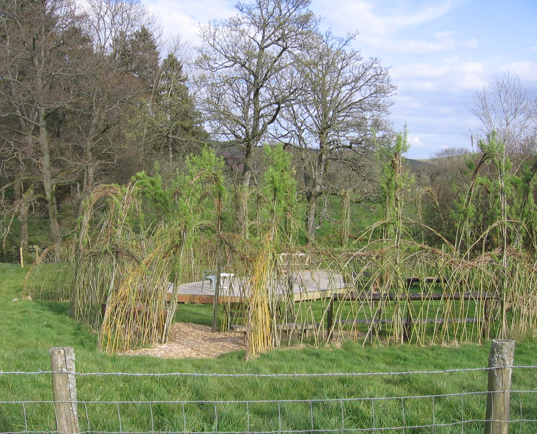
The Willow Globe Theatre ( cy, Glôb Byw, formerly known as the Living Willow Theatre) is an open air community theatre in Powys, Wales. It is a scaled-down version of the Globe Theatre in London, about a third of its size in diameter and similar to the Open Air Theatre, Regent's Park in London. The theatre is formed from living willow trees that have been woven together from a design by Dr Rebecca Heaton. It seats an audience of around 150 people. The theatre was formally opened on 22 April 2007. The Willow Globe is part of the charity ''Shakespeare Link'' and has a resident company, the Willow Globe Company. Plays by William Shakespeare are performed among others. The theatre also hosts workshops and festivals. It is run by the actors Phil Bowen and Susanna Best. Location The theatre is located at Penlanole, Nantmel, across the River Wye from the village of Llanwrthwl, between Llandrindod Wells and Rhayader, close to the hamlet of Nant Glas off the A470 The A470 (al ... [...More Info...] [...Related Items...] OR: [Wikipedia] [Google] [Baidu] |
Rhayader
Rhayader (; cy, Rhaeadr Gwy; ) is a market town and community in Powys, Wales, within the historic county of Radnorshire. The town is from the source of the River Wye on Plynlimon, the highest point of the Cambrian Mountains, and is located at the junction of the A470 road and the A44 road north of Builth Wells and east of Aberystwyth. The population was 2,088, with 55% of the community having some form of Welsh identity, according to the 2011 census. The community is the largest in Wales by area, with . It includes the Elan Valley. Rhayader holds the record for the lowest-ever temperature recorded in Wales, -23.3 °C on 21 January 1940. Etymology The name, Rhayader, is a partly-Anglicised form of its Welsh name, ''Y Rhaeadr'' (the waterfall), or, to distinguish it from other places named after waterfalls, "Rhaeadr Gwy" (waterfall n theWye). Strictly speaking, according to place-name spelling conventions in Welsh, the name of the town would be 'Rhaeadr-gwy', ... [...More Info...] [...Related Items...] OR: [Wikipedia] [Google] [Baidu] |
Brecknockshire
, image_flag= , HQ= Brecon , Government= Brecknockshire County Council (1889-1974) , Origin= Brycheiniog , Status= , Start= 1535 , End= 1974 , Code= BRE , CodeName= Chapman code , Replace= Brecknock, Powys , Motto= Undeb Hedd Llwyddiant (Unity, Peace, Prosperity) , Divisions= , DivisionsNames= , DivisionsMap= , Image= , Map= , Arms= , Civic= , PopulationFirst= 47,763Vision of Britain 1831 Census/ref> , PopulationFirstYear= 1831 , AreaFirst= , AreaFirstYear= 1831 , DensityFirst= 0.1/acre , DensityFirstYear= 1831 , PopulationSecond= 54,213 , PopulationSecondYear= 1901 , AreaSecond= , AreaSecondYear= 1911 , ... [...More Info...] [...Related Items...] OR: [Wikipedia] [Google] [Baidu] |
Gwrthwl
Saint Gwrthwl is a Pre-Congregational Saint of Powys in Wales. He was said to have been a hermit and to have founded a church in the village of Llanwrthwl. The site of his church yielded artefacts form the Bronze Age and Roman Empire The Roman Empire ( la, Imperium Romanum ; grc-gre, Βασιλεία τῶν Ῥωμαίων, Basileía tôn Rhōmaíōn) was the post- Republican period of ancient Rome. As a polity, it included large territorial holdings around the Mediter .... The saint appears to have converted a pagan place of worship as there is indications of the site being used for religious purposes from about 2000 B.C. He is remembered as 'The Confessor', and his Feast Day is commemorated on 2 March. Baring-Gould, Sabine. The Lives of the Saints, Vol. XVI, "The Celtic Church and its Saints", p.71. (Longmans, Green, & Co. (New York), 1898). References {{reflist Medieval Welsh saints ... [...More Info...] [...Related Items...] OR: [Wikipedia] [Google] [Baidu] |
Old Bridge, Elan Valley - Geograph
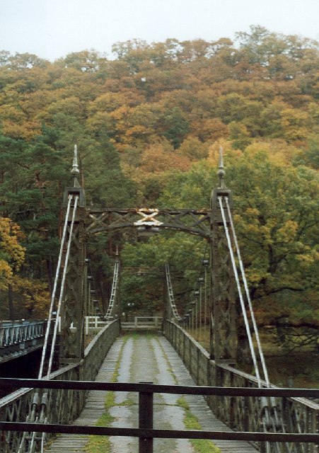
Old or OLD may refer to: Places *Old, Baranya, Hungary *Old, Northamptonshire, England *Old Street station, a railway and tube station in London (station code OLD) *OLD, IATA code for Old Town Municipal Airport and Seaplane Base, Old Town, Maine, United States People *Old (surname) Music *OLD (band), a grindcore/industrial metal group * ''Old'' (Danny Brown album), a 2013 album by Danny Brown * ''Old'' (Starflyer 59 album), a 2003 album by Starflyer 59 * "Old" (song), a 1995 song by Machine Head *''Old LP'', a 2019 album by That Dog Other uses * ''Old'' (film), a 2021 American thriller film *''Oxford Latin Dictionary'' *Online dating *Over-Locknut Distance (or Dimension), a measurement of a bicycle wheel and frame *Old age See also *List of people known as the Old * * *Olde, a list of people with the surname *Olds (other) Olds may refer to: People * The olds, a jocular and irreverent online nickname for older adults * Bert Olds (1891–1953), Australian rules ... [...More Info...] [...Related Items...] OR: [Wikipedia] [Google] [Baidu] |
Radnorshire
, HQ = Presteigne , Government = Radnorshire County Council (1889–1974) Radnorshire District Council (1974–1996) , Origin = , Status = historic county, administrative county , Start = 1536 , End = 1974 , Code = RAD , CodeName = Chapman code , Replace = Radnor , Motto = Ewch yn Uwch(Go Higher) , Divisions = Hundreds, sanitary districts, urban districts, rural districts , DivisionsNames = , DivisionsMap = , Map = , Image = , Arms = , Civic = , PopulationFirst = 24,651Vision of Britain 1831 Census/ref> , PopulationFirstYear = 1831 , AreaFirst = , AreaFirstYear = 1831 , DensityFirst = 0.1/acre , DensityFirstYear = 1831 , PopulationSecond = 23,281 , PopulationSecondYear = 1901 , AreaSecond = , Ar ... [...More Info...] [...Related Items...] OR: [Wikipedia] [Google] [Baidu] |
Copper Ore
Following is a list of minerals that serve as copper ores in the copper mining Copper extraction refers to the methods used to obtain copper from its ores. The conversion of copper consists of a series of physical and electrochemical processes. Methods have evolved and vary with country depending on the ore source, loca ... process:Samans, Carl H. ''Engineering Metals and their Alloys'' MacMillan 1949 References {{DEFAULTSORT:Copper ores Copper ores Mining-related lists ... [...More Info...] [...Related Items...] OR: [Wikipedia] [Google] [Baidu] |
Drygarn Fawr
Drygarn Fawr is a mountain in the county of Powys, Wales. It is one of the highest summits in Mid Wales at above sea level. It lies to the south of the Elan Valley Reservoirs. Rising above the remote moorland plateau of the Cambrian Mountains, and to the west of the peaks of Radnor Forest, the summit is topped by two distinctive, large cairns. The mountain has a gentle, grassy, conical shape with a few rocks near the summit. Nearby are the summits of Gorllwyn, Y Gamriw, and Drum yr Eira all over 600m. Access There are two paths to the summit. From Llannerch Yrfa, a bridleway winds up through forests in the Nant y Fedw valley before skirting the southern edge of the mountain. An alternative route may be taken starting from Rhiwnant on the edge of the Caban Coch reservoir, one of the Elan Valley Reservoirs, and following the Nant Paradwys before turning off west towards the summit cairn. Both routes pass across wild moorland and peat bog A bog or bogland is a ... [...More Info...] [...Related Items...] OR: [Wikipedia] [Google] [Baidu] |
Capel Ger Llanwrthwl - Chapel Near Llanwrthwl - Geograph
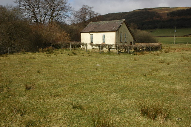
Capel may refer to: People *Capell, surname, includes a list of people with the surnames Capel and Capell *Capel (given name), includes a list of people with the given name Capel Places England *Capel, Kent, a village and civil parish near Tunbridge Wells *Capel, Surrey, a village and civil parish *Capel-le-Ferne, Kent *Capel St Andrew, Suffolk *Capel St Mary, Suffolk *RNAS Capel, a First World War airship station near Folkestone, Kent Australia *Capel, Western Australia *Shire of Capel, Western Australia *Electoral district of Capel, Western Australia, a Legislative Assembly electorate from 2005 to 2008 *Capel River, Western Australia Other uses * HMS ''Capel'', two Royal Navy ships *Cooperativa Agrícola Pisquera Elqui Limitada Cooperativa Agrícola Pisquera Elqui Limitada (CAPEL), also called Pisco Capel, is one of Chile's biggest spirits company and producer of pisco. Most of its croplands are in the Elqui Valley where the company was founded as a producers cooperati ... [...More Info...] [...Related Items...] OR: [Wikipedia] [Google] [Baidu] |
Carmarthenshire
Carmarthenshire ( cy, Sir Gaerfyrddin; or informally ') is a county in the south-west of Wales. The three largest towns are Llanelli, Carmarthen and Ammanford. Carmarthen is the county town and administrative centre. The county is known as the "Garden of Wales" and is also home to the National Botanic Garden of Wales. Carmarthenshire has been inhabited since prehistoric times. The county town was founded by the Romans, and the region was part of the Kingdom of Deheubarth in the High Middle Ages. After invasion by the Normans in the 12th and 13th centuries it was subjugated, along with other parts of Wales, by Edward I of England. There was further unrest in the early 15th century, when the Welsh rebelled under Owain Glyndŵr, and during the English Civil War. Carmarthenshire is mainly an agricultural county, apart from the southeastern part which was once heavily industrialised with coal mining, steel-making and tin-plating. In the north of the county, the woollen industr ... [...More Info...] [...Related Items...] OR: [Wikipedia] [Google] [Baidu] |
Churchyard
In Christian countries a churchyard is a patch of land adjoining or surrounding a church, which is usually owned by the relevant church or local parish itself. In the Scots language and in both Scottish English and Ulster-Scots, this can also be known as a kirkyard. While churchyards can be any patch of land on church grounds, historically, they were often used as graveyards (burial places). Use of churchyards as a place of burial After the establishment of the parish as the centre of the Christian spiritual life, the possession of a cemetery, as well as the baptismal font, was a mark of parochial status. During the Middle Ages, religious orders also constructed cemeteries around their churches. Thus, the most common use of churchyards was as a consecrated burial ground known as a graveyard. Graveyards were usually established at the same time as the building of the relevant place of worship (which can date back to the 6th to 14th centuries) and were often used by those ... [...More Info...] [...Related Items...] OR: [Wikipedia] [Google] [Baidu] |


