|
Littleport
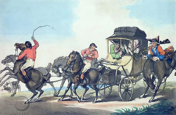
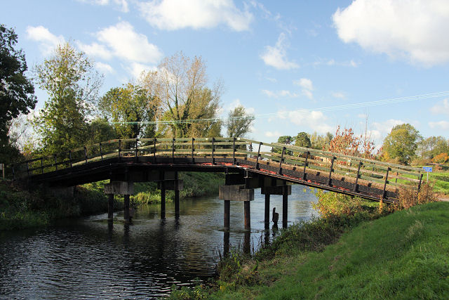
Littleport is a large village in East Cambridgeshire, in the Isle of Ely, Cambridgeshire, England. It lies about north-east of Ely and south-east of Welney, on the Bedford Level South section of the River Great Ouse, close to Burnt Fen and Mare Fen. There are two primary schools, Millfield Primary and Littleport Community, and a secondary, Littleport and East Cambridgeshire Academy. The Littleport riots of 1816 influenced the passage of the Vagrancy Act 1824. History With an Old English name of ''Litelport'', the village was worth 17,000 eels a year to the Abbots of Ely in 1086. The legendary founder of Littleport was King Canute. A fisherman gave the king shelter one night, after drunken monks had denied him hospitality. After punishing the monks, he made his host the mayor of a newly founded village. The Littleport Riots of 1816 broke out after war veterans from the Battle of Waterloo returned home, only to find they could get no work and grain prices had gone up. The ... [...More Info...] [...Related Items...] OR: [Wikipedia] [Google] [Baidu] |
Ely And Littleport Riots Of 1816
The Ely and Littleport riots of 1816, also known as the Ely riots or Littleport riots, occurred between 22 and 24 May 1816 in Littleport, Cambridgeshire. The riots were caused by high unemployment and rising grain costs, similar to the general unrest which spread throughout England following the Napoleonic Wars. The Littleport riot broke out when a group of residents met at The Globe Inn. Fuelled by alcohol, they left the inn and began intimidating wealthier Littleport residents, demanding money and destroying property. The riot spread to Ely where magistrates attempted to calm the protests by ordering poor relief and fixing a minimum wage; see printed bill (reproduced at right). The following day, encouraged by Lord Liverpool's government, a militia of the citizens of Ely, led by Sir Henry Bate Dudley and backed by the 1st The Royal Dragoons, rounded up the rioters. In the ensuing altercation at The George and Dragon in Littleport, a trooper was injured, one rioter was killed, ... [...More Info...] [...Related Items...] OR: [Wikipedia] [Google] [Baidu] |
Ely, Cambridgeshire
Ely ( ) is a cathedral city in the East Cambridgeshire district of Cambridgeshire, England, about north-northeast of Cambridge and from London. Ely is built on a Kimmeridge Clay island which, at , is the highest land in the Fens. It was due to this topography that Ely was not waterlogged like the surrounding Fenland, and was an island separated from the mainland. Major rivers including the River Witham, Witham, River Welland, Welland, River Nene, Nene and River Great Ouse, Great Ouse feed into the Fens and, until draining commenced in the eighteenth century, formed freshwater marshes and Mere (lake), meres within which peat was laid down. Once the Fens were drained, this peat created a rich and fertile soil ideal for farming. The River Great Ouse was a significant means of transport until the Fens were drained and Ely ceased to be an island in the seventeenth century. The river is now a popular boating spot, and has a large marina. Although now surrounded by land, the city ... [...More Info...] [...Related Items...] OR: [Wikipedia] [Google] [Baidu] |
River Great Ouse
The River Great Ouse () is a river in England, the longest of several British rivers called "Ouse". From Syresham in Northamptonshire, the Great Ouse flows through Buckinghamshire, Bedfordshire, Cambridgeshire and Norfolk to drain into the Wash and the North Sea near Kings Lynn. Authorities disagree both on the river's source and its length with one quoting and another . Mostly flowing north and east, it is the fifth longest river in the United Kingdom. The Great Ouse has been historically important for commercial navigation, and for draining the low-lying region through which it flows; its best-known tributary is the Cam, which runs through Cambridge. Its lower course passes through drained wetlands and fens and has been extensively modified, or channelised, to relieve flooding and provide a better route for barge traffic. The unmodified river would have changed course regularly after floods. The name ''Ouse'' is from the Celtic or pre-Celtic *''Udso-s'', and probably me ... [...More Info...] [...Related Items...] OR: [Wikipedia] [Google] [Baidu] |
Ely Rural District
Ely Rural District was a rural district in England from 1894 to 1974. It was named after Ely, but did not include the city itself, instead covering the rural area to the west and north of it. It formed part of the administrative county of the Isle of Ely from 1894 to 1965, when this was merged into Cambridgeshire and Isle of Ely. History The district had its origins in the Ely Poor Law Union, which had been created in 1836, covering Ely and several surrounding parishes. In 1872 sanitary districts were established, giving public health and local government responsibilities for rural areas to the existing boards of guardians of poor law unions. The Ely Rural Sanitary District therefore covered the area of the poor law union except for Ely itself, which already had a local board of health and so formed its own urban sanitary district. The Ely Rural Sanitary District was administered from Ely Union Workhouse, which had been built in 1837 on Cambridge Road in Ely. Under the Loca ... [...More Info...] [...Related Items...] OR: [Wikipedia] [Google] [Baidu] |
Burnt Fen
Burnt Fen is an area of low-lying land crossed by the A1101 road between Littleport in Cambridgeshire and Mildenhall in Suffolk, England. It is surrounded on three sides by rivers, and consists of prime agricultural land, with sparse settlement. It is dependent on pumped drainage to prevent it from flooding. Between 1759 and 1962 the area was managed by the Commissioners of the Burnt Fen First Drainage District, who were then replaced by the Burnt Fen Internal Drainage Board, when the area of responsibility was expanded. Funding for the drainage works is collected by a system of rates, paid by those whose property would be threatened by flooding without the works. Location Burnt Fen is located near the eastern borders of the Isle of Ely, Cambridgeshire, although parts of it are also located in Suffolk and Norfolk. It is an area of prime agricultural land, which is mostly below sea level, and all of it is below the normal flood levels of the rivers which surround it on three si ... [...More Info...] [...Related Items...] OR: [Wikipedia] [Google] [Baidu] |
North East Cambridgeshire (UK Parliament Constituency)
North East Cambridgeshire is a constituency represented in the House of Commons of the UK Parliament since 2010 by Steve Barclay, a Conservative. Constituency profile This large and rural seat is in The Fens and has a significant farming and food production sector. Residents are less wealthy and healthy than the UK average. History Clement Freud, former Liberal MP for Isle of Ely from 1973, represented the seat from its creation in 1983 until 1987, when he was defeated by the Conservative Malcolm Moss and since then it has been served by one other Conservative MP, namely Steve Barclay, first elected in 2010. On 16 November 2018, Barclay was appointed Secretary of State for Exiting the European Union. Boundaries and boundary changes 1983–1997: The District of Fenland, the District of East Cambridgeshire wards of Downham, Haddenham, Littleport, Stretham, Sutton, and Witchford, and the City of Peterborough wards of Eye, Newborough, and Thorney. The seat was created for the 1 ... [...More Info...] [...Related Items...] OR: [Wikipedia] [Google] [Baidu] |
Little Ouse, Cambridgeshire
Little Ouse is a hamlet in Littleport parish, East Cambridgeshire, England, about north-east of Littleport village. It lies on the left bank of the River Little Ouse, which here marks the boundary between Cambridgeshire and Norfolk. The lowest trig point A triangulation station, also known as a trigonometrical point, and sometimes informally as a trig, is a fixed surveying station, used in geodetic surveying and other surveying projects in its vicinity. The nomenclature varies regionally: they a ... in Britain is near Little Ouse; it sits at 1 m below sea level. References Hamlets in Cambridgeshire Littleport {{Cambridgeshire-geo-stub ... [...More Info...] [...Related Items...] OR: [Wikipedia] [Google] [Baidu] |
Cambridgeshire
Cambridgeshire (abbreviated Cambs.) is a Counties of England, county in the East of England, bordering Lincolnshire to the north, Norfolk to the north-east, Suffolk to the east, Essex and Hertfordshire to the south, and Bedfordshire and Northamptonshire to the west. The city of Cambridge is the county town. Following the Local Government Act 1972 restructuring, modern Cambridgeshire was formed in 1974 through the amalgamation of two administrative counties: Cambridgeshire and Isle of Ely, comprising the Historic counties of England, historic county of Cambridgeshire (including the Isle of Ely); and Huntingdon and Peterborough, comprising the historic county of Huntingdonshire and the Soke of Peterborough, historically part of Northamptonshire. Cambridgeshire contains most of the region known as Silicon Fen. The county is now divided between Cambridgeshire County Council and Peterborough City Council, which since 1998 has formed a separate Unitary authorities of England, unita ... [...More Info...] [...Related Items...] OR: [Wikipedia] [Google] [Baidu] |
East Cambridgeshire
East Cambridgeshire (locally known as East Cambs) is a local government district in Cambridgeshire, England. Its council is based in Ely. The population of the District Council at the 2011 Census was 83,818. The district was formed on 1 April 1974 with the merger of Ely Urban District, Ely Rural District, and Newmarket Rural District. The district is divided into 14 electoral divisions, which return a total of 28 councillors. The council has been controlled by the Conservative Party since 2007. Archaeology The recent Fenland survey of archaeological finds mentions an enumeration of findings made between 1884 and 1994 in the region to the north of Devil's Dyke and Cambridge, from the Stone Age, the Bronze Age and the Iron Age (the region south of Devil's Dyke is not yet included in the survey). By far the greatest quantities of bronze objects found in England were discovered in East Cambridgeshire. The most important Bronze Age finds were discovered in Isleham (more than ... [...More Info...] [...Related Items...] OR: [Wikipedia] [Google] [Baidu] |
Cambridgeshire County Council
Cambridgeshire County Council is the county council of Cambridgeshire, England. The council consists of 61 councillors, representing 59 electoral divisions. The council is based at New Shire Hall at Alconbury Weald, near Huntingdon. It is a member of the East of England Local Government Association. Since May 2021, it has been run by a joint administration of the Liberal Democrats, Labour Party, and independent groups. History Cambridgeshire County Council was first formed in 1889 as a result of the Local Government Act 1888, as one of two county councils covering Cambridgeshire; the other was the Isle of Ely County Council. In 1965 the two councils were merged to form Cambridgeshire and Isle of Ely County Council. This arrangement lasted until 1974 when, following the Local Government Act 1972, Cambridgeshire and Isle of Ely was merged with Huntingdon and Peterborough to form a new non-metropolitan county of Cambridgeshire under the control of a newly constituted Cambridg ... [...More Info...] [...Related Items...] OR: [Wikipedia] [Google] [Baidu] |
Burns London
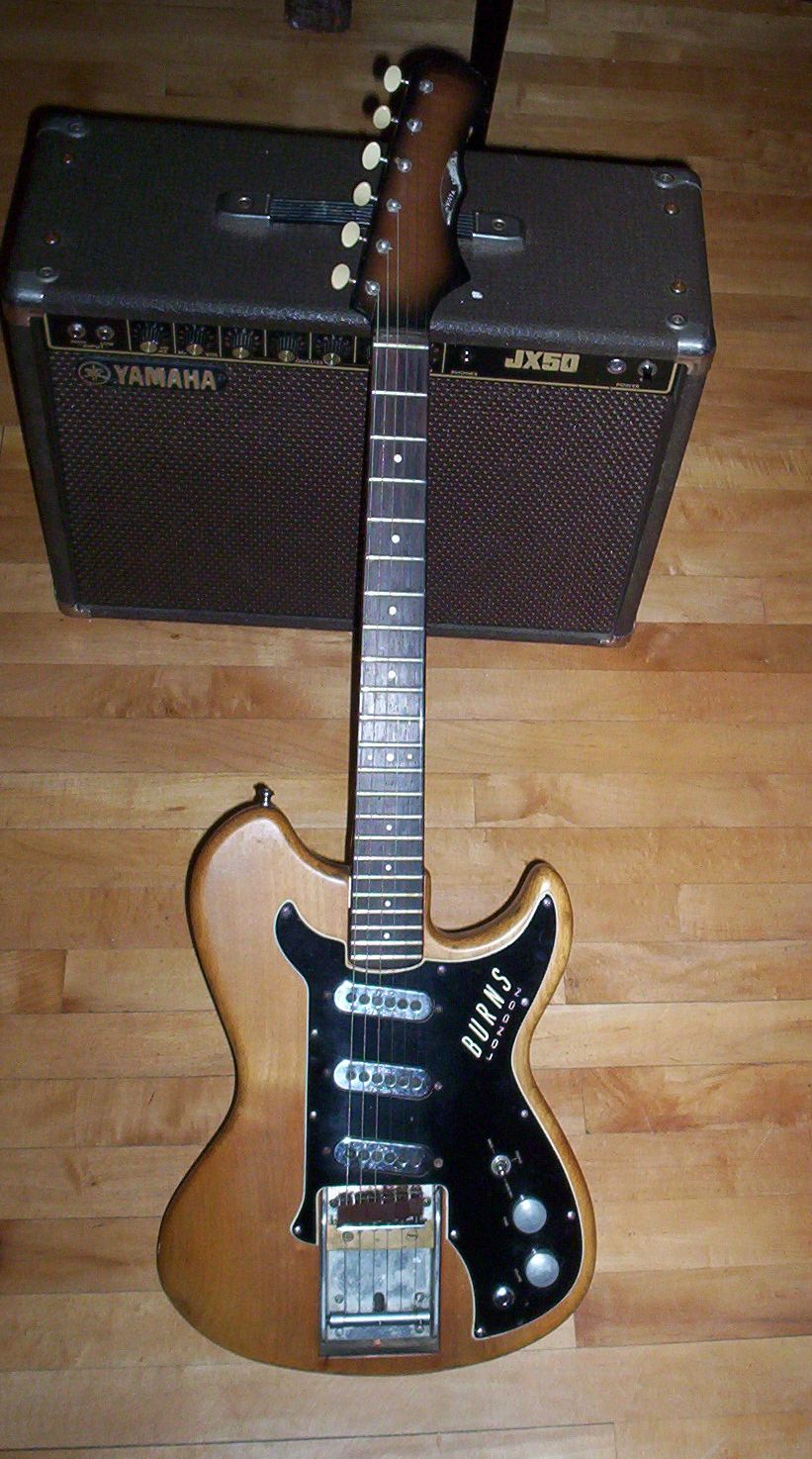
Burns Guitars London is an English manufacturer of electric guitars and bass guitars, founded by Alice Louise Farrell (1908–1993) and James Ormston (Jim) Burns (1925–1998) in 1959. The company was first named "Burns-Weill", then renamed "Ormston Burns Ltd". At its peak, in the 1960s, it was the most successful guitar company in England. Ormston Burns Ltd. was bought up by Baldwin Piano Company in 1965, and the company was renamed "Baldwin-Burns". Burns guitars were reintroduced in 1991 under the name "Burns London", and the product line now includes a collector's edition of the first model the company produced. History Jim Burns set out to make, in his own words, "mass produced one-offs", such as the Marvin, a radical take on the Stratocaster style with many more differences than it is generally credited with The Bison, now considered as a classic, combined fewer Fender influences with a shorter scale length of 25 inches, and the "Wild Dog" electronics, allowing the hig ... [...More Info...] [...Related Items...] OR: [Wikipedia] [Google] [Baidu] |
Trig Point
A triangulation station, also known as a trigonometrical point, and sometimes informally as a trig, is a fixed surveying station, used in geodetic surveying and other surveying projects in its vicinity. The nomenclature varies regionally: they are generally known as trigonometrical stations or triangulation stations in North America, trig points in the United Kingdom, trig pillars in Ireland, trig stations or trig points in Australia and New Zealand, and trig beacons in South Africa. Use The station is usually set up by a government with known coordinates and elevation published. Many stations are located on hilltops for the purposes of visibility. A graven metal plate on the top of a pillar may provide a mounting point for a theodolite or reflector, often using some form of kinematic coupling to ensure reproducible positioning. Trigonometrical stations are grouped together to form a network of triangulation. Positions of all land boundaries, roads, railways, bridges and other ... [...More Info...] [...Related Items...] OR: [Wikipedia] [Google] [Baidu] |


