|
Littleborough, Lancashire
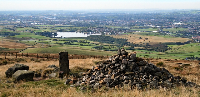
Littleborough ( ) is a town in the Metropolitan Borough of Rochdale, Greater Manchester, England, in the upper Roch Valley by the foothills of the South Pennines, northeast of Rochdale and northeast of Manchester; Milnrow and the M62 motorway are to the south, and the rural uplands of Blackstone Edge to the east. In 2001, Littleborough, and its suburbs of Calderbrook, Shore and Smithy Bridge,. had a population of 13,807. Within the boundaries of the historic county of Lancashire, Littleborough and its surroundings have provided evidence of Neolithic, Celtic, Roman and Anglo-Saxon activity in the area. During the Middle Ages, Littleborough was a hamlet in the manor of Hundersfield, parish of Rochdale and hundred of Salford.. It was focussed upon the junction of two ancient routes over the Pennines — one of which may have been a Roman road — that joined to cross the River Roch. By 1472, Littleborough consisted of a chapel, a cluster of cottages, and an inn, and its ... [...More Info...] [...Related Items...] OR: [Wikipedia] [Google] [Baidu] |
Metropolitan Borough Of Rochdale
The Metropolitan Borough of Rochdale is a metropolitan borough of Greater Manchester in North West England. It is named after its largest town, Rochdale, The borough covers other outlying towns and villages with a population of 206,500 at the 2011 census. It is the ninth-largest district by population in Greater Manchester. History The borough was formed in 1974 as part of the provisions of the Local Government Act 1972 and is an amalgamation of six former local government districts. It was originally proposed that the borough include the neighbouring town of Bury and disclude Middleton; Bury however went on to form the administrative centre for the adjacent Metropolitan Borough of Bury. The borough was formed by a merger of the former county borough of Rochdale and from the administrative county of Lancashire, the municipal boroughs of Heywood and Middleton, along with the urban districts of Littleborough, Milnrow and Wardle.The borough lies mostly within the historic count ... [...More Info...] [...Related Items...] OR: [Wikipedia] [Google] [Baidu] |
Roman Britain
Roman Britain was the period in classical antiquity when large parts of the island of Great Britain were under occupation by the Roman Empire. The occupation lasted from AD 43 to AD 410. During that time, the territory conquered was raised to the status of a Roman province. Julius Caesar invaded Britain in 55 and 54 BC as part of his Gallic Wars. According to Caesar, the Britons had been overrun or culturally assimilated by other Celtic tribes during the British Iron Age and had been aiding Caesar's enemies. He received tribute, installed the friendly king Mandubracius over the Trinovantes, and returned to Gaul. Planned invasions under Augustus were called off in 34, 27, and 25 BC. In 40 AD, Caligula assembled 200,000 men at the Channel on the continent, only to have them gather seashells ('' musculi'') according to Suetonius, perhaps as a symbolic gesture to proclaim Caligula's victory over the sea. Three years later, Claudius directed four legi ... [...More Info...] [...Related Items...] OR: [Wikipedia] [Google] [Baidu] |
Manchester And Leeds Railway
The Manchester and Leeds Railway was a British railway company that built a line from Manchester to Normanton where it made a junction with the North Midland Railway, over which it relied on running powers to access Leeds. The line followed the valley of the River Calder for much of the way, making for easier gradients but by-passing many important manufacturing towns. Crossing the watershed between Lancashire and Yorkshire required a long tunnel. The line opened throughout in 1841. Early on, the company realised that the initial route required expansion, and branches were built by the company or by new, sponsored companies. In Manchester steps were taken to make a railway connection with the Liverpool and Manchester Railway, and a connecting line was built, including an important joint passenger station, named Victoria station. The pace of expansion accelerated and in 1846 it was clear that the company's name was no longer appropriate, and the opportunity was taken, when get ... [...More Info...] [...Related Items...] OR: [Wikipedia] [Google] [Baidu] |
Rochdale Canal
The Rochdale Canal is in Northern England, between Manchester and Sowerby Bridge, part of the connected system of the canals of Great Britain. Its name refers to the town of Rochdale through which it passes. The Rochdale is a broad canal because its locks are wide enough to allow vessels of width. The canal runs for across the Pennines from the Bridgewater Canal at Castlefield Basin in Manchester to join the Calder and Hebble Navigation at Sowerby Bridge in West Yorkshire. As built, the canal had 92 locks. Whilst the traditional lock numbering has been retained on all restored locks, and on the relocated locks, the canal now has 91. Locks 3 and 4 have been replaced with a single deep lock, Tuel Lane Lock, which is numbered 3/4. History The Rochdale Canal was conceived in 1776, when a group of 48 men from Rochdale raised £237 and commissioned James Brindley to conduct a survey of possible routes between Sowerby Bridge and Manchester. Brindley proposed a route similar to ... [...More Info...] [...Related Items...] OR: [Wikipedia] [Google] [Baidu] |
Walsden
Walsden (; ) is a large village in the civil parish In England, a civil parish is a type of administrative parish used for local government. It is a territorial designation which is the lowest tier of local government below districts and counties, or their combined form, the unitary authority ... of Todmorden in the Metropolitan Borough of Calderdale, West Yorkshire, England, though Historic counties of England, historically partially administered in Lancashire (the Walsden Water as tributary to the River Calder, West Yorkshire, Calder serving as the county boundary), and close to the modern boundary with Greater Manchester. It lies along the A6033 road (Great Britain), A6033 Keighley to Littleborough road in the Walsden Valley, a branch of the Upper Calder Valley, and is south of Todmorden and north of Littleborough, Greater Manchester, Littleborough. Overview Walsden railway station, on the Leeds-Todmorden-Manchester line, originally opened in 1841 and re-opened 10 ... [...More Info...] [...Related Items...] OR: [Wikipedia] [Google] [Baidu] |
Summit Tunnel
Summit Tunnel in England is one of the world's oldest railway tunnels. It was constructed between 1838 and 1841 by the Manchester and Leeds Railway Company to provide a direct line between Leeds and Manchester. When built, Summit Tunnel was the longest railway tunnel in the world. The tunnel, between Littleborough and Walsden near Todmorden, was bored beneath the Pennines, a natural obstruction to most forms of traffic. The tunnel is just over long and carries two standard-gauge tracks in a single horseshoe-shaped tube, approximately wide and high. Summit Tunnel was designed by Thomas Longridge Gooch, assisted by Barnard Dickinson. Progress on its construction was slower than anticipated, largely because excavation was more difficult than anticipated. On 1 March 1841, Summit Tunnel was opened by Sir John Frederick Sigismund Smith; it had cost of £251,000 and 41 workers had died. On 20 December 1984, the Summit Tunnel fire occurred. There were no deaths and five months lat ... [...More Info...] [...Related Items...] OR: [Wikipedia] [Google] [Baidu] |
West Riding Of Yorkshire
The West Riding of Yorkshire is one of three historic subdivisions of Yorkshire, England. From 1889 to 1974 the administrative county County of York, West Riding (the area under the control of West Riding County Council), abbreviated County of York (WR), was based closely on the historic boundaries. The lieutenancy at that time included the City of York and as such was named West Riding of the County of York and the County of the City of York. Its boundaries roughly correspond to the present ceremonial counties of West Yorkshire, South Yorkshire and the Craven, Harrogate and Selby districts of North Yorkshire, along with smaller parts in Lancashire (for example, the parishes of Barnoldswick, Bracewell, Brogden and Salterforth became part of the Pendle district of Lancashire and the parishes of Great Mitton, Newsholme and Bowland Forest Low became part of the Ribble Valley district also in Lancashire), Cumbria, Greater Manchester and, since 1996, the unitary East Riding of ... [...More Info...] [...Related Items...] OR: [Wikipedia] [Google] [Baidu] |
Cotton
Cotton is a soft, fluffy staple fiber that grows in a boll, or protective case, around the seeds of the cotton plants of the genus ''Gossypium'' in the mallow family Malvaceae. The fiber is almost pure cellulose, and can contain minor percentages of waxes, fats, pectins, and water. Under natural conditions, the cotton bolls will increase the dispersal of the seeds. The plant is a shrub native to tropical and subtropical regions around the world, including the Americas, Africa, Egypt and India. The greatest diversity of wild cotton species is found in Mexico, followed by Australia and Africa. Cotton was independently domesticated in the Old and New Worlds. The fiber is most often spun into yarn or thread and used to make a soft, breathable, and durable textile. The use of cotton for fabric is known to date to prehistoric times; fragments of cotton fabric dated to the fifth millennium BC have been found in the Indus Valley civilization, as well as fabric remnants dated back ... [...More Info...] [...Related Items...] OR: [Wikipedia] [Google] [Baidu] |
Halifax, West Yorkshire
Halifax () is a minster and market town in the Metropolitan Borough of Calderdale in West Yorkshire, England. It is the commercial, cultural and administrative centre of the borough, and the headquarters of Calderdale Council. In the 15th century, the town became an economic hub of the old West Riding of Yorkshire, primarily in woollen manufacture. Halifax is the largest town in the wider Calderdale borough. Halifax was a thriving mill town during the industrial revolution. Toponymy The town's name was recorded in about 1091 as ''Halyfax'', from the Old English ''halh-gefeaxe'', meaning "area of coarse grass in the nook of land". This explanation is preferred to derivations from the Old English ''halig'' (holy), in ''hālig feax'' or "holy hair", proposed by 16th-century antiquarians. The incorrect interpretation gave rise to two legends. One concerned a maiden killed by a lustful priest whose advances she spurned. Another held that the head of John the Baptist was buried he ... [...More Info...] [...Related Items...] OR: [Wikipedia] [Google] [Baidu] |
Roman Road
Roman roads ( la, viae Romanae ; singular: ; meaning "Roman way") were physical infrastructure vital to the maintenance and development of the Roman state, and were built from about 300 BC through the expansion and consolidation of the Roman Republic and the Roman Empire. They provided efficient means for the overland movement of armies, officials, civilians, inland carriage of official communications, and trade goods. Roman roads were of several kinds, ranging from small local roads to broad, long-distance highways built to connect cities, major towns and military bases. These major roads were often stone-paved and metaled, cambered for drainage, and were flanked by footpaths, bridleways and drainage ditches. They were laid along accurately surveyed courses, and some were cut through hills, or conducted over rivers and ravines on bridgework. Sections could be supported over marshy ground on rafted or piled foundations.Corbishley, Mike: "The Roman World", page 50. Warwick Press, ... [...More Info...] [...Related Items...] OR: [Wikipedia] [Google] [Baidu] |
Salford (hundred)
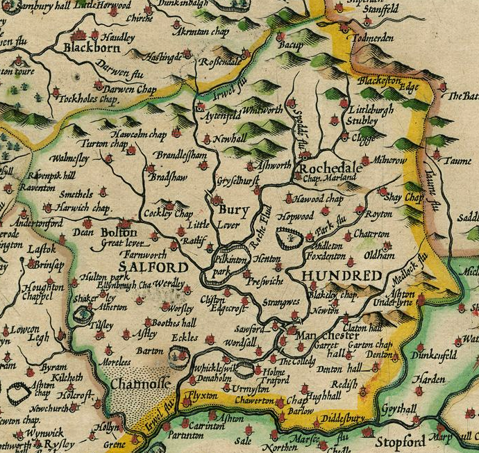
The Salford Hundred (also known as Salfordshire) was one of the subdivisions of the historic county of Lancashire, in Northern England (see:Hundred (county division). Its name alludes to its judicial centre being the township of Salford (the suffix ''-shire'' meaning the territory was appropriated to the prefixed settlement). It was also known as the Royal Manor of Salford and the Salford wapentake.. Origins The Manor or Hundred of Salford had Anglo-Saxon origins. The ''Domesday Book'' recorded that the area was held in 1066 by Edward the Confessor. Salford was recorded as part of the territory of ''Inter Ripam et Mersam'' or "Between Ribble and Mersey", and it was included with the information about Cheshire, though it cannot be said clearly to have been part of Cheshire. The area became a subdivision of the County Palatine of Lancaster (or Lancashire) on its creation in 1182. Salford Hundred Court In spite of its incorporation into Lancashire, Salford Hundred retained a se ... [...More Info...] [...Related Items...] OR: [Wikipedia] [Google] [Baidu] |
Rochdale (ancient Parish)
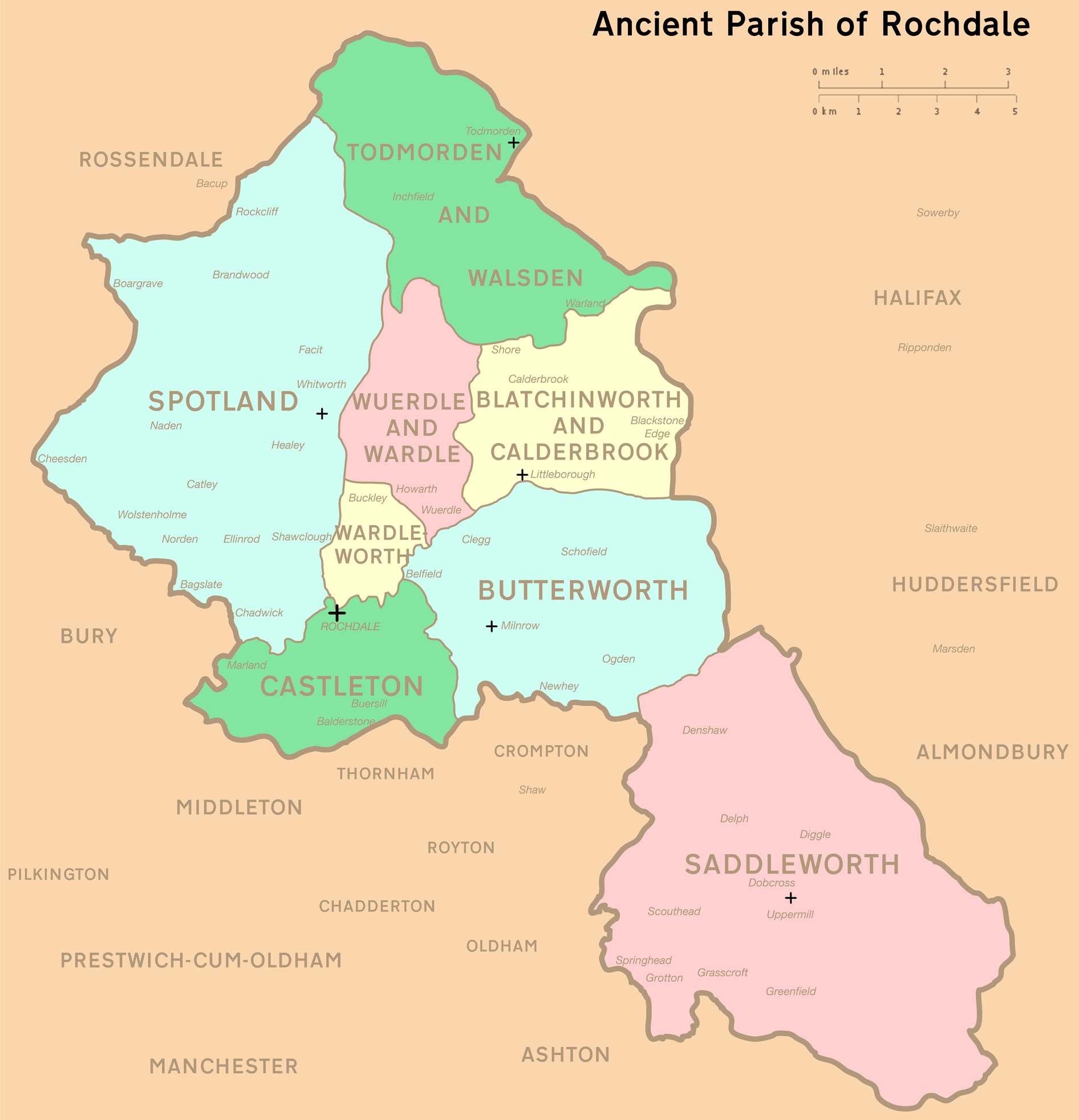
Rochdale was an ecclesiastical parish of early-medieval origin in northern England, administered from the Church of St Chad, Rochdale. At its zenith, it occupied of land amongst the South Pennines, and straddled the historic county boundary between Lancashire and the West Riding of Yorkshire. To the north and north-west was the parish of Whalley; to the southwest was the parish of Bury; to the south was Middleton and Prestwich-cum-Oldham. Anciently a dependency of Whalley Abbey, the parish of Rochdale is believed to be of Anglo-Saxon origin, as evidenced by historical documentation, toponymy and its dedication to Chad of Mercia. Urbanisation, population shifts, and local government reforms all contributed towards the gradual alteration and ultimate dissolution of the historic parish boundaries; the social welfare functions of the parish were broadly superseded by the English Poor Laws and new units of local governance, such as the County Borough of Rochdale and the Milnrow Ur ... [...More Info...] [...Related Items...] OR: [Wikipedia] [Google] [Baidu] |


