|
List Of Star Forts
This is a list of bastion forts. Angola * Fortaleza de São Miguel, Luanda Antigua and Barbuda * Fort James Bahrain * Forte de Barém - also known as the Qal'at al-Bahrain Brazil * Fort Orange (Fortaleza de Santa Cruz), Ilha de Itamaracá, State of Pernambuco * Forte de Tiago das Cinco Pontas, Recife, State of Pernambuco * Forte de São João Batista do Brum, Recife, State of Pernambuco *Fortaleza de São José de Macapá, Macapá, Amapá * Forte do Presépio, Belém, Pará *Fortaleza de Nossa Senhora da Assunção, Fortaleza, Ceará (only two bastions remain) *Forte de Nossa Senhora dos Remédios, Fernando de Noronha, State of Pernambuco * Fortaleza dos Reis Magos, Natal, Rio Grande do Norte *Forte de Santa Catarina, Cabedelo, Paraíba * Forte de Santo Inácio de Tamandaré, Tamandaré, State of Pernambuco *Forte do Barbalho, Salvador, Bahia * Forte de São Lourenço, Itaparica, Bahia * Fortaleza de São João da Barra do Rio de Janeiro, Urca, Rio de J ... [...More Info...] [...Related Items...] OR: [Wikipedia] [Google] [Baidu] |
Coevorden
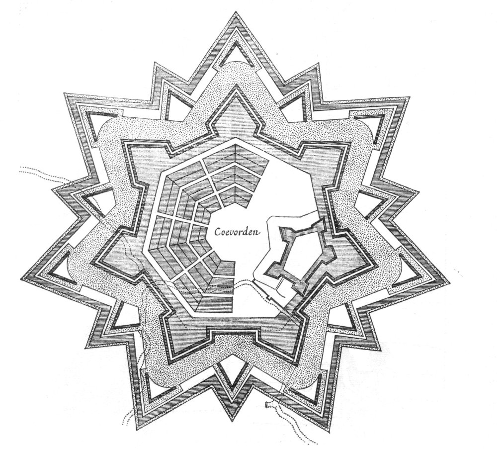
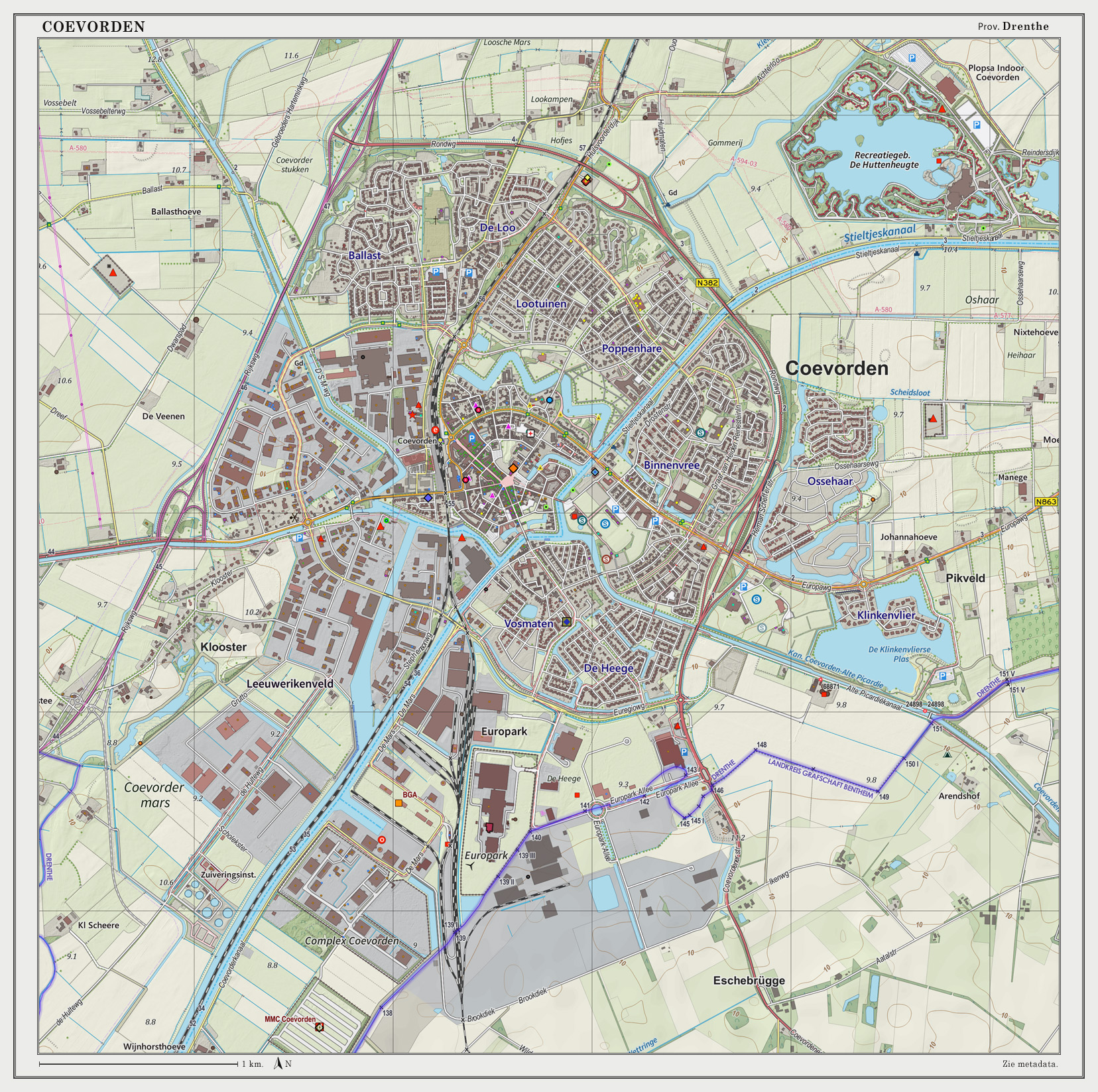
Coevorden (; nds-nl, Koevern) is a city and municipality in the province of Drenthe, Netherlands. During the 1998 municipal reorganisation in the province, Coevorden merged with Dalen, Sleen, Oosterhesselen and Zweeloo, retaining its name. In August 2017, it had a population of 35,267. Etymology The name ''Coevorden'' means "cow ford(s)" or "cow crossing", similar to ''Bosporus'' or ''Oxford''. History Coevorden received city rights in 1408. It is the oldest city in the province of Drenthe. The city was captured from the Spanish in 1592 by a Dutch and English force under the command of Maurice, Prince of Orange. The following year it was besieged by a Spanish force but the city held out until its relief in May 1594. Coevorden was then reconstructed in the early seventeenth century to an ''ideal city'' design, similar to Palmanova. The streets were laid out in a radial pattern within polygonal fortifications and extensive outer earthworks. The city of Coevorden indir ... [...More Info...] [...Related Items...] OR: [Wikipedia] [Google] [Baidu] |
Amap√°
Amap√° () is one of the 26 states of Brazil. It is in the northern region of Brazil. It is the second least populous state and the eighteenth largest by area. Located in the far northern part of the country, Amap√° is bordered clockwise by French Guiana to the north, the Atlantic Ocean to the east, Par√° to the south and west, and Suriname to the northwest. The capital and largest city is Macap√°. The state has 0.4% of the Brazilian population and is responsible for only 0.22% of the Brazilian GDP. In the colonial period the region was called Portuguese Guiana and was part of Portuguese Empire, Portugal's State of Brazil. Later, the region was distinguished from the other The Guianas, Guianas. Amap√° was once part of Par√°, but became a separate territory in 1943, and a state in 1990. The dominant feature of the region, and 90 percent of its total area, is the Amazon Rainforest. Unexplored forests occupy 70 percent of Amap√°, and Tumucumaque Mountains National Park, establish ... [...More Info...] [...Related Items...] OR: [Wikipedia] [Google] [Baidu] |
Cabedelo
Cabedelo is a municipality in the state of Paraíba in the Northeast Region of Brazil. The municipality contains the Restinga de Cabedelo National Forest, created in 2004. Cabedelo is a municipality in the Metropolitan Region of João Pessoa, in the state of Paraíba. It has an area of 29,873 square kilometers, with singular measures: 18 kilometers long and only three kilometers wide. Its population in 2020 was estimated by the Brazilian Institute of Geography and Statistics (IBGE) at 68,767 inhabitants. On 17th century Dutch maps, it appeared as an island because of the Jaguaribe and Mandacaru rivers. Its geophysical age also differs from neighbouring municipalities that tend to have older sedimentary plateaus and therefore divergent average altitude and climate. Currently, it is troubled by the capital of Paraíba, João Pessoa, and serves as an extension of certain tertiary activities of the headquarters, such as tourism but also private higher education, etc. CBTU urba ... [...More Info...] [...Related Items...] OR: [Wikipedia] [Google] [Baidu] |
Forte De Santa Catarina
Forte de Santa Catarina is a fort located in Cabedelo, Paraíba in Brazil. See also *Military history of Brazil The military history of Brazil comprises centuries of armed actions in the territory encompassing modern Brazil, and the role of the Brazilian Armed Forces in conflicts and peacekeeping worldwide. For several hundreds of years, the area was the s ... References External links Santa Catarina Buildings and structures in Paraíba Portuguese colonial architecture in Brazil {{Brazil-mil-stub ... [...More Info...] [...Related Items...] OR: [Wikipedia] [Google] [Baidu] |
Rio Grande Do Norte
Rio Grande do Norte (, , ) is one of the states of Brazil. It is located in the northeastern region of the country, forming the northeasternmost tip of the South American continent. The name literally translates as "Great Northern River", referring to the mouth of the Potengi River. The capital and largest city is Natal. The state has 410 km (254 mi) of sandy beaches and contains Rocas Atoll, the only atoll the Atlantic Ocean. The main economic activity is tourism, followed by the extraction of petroleum (the second largest producer in the country), agriculture, fruit growing and extraction of minerals, including considerable production of seasalt, among other economic activities. The state is home to 1.7% of the Brazilian population and produces 1% of the country's GDP. In 2000-17 the murder rate rose by 655%, making Rio Grande do Norte the state with the highest murder rate in Brazil: 63.9 per 100,000. Tourist attractions in the state include the Cashew of Pirang ... [...More Info...] [...Related Items...] OR: [Wikipedia] [Google] [Baidu] |
Natal, Rio Grande Do Norte
Natal ( ) is the capital and largest city of the state of Rio Grande do Norte, located in northeastern Brazil. According to IBGE's 2021 estimate, the city had a total population o896,708 making it the 19th largest city in the country. Natal is a major tourist destination and an exporting hub of crustaceans, carnauba wax and fruits, mostly melon, sugar apple, cashew and papaya. It is the country's closest city to Africa and Europe, with its Greater Natal International Airport connecting Natal with many Brazilian cities and also operating some international flights. The city was one of the host cities of the 2014 FIFA World Cup. History The Brazilian coast has long been home to indigenous peoples, generally members of the Tupi language family. While written records do not exist, archeological evidence suggests that pre-European inhabitants moved from the Amazon to the coasts approximately 2,900 years ago. Near the Rio Grande de Norte, the Potiguara people were the most num ... [...More Info...] [...Related Items...] OR: [Wikipedia] [Google] [Baidu] |
Forte Dos Reis Magos
The Forte dos Reis Magos or Fortaleza dos Reis Magos (Fortress of the Three Wise Men) is a fortress located in the city of Natal in the Brazilian state of Rio Grande do Norte. The fortress was the first milestone of the city ‚Äď founded on 25 December 1599 ‚Äď on the right side of the bar of the Potengi River (today near the Newton Navarro bridge). It received its name based on the date of commencement of its construction, 6 January 1598, at Epiphany Catholic calendar. References External links Forte dos Reis Magos in: Fortalezas.org Buildings and structures in Rio Grande do Norte Reis Magos Reis Magos is a village located on the northern bank of the Mandovi River in Bardez, Goa, opposite to the capital city of Panjim. The village is famous for two of Goa‚Äôs famous structures; the Reis Magos Fort, and the Reis Magos Church ‚Äď the ... Natal, Rio Grande do Norte Portuguese colonial architecture in Brazil National heritage sites of Rio Grande do Norte {{Brazil ... [...More Info...] [...Related Items...] OR: [Wikipedia] [Google] [Baidu] |
Fernando De Noronha
Fernando de Noronha () is an archipelago in the Atlantic Ocean, part of the State of Pernambuco, Brazil, and located off the Brazilian coast. It consists of 21 islands and islets, extending over an area of . Only the eponymous main island is inhabited; it has an area of and a population estimated at 3,101 in 2020. While the archipelago is relatively low-lying, there are parts stretching above in elevation. The islands are administratively unique in Brazil. They form a "state district" ( pt, distrito estadual) that is administered directly by the government of the state of Pernambuco (despite being closer to the state of Rio Grande do Norte). The state district's jurisdiction also includes the very remote Saint Peter and Saint Paul Archipelago, located northeast of Fernando de Noronha. Seventy percent of the islands' area was established in 1988 as a national marine park. In 2001, UNESCO designated it as a World Heritage Site because of its importance as a feeding ground for t ... [...More Info...] [...Related Items...] OR: [Wikipedia] [Google] [Baidu] |
Forte De Nossa Senhora Dos Remédios
Forte de Nossa Senhora dos Remédios is a fort located on the island of Fernando de Noronha (in the archipelago and municipality of the same name) in the state of Pernambuco in Brazil. See also *Military history of Brazil The military history of Brazil comprises centuries of armed actions in the territory encompassing modern Brazil, and the role of the Brazilian Armed Forces in conflicts and peacekeeping worldwide. For several hundreds of years, the area was the s ... References External links Nossa Senhora Buildings and structures in Pernambuco Portuguese colonial architecture in Brazil {{Forts and fortresses of the Portuguese empire , state=collapsed ... [...More Info...] [...Related Items...] OR: [Wikipedia] [Google] [Baidu] |
Cear√°
Ceará (, pronounced locally as or ) is one of the 26 states of Brazil, located in the northeastern part of the country, on the Atlantic coast. It is the eighth-largest Brazilian State by population and the 17th by area. It is also one of the main tourist destinations in Brazil. The state capital is the city of Fortaleza, the country's fourth most populous city. The state has 4.3% of the Brazilian population and produces 2.1% of the Brazilian GDP. Literally, the name ''Ceará'' means "sings the jandaia". According to José de Alencar, one of the most important writers of Brazil and an authority in Tupi Guaraní, ''Ceará'' means turquoise or green waters. The state is best known for its extensive coastline, with of sand. There are also mountains and valleys producing tropical fruits. To the south, on the border of Paraíba, Pernambuco and Piauí, is the National Forest of Araripe. Geography Ceará has an area of . It is bounded on the north by the Atlantic Ocean, ... [...More Info...] [...Related Items...] OR: [Wikipedia] [Google] [Baidu] |
Fortaleza
Fortaleza (, locally , Portuguese for ''Fortress'') is the state capital of Cear√°, located in Northeastern Brazil. It belongs to the Metropolitan mesoregion of Fortaleza and microregion of Fortaleza. It is Brazil's 5th largest city and the twelfth richest city in the country in GDP. It also has the third richest metropolitan area in the North and Northeast regions. It is an important industrial and commercial center of Brazil, the nation's eighth largest municipality in purchasing power. According to the Ministry of Tourism, the city reached the mark of second most desired destination of Brazil and fourth among Brazilian cities in tourists received. The BR-116, the most important highway of the country, starts in Fortaleza. The municipality is part of the Common Market of Mercosur Cities, and also the Brazilian state capital which is closest to Europe, from Lisbon, Portugal. To the north of the city lies the Atlantic Ocean; to the south are the municipalities of Pacatuba, E ... [...More Info...] [...Related Items...] OR: [Wikipedia] [Google] [Baidu] |
Fortaleza De Nossa Senhora Da Assunção
Fortaleza de Nossa Senhora da Assunção is a fort located in Fortaleza, Ceará in Brazil. See also *Military history of Brazil The military history of Brazil comprises centuries of armed actions in the territory encompassing modern Brazil, and the role of the Brazilian Armed Forces in conflicts and peacekeeping worldwide. For several hundreds of years, the area was the s ... References External links {{Authority control Nossa Senhora Buildings and structures in Fortaleza Portuguese colonial architecture in Brazil ... [...More Info...] [...Related Items...] OR: [Wikipedia] [Google] [Baidu] |


