|
List Of Talukas Of Kerala ...
In Kerala, the administrative divisions below the district are called taluks. There are 78 taluks with 1670 villages (including group villages).https://ildm.kerala.gov.in/wp-content/uploads/2018/01/Revenue-Guide-2018.pdf See also * Districts of Kerala References * {{Kerala topics Kerala Kerala ( ; ) is a state on the Malabar Coast of India. It was formed on 1 November 1956, following the passage of the States Reorganisation Act, by combining Malayalam-speaking regions of the erstwhile regions of Cochin, Malabar, South C ... [...More Info...] [...Related Items...] OR: [Wikipedia] [Google] [Baidu] |
Kerala
Kerala ( ; ) is a state on the Malabar Coast of India. It was formed on 1 November 1956, following the passage of the States Reorganisation Act, by combining Malayalam-speaking regions of the erstwhile regions of Cochin, Malabar, South Canara, and Thiruvithamkoor. Spread over , Kerala is the 21st largest Indian state by area. It is bordered by Karnataka to the north and northeast, Tamil Nadu to the east and south, and the Lakshadweep Sea to the west. With 33 million inhabitants as per the 2011 census, Kerala is the 13th-largest Indian state by population. It is divided into 14 districts with the capital being Thiruvananthapuram. Malayalam is the most widely spoken language and is also the official language of the state. The Chera dynasty was the first prominent kingdom based in Kerala. The Ay kingdom in the deep south and the Ezhimala kingdom in the north formed the other kingdoms in the early years of the Common Era (CE). The region had been a prominent spice exp ... [...More Info...] [...Related Items...] OR: [Wikipedia] [Google] [Baidu] |
Kottarakkara
Kottarakkara (IAST: Koṭṭārakkara), also transliterated as ''Kottarakara'', is a town and municipality in the Kollam district of the Kerala, India. The town is close to Kollam Port, which has a rich history linked to the early medieval period as well as the reputation as an important commercial, industrial and trading center. Kottarakkara lies to the east of Kollam city centre. History Kottarakkara, also known in the ancient days of the kings as the Elayadathu Swarupam, was a principality ruled by a branch of the Travancore Royal Family. It is the home of Kathakali, a well known dance drama which originated initially as Ramanattam created in the 17th century by Prince Kottarakkara Thampuran and later patronized by the Raja of Kottarakkara in the early 19th century absorbing other dance forms of Krishnattam with further innovations. Etymology Kottarakkara, a compound word made up of the words ''Kottaram'', meaning "palace", and ''kara'' meaning "land", literally means "la ... [...More Info...] [...Related Items...] OR: [Wikipedia] [Google] [Baidu] |
Mavelikkara
Mavelikkara is a taluk and municipality in the '' Onattukara'' region of Alappuzha district in the Indian state of Kerala. Located in the southern part of the district on the banks of the Achankovil River. Etymology The name Mavelikara is believed to be turned out from the words ''Maveli'' or Mahabali, the mythical king of Kerala, and ''Kara'' means land. This land is believed to be the place 'Mattom Mahadeva temple'where king Mahabali knelt before Vamana, offering his head for Vamana to keep his feet. Background The town boasts about a rich historical and cultural background. The Chettikulangara Devi Temple, known for the '' Kumbha Bharani'' festival is located near the municipality. The place is home to one of the 108 Shiva temples of Kerala created by Lord Parashurama, the Kandiyoor Mahadeva Temple. It was also a major centre of trade and commerce in ancient Kerala and the erstwhile capital of the rulers of Onattukara. As a result of the close association with ... [...More Info...] [...Related Items...] OR: [Wikipedia] [Google] [Baidu] |
Chenganoor
Chengannur (also spelled Chengannoor or Chenganur) is a Municipality in the Alappuzha district of Kerala State, India. It is located in the extreme eastern part of the Alappuzha district, on the banks of Pamba River. Chengannur is north of the state capital Thiruvananthapuram on the MC Road (State Highway 1). Chengannur is connected to Kollam and Kottayam by NH 220. Chengannur is noted for the Chengannur Mahadeva Temple (aka 'Dakshina Kailasam' as a major Shiva temple of South India) and its Old Syrian Church of the ancient Syrian Christian community. Chengannur is also a major destination of Sabarimala pilgrims known as the Gateway of Sabarimala. The nearby municipal towns are Pandalam to the south, Mavelikkara to the west Pathanamthitta to the east and Tiruvalla to the north. The ''taluk'' comprises villages such as Kurattissery, Mannar, Ennakkad, Pandanad, Thiruvanvandoor, Chengannur, Mulakuzha, Ala, Puliyoor, Cheriyanad, Budhanoor and Venmony. [...More Info...] [...Related Items...] OR: [Wikipedia] [Google] [Baidu] |
Thiruvalla
Thiruvalla, alternately spelled Tiruvalla, is a town in Kerala and the Headquarters of the Taluk of the same name located in Pathanamthitta district in the State of Kerala, India. The town is spread over an area of . It lies on the banks of the Pambas and Manimala rivers, and is a land-locked region surrounded by irrigating streams and rivers.It is the largest town in the district and central Travancore. Thiruvalla is regarded as the "Land of Non resident Indians". It is the financial,educational,cultural and commercial capital of central travancore. Demographics The town spans a geographic area of with a population of 52,883 as of 2011, a decline from the 57,800 recorded in the previous census. Males constitute 48% of the population and females 52%. In Thiruvalla, 5% of the population is under 6 years of age. Etymology Tradition tells that the name Thiruvalla comes from the word "''Valla Vaay''", named after the river Manimala which was known as ''Vallayār'' in anci ... [...More Info...] [...Related Items...] OR: [Wikipedia] [Google] [Baidu] |
Mallappally
Mallappally (meaning "wrestler shrine" in Malayalam, from മല്ലൻ "Mallan" or "wrestler" + പള്ളി "palli" or "shrine") is a taluk in Kerala state in India. It is one of the five taluks that make up the Pathanamthitta district. Historically a part of the kingdom of Travancore and Cochin. Called "Land of the BA graduates" due to English education imparted by the CMS College Kottayam in the 19th century, Mallappally is the original home of many Non-resident Indians, and has one of the lowest population growth and highest literacy rates in India. It comes under the Thiruvalla Revenue Division & Thiruvalla Constituency. It is Located 18 km from Thiruvalla railway station and NH 183 in Thiruvalla. Buses leave every five minutes From Thiruvalla to Mallappally and vice versa. Geography Most of the area is hilly with a midland climate. The Manimala River flows through the heart of the town and divides it into Mallappally West and Mallappally East. Mallappally t ... [...More Info...] [...Related Items...] OR: [Wikipedia] [Google] [Baidu] |
Ranni, Kerala
Ranni or Ranny is a town in the Pathanamthitta district of Kerala, India, and the 16th largest ''taluk'' (administrative division) in Kerala, located on both sides of the Pamba River.It Is Located 30 km From Thiruvalla Railway Station & NH 183 in Thiruvalla.Buses Ply Every 5 minutes From Thiruvalla To Ranni & Vice Versa Etymology The name ''Ranni'' is derived from a word in Malayalam which means "Queen", or ''Rani''. The town is known as "The Queen of the Eastern Hill Lands" (മലനാടിന്റെ റാണി). History The history of Ranni can be traced back 5000 years to the early settlement of Adi Dravidans around Sabarimala and Nilakkal. The temple at Sabarimala dates back 2000 years. The deity's sitting posture and resemblance of the prayer 'Sharanam vili' to "Buddham Sharanam / Sangam Sharanam" points to the area's Buddhist past. The word 'Ayya' is a Buddhist Pali word that means Lord/God. An ancient trade route used to pass through Nilackal between Kera ... [...More Info...] [...Related Items...] OR: [Wikipedia] [Google] [Baidu] |
Pathanamthitta
Pathanamthitta (), is a municipality situated in the Central Travancore region in the state of Kerala, India, spread over an area of 23.50 km2. It is the administrative capital of Pathanamthitta district. The town has a population of 37,538. The Hindu pilgrim centre Sabarimala is situated in the Pathanamthitta district; as the main transport hub to Sabarimala, the town is known as the 'Pilgrim Capital of Kerala'. Pathanamthitta District, the thirteenth revenue district of the State of Kerala, was formed with effect from 1 November 1982, with headquarters at Pathanamthitta. Forest covers more than half of the total area of the District. Pathanamthitta District ranks the 7th in area in the State. The district has its borders with Allepey, Kottayam, Kollam and Idukki districts of Kerala and Tamil Nadu.Nearest City Is Thiruvalla,Located At A Distance Of 30 km .Thiruvalla Railway Station Is 30 km via Thiruvalla-Kumbazha Highway.Buses Ply Every 4 Minutes From Thiruvalla To Pa ... [...More Info...] [...Related Items...] OR: [Wikipedia] [Google] [Baidu] |
Kozhencherry
Kozhencherry ( ml, കോഴഞ്ചേരി) is a census town in Pathanamthitta district of Central Travancore region (South Central Kerala) in Kerala state, India. census, the population was 433,357 people in 92,825 households. History Kozhencherry is situated in the central Travancore and in the centre of Pathanamthitta District. It is on the bank of the Holy river Pampa (it descends from Sabarimala) and blessed by hills and green valleys. It is a very beautiful place. The history of Kozhencherry is very closely related to the history of the Central Travancore State. Kozhencherry was one among the five major towns in the earstwhile Travancore. It is model of communal harmony. Kozhencherry is a very fertile land and cultivating plantations, paddy, tapioca, coconut, rubber, pepper, sugar cane, vegetables, spices etc. From Kozhencherry market goods were marketed to Kochi and Alapuzha through the river Pampa in big boats in olden days. In the year 1869 at the time of the rul ... [...More Info...] [...Related Items...] OR: [Wikipedia] [Google] [Baidu] |
Konni, India
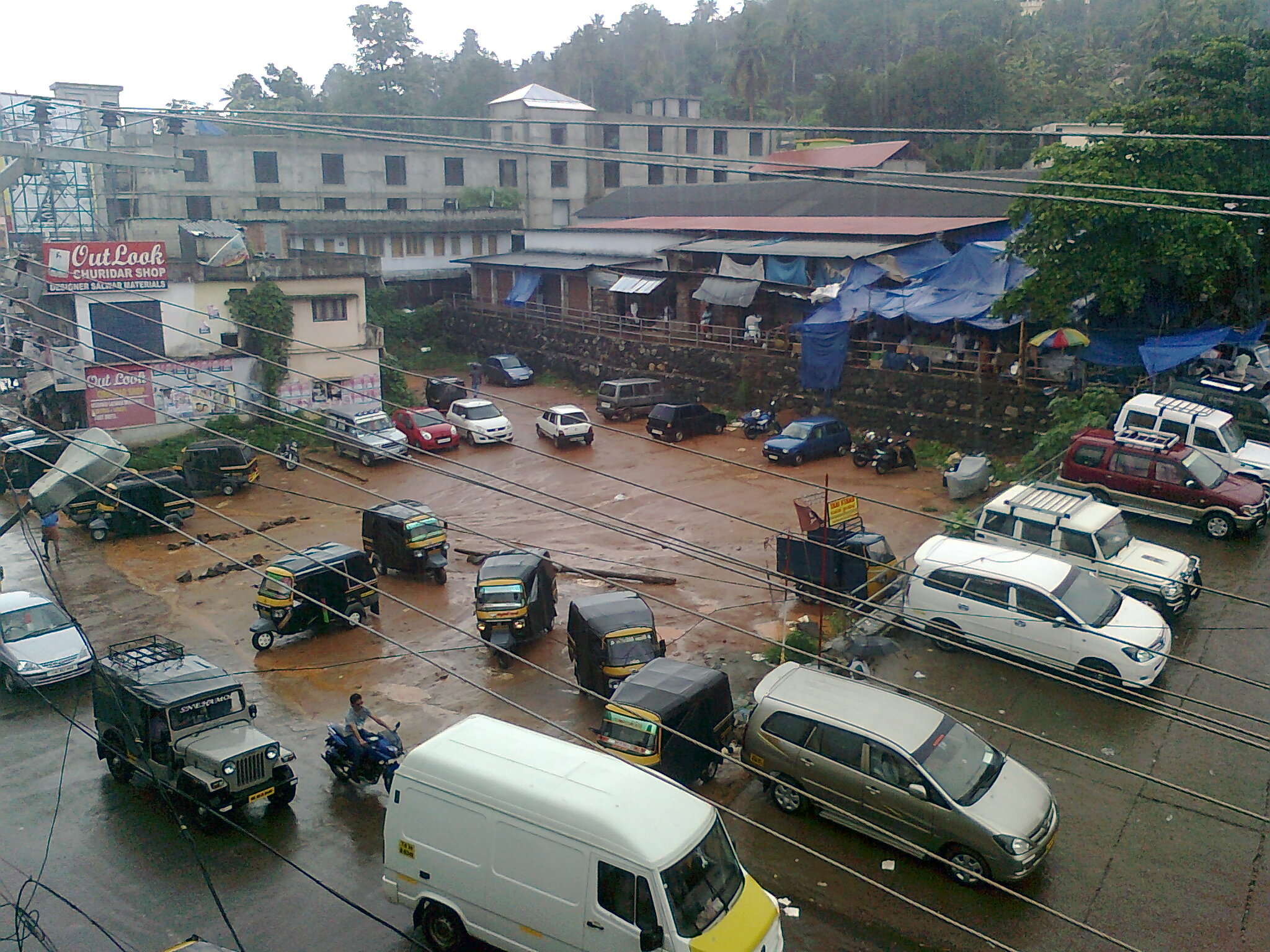
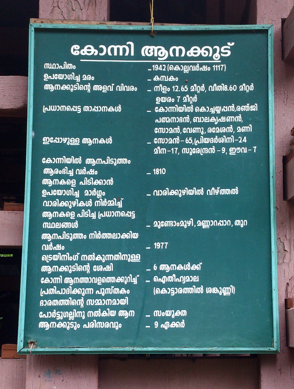
Konni is a town and a Taluk headquarters in Pathanamthitta district, Kerala, India. Konni is known for its elephant cages, forests, and rubber plantations. Konni is also known as "Anakoodinte Nadu".Nearest City Is Thiruvalla.Konni Is Located 40 km Distance From Thiruvalla Railway Station.Well Connected Via Thiruvalla- Kumbazha Highway.Buses Ply Frequently From Thiruvalla KSRTC Bus Station To Konni. Overview Konni is an important town on the Main Eastern Highway (SH 08). Konni is about away from the district headquarters. Konni assembly constituency is part of Pathanamthitta (Lok Sabha constituency). The lush green land has been prominent as a haven of wild elephants and as an elephant training center. The large area of thick forest with wild animals made Konni to emerge as another tourist spot for safaris and trekking. In Kerala there are two elephant training centers, the other located at Kodanad. It is located in the Adoor revenue division and it is one of the major towns ... [...More Info...] [...Related Items...] OR: [Wikipedia] [Google] [Baidu] |
Pathanamthitta District
Pathanamthitta District (), is one of the 14 districts in the Indian state of Kerala. The district headquarters is in the town of Pathanamthitta. There are four municipalities in Pathanamthitta: Adoor, Pandalam, Pathanamthitta and Thiruvalla. According to the 2011 Census of India, the population was 1,197,412, making it the third least populous district in Kerala (out of 14), after Wayanad and Idukki. Pathanamthitta has been declared the first polio-free district in India. The district is 10.03% urbanised. Pathanamthitta is one of the richest districts in India with just 1.17% poverty as of 2013, which places the district among top 5 districts in India with least poverty. Etymology The district's name is a combination of two Malayalam words, and , which together mean 'array of houses on the river side'. The district capital is located on the banks of the river Achankovil. History It is presumed that the regions that form the district were formerly under the ... [...More Info...] [...Related Items...] OR: [Wikipedia] [Google] [Baidu] |
.jpg)

.jpg)
.jpg)


