|
List Of Sites Of Special Scientific Interest On The Isle Of Wight
This is a list of the Sites of Special Scientific Interest (SSSIs) on the Isle of Wight, England. The Isle of Wight is an island and county three miles off the south coast of England in the English Channel. Its geology is complex, with a chalk downland ridge running east to west through its centre and important fossil beds from the Lower Cretaceous to the Lower Tertiary around the coast. This geology gives rise to many distinct habitats, with strong maritime influences, including chalk grassland, neutral meadows, and broad-leaved woodland. The Isle of Wight has a population of 140,000, making it one of the country's smaller counties in terms of population. In England, the body responsible for designating SSSIs is Natural England, which chooses a site because of its fauna, flora, geological or physiographical features. Natural England took over the role of designating and managing SSSIs from English Nature in October 2006, when it was formed from the amalgamation of Engli ... [...More Info...] [...Related Items...] OR: [Wikipedia] [Google] [Baidu] |
The Needles
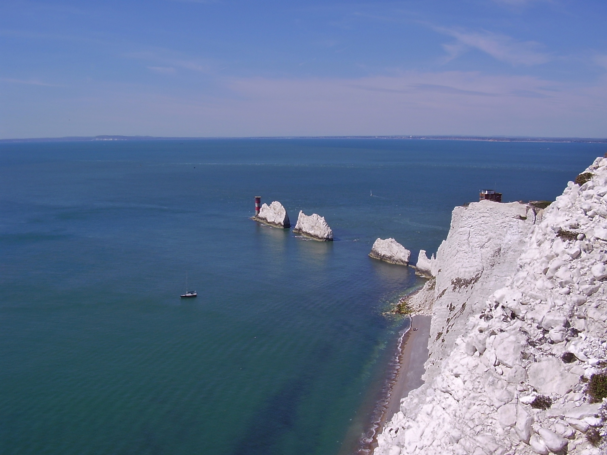
The Needles is a row of three stacks of chalk that rise about out of the sea off the western extremity of the Isle of Wight in the English Channel, United Kingdom, close to Alum Bay and Scratchell's Bay, and part of Totland, the westernmost civil parish of the Isle of Wight. The Needles Lighthouse stands at the outer, western end of the formation. Built in 1859, it has been automated since 1994. The waters and adjoining seabed form part of the Needles Marine Conservation Zone and the Needles along with the shore and heath above are part of the Headon Warren and West High Down Site of Special Scientific Interest. The formation takes its name from a fourth needle-shaped pillar called Lot's Wife, which collapsed in a storm in 1764. The remaining rocks are not at all needle-like, but the name has stuck. The Needles were featured on the BBC Two TV programme ''Seven Natural Wonders'' (2005) as one of the wonders of Southern England. During Storm Eunice on 18 February 2022, t ... [...More Info...] [...Related Items...] OR: [Wikipedia] [Google] [Baidu] |
Rural Development Service
The Rural Development Service (RDS) was formerly part of the UK Government's Department for Environment, Food and Rural Affairs (Defra). It ceased to exist on 1 October 2006 following the creation of Natural England. History The RDS was created in 2001, when the Farming and Rural Conservation Agency merged with the then Ministry of Agriculture, Fisheries and Food's regional service centres. The body was charged with the implementation of the England Rural Development Programme (ERDP), as well as a range of other rural services, placing the agency at the forefront of change in rural areas. The RDS employed 1,500, working with rural partners and local people to improve the environment, promote the conservation of wildlife and biodiversity and develop stronger rural economies and communities. Following a review by Christopher Haskins, enacted in the Natural Environment and Rural Communities 2006 [...More Info...] [...Related Items...] OR: [Wikipedia] [Google] [Baidu] |
Compton Chine To Steephill Cove SSSI
Compton Chine to Steephill Cove is a Site of Special Scientific Interest which extends from Compton Chine on the south-west coast of the Isle of Wight along the coast, around St. Catherine's Point to Steephill Cove, just west of Ventnor Ventnor () is a seaside resort and civil parish established in the Victorian era on the southeast coast of the Isle of Wight, England, from Newport. It is situated south of St Boniface Down, and built on steep slopes leading down to the sea. ... on the south-east coast of the island. This is the largest SSSI area on the island. The site was notified in 2003 for both its biological and geological features. SourcesNatural England citation sheet {{SSSIs IoW Sites of Special Scientific Interest on the Isle of Wight ... [...More Info...] [...Related Items...] OR: [Wikipedia] [Google] [Baidu] |
Colwell Bay
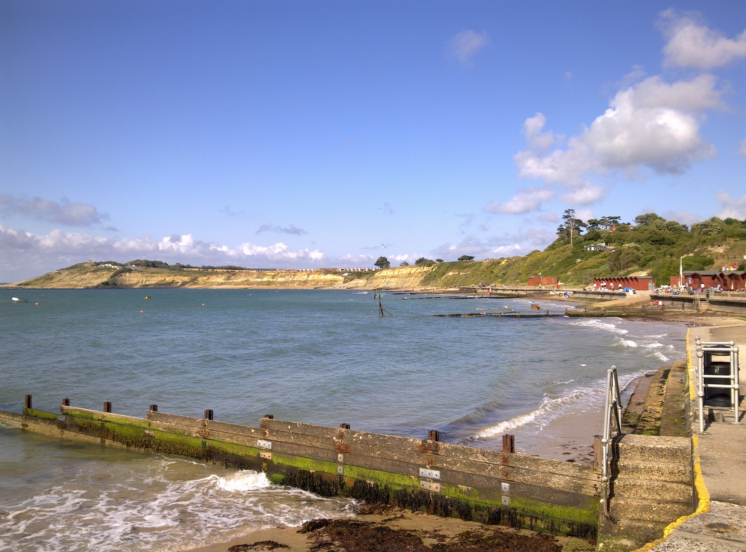
Colwell Bay () is a bay in the west of the Isle of Wight. It is located between the towns of Totland and Yarmouth. The bay's northernmost point is Cliff's End (Fort Albert) the closest point of the Island to the British mainland, with Hurst Castle lying at the end of a long peninsula just 1500 metres (a little less than a mile) to the northwest. The southernmost point is Warden Point. Colwell Bay has a popular beach, with two miles of sand and shingle, and facilities including cafes, shops and equipment hire outlets. An area of 13.56 hectares has been notified as a geological Site of Special Scientific Interest, notification originally taking place in 1959. The site is significant for its Eocene geology and maritime vegetated soft cliff habitat. It is the location of three chines: Colwell Chine, Brambles Chine and Linstone Chine. Colwell Bay is on the A3054 road and near the western end of the A3055 road The A3055 is an A-Class Road on the Isle of Wight in Southern Eng ... [...More Info...] [...Related Items...] OR: [Wikipedia] [Google] [Baidu] |
Calbourne Down
Calbourne is a village in the civil parish of Calbourne, Newtown and Porchfield, on the Isle of Wight, England. It is located 5 miles (8 km) from Newport in the west of the island. The village takes its name from the stream that passes through town, the Caul Bourne. The stream used to power five mills just north of the town. In the deed for the land produced in 826 CE, it is recorded as Cawelbourne. The village has a post office, a garage, a church and a public house, The Sun Inn. The garage is on the previous site of a blacksmith and wagonmaker. Calbourne is also the home of Westover cricket team, who play on the village green. History There is a privately held manor house, Westover House, on a hill overlooking Calbourne. The Westover Estate was established during the reign of Edward the Confessor. Westover House was once owned by Colonel Moulton-Barrett. Colonel Mouton-Barrett was a relative of the poet Elizabeth Barrett. Calbourne is also close to the site of Swa ... [...More Info...] [...Related Items...] OR: [Wikipedia] [Google] [Baidu] |
Briddlesford Copses
Briddleford Copses is a Site of Special Scientific Interest (SSSI) and Special Area of Conservation (SAC) which is south of Wootton Bridge on the Isle of Wight in Britain. The site was designated an SAC in 1995 in recognition of the internationally important breeding population of Bechstein's bat that are resident there. The majority of the copses form part of the Briddlesford Nature Reserve, owned and managed by the People's Trust for Endangered Species (PTES), a charitable organisation A charitable organization or charity is an organization whose primary objectives are philanthropy and social well-being (e.g. educational, religious or other activities serving the public interest or common good). The legal definition of a ch .... References Natural England citation sheet Sites of Special Scientific Interest on the Isle of Wight {{England-SSSI-stub ... [...More Info...] [...Related Items...] OR: [Wikipedia] [Google] [Baidu] |
Brading Marshes To St
The ancient 'Kynges Towne' of Brading is the main town of the civil parish of the same name. The ecclesiastical parish of Brading used to cover about a tenth of the Isle of Wight. The civil parish now includes the town itself and Adgestone, Morton, Nunwell and other outlying areas between Ryde, St Helens, Bembridge, Sandown and Arreton. Alverstone was transferred to the Newchurch parish some thirty years ago. History Early history From early times, Brading ranked as an important Island port. The ancient name of Brerdynge, from which 'Brading' is derived, probably meant ''the people living by the ridge of the Downs'', and dates from at least 683. The Roman Villa south of the town, and Roman relics discovered locally, indicate that this was an important seaport 2,000 years ago. Signs of prehistoric activity have also been found on Brading Down. History records that St Wilfrid came to the island during the 680s, landed at Brading, preached there to the islanders, and ... [...More Info...] [...Related Items...] OR: [Wikipedia] [Google] [Baidu] |
Bonchurch Landslips
Bonchurch Landslips is a site of special scientific interest which is located north-east of Ventnor, Isle of Wight. A wooded coastal landslip zone, the site was notified in 1977 for both its biological and geological features. Part of the Isle of Wight Undercliff, it is accessed by several footpaths, including V65C, that descends into the landslip via the Devil's Chimney rock cleft; V65, descending via another rock chimney called ' The Chink'; V65b from Ventnor; and V65a from Luccombe. Significance The Bonchurch Landslip (also called East End Landslip) involves a coastal Cretaceous sequence where harder Upper Greensand rocks overlie softer Gault clay. It has SSSI status for its geomorphological interest (the Undercliff itself, and the landslips and mud flows below) and its botanical assemblage. The Gault clay supports established woodland of ash, oak and beech, with unusual lichen species. The lower slips, comprising mixed clay and sandy habitats, support a complex mix of ac ... [...More Info...] [...Related Items...] OR: [Wikipedia] [Google] [Baidu] |
Bembridge School And Cliffs SSSI
Bembridge School And Cliffs SSSI () is a 12.58 hectare geological Site of Special Scientific Interest near Bembridge on the Isle of Wight, notified in 1999. It is listed in the Geological Conservation Review. This site consists of the coastral strip in the northern part of Whitecliff Bay. Steyne Wood Clays containing fossils from the Quaternary The Quaternary ( ) is the current and most recent of the three periods of the Cenozoic Era in the geologic time scale of the International Commission on Stratigraphy (ICS). It follows the Neogene Period and spans from 2.58 million years ... period are found at the site. Natural England w ... [...More Info...] [...Related Items...] OR: [Wikipedia] [Google] [Baidu] |
Bembridge Down
Bembridge Down is a Site of special scientific interest which is north-east of Sandown, Isle of Wight The Isle of Wight ( ) is a county in the English Channel, off the coast of Hampshire, from which it is separated by the Solent. It is the largest and second-most populous island of England. Referred to as 'The Island' by residents, the Isle of ..., England. The site was notified in 1951 for both its biological and geological features. References Natural England citation sheet Sites of Special Scientific Interest on the Isle of Wight Hills of the Isle of Wight Bembridge {{England-SSSI-stub ... [...More Info...] [...Related Items...] OR: [Wikipedia] [Google] [Baidu] |
Arreton Down
Arreton Down () is a 29.77 hectare biological Site of Special Scientific Interest on the Isle of Wight, originally notified in 1979 for its geological interest and then renotified in 1987, but for its biological interest only. It is public access land and popular with early morning dog walkers, who park near the chalk pit entrance. The land is marked by extensive ancient field features as yet unexcavated. The Down The Arreton Down Site of Special Scientific Interest is a large area of south-sloping chalk grassland in the central part of the Isle of Wight. It is grazed by cattle and horses during the winter, and is dominated by fine grasses such as red fescue and sheep's fescue. The flowering plants are typical of downland habitats and include horseshoe vetch, rock rose, wild thyme, carline thistle, pyramidal orchid, harebell, small scabious and the uncommon bastard toadflax. There are large numbers of chalkhill blue butterflies on the site as well as small blue, common blue an ... [...More Info...] [...Related Items...] OR: [Wikipedia] [Google] [Baidu] |


.jpg)