|
List Of Schools In Wakefield
This is a list of schools in the City of Wakefield in the English county of West Yorkshire. State-funded schools Primary schools *Ackton Pastures Primary Academy, Whitwood *Ackworth Howard CE Junior and Infant School, Low Ackworth *Ackworth Mill Dam School, Ackworth *Airedale Infant School, Airedale *Airedale Junior School, Airedale *Alverthorpe St Paul's CE School, Alverthorpe *Ash Grove Primary Academy, South Elmsall *Badsworth CE Junior and Infant School, Badsworth *Carleton Park Junior and Infant School, Carleton *Carlton Junior and Infant School, South Elmsall *Castleford Park Junior Academy, Castleford *Castleford Three Lane Ends Academy, Castleford *Castleford Townville Infants' School, Castleford *Castleford Wheldon Infant School, Castleford *Cherry Tree Academy, Pontefract *Crigglestone St James CE Primary Academy, Crigglestone *Crofton Infant School, Crofton *Crofton Junior School, Crofton *Dane Royd Junior and Infant School, Hall Green *De Lacy Primary School, ... [...More Info...] [...Related Items...] OR: [Wikipedia] [Google] [Baidu] |
City Of Wakefield
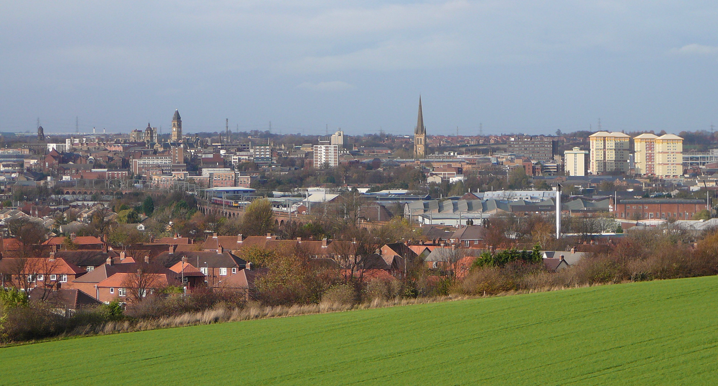
The City of Wakefield is a local government district with the status of a city and metropolitan borough in West Yorkshire, England. Wakefield, the largest settlement, is the administrative centre of the district. The population of the City of Wakefield at the 2011 Census was 325,837. The district includes the ''Five Towns'' of Normanton, Pontefract, Featherstone, Castleford and Knottingley. Other towns include Ossett, Horbury, Hemsworth, South Kirkby and Moorthorpe and South Elmsall. The city and district are governed by Wakefield Metropolitan District Council from headquarters in County Hall. In 2010, Wakefield was named as the UK's third most musical city by PRS for Music. Economy The economic and physical condition of several of the former mining towns and villages in Wakefield District have started to improve due to the booming economy of Leeds – and an increase in numbers of commuters to the city from the sub-region – and a recognition of undeveloped assets. ... [...More Info...] [...Related Items...] OR: [Wikipedia] [Google] [Baidu] |
Ossett
Ossett is a market town in the City of Wakefield metropolitan borough in West Yorkshire, England. Historically part of the West Riding of Yorkshire, it is situated between Dewsbury, Horbury and Wakefield. At the 2011 Census, the population was 21,231.https://www.nomisweb.co.uk/census/2011/ks101ew Census 2011 table KS101EW Usual resident population, West Yorkshire – Ossett BUASD, code E35000387 Ossett forms part of the Heavy Woollen District. History Toponymy The name ''Ossett'' derives from the Old English and is either "the fold of a man named Osla" or " a fold frequented by blackbirds". Ossett is sometimes misspelled as "Osset". In Ellis' ''On Early English Pronunciation'', one of the founding works of British linguistics, the incorrect spelling is used. The British Library has an online dialect study that uses the spelling. One new alternative theory is that it is the place where King Osbehrt died after receiving fatal wounds when fighting the Great Heathen Army of the Vi ... [...More Info...] [...Related Items...] OR: [Wikipedia] [Google] [Baidu] |
Wrenthorpe
Wrenthorpe is a village north-west of Wakefield, in West Yorkshire, England. It is located in the Rhubarb Triangle. History Although earlier remains, such as Roman coins and pottery, have been found in the area, the current settlement dates from after the ''Domesday Books compilation in 1086. Pottery has played an important role in Wrenthorpe's history, building from the presence of a few potters in the 15th century, to a thriving cottage industry that peaked in the 17th century, before declining over the course of the 18th. Such was the scale of pottery production, the village became known as "Potovens," attributed to the kilns used to fire finished pottery. Reminders of this heritage can be found in local names, such as "Potovens Lane" and the remains of pottery and clay tobacco pipes that can be found in the soil. As the potteries declined, coal mining, already present on a smaller scale providing fuel for the potters' kilns, expanded to meet the needs of the Industrial R ... [...More Info...] [...Related Items...] OR: [Wikipedia] [Google] [Baidu] |
Horbury
Horbury is a town in the City of Wakefield in West Yorkshire, England. Historically in the West Riding of Yorkshire, it is situated north of the River Calder about three miles (5 km) south west of Wakefield and two miles (3 km) to the south of Ossett. It includes the outlying areas of Horbury Bridge and Horbury Junction. At the 2001 census the Horbury and South Ossett ward of Wakefield Metropolitan District Council had a population of 10,002. At the 2011 census the population was 15,032. Old industries include woollens, engineering and building wagons for the railways. Horbury forms part of the Heavy Woollen District. History Toponymy The name Horbury is attested in 1086 as ''(H)orberie''. It is derived from Old English ''horu'' 'dirty land' and ''burh'' (in its dative form ''byrig''), which translates as 'filthy fortification' or 'stronghold on muddy land'. Other spellings include Orberie, Horbiry and Horberie. The name possibly referred to a fortification near an ... [...More Info...] [...Related Items...] OR: [Wikipedia] [Google] [Baidu] |
Kettlethorpe, West Yorkshire
Kettlethorpe, originally a separate village, is a suburb that lies south of Wakefield city centre, in West Yorkshire, England. The suburb has a secondary education school, Kettlethorpe High School, which is a specialist maths and computing college. It was deemed to be good by Ofsted in 2011 and again in 2016. Kettlethorpe Hall was built in 1727Howard Colvin, ''Dictionary of British Architects 1600-1840'', 3rd ed. (Yale University Press) 1995: note p. 136. "the identity of its architect is unknown" but singles it out, with the east wing of Wentworth Castle Wentworth Castle is a grade-I listed country house, the former seat of the Earls of Strafford, at Stainborough, near Barnsley in South Yorkshire, England. It is now home to the Northern College for Residential and Community Education. An ... by Johann von Bodt, as an "almost unique example of Franco-Prussian architecture in Georgian England". by the Pilkington family. It has been converted into two separate hous ... [...More Info...] [...Related Items...] OR: [Wikipedia] [Google] [Baidu] |
Hemsworth
Hemsworth is a town and civil parish in the City of Wakefield, West Yorkshire, England. Historically within the West Riding of Yorkshire and had a population of 13,311 at the 2001 census, with it increasing to 13,533 at the 2011 Census. History While Hemsworth's recent history and reputation are dominated by the coal mining industry that developed in the latter part of the nineteenth century, it had long existed as an agricultural village. Hemsworth, meaning “Hymel’s enclosure” is mentioned in Domesday as Hemeleswrde and in the twelfth century as Hymelswrde. Into the Middle Ages it was a township in the Wapentake of Staincross and is also thought to have been in the honour, or feudal barony, of Pontefract. From the Middle Ages to Tudor times it would have seen little change to the manorial features, open fields, woods, commons, enclosed holdings, manor house, scattered farmsteads and the church, dedicated to St Helen, which dates to the eleventh or twelfth century ... [...More Info...] [...Related Items...] OR: [Wikipedia] [Google] [Baidu] |
Gawthorpe, Wakefield
Gawthorpe is a village to the north of Ossett, in the Wakefield district, in the county of West Yorkshire, England. It is roughly midway between Wakefield and Dewsbury north of the A638. Gawthorpe's name derives from Gorky, a Viking name, and thorpe was a settlement, but evidence suggests the village may have Roman origins. Gawthorpe's Mayday celebrations date back to at least 1875 when a seventy-foot fir tree was bought and erected by public subscription on the village green. The maypole was last replaced in 1986. Gawthorpe Water Tower is a Grade II listed concrete structure built between 1922 and 1928 to store drinking water for the Ossett area. The 55m tall tower is a prominent local landmark of the Ossett and Gawthorpe area. Gawthorpe hosts the World Coal Carrying Championships. The Championships were originally run from the Shaw Cross colliery to the May Pole, although the collieries in this area all closed in the Robens era. It also gives its name to the Gawthorpe seam ... [...More Info...] [...Related Items...] OR: [Wikipedia] [Google] [Baidu] |
Flushdyke
Ossett is a market town in the City of Wakefield metropolitan borough in West Yorkshire, England. Historically part of the West Riding of Yorkshire, it is situated between Dewsbury, Horbury and Wakefield. At the 2011 Census, the population was 21,231.https://www.nomisweb.co.uk/census/2011/ks101ew Census 2011 table KS101EW Usual resident population, West Yorkshire – Ossett BUASD, code E35000387 Ossett forms part of the Heavy Woollen District. History Toponymy The name ''Ossett'' derives from the Old English and is either "the fold of a man named Osla" or " a fold frequented by blackbirds". Ossett is sometimes misspelled as "Osset". In Ellis' ''On Early English Pronunciation'', one of the founding works of British linguistics, the incorrect spelling is used. The British Library has an online dialect study that uses the spelling. One new alternative theory is that it is the place where King Osbehrt died after receiving fatal wounds when fighting the Great Heathen Army of the Vi ... [...More Info...] [...Related Items...] OR: [Wikipedia] [Google] [Baidu] |
Flanshaw
Flanshaw is a suburb of Wakefield in West Yorkshire, England. It is located to the west of the city centre and is administrated by the City of Wakefield. Part of the area is a council housing estate. The local primary schools are Flanshaw Junior and Infant School and Flanshaw St. Michaels Junior and Infant School. Retrieved 23 October 2016 References Suburbs of Wakefield {{WestYorkshire-geo-stub ... [...More Info...] [...Related Items...] OR: [Wikipedia] [Google] [Baidu] |
Fitzwilliam, West Yorkshire
Fitzwilliam is a small village on the edge of West Yorkshire, England, in the City of Wakefield district. The village falls within the Hemsworth ward of Wakefield City Council. Governance It is part of the town of Hemsworth and local government is in the hands of Wakefield Metropolitan District Council, with the Hemsworth Town Council as a mainly consultative body. However, the Post Office recognises it as a separate settlement from the town of Hemsworth. History It was built as a pit village. It has a railway station on the Wakefield Line, providing it with connections to Leeds, Wakefield, Doncaster and Sheffield. The railway station closed in 1967, reopened in 1982 and the line was electrified in 1989. The village provided housing for miners at the colliery originally named "Fitzwilliam Main". The name was taken from the family name of the colliery's proprietor. In 1905, a bitter industrial dispute led to all the miners being expelled from their homes, which were own ... [...More Info...] [...Related Items...] OR: [Wikipedia] [Google] [Baidu] |
Featherstone
Featherstone is a town and civil parish in the City of Wakefield, West Yorkshire, England, two miles south-west of Pontefract. Historically part of the West Riding of Yorkshire, in 2011 it had a population of 15,244. Featherstone railway station is on the Pontefract Line. History Despite most population growth taking place around the Industrial Revolution, Featherstone traces its history back much further than this. The Domesday Book (1086) records "In Ferestane eatherstoneand Prestone urstonand Arduwic ardwickand Osele ostell Ligulf had 16 carucates of land for geld, and 6 ploughs may be there." It is thought that a local public house, the Traveller's Rest, can trace its origins to the 17th century whilst the former Jubilee Hotel, a listed building now converted to apartments, once provided a resting place for wealthy Victorians and their horses. Standing stone's just outside the village indicate that there is evidence of an ancient druid grove. The original village is ... [...More Info...] [...Related Items...] OR: [Wikipedia] [Google] [Baidu] |
